April 2008
Costa Rica
Everybody loves Costa Rica!
It makes all the lists and is certainly one of the most popular destinations in Central America. After a bit of a down experience we were primed and ready to move upscale as it were by entering this highly regarded country. Nicaragua, for us, had been just a little too poor, a little less friendly... a little less special than we had become accustomed to in Guatemala and Honduras.
And then we hit the first large-ish town in the new country – Liberia – and immediately realized Costa Rica was going to be different. Rick thought he’d died and gone to heaven. Not only did they have a Burger King, but a very nice supermarket with some of the things we’d been missing for eons (sweet Italian sausages! I could make lasagna!). Not for these reasons alone, but for its charm and cheerful air, we liked Liberia very much. We spent a couple of days in the area, coming in for shopping and internet access. While walking around town we realized all the traffic was stopped on one street. We thought it was a parade, but no – a protest march. Very peaceful, in support of more rights for university teachers. We cheered them on. We were hanging around this part of the country because we were waiting for friends, Lisa and Tod, whom we had met in Oaxaca, Mexico. They had moved through Central America more quickly than we, and were on their return trip back toward the States after going all the way to Panama City and spending considerable time there.
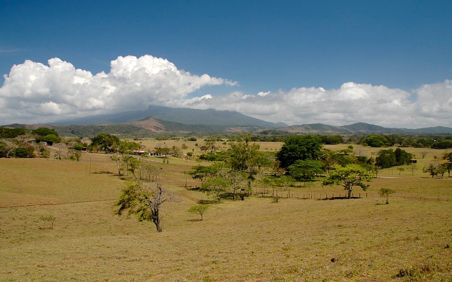
We waited for them in a defunct trailer park north of town, which worked out really well. Defunct, perhaps, but quite open and friendly, with electricity, a nice swimming pool and plenty of shade. Oh yes, and horses nearby munching away. We were very happy to wait for our friends. This is northwestern Costa Rica, very dry cattle country. Not the most beautiful, and not what we’d been expecting from the pictures we’d seen of this country, but certainly pleasant.
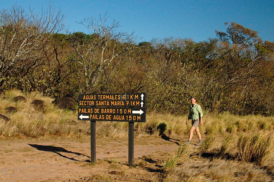
Well Tod and Lisa, who are considerably younger and more active than we are, arrived and hit the ground running. They knew a great spot for camping and hiking that was close by so we all trekked off to Rincon de la Vieja National Park and had a great couple of days together. We talked and talked and got caught up, sharing ideas on what to check out in the countries ahead (for us) and behind (that they would be moving through much more slowly on their way back up the hill). We cooked and giggled and hiked and threw Allie’s ball for her. There was a semi-tame coatimundi wandering the parking area where we camped, along with monkeys and birds as we hiked along. This area is thermal, with mud pots and hot springs and waterfalls. During the day we were inundated with rental SUV’s all lined up in a row, but at night it was just us and the starry skies. Cool. We parted with hugs and promises to keep in touch.
We were interested in traveling around the side of this volcano, up into the northern lowlands, and then around the other side where we would drop down and pick up the road to La Fortuna, our next point of interest. It got greener as we went along on a nice paved road, closer and closer to the volcano (Vulcan Miravalles this time). This is an area where the government is developing geothermal electricity; there are regular wisps of mist coming out of the ground. There are many tourist facilities in the area because there are hornillas (literally little ovens) and tumeroles (mud baths); we got permission to overnight in the parking area of one of these facilities, and, for the first time, realized how much more tourist-oriented Costa Rica is. They want and expect money for everything. Ten dollars just to park on a very unlevel, grassy area for the night. But it was quiet, and again we had horses for company.
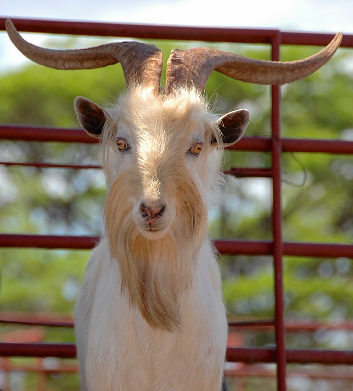
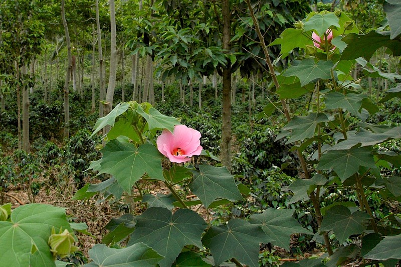
Anyhow, the next day we went on up between the two volcanoes (Rincon de la Vieja and Miravalles), driving through nice countryside and stopping to check out a new flowering tree on the one hand, and to take pictures of some incredibly cool goats on the other. This stop caused a couple of friendly fellows to come chat with us and talk about the plantings we were seeing. They said that in another month (this was early April) the rains would come and the area would be green again. We thought it looked pretty nice right now. There were fat dairy cattle in the fields; we decided this was a pretty darn nice area.
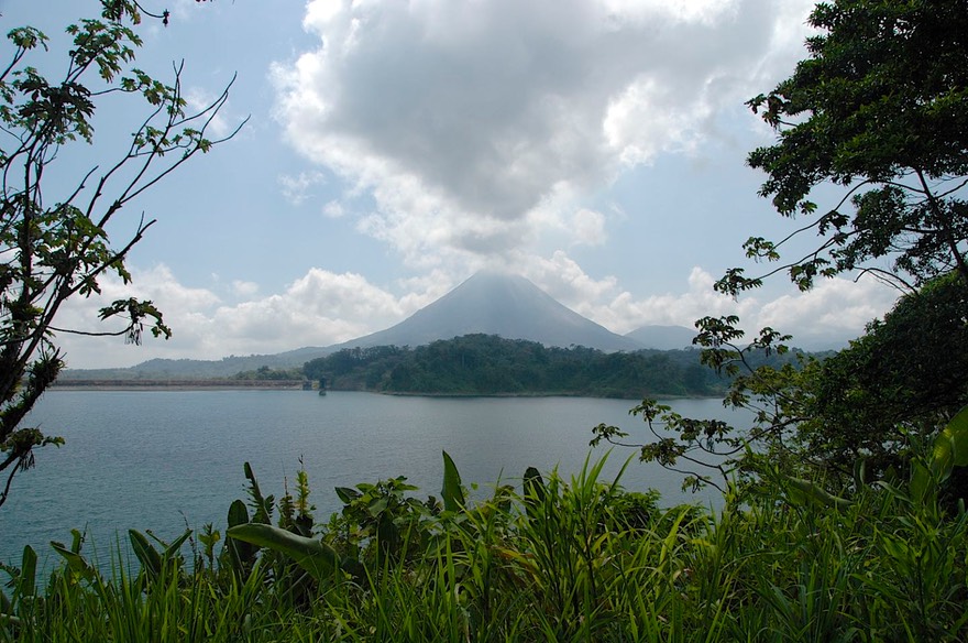
On above Vulcan Miravalles (now unpaved), into the lowlands (pineapples, sugar cane and row crops) and (now paved) through the cowboy town of Upala (rodeo tonight) and back into the mountains again, to Guateso, also known as Guatuso, or maybe Guatuzo, and which is officially San Rafael de Guateso (welcome to maps of Central America!) and then to La Fortuna. Okay, folks, this is a major tourist area. La Fortuna sits on the slopes of the east side of Vulcan Arenal, a very active volcano. The scene reminded us of Denali NP in Alaska. People come here from all over to see the volcano spit fire and spew smoke – if they can get a clear view. Like all really tall mountains, it makes its own weather, and is often too cloudy to be tourist-friendly. Got lucky: found a camping spot on a river that had a good view window, it was a clear night, and the volcano performed admirably. You could see the fire bouncing off the slopes and then look away and see all these beautiful stars. A truly cool deal.
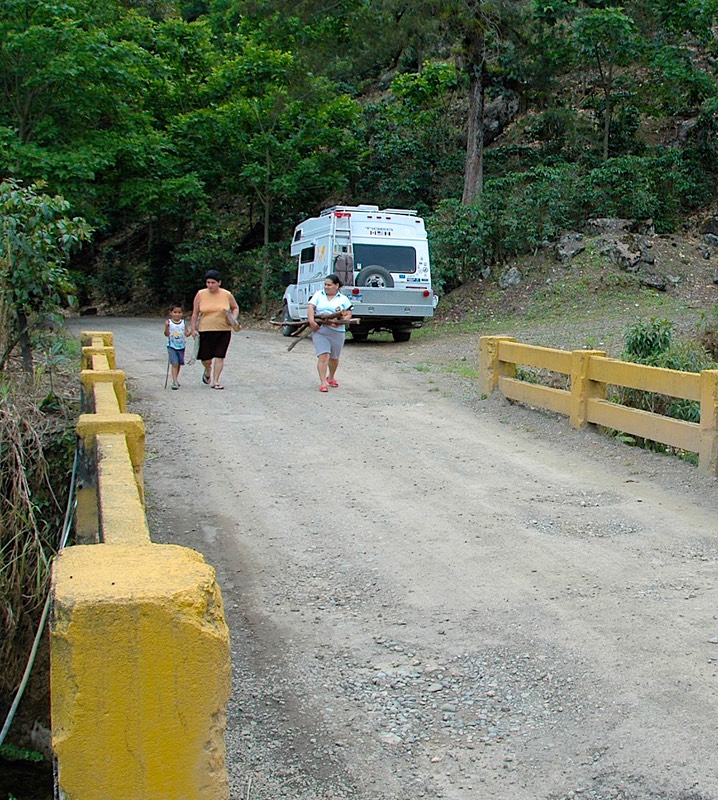
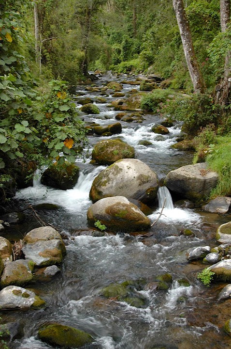
Lake Arenal and Monteverde, two major-major destinations, are nearby. Lake Arenal was formed by the creation of a hydroelectric dam, and is quite lovely. The drive around the lake is just great, and the road has been recently paved so it was a pleasure. The road winds around, crossing many streams. It was here that we first met the phrase (to be seen everywhere in Costa Rica): Puente Angosta, which means narrow bridge. It seems that regardless of how wide the road is, they never seem to widen the creek crossings. The road goes down to nothing, there is a yield sign in one direction, and everyone crosses their fingers no one comes at them quickly in the opposite direction. We found these little bridges in small towns, big cities, along very busy corridors of the Pan-American highway – everywhere. Now how can you justify that? But I digress.
There are a couple of cute towns to browse along the way around Lake Arenal, and we were delighted to find a spot on a ridge overlooking the valley where we could spend the night next to some beautiful and friendly cows/calves. It was cool and breezy (enough wind on a regular basis to justify the wind farm across the valley – Doug Davison, do you know about this area?); late in the afternoon we watched a storm coming across, moving overhead, and moving on. We were in an abandoned, or at least not currently active, upscale housing development, and were very glad it was ungated and available to us.
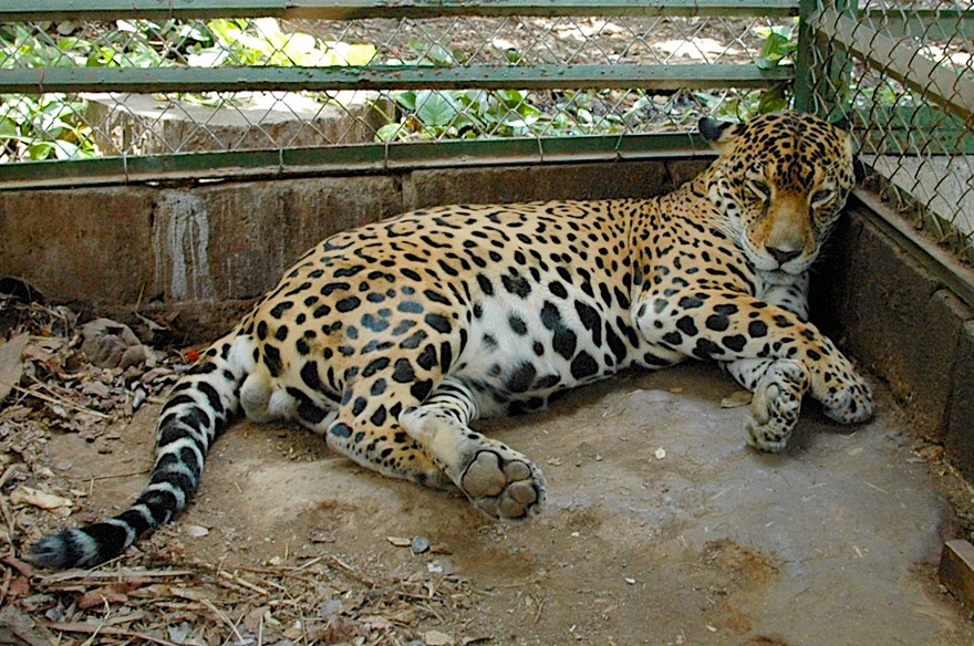
We wanted to continue on around the lake and head for Monteverde, supposedly a really nice area settled by Quakers and home to the country’s most famous cheese. However, we knew the road to get there was unpaved and gawd-awful. we took a quick break and headed back down the mountains to the hot/dry town of Canas (or Canos or Las Canas or Los Canos – you decide) to see the Las Pumas Rescue Center. This is a private foundation that is devoted to rescuing or housing wild animals that need shelter. We saw pumas and magueys and other cats; plenty of birds and monkeys; and even rabbits that were part of an educational exhibit to show visiting children which animals should and shouldn’t be pets. We really enjoyed our experience there, traipsing through with a bus load of small school kids for company.
Then back into the mountains, through Tilaran, where the pavement ended, and then up this really, really bad road to Monteverde by way of Santa Elena. We wandered the area and visited Monteverde, of the famous cheese factory, and spent the night in the parking lot of the Argentine Café, home of an incredible chocolate soufflé that Tod and Lisa had told us not to miss, and an unfortunately un-level parking lot (refrigerator rebelled, of course). Then, the next day we took the only other option down from Monteverde, and it wasn’t any better (which we already knew). Each way, to get to pavement was about thirty miles of incredibly difficult road. But you survive. Worth it (?) maybe, but only because of the soufflé. This is one of many really touristy areas in Costa Rica; folks fly in from everywhere to do canopy tours and butterfly houses, yada, yada, yada, but they all come up the roads in rental cars or shuttle vans so who cares. Anyway, far too many billboards, inns, resorts and spas for your intrepid correspondents. On another trip, we’d give this place a pass.
After all this we wanted to crash for a few days. We headed to a “real” campground outside San Jose, the country’s capital. This, the Belen Trailer Park, is an oasis of comfort; we spent a week. There is w-ifi (unless the city has shut off the electricity to work on a power pole – two days of our time there), electricity, water, a laundry, and showers. High enough in the mountains to be cool and comfortable. We took two trips, the first to get propane for the vehicle.
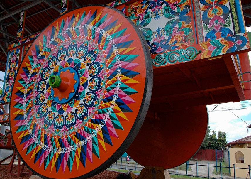
Our second, less successful foray was into the mountains above San Jose. The city is in a lovely setting, surrounded by green hillsides leading up into the mountains on three sides. There are several mountain towns that are picturesque and reportedly worth a visit. So we sallied forth. The towns were indeed interesting; we visited Sarchi, Naranjo and Zarcero, all up in the mountains along windy roads; scattered cattle and other critters helped keep it pretty; so did the fog and mist as we climbed higher up into the clouds. The dirt was rich and dark and thick; we were on the side of an extinct volcano. We noticed lots of new development, both weekend homes and large spreads; this area has become an extension of San Jose and its terrible traffic. Sarchi was interesting because it is known for its lovely painted ox carts; there is an enormous one in the town square; the designs reminded me of tole painting. Zarcero is famous for some really weird topiary in the park in front of the church. All these towns have lovely churches, among the few architecturally interesting churches in Costa Rica (apparently they all have been repeatedly destroyed by earthquakes and the new ones are simply ugly and boring – so much for creativity).
This should have been a lovely day, and we did manage all right. But the roads were, again, really awful; and the Costa Rican drivers were the worst we had seen yet. The traffic was heavy and we would get stopped on these curvy mountain roads; drivers would simply go off into the dirt on the left side of the road, forcing oncoming traffic to go around them; they’d pass each other, honking and pushing, regardless of what was happening ahead. It was all rather nerve-wracking. We finally gave up and started to head for the barn, and then it began raining like the devil. We got into the San Jose suburb of Alejuala, hoping for a shortcut to home, and ran into a huge parade! It seems the big hero of the Costa Rican revolution was born in this town and this was his birthday. Horses everywhere, crowds galore, traffic backed up for forever; what a gas! But really hard to maneuver through, of course. We did get back eventually and looking back on it we had had a pretty good adventure.
After we returned, we found out that we were in the middle of a 3-day weekend, which had added to the traffic in these pretty little resort towns; we decided the better part of valor would be to hunker down and wait it out. And we spent some of this waiting period trying to decide why we weren’t enjoying Costa Rica, a country we had anticipated with great pleasure. What was wrong
I think I can explain. Let’s talk about Costa Rica for a minute. It has about a billion volcanoes; they are strung across the country from west to east, continuing a chain from Nicaragua, and are major destinations for visitors, along with two lovely and popular coastlines. It is an incredible country for outdoor enthusiasts; you can hike, snorkel/dive, go birding, raft, canopy/zip line tour, etc. etc. The whole area is developing rapidly, with condominiums and planned developments in all the popular areas – US real estate companies like ERA, ReMax and Century 21 are all active here. It is more modern than any of the other CA countries we had been in to date, although it has really lousy roads and the worst drivers we’ve come across, often just plain discourteous. It is the most expensive country in CA. They have their own money but are just as happy taking dollars off you as colones (at 500 to the dollar, the money exchange was an ongoing challenge. Don’t care what you call it, 60,000 of anything seems like a heck of a price for a tank of gas). We either knew all these things or found them out quickly. What we found, as a result, was that we were having trouble settling in and enjoying ourselves.
Each country has its own charms, but sometimes it’s hard find what appeals to you. We wandered from one area to another, not finding “our” Costa Rica. We are strongly put off by excessive tourism. We like quiet, out-of-the-way areas with local people for company. We basically don’t do beach areas with their heat, bugs and, well, beach people. We like to meet local folks and find a commonality. Everywhere we went it seemed we were being charged for things that would be free in most countries. We were coming to the conclusion that Costa Rica used to be a country but was now mostly a tourist destination. We didn’t give up, but were getting discouraged.
We also knew that most people who visit Costa Rica arrive by plane and either rent a car or take tour busses to see the sites. They either aren’t dealing with the roads and drivers at all, or are in a car that isn’t theirs and to which they have no sense of responsibility (to say nothing of the pots and pans that aren’t crashing down around their ears!).
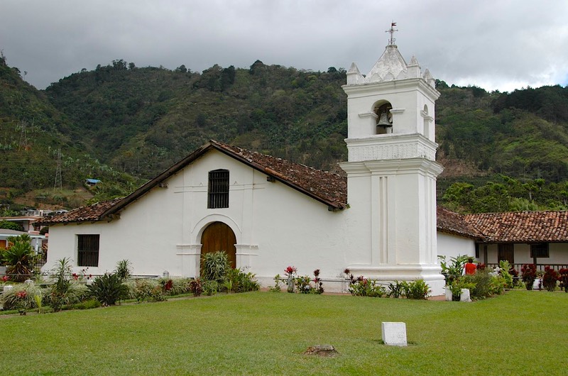
Well, what to do? We couldn’t just stay in our campground, and we really did want to keep trying. So we struck out again, and this time we struck gold. To the east of San Jose is the Orosi-Cachi Valley area. We decided to go check it out. And we fell in love. The area reminded us of a smaller version of California’s Napa Valley, 50-60 years ago. It’s lovely and green, nestled in the hills; instead of vineyards there were coffee fincas. In this area, the bushes were all in bloom, covered in lovely white blossoms; the plantations were neat and well tended; streams ran through the valley, with puny high and narrow bridges keeping most people from crossing. The town of Orosi has a Franciscan church that looks like it belongs in rural California; one-story whitewashed adobe, red tile roofs, and a neat little rose garden along the side. We weren’t homesick, but definitely nostalgic. We spent the night parked in front of the church and alongside the soccer field.
This town has an incredible Italian restaurant, the Stella du Nord, which lived up to its reputation of making wonderful pizza. The view from its location high above the valley was just as impressive. We strongly felt a sense of community among the residents here; women were walking their children to school and then gathering for some activity of their own, everyone was open and friendly, the kids were all dressed in little blue uniforms. What a great spot! On one lovely loop drive we knew there was a bridge with a low overhang that some friends had not been able to cross. After Rick got out to measure the clearance and watch a bus come through, we crossed with just inches to spare.
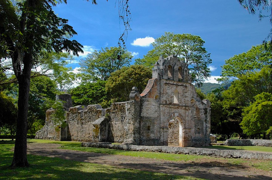
At another town in the valley we stopped at a ruin to take some pictures, and were impressed at how clean the area was and how well the ruin (of a very old church) had been preserved. There wasn’t much left, and it hadn’t been reconstructed, but you had a sense of reverence for what had been there. The setting, and the color of the building, made us think of the Alamo – but not surrounded by the huge city of San Antonio: just a quiet country location. It was quite special.
San Jose had been at about 3,000 feet and nice and cool. Orosi was about 5,000 feet and even cooler. When we reluctantly left and continued east, our goal was to stay in the mountains as much as possible as we headed towards Panama. So we mostly followed the spine of the Continental Divide.
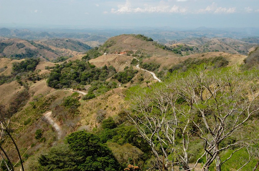
This led us up, up, up to over 11,000 feet (and a temperature of 53 degrees) as we went through the Cerro de Muerte area. We had been given some info about a place to camp right at the summit but somehow missed it and plunged on down the other side. And what a plunge it was: we dropped nearly 9,000 feet in 29 miles. We took a short detour into the highly recommended tiny Rio Sevegre Valley. It was steep and tight and narrow, even one lane part of the way, but incredibly beautiful, following the river down and down. This is a weekend retreat area and there were lodges/spas, and retreats around every corner. What a lovely place for a getaway. It was quite enchanting. But too early in the day to stop, and no good places for us anyway. So we climbed back out and headed on.
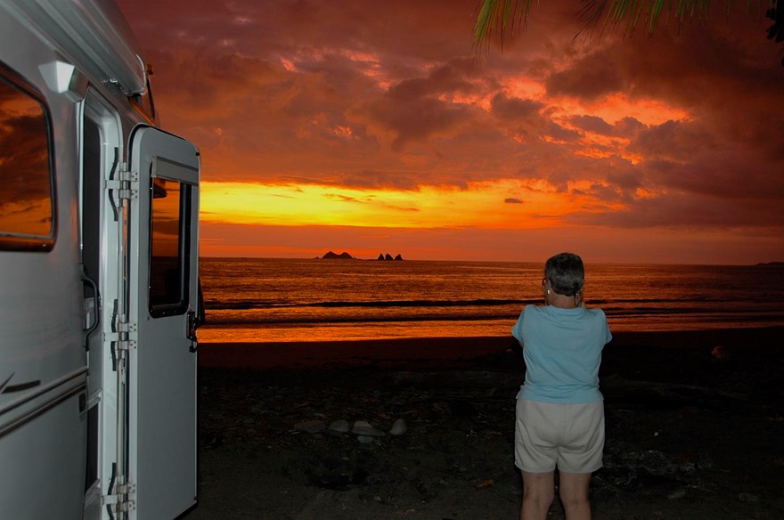
I was determined that we weren’t going to leave Costa Rica without checking out the beaches, even if briefly. I’d heard too many wonderful things. So we turned Pacific-ward, taking a steep road down out of the mountains and over to the coast. We stopped for the night right along the water, at a small national park beach called Playa Pinuela. It was lovely, though very hot; I walked the beach (picking up sand fleas that tormented us for the next several days, but SO WHAT), the sunset was stunning as a backdrop for the palm trees, all you could hope for. We had a quiet night, then in the morning, before moving on, watched fishermen bring in their catch and load it into refrigerator trucks to be taken to market.
After a very early breakfast, we split and headed straight back up into the mountains, following the Rio Gravele de Terraba through a lovely lush and narrow river valley with banana plantations, up to Paso Real where we turned east along the spine of the mountains to the small but important hub town of San Vito. There were cattle on the steep slopes and in holding pens, evidence of the main focus of the area. What a gorgeous part of the world, and from this road you really can see forever – almost to both oceans.
We crossed into Panama just east of San Vito. And this really was a border town to fall in love with. Tiny and quiet (we almost had to wake up the customs people to help us) with no turmoil. We were through in about one and a half hours; most of the time was spent in Rick having to walk about a quarter mile into town to get to the bank where he bought the entry stamps for our passports. At larger crossings, there is always a banco right at the border, but not here. Painless and easy. We congratulated ourselves on another successfully negotiated entry into a new country - until later when we discovered that the border person, who hadn’t even come outside to look at the truck, entered the license number of the truck incorrectly. Ah well, that’s a story for another day.
As we left Costa Rica, we reflected on our time there. We had been disappointed in the commercialized nature of so many aspects of the country, but we knew this had led to a good economy and a better standard of living than we had seen elsewhere in Central America. The taxis were real cars, for Pete’s sake! Costa Rica is so similar to the United States; we thought this a real detraction, but we also knew this helped make it so popular with tourists. In the final diagnosis, we determined there were many parts of Costa Rica that we had thoroughly enjoyed, and would be happy to revisit down the road, but that we preferred our Central America a bit more “foreign.”
Click here to see more of our pictures of Costa Rica.