August 2005
Alaska… the Rest of the Story
Alaska, Yukon Territory, Alberta
Or ….. miles and miles of miles and miles; but cool stuff too.
Well, howdy again. We said “so long” as we were heading up out of the Alaska’s Kenai Peninsula, fleeing wilderness fires, fishermen, and bad weather. We had decided we would go north and visit Denali National Park and Fairbanks. Well darn, that doesn’t sound too awful! Remember, of course, you can’t get anywhere very quickly. The distances in Alaska are enormous. From Homer (at the bottom of the Kenai Peninsula) to Denali National Park is 465 miles. The roads in this area are, fortunately, mostly very good as this highway, the George Parks Highway, was only completed in 1971. (Prior to that, the only access to Denali was a gravel road from a long ways to the east.) We made it to Denali in a couple of days, including a repeat stop in Anchorage to take care of a couple of things. We spent the night along the way at the Trapper Creek Pizza Pub, home of very good you-know-what; they let us stay the night in their parking lot. All very fine, except that a logger arrived at 11:30 pm to unload a bunch of wood for them; that took over an hour. Yup, an actual logging truck, complete with crane and chainsaw for the stuff he wanted to make smaller. Sigh. Another thing to not like about the 24 hour daylight in mid-summer: some of the locals seem to work two or three jobs taking advantage of the daylight.
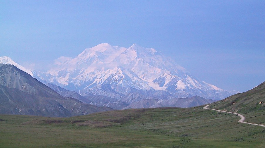
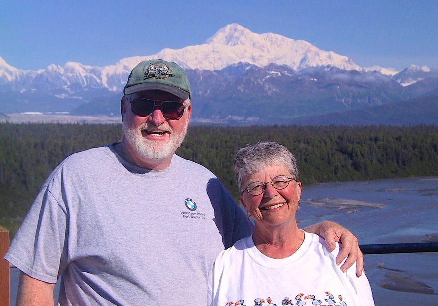
But never mind – on to Denali National Park! Wow! What can you say about a six million acre national park and wildlife preserve containing the tallest mountain in North America? This enormous area is largely set aside as a wilderness area and is inaccessible by road other than a single mostly gravel road from the park entrance about eighty miles into the center. For most of the length of this road access is limited to bus tours operated by the park and a few concessionaires. We were very, very fortunate with the weather at this point as we had two absolutely gorgeous days at the park. Denali – formerly Mt. McKinley – is famous for manufacturing its own weather and for being hidden much of the time.
The Ranger at the visitor center said that out of 105 days in the summer season, the mountain might be visible to some degree only about 60 days. The driver of our tour bus drives the route five days a week and had been doing so for about five weeks so far this season; he said this was only the second day he had seen the mountain this year.
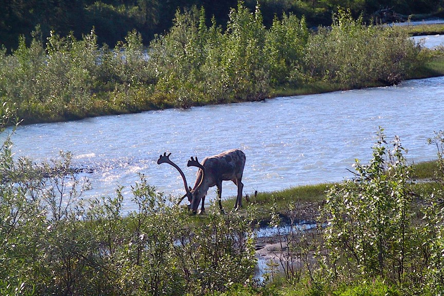
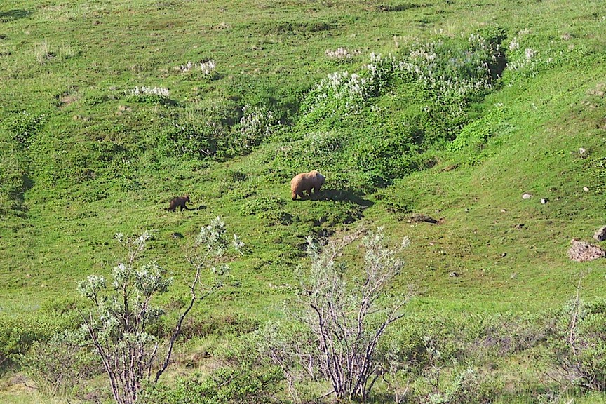
There are other attractions aside from the mountain, of course. The Park is a prime place for seeing wildlife, particularly the four big mammals: moose, bear, caribou, and Dall sheep. We were again extremely fortunate in having excellent sightings of all of these as well as hares, ptarmigans, fox, and even a seldom seen lone wolf. Our driver said that given the great views of the mountain and the sightings of all the wildlife, we should consider ourselves members of the 10% club; meaning that only that small number of park visitors are able to see as much as we had. (ed note: as I am redoing this article while updating our website in 2015 I feel compelled to say that ten years ago when we had our wonderful Denali experience I was still using a first generation Canon G1 digital camera with a very limited zoom capability. We were fortunate to see these animals, but our ability to photograph them was limited. In fact, it was this experience that convinced us to upgrade to our first DSLR cameras in the fall of 2005. Nonetheless, the fantastic memories of that visit to Denali remain.)
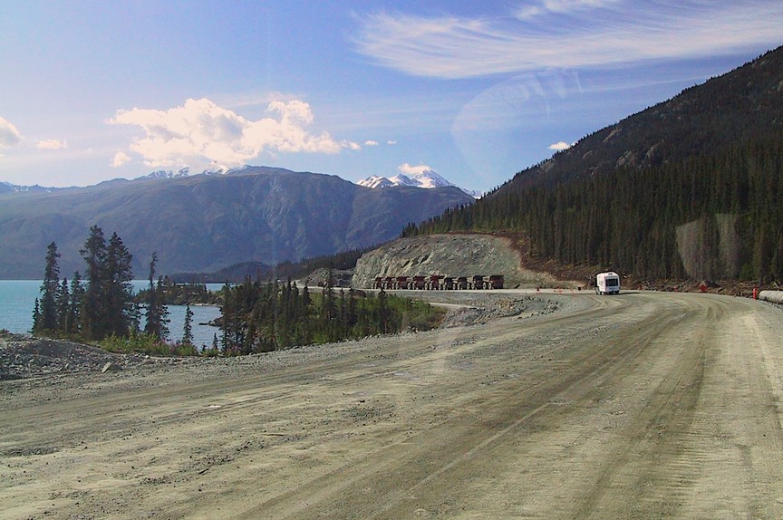
Another highlight was a chance to learn more about sled dogs and to visit the pack that works in the park during the winter. About one third of the park area is maintained as a true wilderness, with zero motorized vehicles allowed. For this reason the park staff continues to do its winter patrolling using dog sleds. In the summer time, the dogs are exercised in a number of ways including performing for the tourists three times a day. The animals were wonderfully friendly and athletic and the handlers charming. Twas a delightful visit. In addition to our wonderful day and a half in Denali, we had spent the previous day enjoying spectacular weather and mountain views from as much as 100 miles away as we approached from the south. It was all in all a truly special experience. Leaving Denali, we said “once more into the permafrost,” and trekked on up to Fairbanks. It was on this section of bumpy, under-reconstruction road that we picked up what would prove would be our only windshield crack of the trip. Just coming off of the last bit of a 20-mile stretch of gravel (and after nearly 200 miles of gravel overall), SMACK! Ah well, it wasn’t like we weren’t expecting it.
Small bit of geography coming your way. Alaska is very large, as you know. If you think of a woman’s bonnet with two tie strings hanging down below (and sort of blowing in the wind) that might help. Looking at the woman’s face, we had entered Alaska at about her right eye, and traveled down the side of her face. Then we went out onto the right tie, visiting Whittier and Seward. After this we tiptoed across her chin (cootchie coo) and down the left-hand tie almost as far as Homer (the Aleutian chain, remember?). Now up her nose (“watch out – she’s gonna sneeze!”) to Denali, followed by Fairbanks, which you might think of as between our beauty’s eyes.. Nome, incidentally, is at about her left ear; you can’t drive there, though; it’s only accessible by boat or plane. My description bizarre enough for you? Oh, and you have to remember that anything above our lady’s forehead is above the Arctic Circle; no paved roads and accessible mostly by plane. Wouldn’t want to hazard a guess on exact percentages, but the great majority of this enormous land remains only accessible to the hardiest of souls. We humble RVers who swarm to the area each summer certainly can’t begin to see most of the state.
So when we got to Fairbanks, we were at the top of our journey up the map, as far north as we were going to get. Fairbanks lies almost at the 65th parallel; it gets 21:49 hours of sunshine on June 21 and 3:42 hours on December 21. You’d think this might leave them in the doldrums all winter and totally hyper in the summer. Well, yes and no. Summers do seem a bit frantic, as the locals appear to want to be outside just as much as they possibly can. Rubber-ducky races through the center of town and all that. But Fairbanks is a college town, and it has a nice mix of art and recreational activities, and a comfortable base of real people having real lives. And it seems people who live here do so because this is what they want, and winter sports are a major attraction. We spoke to several individuals who had been stationed here during their time in the service and who had elected to stay. A doctor we met was married to another doctor, and he was about to be transferred to the Phoenix area. She has decided she’ll come back to Fairbanks in the summers, rather than endure the Arizona heat, and maintain her ties here. The art community is very active year round; the college campus has the largest recreational complex I’ve every seen, and there’s a lot going on here. We felt very much at home, and stayed several days. The campus has an excellent museum containing a huge collection of animals of the north, among other things. It was great to get so close to an enormous grizzly that stood over 12 feet tall (yes, yes; stuffed of course).
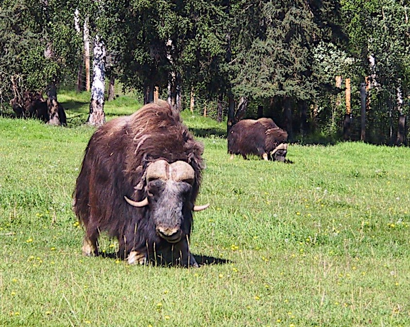
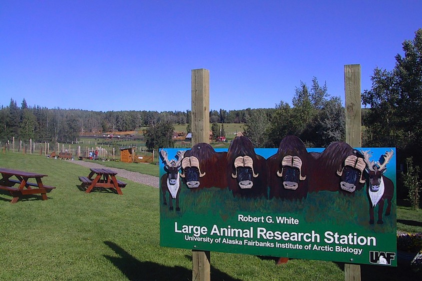
Fairbanks is filled with flowers in the summer. Gardening is taken seriously here; there is a botanical garden on campus that’s used for research and is well visited by locals as well as visitors. When we were there a painting group was out in force; it was a beautiful day and the flowers were incredible. While the growing season is short, the long hours of sunlight make for very rapid and impressive growth. The campus also had one other treat for us: the Large Animal Research Station, where the large animals in question were reindeer, caribou, and ……musk ox. Have you ever seen a musk ox? They are soooo cool. They stand 4 to 5 feet tall, have this long flowing hair and enormous horns, and are just plain swell. We toured the facility and really enjoyed it. The caribou and reindeer were fun, too. These two animals are closely related; reindeer are somewhat shorter and thicker; they are semi-domesticated and are raised for meat, along with other products. The LARS was a real treat; we went back for a second visit before we left town.
By the way, up here the light at about 10:00 at night is so soft and lovely. I imagine people who live here save up that thought for the long winter days and nights when there’s almost no light at all. Another aspect of these long summer days has managed to keep Rick in something of a frump for the past month. Photographically speaking, this light is a real challenge as the sun almost always manages to be in the wrong spot and it would require actions above and beyond the call of duty to take advantage of the early morning and evening light that is traditionally the photographer’s favorite. The reason the sun is up so long is not that it somehow slows down up here, but rather that it traverses a much longer arc in the sky. Picture yourself standing facing due south. At the equator, the sun will rise directly on your left and travel straight over your head on its way to setting directly on your right. In most of the US, while this description varies somewhat, it still is pretty much what you experience. Well, up here, the sun will rise behind your left shoulder, then move around the horizon, never getting above about fifty degrees, where it kind of stares you right in the face all day long until, sometime after you’ve given up and gone to bed, it finally sets way behind your right shoulder. It never gets really dark because the arc of the sun carries it around behind you just below the horizon. Even further north, of course, it never sets at all in mid-summer.
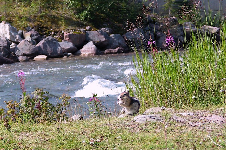
Speaking of late evening sun, we saw the Alaska Goldpanners play baseball at night without lights. It was a hoot. They are the best team in their league, and generally play very well, although they lost the game we watched. It was actually a make-up game from the one the evening before that had been rained out. This had been no ordinary shower. Lightening took out the scoreboard, which was still only partially fixed by the evening’s game we watched (home team stats available but all 0000s for the visitors – nice try, but they won anyway). A gully-washer. This was definitely small town baseball; there was a squirrel sitting on a bench near us eating peanuts during the game.
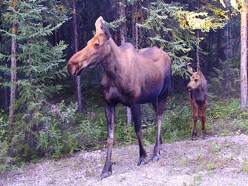
While visiting Fairbanks, we were staying in a campground about 25 miles out of town, along a lovely lake. One night, this was the site of one of our most awesome experiences this summer. About 10:00 pm we looked out the window, and right in our campsite was a mama moose with baby right beside! She looked us over, we got in some pictures through the side window, and then she silently slipped away into the trees. And I do mean silently; she was huge, but made almost no noise. We caught our breath, grinned goofily, and felt honored to have had her visit us. The Fairbanks area is famous for its moose; still, we felt very special.
It’s also famous for several local hot springs. We took a ride out to Chena Hot Springs one day, intending to enjoy a lovely hot soak. Unfortunately, we arrived just behind a busload of tourists with towels in hand, so we made do with a nice lunch at the resort and headed on out. We’ll have another chance at Liard Hot Springs in a few weeks in northern BC; we can wait, and it was a really nice ride and an excellent lunch.
Busloads of tourists have been a problem all summer. The areas we are visiting are very popular with all kinds of folks. If you are going to “do” Alaska and the Yukon, there is a list of places to go. There are only a few roads, so you keep bumping into all the same people (different faces, same agendas) and it’s difficult to have a “different experience.” When we speak to folks at rest stops or campgrounds, we all are either headed toward or returning from the same places. One of our prime goals in the states is to stray from the beaten path, avoiding places during their touristy seasons, living in the shoulder seasons for wherever we happen to be and traveling primarily on secondary roads. We are very successful at doing this in the lower 48, but up here it is more difficult. The season is short and the roads are few. Ultimately, all of us, from tent campers to RVers to cruise ship folks out on bus tours, are going to the same places at the same time of year. It makes for sort of an impacted experience. The “real” Alaska (the part you read about) is there, we know, but very often tucked away in far off corners not easily accessible to us road-bound travelers. The way to see the out-of-the-way places is to charter a plane to drop you off way out in the woods, and for that activity Alaska is an unparalleled opportunity, with more unspoiled wilderness than it is possible to imagine. For most of us, however, things can feel a bit limited. The national parks are beautiful, but have very controlled access, both because they are intended to really preserve the natural environment, and because of the nearly insurmountable transportation obstacles of the weather and the terrain; so you get in line with everyone else and see what you can. (ed note #2: see our reports from our return trip to Alaska in 2007 when we we traveling in our 19’ four wheel drive Tiger for another take on this topic).
The interior of Alaska is very different from the coastal areas. The terrain is called taiga, or sometimes the boreal forest. This is mostly spruce, but also pines and firs. And not so healthy looking due to poor soil and harsh weather. You gotcher sickly spruces (black, white, Northern, Sitka), your peaked pines, and your flimsy firs. Anything else mixed in is so puny it tends to bend in a huge arc. Unless it has been cleared for use, the entire interior is like this. With bogs. Nothing else until you get back into the southern Yukon and see some poplars (also all bend-y) and birch. Rather dreary; but the moose and caribou love it. Cars don’t; they rust. We talked to one fellow with a particularly nasty-looking pickup; wanted to know how long he could expect the framework to hold up. Said he didn’t know, but he was using it as a “science experiment” to see how long it would take to get it all the way down to nothing. Said with a smile.
Bumper sticker: Just Say NO to Negativity
After visiting Denali and Fairbanks, we looked at each other and said, well we think we’ve about covered it. There are a couple of dirt/gravel roads we could take up to the Arctic Circle, and on up to Prudhoe Bay, but another time. Time to head on out. There’s lots still to see as we begin to head on down the hill, back into the Yukon Territory again. For one thing, we still want to see Haines, Skagway and Juneau. But you can’t get there from here; even though all three are in Alaska, you have to go through Canada to get to them. So off we go.
Leaving Fairbanks we started east. This was new territory for awhile, then we arrived back in Tok (the top end of that infinity sign we described to you earlier this summer). Rick was hell bent for a hamburger at Fast Eddie’s, the best food in town; we munched them down and then kept on trucking on toward the Canadian border. Now, if you’re keeping track, you know when we cross into Canada we’re ending up back in Yukon Territory. Which is just fine with us; we like the Yukon.
Sign at the border: “All those who don’t like speeding tickets …..RAISE YOUR RIGHT FOOT.” My kind of message. Incidentally, it seems Canada has territories when there isn’t enough population in the area to warrant province-hood. The government (or “Ottawa” as it is always referred to) financially supports these areas (there are two others besides the Yukon: the Northwest Territories and Nunavut) more than it does the provinces, but also, apparently, provides for less local autonomy. Both good and bad, we suspect.
Canada (and probably Alaska too) seems to have huge numbers of women involved in construction projects. We experienced road work everywhere, naturally. And women everywhere. Not just holding the SLOW/STOP sign or driving the FOLLOW ME truck; driving the big rigs, too. Not stripped to the waist (thank you), but otherwise indistinguishable from the guys and doing every kind of road paving work you can imagine. Yes, the tar truck driver. You go, girls!
A common technique used in the naming of places in the early days of the Alcan was to reference things to mileposts; distances from one place or another. This is carried over today with the well known tour guide “The Milepost” that is considered required reading for travelers. This has resulted in place names like 115 Mile Bridge, or 100 Mile Creek. Our favorite is the town of Wonowon. In an area that is also replete with Indian place names, it took us awhile to realize that 101 is the number of miles the town is from Dawson Creek.
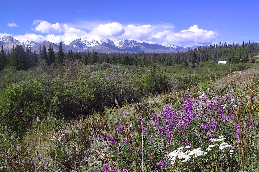
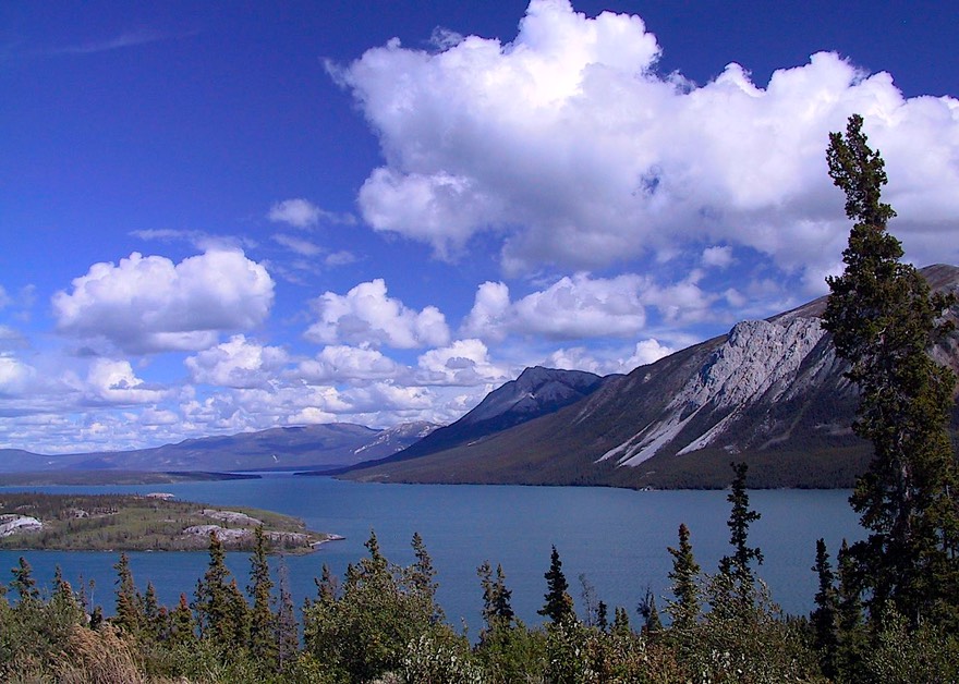
We cranked on down the highway, heading toward the turnoff to Haines, which is at Ta-Da: Haines Junction. Which is a very pretty little town in a lovely setting at the base of the mountains. A nice place to hang out some time. As to the mountains, this is the east side of the Wrangell-St. Elias Mountain Range whose west side we had visited earlier in the summer. We stopped for a couple of nights at the Kluane National Park there, staying at lovely (of course) Kathleen Lake.
And now a little more about salmon. (“Oh, no” we hear you mutter; never fear, just a little more, we promise.) Kathleen Lake used to be accessed by a running stream, but became closed off by a glacial moraine or other natural event (we can’t remember). The sockeye salmon that used to commute upstream to do their thing became land-locked and had to adapt to living full time in fresh water. They did so and are now called kokanee salmon. No, there isn’t going to be a quiz and besides we’re all out of fingers; but you do need to know these things……
Kluane NP is also a great place to see Dall sheep; and again, we got lucky and spotted some on the hillside. Too cool.
Okay, here’s the deal: to get to Haines you start in the Yukon, on Highway 3; below Kluane you pass into British Columbia (how’d that get there?) and the road now becomes Highway 4. Okay, that’s cool. But oops, now we’re crossing back over into the U.S., and the road has now been renamed Highway 7. Go figure (4+3?).
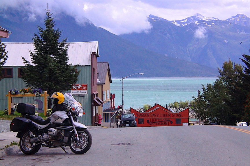
But Haines is worth the bother. It’s a great little town to visit; and home to a lovely library recently honored as the best small library in the US. The town is situated on a lovely bay, surrounded by mountain ranges, and full of eagles. It’s more of a real town than Skagway, only about 15 miles across the bay, primarily because it doesn’t get all the cruise ship traffic. This is where the Bald Eagle Reserve is; and they were definitely around. There is a permanent population of about 300-400; then in October-November, when the salmon are really running, the group increases to about 3500; the largest congregation of them anywhere in the world. We saw them perched in trees and soaring in the air. We saw pictures of them fishing in the river and sitting in groups of 20 or more on the branches of a tree; some day we’ll come back when this is happening. We camped in a state park at the end of a road beside a stream where the grizzlies come every night and early morning to fish. There were some sightings, although not by us. But it was one of the most beautiful spots we’ve seen, and we were happy to have our time there.
Haines is a very active arts community, with many different kinds of artistry around, from wood carving to jewelry to boat making for starters. For once, we enjoyed wandering the shops, wishing we had places to put the things we would otherwise be thinking of buying. But just looking is great fun, too. We visited a very nice local museum that had the best display of Chilkat blankets I’ve ever seen. And we went to the Bald Eagle Foundation museum, which has an incredible display of all the “critters” of the area. We saw, up close, huge moose, tons of eagles, bears (more on them later), caribou; you name it, they had it. All beautifully mounted and displayed and in wonderful condition.
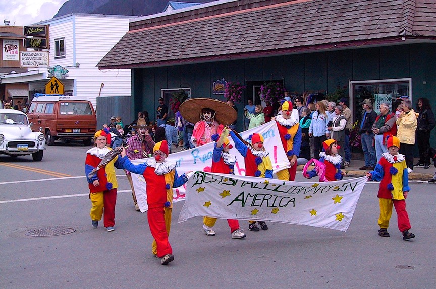
We were in Haines for most of 5 days, and it was shrouded in fog almost the entire time. This is southeast Alaska, and it’s rain forest. But, and that’s a big BUT: this doesn’t keep Haines from being the home of the SE Alaska State Fair. And was that a hoot! We were worried we wouldn’t be able to find a place to camp, that the crowds would drive us away, that the prices would be up all over town. Not a problem. This was probably the smallest, cutest little fair anywhere. Complete with the decorated cucumbers contest. They even have pig races (apparently they will race for Oreos…), which we would have watched if we could have somehow found enough to do to enable us to hang around long enough to do so. Wasn’t gonna happen. All the usual fair activities were present, just in tiny quantities – six bunnies, three ponies, a few goats and one enormous rooster pretty much made up the animal contestants. One cool story we picked up in the local paper had to do with the fair buying its own Ferris wheel. Since the fair is small and far away from larger populations (down the lovely but lengthy highway 3-4-7 referenced above); over the years the fair board has acquired a few of its own attractions as touring companies won’t make the trip. The latest of these, and making its debut this year, is a cute small scale Ferris wheel purchased used and restored by local volunteers. It joins a carousel and a little train on wheels that carts kids around the grounds. Also part of the fair site, ‘though not really incorporated into the festivities much, is a left over old west downtown movie set from the Disney film “White Fang.” On Saturday morning we watched the downtown parade – don’t blink – which made the one we reported on in Magrath, Alberta a couple of summers ago (what would you do without us?) look like the Rose Parade.
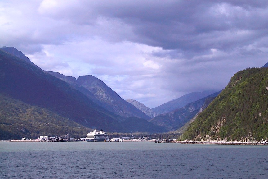
We stayed in Haines longer than we might have otherwise (enjoying every minute) because we were waiting to take the ferry over to Skagway. Going to Skagway, you have two choices: the ferry travels 15 miles to the nearby port, or you drive for 360 miles around the mountains in between. The ferry is expensive, but not much more than the fuel would have cost. And we were interested in arriving in Skagway by “ship.” The town is in a splendid setting, and it is very attractive. Surrounded by mountain peaks, as are so many of these southeastern Alaska ports, it is filled with gold-rush-era buildings that make a very pretty sight. As we had been warned, Skagway is very commercialized, filled with jewelry shops (which we’ve been told are all owned by the cruise ship lines that support the area) and gift stores. But we enjoyed wandering around. Skagway and nearby Dyea (which is now mostly a ghost town) were the jumping off places for a huge portion of the “stampede-ers” trying to get to Dawson City and the Klondike Strike back in ’97-‘98. From here they struggled over the Chilkoot and White Passes, then made their way to the Yukon River. It was a terrible journey, and the story is well told here in Skagway. The government has established a heritage site here, and has excellent information on the hardships endured by these courageous people, along with artifacts. There was even a pile of goods the size of that which each person had to carry over the pass (it took many, many trips); this was required by the RCMP; it was about a ton, and was meant to be supplies to last one person for an entire year (they weren’t interested in having these crazy people starve to death on them).
We had hoped for good weather in Skagway, but were disappointed. These coastal towns are beautifully situated, but without clear skies, you cannot really appreciate them. Also, we were interested in taking a ferry from Skagway to Juneau, the state capital. Juneau is supposed to be a nice visit. But the weather reports for the next several days were not encouraging, so we headed out of Skagway, up over the mountains and back toward Whitehorse. It was a beautiful drive; the far northwest is full of lovely mountains, and many of the roads follow along the stream beds that fill the valleys in between. Along the way we screeched to a stop as we passed a sign saying Eat Here or We Both will Starve, and ducked into the Cinnamon Cache Café, which had a second sign saying Get Your Buns In Here. We wanted to reward their enterprise, and had some good sticky buns to boot.
We overnighted in Whitehorse; this was our first chance in quite a while to stock up on supplies, so we took advantage of the opportunity. And then, back on the Alaska Highway (which we would be enjoying for quite some time now), we swung through Teslin, a stop we’d also made going the other way. While heading west toward Alaska, we’d heard “everyone stops at Mukluk Annie’s,” so we did. Funky wide parking lot where she lets you stay the night if you eat there. Which we did. Teslin is a nice little town, with the Tlingit Heritage Center, which I’d saved for the return trip. This is a small museum and cultural center for the area. They had exquisite masks and other artifacts. And some cool totems in front. The Interior Tlingit, as they refer to themselves, are a small group but very proud, and with every right to be so. It was a nice stop.
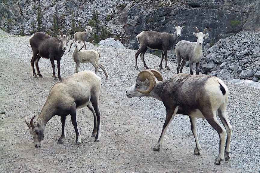
The Alaska Highway east from Whitehorse was a treat, after the many very poor roads we’ve been on this summer. Mostly in very good condition, with wide shoulders and even an occasional passing lane, we began to relax. And the scenery was grand. Traveling through southern Yukon is a pleasure, and as we traveled eastward, we were also moving south. We began to see more of a mixed forest, with more poplars and birch among the spruce; all this was interspersed with lakes and streams, and even some more southerly wildflowers mixed in with the fireweed. We traveled the lovely Liard River Valley, stopping at the famous hot springs for a dip, and while driving along started to see small patches of yellow leaves on the trees (on August 1st) – autumn comes very early here. We stopped for a few days at pretty little Muncho Lake (so named because Mosquito Lake was already taken?), a lovely place; unfortunately it became over-run with the locals out of Fort Nelson as the weekend approached, so on we went. The wildlife in this area were closer to the road than we’d ever dared to hope: we saw a black bear yearling, a buffalo calf (they run wild in this area), lots of young caribou, and several families of stone sheep. The sheep are interested in the mineral deposits along the road; that’s what brings them so close. They weren’t really even interested in getting out of our way, so we really had a good chance to enjoy them. We were reminded of what we’ve been told before: these far northern animals have 4 months each year to prepare for 8 months of very harsh winter. They don’t have time to fool around with the likes of us!
Crossing the Rockies (4250 feet), we continued along, now following the Tetsa River. A horrible experience: we passed an RV completely enveloped in flames, including its towed car, and already pretty much completely destroyed. The folks had all gotten out, it appeared, and were standing there along with others who had stopped to help watching it burn. Nothing to be done; and on such a deserted stretch of road, no help would be on its way very quickly. This is a nightmare we all fear; electrical problems sometimes will be the cause, but more likely an undetected tire problem. Very sobering.
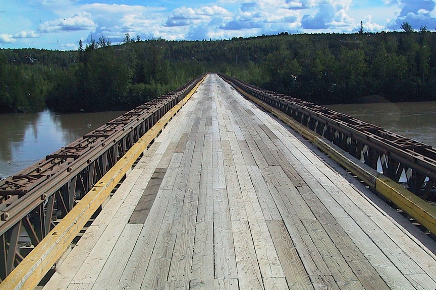
We headed on toward Fort Nelson; from there we would turn south toward Dawson Creek and the end of the Alaskan Highway. But look, a turn toward the north. Hmmm, it goes up into the Nortrhwest Territories; and hmmm, it’s even paved (well, at least part of the way). So we went to take a look. Kathy was dying to reach the NWT. But the area wasn’t too interesting, and we decided to hold off on that voyage for another trip. We went only far enough to cross the Fort Nelson River on the longest Bailey bridge in the world (1410 feet, for all of you who are prepared to be amazed). For anyone who cares, the Bailey bridge was developed during WWII as a modular bridge that could be erected rapidly. Back on the highway again, we stopped in Fort Nelson. This area has oil and gas deposits and is growing. But we are regularly reminded that the people who live along the Alaskan Highway weren’t born there, unless they are young. The highway didn’t exist until during World War II; prior to that there were forts and trading posts and not much else; so most of the folks who are here came from somewhere else.
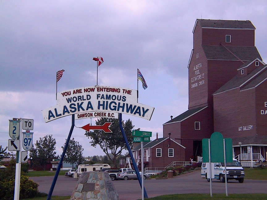
Fort Nelson is the first time we’ve seen fields and pastures all summer. We knew we were getting further south: better soil, more open fields, even though the winters are still nasty. Fort St. John came next, with even more pastureland; we were well east of the Rockies now, and on the edge of the northern plains. We passed through Dawson Creek, the end of the Alaskan Highway (or start, because most travelers begin here on their way up to Alaska). The visitor’s center has an excellent film on the construction of the Alcan, which we thoroughly enjoyed, probably more than we would have had we viewed it before we went. Just south of Dawson Creek is the town of (little) Pouce Coupe – come on, you get the reference! (think Beachboys).
Leaving Dawson Creek traditionally ends a trip to Alaska. You can head southwest into southern British Columbia, southeast to Edmonton, or down the eastern slope of the Rockies toward Jasper and Banff/Lake Louise. We chose the latter. We wanted to travel the Icefields Parkway, visit these wonderful Canadian national parks, and then end up in our own Glacier National Park just after Labor Day. I must admit I was very sorry to say good-by to the fireweed that covers the ground all over the north; it is the most beautiful of wildflowers and isn’t prevalent where we were going. But otherwise we were ready for new scenery and new adventures.
So we crossed into Alberta Province (ooomygod – Mountain Time!), and the roads got worse. Why are we not surprised! We’re still kinda far north, and the winter weather is awful around here. This is east of the Rockies, mind you, which means PRAIRIE COUNTRY.
We dropped down through Grande Prairie and Grande Cache, and through Hinton (yuck) and west to Jasper National Park. Now this is a pretty place. Lots of elk, not too many folks, gorgeous mountains and lush trees, and…..lots of rain. But we did have one beautiful day for a ride. We saw Mt. Robson, which is actually outside the park, to the west, and much of the park itself. A lovely, rejuvenating day. then it rained some more. We felt so sorry for all the people tent-camping. When you leave Jasper, a treat is to travel down the Icefields Parkway (Le Promenade des Glaciers – can’t you just see all these big white peaks slowly lumbering along to the music from Fantasia??). and we really did enjoy it. The weather didn’t really cooperate, so we saw the peaks in the mists and between clouds, but they were beautiful; reminded me of a long procession of giant mammoth molars.
But the mobs were getting bigger as we got closer to Banff and Lake Louise, so we took a quick turn to the west, headed out of “the big three,” and on our way. Interestingly, as soon as you leave the Lake Louise area, going west, you travel through three other very lovely Canadian national parks, all very pretty, much less crowded, and worth a visit in their own right. More glaciers, lots of critters and nice visitor’s centers, beautiful scenery. And we found out the huge “crows” we’d been pestered with in the Jasper area were actually ravens. Big, fat, and sassy. We left them alone….
We stopped our burst to the west at Revelstoke, a very pretty area. There is a mountain there (Mt. R. of course), with a road to the top. Revelstoke is a nice little resort town. We camped for several days about 15 miles south of there, in a beautiful little park with its own lake, lots of trees, stuff like that. We were pretty happy. We even took a tour of the Revelstoke Dam, although we aren’t dam people (at least not in our own eyes…). It was pretty interesting. This is part of the Columbia drainage basin, with dams all along. Providing “hydro” for SLO, you might say. We went on down the Columbia, which changes names regularly, depending on which lake the local dam has created. The area is serviced by a series of free ferries, which we hugely enjoyed. We like ferries. We ended up along the Kootenay River in a small provincial park in a cedar grove. Enchanting. We could have stayed forever. We rode the ferries and explored the area on our motorcycle. We were down the lake from the little town of Gray Creek, which advertises itself as “metric free.” We visited the Nikkei Internment Center in New Denver; this is the only remaining one of the internment camps where all the Canadian Japanese were sent during WWII to put them east of the West Coast. It is now a shrine, and I found it fascinating, if quite disturbing. The Canadians were no more humane at that point in time than we were.
By now we were only 30-40 miles from the U.S. border. So we started eating fruit and meat (bought in Alberta and not sure what the border guards might think of it). One last bike ride, to the south of us, made us realize we were very close. This is a popular southern BC resort area; we started seeing dreadlocks, smelling incense and noticing signs advertising yoga retreats. We began preparing ourselves for “re-entry.”
Crossing the border we dropped down into Bonners Ferry, Idaho. We had intended to take on fuel there, but it was the opening day of their county fair and the entire town was in the middle of a parade. Motorhomes and small town parades don’t mix very well, so we moved on, ending up in Libby, Montana. We are here now, camped alongside the Kootenai River (ref. Kootenay River in BC), in a lovely spot. There are ospreys in the trees across the river, someone saw a mountain lion a couple of days ago, the weather is warm and wonderful….we may never leave. Libby is small-town western Montana at its best; a real town with real people and real stores. On a day trip we wandered the mountains, visiting Yaak (not to be missed) and enjoying the area very much. We’re about 120 miles from Glacier NP, which we intend to visit next, after Labor Day, followed by Yellowstone and then the Black Hills of South Dakota.
And finally, we can’t possibly finish a discussion of our summer travels (travails?) without sharing some thoughts on those pesky, ever present mosquitoes. How can something that lives such a short time be born so instinctive? You’d think they’d have a learning curve like the rest of us; it must last about 90 seconds! After several weeks of in vitro observations, we offer the following…….
• First, in Alaska the tourist is considered part of the food chain (“Uncle Food Chain Needs YOU!”). We help feed the skeeters, who are then eaten by small birds and fish, etc., etc.
• There are varieties of mosquitoes (we’re not talkin’ latin names here): Newbies, who haven’t tasted blood yet; Looky-loos: on the outside of the window trying to get in; and Easy Marks: they are slower because they are fat and happy and full of your blood. They are often identified by the burping sounds they emit; this is caused by what we term blood bloat.
• There is an ongoing research project as to which killing method works better: “stun and squish” vs. “splat.”
• Was it really necessary for all those visitor centers to display those huge mockups of the dreaded beasts alongside the bears and moose?
• Most important, we must all remember that being stalked and bitten by wild critters is a traditional part of the outdoor experience. Better a horde of mosquitos than a Grizzly we always say.
And, finally…….
Ode to A Mosquito
Hail to thee, brute spirit! Bird thou never wert;
E’er a buzzing fighter jet, blood your only sport.
In your youth a Looky-loo and Wannabe, trying to get in;
Once entry ist achieved, let the games begin.
We swat and dodge all evening, but once in bed, relax;
A somnolent body is less aware, and ready for the probe-axe.
You munch and chew and have your way with our Grade A, Number One flesh;
Then, sated and weary you drift away, seeking a quiet rest.
Morning finds you bloated and gloating, only just floating;
You’re easily spotted – finally swatted – and slink away to your death;
Just a spot on the wall, you’re nothing at all,
How the mighty has suddenly fallen;
The food chain’s been broken though you’re but a token,
Too many just like you remain.
In fairness, we have to admit that the skeeters were only really a problem early in the summer. By mid-July they had pretty much been supplanted by horse flies…. We’ll save a discussion of them for another time (not). We hope you are well and happy, eating properly, wearing a light sweater in these cooler evenings, and shaping up your costume for Hallowe’en.
Love to all,
Rick & Kathy, with a clean coach again after weeks of unpaved-road-induced total filth.
Oh, and we include this final photo to dispel the silly rumor that we can just go any old place any time we want to.
See more photos from Canada & Alaska in 2005