July/August 2005
Where the Sun don’t Set
British Columbia, Yukon Territory, Alaska
Or: So, just how much do you really want to know about salmon?
Ah, g’waaan; just a little info?
Well, here’s our first message for the summer. Our trip to Alaska and western Canada has provided us with way too much info to include all of it at one time. We’ll finish this for you in another month or so.
When last we spoke, we were in the Northwest. After a short digression to southern California (not as pretty as it was in smog-less March) to see daughter graduate from college (and yes, it was worth it, regardless of Rick’s mutterings about airplanes and motels and traffic – it’s a pinnacle for every graduate, but particularly when you’re 35), we flew back to Seattle and prepared to cross the border. Did the laundry, shopped for groceries we knew weren’t available in the far north, picked up our mail (and paid our bills), made a note to shut off the satellite TV service once we were out of range, and rendezvous’ed with our destiny (or at least with Bobby, the border guard).
Now I have a thing about border crossings. No matter what I try to anticipate they are going to ask me about, I miss the mark. We’ve had potatoes taken away when crossing between Newfoundland and Nova Scotia; oranges and grapefruit absconded at almost any crossing back into the States; been asked about meat going in all directions; etc., etc. But I erred yet again. We’d never crossed into Canada from western Washington before, and there is an apple maggot problem in the area. THE NASTY S.O.B. TOOK ALL THE APPLES I’D JUST BOUGHT. Made me put them into a bin marked “seized goods.” Washington State Apples... say it isn’t so! Harrumph.
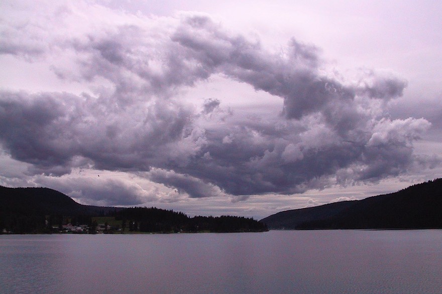
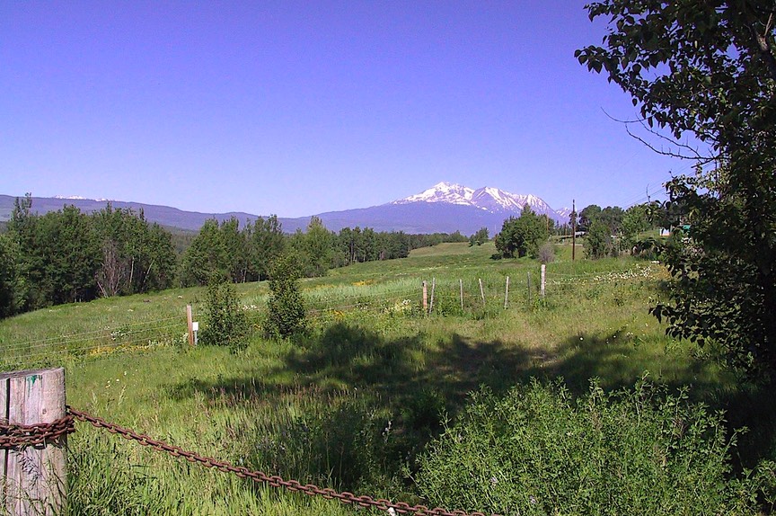
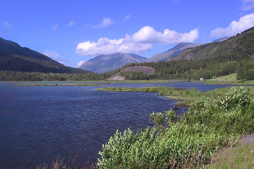
We had picked the small town of Sumas for our crossing, north of Bellingham and slightly east; much quieter than crossing at Blaine, which is on I-5, the main road on up to Vancouver. It was a good choice, in a peaceful dairying area. In mid-June there were cows in the fields with grass up to their bellies, trees with new growth, fruit stands along the roads, very lush. This is an area we would like to explore further, at another time. A very scenic road here leads up to the top of Austin Pass, with an incredible view of Mt. Baker ……so we’ve been told. It was a cloudy day, so there was no point. We’ll save it for another time.
Well, across the border, we quickly stopped and bought strawberries alongside the road (superb) and then apples in Hope, the first town we came to. Now we were back in business. Hope is a lovely, typically Canadian town; we had stayed overnight there before, on a motorcycle trip several years ago. Flowers in hanging baskets, stately cedar and Douglas fir trees everywhere (some now formed into the sculptures for which the town is quite famous). We walked around the town and talked to a few locals. Seems many came to the area from northern Europe (still with accents 40-odd years later), which is probably why the town looks the way it does. Hope really makes you feel you’ve left the US behind and have started on a true “voyage of discovery” (thanks, Mr. Jefferson, for the phrase).
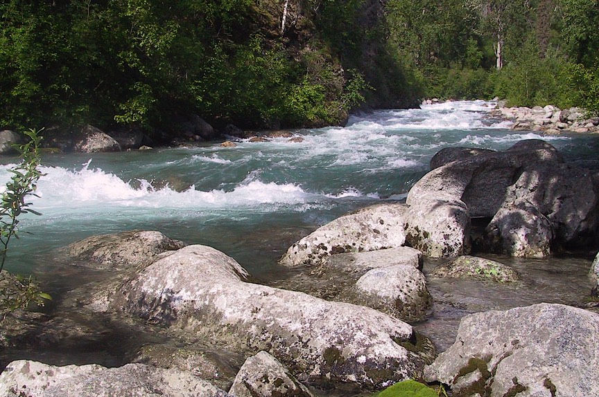
When you leave Hope, you turn north (“North to Alaska” – would make a good TV show title?; or maybe “Sergeant Kathy of the Yukon”) and start the long trek. We began by following the Fraser River Canyon. This is a large river drainage system which has had much dredging over the years. It’s good to remember that mining has been the reason for much of the inland development of British Columbia. Actually, this holds true for much of Alaska and western Canada. The first explorers came for furs; then gold was discovered. Then other mining and forestry took over. My apologies for the terrible oversimplification, but in a nutshell, that’s it. Fish on the coast. The rivers were the first highways; then the railroads opened up new areas while bringing supplies to the miners and logging operations and taking all the goodies out. The roads we travel are all recent additions to the scene.
The road north takes you up the Fraser River, then along the Thompson River, then along another river, etc. etc. We have noticed that the early development of this area, the same as the western expansion in the United States, was along river routes developed by early explorers. In mountainous terrain, the rivers have carved the canyons that provide the easiest access; so the railroads tended to follow these same paths and we often saw train tracks as we went along. In many places this summer we would see river-railroad-road all together.
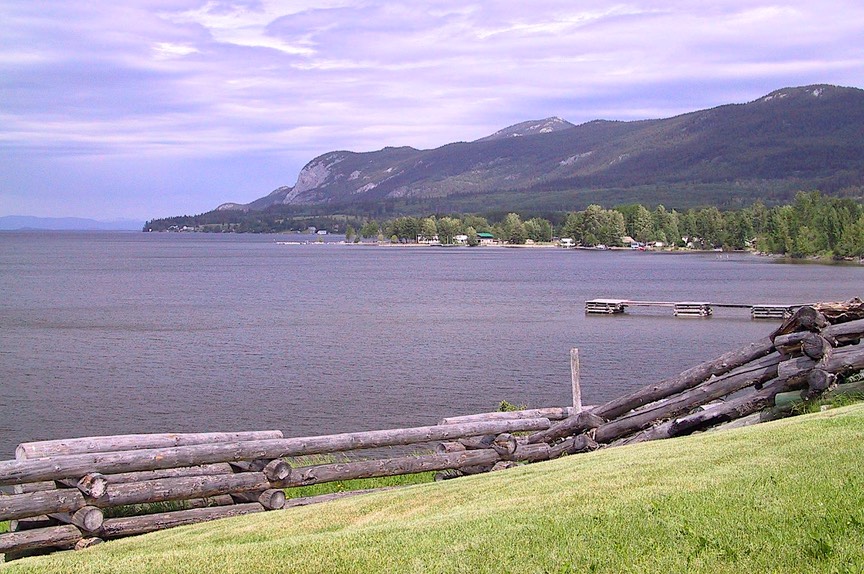
As we moved north the countryside became prettier, more mountainous as well as greener. Yellow daisies beside the road, lakes appearing with some regularity. We went through Lac La Hache and very pretty little Williams Lake (the home of Rick Hansen – huh?). Now white daisies, too. More pastureland, and signs warning us of moose. Fun little towns abounded: Vanderhoof (the geographic center of British Columbia); 100 Mile House, with its world’s largest cross-country skies on the roof of the visitor’s center; Howard, with the world’s largest fly rod in a similar position. Now we were getting to the good stuff……..this is why we had come. We were headed “up-map,” and the further north we were, the better it was.
Forests were getting larger, lots of logging was going on. Many of the trees were diseased, unfortunately; the pine beetle has taken over much of British Columbia and they expect eventually to lose most of their pine forests; literally, an article in the paper discussed the worst case scenario of a 95% loss of all pine trees in the province. Ouch! The current discussions center on how to take advantage of the dead trees; very sad.
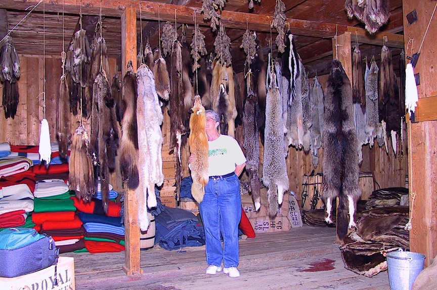
We stopped at Fort St. James, a national historic site; this is the location of the western-most outpost of the Hudson’s Bay Company, and the site has been restored/reconstructed. It was a fascinating experience; we learned a lot about the activities of that time. Our guide was a young First Nation woman from the local community, and she was great. She was probably in her early 20’s, is finishing up one degree and working on another, in international business. She commented that she was probably going to have to go all the way to the US to look for a husband who was not from her tribe, it was so large and widespread. She was very bright and we enjoyed talking with her. As an add-on to the discussion of rivers, trains, roads, Fort St. James was actually the capital of British Columbia at one time; the cultural and financial hub of western Canada. That is very hard to believe when you look at a modern map, as the town is off at the end of a dead end road, in the middle of nowhere; but back in the day, when you traveled by river and lake and carried your boat on your back in between, this was the logical site for traders to meet and transact business. With the coming of the railroad along a different route, Fort St. James was bypassed and commerce and government moved to other locations.
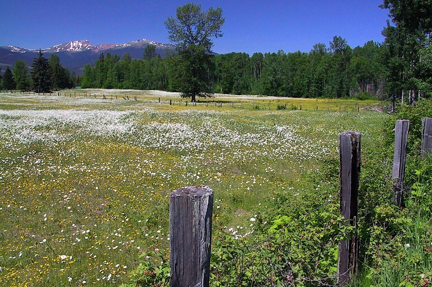
It was near Fort St. James that we first saw the pink wild roses that would accompany us far into the Yukon before finally disappearing. They are bushier than rock roses, but otherwise quite similar. They carpeted the countryside and were charming as well as colorful.
Aha! Bears – two of them, black, on the side of the road. Now we’re getting some action.
British Columbia is BIG. It takes awhile to get all the way to the top. We kept pushing on, through Prince George, where we turned left (west) and wandered toward Prince Rupert. We stopped along the way at the ‘KSan Village, a First Nation community well known for their striking, strong designs. There was a nice museum there (and a lovely gift shop, I might add…..), and several original tribal buildings. This is a very nice spot; we had to cross a really wicked bridge (the Hagwilget Canyon Bridge over the Skeena River) and go down a bad road to get there, but it was worth it. These people are well known in the artistic world; they have splendid totems, beautiful clothing, etc. Lots of black and red. Neat.
We followed the Skeena River out to the coast and Prince Rupert. This was a cool visit. It was a quiet, rainy Sunday afternoon, and evidently there were no cruise ships in port, because the town was deserted. And we saw zillions of bald eagles. They were flying around everywhere, after fish, and perched in all the trees along the waterfront. It was quite a sight. We’ve seen many, many eagles on this trip and it has really been special; but Prince Rupert was the first time we’d seen a number of them together just being, well, birds. Swooping and eating and just plain ol’ flying around. Totally Cool. There are also two excellent museums in town, which we enjoyed very much; the Museum of Northern British Columbia, with many beautifully-preserved First Nation artifacts, along with information on the development of the area; and a small railroad museum housed in a restored old train station with very nicely done exhibits on the impact of the railroad on rural areas.
Prince Rupert is really at the end of the line; from here on out we are traveling in pretty remote country. We saw, for the first but not last time, Greyhound buses that were pulling medium-sized utility trailers. We suspected that they took the place of the normally-ubiquitous UPS and FedEx trucks. More than one way to skin a cat!
Oh yes, we knew we now were traveling in areas with harsher winters – a “chain up area” for a summit that was only 528 feet in elevation!
Next we tackled the somewhat infamous Cassiar Highway. First, let’s talk for a minute about how to get to Alaska (by road). Hmmmm, let’s put that in capitals: HOW TO GET TO ALASKA (BY $^@*(&)re#$%&). Well, the path is amazingly similar to an infinity sign (an analogy which seems incredibly apt while you are en route). As you travel north through British Columbia, you come to Prince George, and there you have a choice; either you go right, up the Alaska Highway, or left, up the Cassiar Highway; the two routes meet in Watson Lake and take you on to Whitehorse. The Cassiar is shorter (by over 100 miles); however, and this is the biggie, it is only about 80 percent paved. So what’s the big deal, you say; well, actually, it REALLY IS A BIG DEAL. That 20% dirt/gravel/under construction amounts to about sixty miles. All at very slow, very dusty speed. And the upper end is through pretty ordinary landscape. So decisions, decisions. And yes, of course, we went up the Cassiar. Because we wanted to see it and to get it out of the way early, fearing that later on we might be reluctant to take it on the way back down; a good choice.
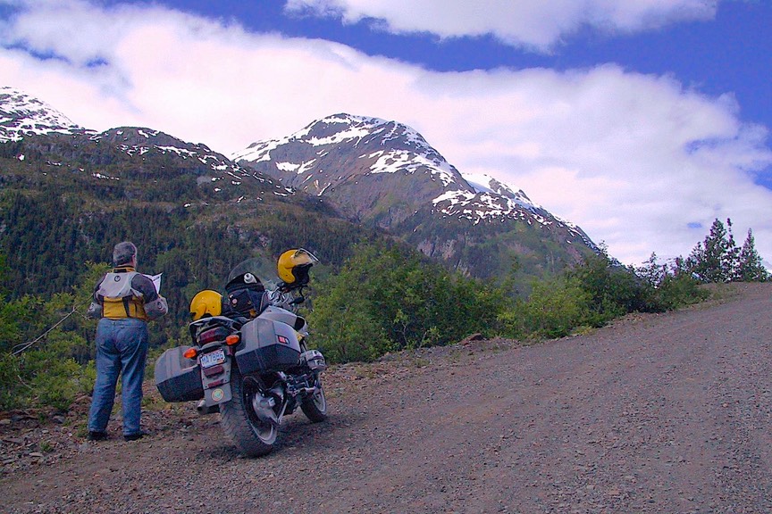
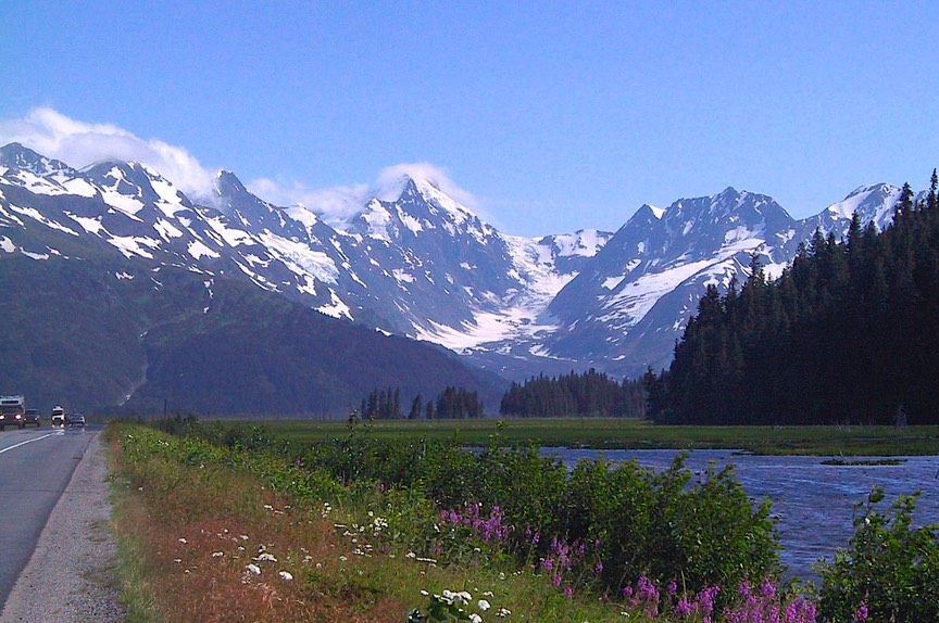
A second good thing about the Cassiar is that near the lower end of this highway is a lovely side trip to see the towns of Stewart and Hyder. Now Stewart is your normal everyday (but very nice) small Canadian town. The road to get there follows along a gorgeous stream and passes lovely glaciers. Then, at the end, you pass through US customs (how’d they get there!) and you’re in Hyder, Alaska, which could be called the busman’s Alaska, being at the far southern tip of the state and by far the closest part of Alaska to anyplace else. Now this is pure funk. Hyder is known to be a wide-open little town (maaaaybe 10-12 buildings), all on a dirt road. Then, after you traverse town (very short rush hour, I suspect), you can travel on another 25 miles to see Salmon Glacier. This is a dirt and gravel mining road (actively mined), very rough and bumpy. We were on the bike; didn’t quite make it all the way, but went about 20 miles and saw some very pretty scenery.
So, do we recommend the Cassiar? Yes, because otherwise you can’t go to Stewart and Hyder. And too, because you pass through the incredibly lovely Cassiar Mountains, truly a sight worth seeing. They are tall, majestic, covered in snow, very photogenic. And, there are wonderful Canadian Provincial Parks scattered on lakes all along the route. But, you only travel this way once, unless you really are a glutton for punishment, or until some day when they finish the road. (ed. note: by our next visit in 2007 the road was almost completely paved.)
At the top of the Cassiar, you join the Alaska Highway again, and boom, you’re in the Yukon Territory. Haven’t found anyone yet to tell me why a Territory, not a Province, but Canada still has several of them across the north. Will keep trying.
It was at about this time that we experienced June 21, the Summer Solstice, the LONGEST DAY OF THE YEAR. No, it never got dark. Yes we could sleep. We have very good blackout blinds in our bedroom. By the way, we experienced this phenomenon of “no dark time” all summer. Yes, you get used to it, sort of. But it takes awhile. You think if you wait long enough it will seem like time to go to bed. Never happens. So you wait a bit longer. Finally, when you can’t keep your eyes open any longer, you hit the sack. Then you can’t wake up in the morning. Total confusion for many days, until you finally impose some arbitrary time frames, then it gets more normal. They say these northern areas have 20 or so hours of daylight in mid-summer, but even that’s misleading; when the sun goes down, it never gets far below the horizon so it never actually gets dark; just a fairly bright twilight at best. We’ve packed away the night light for the summer.
So here we are in the Yukon, and now we’re on the Alaskan (Alcan) Highway. According to the travel guide (locally produced): “There are 11 highways in the Yukon…..a driver’s paradise.” Well, they don’t tell you that only 4 of them are paved, and even those are still bumpy. All that aside, from what we’ve seen so far, Yukon maintains its roads very well, and we had very few problems as we headed north. We swung through Watson Lake, the town that is famous for its forest of signposts (displaying signs from towns all over the world). They are up to about 40,000 of them by now, started by a lonely serviceman in 1942 who was there building the Alaskan Highway. It’s pretty impressive, in a decidedly pointless way; sorry to disappoint, but we decided not to take any pictures. We then moved further west, crossing the Continental Divide at 3100 feet, our furthest north crossing (but not the lowest).
And on to Whitehorse. Now Whitehorse is the capital of the Yukon Territory, and an actual medium-sized town. About 12,000 folks. They have a drive-through Starbucks. (And a bank, and a barbershop, and a bookstore, and a wi-fi spot.) And a totally fascinating museum called Beringia. This is the name the scientific world has given to the huge area west of present day Alaska, an enormous land mass that encompasses the present day Bering Strait, but once included a much larger area. During the various ice ages Beringia created the “land bridge” between Siberia and the North American continent. During this ancient time, this area enjoyed a surprisingly mild climate that created vast grasslands and encouraged, as we now know, the first movement of mammals (including man) from Siberia to the new world. This is an excellent museum, with lots of information and exhibits; it includes the largest woolly mammoth ever recovered and other cool stuff.
While in Whitehorse we were able to take care of some business (see above), and we enjoyed being in our first real town since Prince Rupert. And now, after leaving Whitehorse, you get to the second half of my infinity symbol. You can stay on the Alaskan Highway, going through Haines Junction (which is known to have some bad road) and end up in Tok, Alaska; this offers a possible side trip along the way down to Skagway. Or, or, or … you can “do” the Top of the World Highway, heading north to visit Dawson City and Chicken, Alaska, and still end up in Tok. Tok is the jumping off spot for all road visitors to the great state of Alaska.
So, one thinks, perhaps we’ll go into Alaska by way of Dawson City, and come out by way of Haines Junction, visiting Skagway later in the summer. What’s the big deal? One-hundred-plus-miles-of-dirt-road-big deal is the BIG DEAL. That’s the road between Dawson City and Chicken. You see, the road to Dawson City is quite nice. After that it all turns to hell. Yeabbut, yeabbut. We wanted to see Dawson City.
So first we spent a lovely quiet weekend in a pretty Yukon government campground along a stream outside Whitehorse. Well, quiet except that we managed to have the lock malfunction on the coach (at 11:00 on a Saturday night – but might as well have been noon, it was so light out!) and had to have a locksmith come let us back into our little home. But come Monday we started out up to Dawson City. The road took us due north, and the further “up the map” we got the more tundra-like became the landscape. But we enjoyed it; it kind of reminded us of Newfoundland. Frankly, we like the Yukon a lot; it’s a friendly area, down-home, and people who are there do seem to enjoy life a lot. And Dawson City epitomizes the whole Territory.
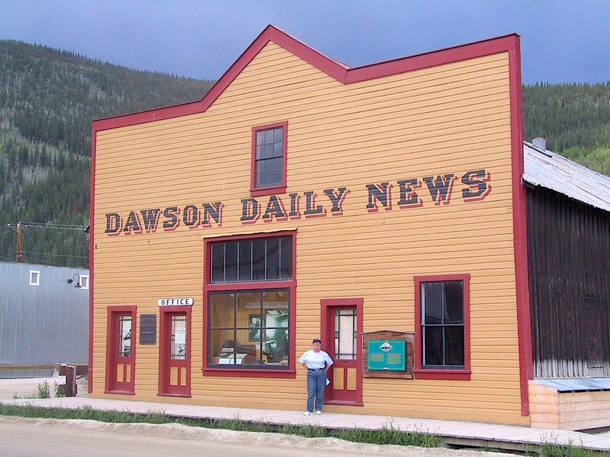
I had read some about Dawson City (used to just be called Dawson). This was the epicenter of the Klondike Gold Rush of 1898. Of course, the world has now passed on, and Dawson City is in the middle of absolutely nowhere. But it’s a good road anyhow. We had a charming afternoon in Dawson; it’s an awesome place. Parks Canada has come in and preserved most of the town, maintaining it in reasonable-but-not-cutesy condition, with dirt streets and wooden sidewalks, and they lead great tours. You get a good feel for how it must have been in its heyday, when it was the capital of the territory and really jumping.
It was here that we had our first real introduction to permafrost, ground that has been frozen for a long period of time. You can’t build directly on it, because then it starts to melt from the warmth of the living spaces. Houses sag; and trees do, too, in the forests. So when they want to build a building, they first dig a big hole, then fill it with gravel, then support the building on concrete pylons set on large squares of thick lumber to spread the load, with wooden spacers and wedges for the final leveling of the structure. Then every three years of so they re-level the building as needed; different, but very effective given the conditions. By the way, the far north might as well be made of gravel. Quarries and gravel pits are everywhere, in addition to the piles of the stuff left behind by the glaciers.
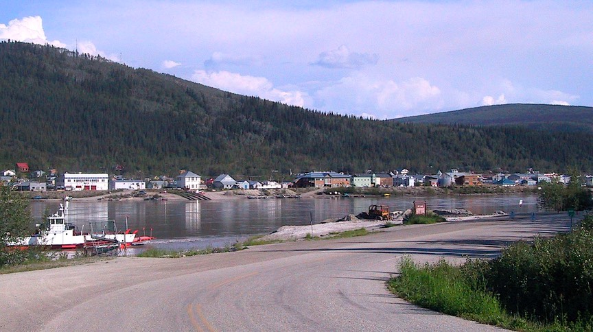
So here’s the deal in Dawson City: when you leave you have to cross the Yukon River to continue on toward Alaska. And there’s no bridge. So there’s this really cute ferry that holds about 6-8 cars (or 2 motorhomes and a couple of other guys), and it’s free and it takes you across the river. (In the winter the ferry is replaced by what they simply refer to as an “ice bridge”.) The ferry runs 24 hours daily (except from 5-7 am on Wednesdays when it’s shut down for maintenance). At certain times it gets backed up with a 3-hour wait. So you want to cross during off hours. But the river is very high and the water is really running fast and the current is amazing and the water is really cold so you don’t want to make a mistake and the ramp going down onto the ferry is steep. So it’s an adventure. But right on the other side is a very nice government campground with sites along the river. And you can walk back to the ferry, get a free ride back, and walk on into town. We picked a quiet moment, took the motorhome across and got settled, and came back for sightseeing and dinner. Later in the evening, while waiting to catch the ferry back to our campsite, we stood in a pouring rain while the ferry brought across a huge tanker truck that filled the entire vessel; it was quite phenomenal, although we would have enjoyed the sight more had we been under shelter.
But Dawson is awesome.
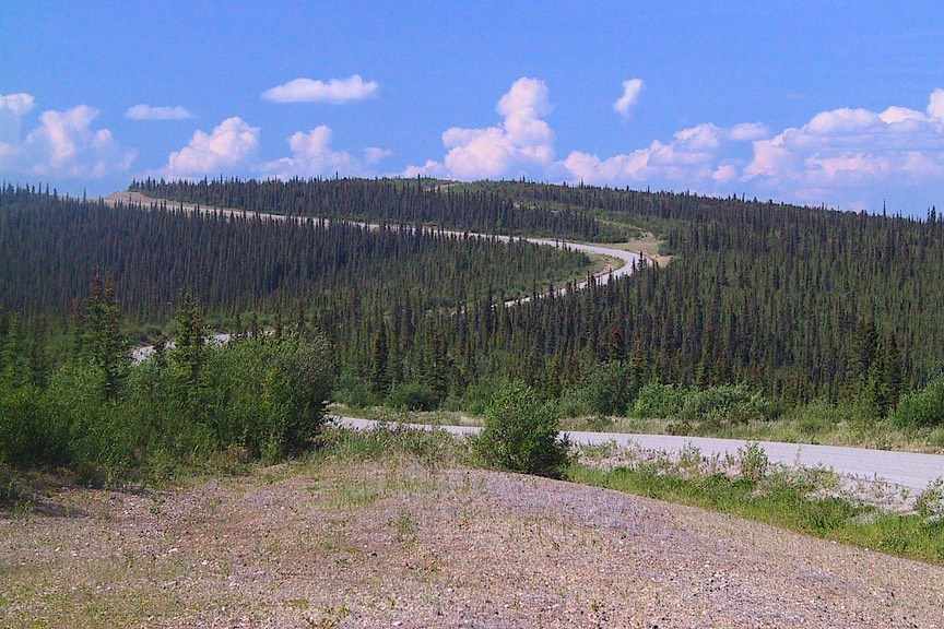
And then the road goes to pot. Literally. It’s about 300 miles to get to Tok, Alaska, much of it totally unpaved, and of course, much of the rest not a lot better; about half the distance is dirt and gravel. This is the Top of the World Highway. You remember the permafrost I was talking about? It’s hell on roads, too. This road goes above timberline, up into the real “frozen tundra” of Green Bay fame. The countryside is interesting, low shrubbery instead of the exposed granite we were used to seeing above timberline in the Sierras; we were crossing a high exposed plain that used to be the summer foraging route of the huge caribou herds that have been largely wiped out. Very stark, and hard to enjoy, given the dust that was settling into our every pore; and not helped by a forest fire burning along the way as well as the damage left by an extensive fire last summer.
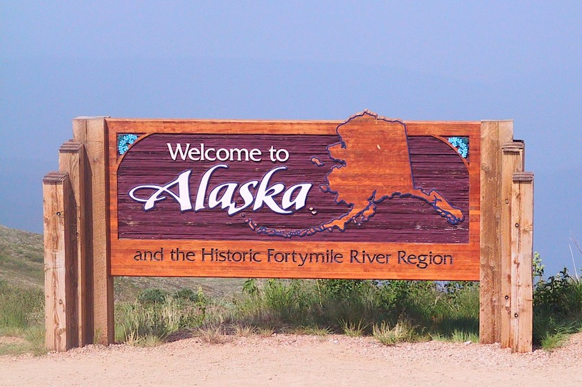
About half way along you cross the border into Alaska and there are those border guards again – we have no idea where they live. We stopped briefly in Chicken, Alaska, so we could say we had. Three houses, a gas stop and an RV park. Then on to Tok, where we washed the coach. For days I was getting dust out of things. We won’t go back that way; but as with the Cassiar, you really have to do these things at least once to see what’s there, so we’re glad we did it; and especially glad we did both those most difficult routes on the outward bound leg of the trip. True story: just the day after finishing the Top of the World Highway, when looking for a quiet place to spend the night and faced with a short section of gravel road, Rick just couldn’t do it. A few yards onto the gravel brought back all those hours of roughness he’d endured the previous day and he just stopped, shook his head, and backed up to where we could turn around. It was like chalk on a blackboard. Generally speaking, driving in Alaska is like driving a lie detector test graph…or maybe an active seismograph. You never really get used to it.
And now we are in Alaska. Yeah! Funny; it looks just like the Yukon. We pressed on. Our first goal was a visit to Valdez, of oil ooze notoriety. And we started experiencing just how far the distances are between destinations. Valdez was 250 miles from Tok, some of it on the dreaded “Tok Cutoff road.” On we went. It (the cutoff road) wasn’t tooooo bad, and beyond was the turnoff for a visit to Wrangell-St. Elias NP, the biggest national park anywhere. This incredibly lovely park has a brand new visitor’s center, and it was very enjoyable. National parks in the far north are largely places to hike and ski, with few roads for sight-seeing; so we didn’t go far. This is a relatively new park, and we expect that in years to come it will be a bit more developed and easier to investigate. Well worth exploring. Just the film at the center was awesome.
We did have information on a couple of roads which we thought we might explore on the bike. We took the coach to the end of the paved section of one of these, intending to spend the night along the river at the trailhead. It turns out this was a hugely popular fishing area, it was the 4th of July weekend, and the place was mobbed with families where papa was fishing and junior was whizzing around on his ATV. So we found another spot for ourselves, after noting that the gravel road we had wanted to take was in pretty rough condition and probably not fit for the motorcycle; besides, we awoke to a rainy morning. We’ll save this adventure for another time.
We noticed here, as well as everywhere else in Alaska, that if there is fishing, there are TONS of fishermen. There’s lots of water in the rivers, fishing in Alaska is every bit as popular as you’ve heard, and both visitors and locals want to limit out – every day. Popular spots would be littered with people in the stream or in boats. During our time in Alaska the salmon were running, and the most heavily visited areas were exhibiting what is referred to as “combat fishing.” We don’t fish, and felt in the minority. It was crazy!
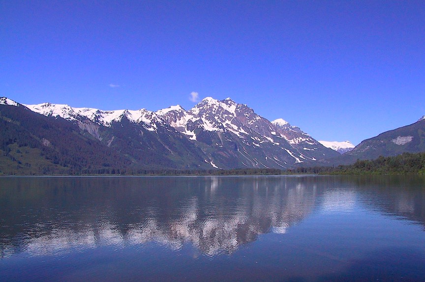
Our visit to Valdez was great. It is a unique area; one of the rainiest and snowiest spots in Alaska. We camped about 20 miles away and went into town two different days. It was perfect, because the last portion of the road goes through the incredibly beautiful Keystone Canyon with lovely waterfalls, following the Lowe River; a very special spot. We were happy to go back and forth several times. It also goes over Thompson Pass and near the Worthington Glacier. Very worthwhile. The town was fun, with a couple of funky but very well done museums. There was lots of information about the oil spill, the earthquake of 1964 that destroyed the town, and the early days of Valdez. Valdez lies on the edge of the truly lovely Prince William Sound, which is surrounded on all sides by glaciers and snowy mountains. We had hoped to take a boat tour around the sound, seeing some of the glaciers and mountains close-up; however, it was very rainy and foggy both days, so we skipped. We decided to take a chance that it would be clear when we visited Whittier, on the opposite side of the Sound; we knew boats left from there as well.
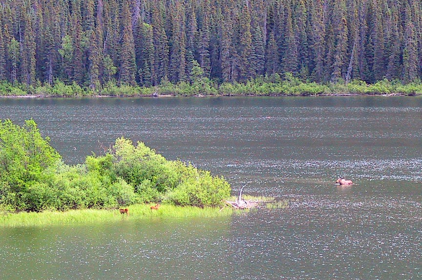
Leaving Valdez we moved on to Anchorage, which proved to be something of a disappointment. Nice enough to be sort of back into civilization, and they have a really good Mexican restaurant. And Jimmy Carter was in town for the 25th anniversary of the signing of the act that tripled the size of Denali National Park (also changing the name of the park from McKinley) as well as establishing numerous other federally protected areas in Alaska. In Anchorage we finally saw a sunset, sort of,– at 11:15 pm - one night. But for a city of 240,000 folks, there’s not a lot of there, there. But it was here that we saw a local paper for the first time in awhile, and were reminded that Alaska is still a pretty rough place. One story was about a 20-year-old experienced hiker who had died of hypothermia over the weekend; another about a black bear that had to be destroyed because it was breaking into the cars in a neighborhood; and grizzlies were getting pretty bold hanging around where anglers were being sloppy with cleaning their fish down in the Kenai River; all this on one day’s front page; we saw several other such stories in the paper on other days.
Anchorage does have an excellent museum of Alaska history. Along with a very good section describing and discussing the various native groups that first settled the region, there was an interesting exhibit on shamans, who were still very active well into the 20th century. One intriguing aspect of the shaman material was that it had been provided by the Russian Museum of Ethnography in St. Petersburg. The USSR was, of course, the primary vehicle for destroying the shamans and their spiritual hold over the locals.
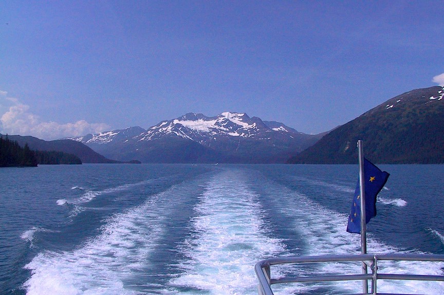
But Anchorage was filled with tourists, both those who’d driven there and those who’d been bussed in from the cruise ships. We moved on, to what we hoped would be some of the highlights of our visit to Alaska. We had anticipated that the south central part of the state would be the prettiest, and we weren’t mistaken. The southern areas are warmer, get more rain, and contain most of the glaciers. This is the country we wanted to see. We started out by heading for Seward. Seward lies at the end of the Seward Highway (they are soooo imaginative up here). Here, and nearby Whittier, is where many cruise ships dock at the northern end of their trip up the Inside Passage from Vancouver. Lots of folks wandering around, but lots to see. The road to Seward is lovely, through beautiful mountains, and the port is fun, with lots of fish being cleaned, good places to eat and shop, the usual. We took a tour boat out to Kenai Fjords National Park, which was also established in 1980, and we saw PUFFINS, TONS OF PUFFINS. Along with humpback whales, sea lions, and other lesser beasts. The tour guide was a park service naturalist, who shared lots of good info. The day was beautiful and we had a lovely time. After a super salmon dinner we headed for our campground, which was back up this lovely road and halfway to Whittier, our next goal. (This was a great campground, by the way. In addition to its location, it has a pretty lake, and there was an eagle in a nearby tree scouting for fish.)
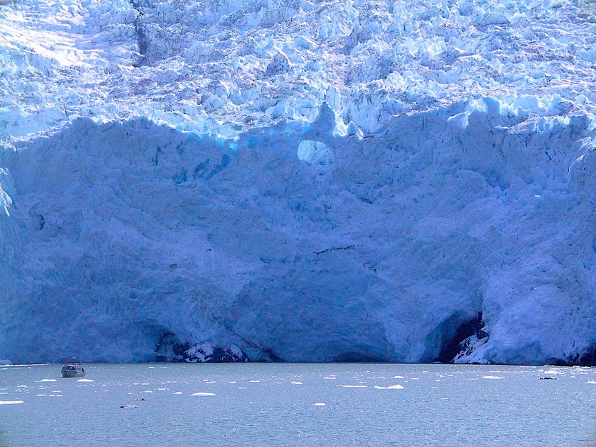
Whittier is a smaller port, recently opened to more activity because in 2000 they finished converting the railroad tunnel (its only access, built in 1942) to also accommodate vehicles – can you say time share?. It’s the longest vehicle tunnel in North America at 2.6 miles, and a little scary on the motorcycle as it seems about all they did was to pave between and on either side of the railroad tracks and motorcyclists don’t like riding between railroad tracks. Whittier is on an arm of Prince William Sound, and we were once again lucky with the weather as it was another beautiful day. Actually it was partly luck; we had chosen to go out again the day after our Seward cruise in hopes of getting another nice day. So we again got on a tour boat and headed out onto the water. Our main purpose was to see glaciers. Everyone thinking of heading to Alaska has in mind the wonderful pictures of the glaciers that come right down to the water (called tidewater glaciers) and calve ice chunks. Well that’s what we got to see; not the huge version (best known is the Columbia Glacier, which is more than four miles wide where it meets the sea), but still pretty impressive. The captain brought the boat up quite close and just sat there as we all took in the sight. He had a pretty good idea that one large feature was due to crack off and fall, and sure enough it did so just as we were finally leaving. The whole experience was strangely moving and definitely a special moment. In addition to the glaciers, on this tour we saw a wonderful group of sea otters just loafing around on their backs in the middle of a bay. It was another totally cool day.
On one of our boat tours we spent some time chatting with a German couple (one of many we’ve seen this summer). They took a direct flight (!) from Frankfurt to Whitehorse (see above – remember? In the Yukon), where they picked up their truck camper. Seems to be a very popular trip these days.
We’re beginning to see more moose in the open areas near the roadbeds, although no good pictures yet. And we paid $5.00 (grumble, grumble) for a half-gallon of milk. Life on the edge……
Ah, now we’re going down the western side of the Kenai Peninsula, directly opposite the area where Seward is. And we have fish/fishermen everywhere. We drove along the Kenai River, one of the most famous salmon fishing areas anywhere, and they were packed three deep. So, you wanted to know about salmon? Well, you’ve already heard that they come back to spawn (that whole upstream thing). There are five kinds of salmon: pink (also known as humpies or humpbacks); silver (coho); king (Chinook); red (sockeye); and chum or dog salmon. I know, I don’t care either. But all those guys in hip waders do. Their wives are called salmon widows. Oh, our ship captain taught us how to remember the five kinds; hold up a hand and start with your little finger: pink (pinky), silver (ring finger), king (the biggest finger), red (index finger to poke someone in the eye), and chum (rhymes with thumb).
Once you get past the Kenai River area (Coopers Landing, for those of you who know these things), the land begins to flatten out. All the mountains are on the east side of the peninsula. It was beginning to look a lot like Pismo Beach. And it was raining. And there were too many people. And too many RVs. And a forest fire that was smoking things up (and got much worse over the next few days). Our original plan for the Peninsula included going on down to the bottom, to Homer, which is supposed to be a fun spot. But we were not enchanted. So we said adios to all this, and headed back up the hill toward central Alaska.
Central Alaska includes two super spots: Denali National Park and Fairbanks; we were looking forward to both. And neither disappointed us. Alaska was proving to be quite an adventure. We’ll tell you all about it later, including a definitive discussion of where mosquitoes/humans fit on the food chain. We bid you farewell for the moment; we are enjoying our journey and hope you are also having a terrific summer.
Rick and Kathy, covered with bites
See more photos from Canada & Alaska in 2005