May 2004
And then it Snowed
Tennessee, Kentucky, Missouri, Kansas, Colorado, Georgia
Then we turned left… and it Snowed… Twice
Or ….. How the Hell’d we end up in Colorado? (Colorado???)
Seems to me the last time we spoke we were happily zipping around the Deep South, enjoying sunshine, spring flowers and being charmed by the locals. Wha’ hoppen? Well, one thing was a bad hose in the chassis air conditioning system. We were muttering about it when we sent our last message. We started by trying to have it fixed in Mississippi, while we were wandering around the Delta. The problem got diagnosed, but the shop couldn’t handle it. Rick is uncomfortable just showing up somewhere with the coach and hoping the guys are good wherever he lands, and we had a recommendation of a good place up in central Tennessee, and we were planning to go visit our friends in Kentucky anyway, so northward (well, sort of northeastward) we trotted, moving up into the Mid-South, as they say.
We skirted Memphis. We always skirt Memphis. I would like to visit there someday, although the whole Elvis thing puts me off sooooo much. But Memphis is supposed to have a place called Mud Island, out in the middle of the Mississippi River, where there is a really huge model of the River that they continually flush with water so you can see all the towns along it and the River, and where everything happens, and all kinds of cool stuff. I’ve been promised a return trip some day (maybe this fall?); and a promise that we don’t EVER have to go to Graceland. So there.
The Mississippi River is very special. I find it’s easy to cross other rivers, but the Mississippi is an event. And when you write about it, even if you just say “the River,” it’s always capitalized. No other waterway in the United States is as significant. That arch in St. Louis is parked where it is for a good reason.
But on to Cookesville, Tennessee, crossing the Loosahatchie River (where do they get these names?), about an hour east of Nashville (which we also skirted, AS USUAL; frump, frump). As it turns out we’ll be back in Nashville again before long, so I rested easy. I-40 east of Nashville is quite lovely. The road gets hillier, the trees are in bloom, the views are lovely, and you are traveling “The Music Highway.” How cool is that!
We got our hose repaired in Cookeville. Between ordering and repairing, we were left to our own devices over a weekend. No problem; we found a place to hang out not far away and wandered the area. We camped in the lovely Sequatchie Valley, part of the Cumberland Plateau. This is great stuff. We have friends in Pikeville, in the Valley, whom we visited, and we poked around the back roads. As we were riding along toward our friends’ home, we just had to make one unscheduled stop. We drove past a house out in the country that had barns and open pens and some acreage. What had caught our eye, though, was piles and piles of puppies. We screeched to a halt, made a quick turn around, and asked if we could come play. Of course. They were mostly Jack Russell terriers and pug dogs. But one was a mix of the two, called a Jug, and was so really adorable! Folks are in the process of getting the Jug listed as an official breed with the AKC. Keep an eye out.
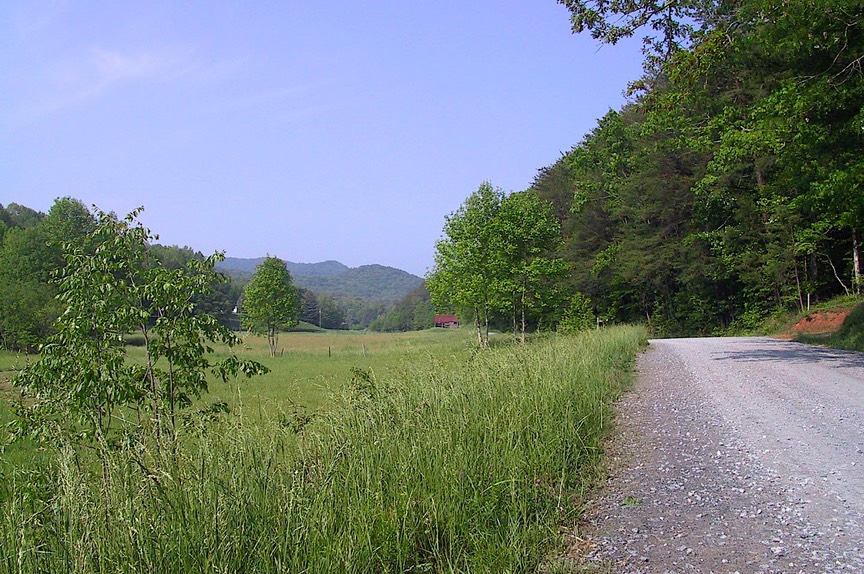
This part of central Tennessee is an area that was settled early, then again during the Depression. The government offered homesteads to people, and helped them build simple houses; a real windfall for many who never expected to have their own homes again. And a wonderful place to live; high enough to be cooler in summer, yet not an area of terrible winters. As you know, we like central-eastern Tennessee a lot; we hope to visit it many times. Pikeville is only 1-1/2 hours from Chattanooga, almost that close to Knoxville, and only a couple of hours from Nashville. Yet it is as rural as you could desire. Just over the ridge from Pikeville is the Eastern Time Zone; folks have to go back and forth between what they call “fast time – slow time.” If you look at the map, it’s a sea of dancing letter T’s (a non-map reader won’t know what that means) as the zone shifts around all across Kentucky and Tennessee. We found out part of the reason that the zone shifts around so much is that all the ports on the Ohio River had to be in the same time zone; go figure.
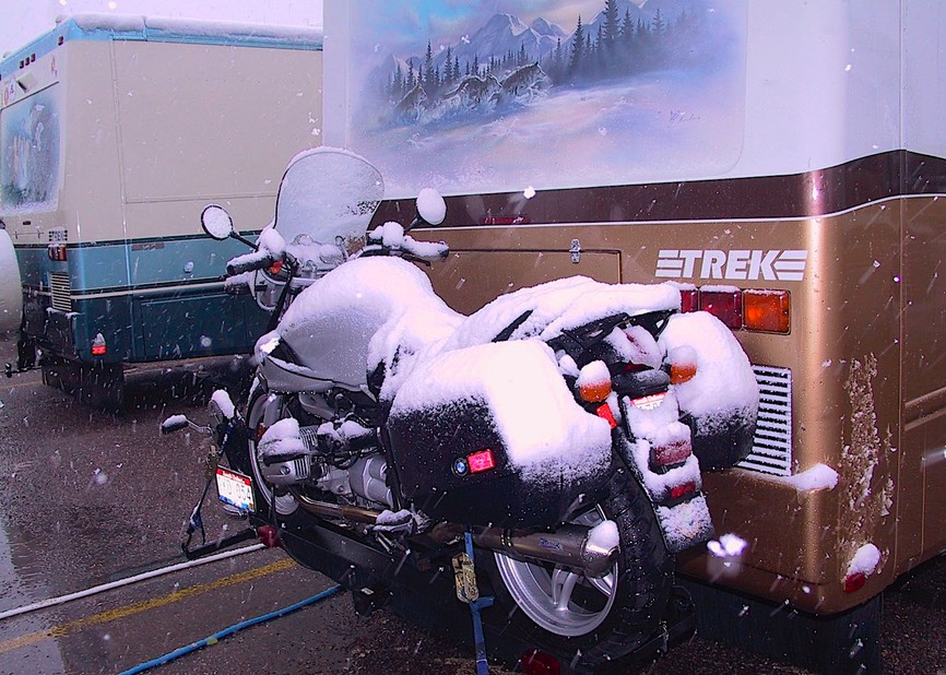
One new hose later, we zoomed up to Louisville, Kentucky to see Tom and Pat Wardell, old buddies from Arroyo Grande, who had just moved there. As we traveled north, we moved further back a week or so in the “time of the dogwoods.” When we arrived in Louisville, they were in full bloom, whereas they were finishing up down in Mississippi. Southern Kentucky is “rougher” than Tennessee, although fully as lovely. Then, as you move further north in the state, closer to Lexington and Louisville, the area becomes “gentrified” – large horse farms (complete with tons of foals), big homes on large parcels of land; it’s all “trimmed up and looking in its prime.” This is the domain of the Kentucky Derby. And Louisville was getting geared up for the fun. In addition to the dogwood, the weeping cherry trees were in bloom, and the spiraea was taking over everything. Louisville is a lovely town. Some day we’ll spend a week. We had a great visit with Tom and Pat, who were deep in the middle of trying to find places for all their stuff; Pat needed a hat to go to lunch with the ladies, because everyone wears a hat during the Time of the Derby. As I say, Louisville was lovely, but it was cold, cold, cold. ….And then it snowed. Damn! We’d gotten too far north again. It snowed the whole evening; we watched the huge gloppy flakes falling; quite a picture. It stuck on the grass and trees; we enjoyed the view. The next morning we all went out, following a recommendation, and had pancakes at one of the best places in the whole world: Lynn’s Paradise Café, in downtown Louisville. Great spot.
Well, by then we had to fly. Why? Because we’d taken it into our goofy little heads we wanted to go to Colorado. Didn’t have enough snow in Louisville, you say? Well, we guessed not. Suppose our quiet little spring was just a little too quiet. But what about all those plans we’d made, in Alabama and Georgia and such? It seemed there was just time enough to squeeze in one more thing. But why Colorado? Well, we’d been getting all kinds of information about a rally, a national Trek rally, the first national Trek rally in fact. We weren’t going; no sirree. Not us. Not that far West. No way, Jose….. But then we kept getting more info, and messages from folks who were going. And we really did have that open space, about two weeks of it in fact. Yeahbut, it’s almost 1500 miles from Louisville to Pueblo; and then 1500 more coming back. So? What’s 3000 miles to your intrepid explorers? (Well, it’s 3000 miles is what it is, but that’s another discussion…) So, we decided to do it. Couldn’t resist; hadn’t had a “Road Trip” in a long time. We won’t discuss the differences between what we do every day and an “RT” now, will we!
Leaving Louisville, we traveled through the gently rolling hills of western Kentucky, past small farmhouses and open, wooded areas. This was different from the horse country further east, but also nice. We traveled on the Wendell H. Ford Parkway (who’s he?), seeing snow in the hills in shady spots, thanks to the previous evening’s flurries. We entered Paducah, approaching with care, because if you aren’t (careful) when you leave Paducah you have to go over a couple of nasty, old bridges (see our message from a couple of years ago when we had to tackled those icky giants) if you are heading west. Paducah is a city of incredible dogwood trees; the town prides itself on their beauty and had a festival planned for a couple of days later. They were stunning. But not distracted, we left Paducah over an easy, safe bridge that temporarily took us into southern Illinois, where we tagged alongside the Ohio River and went through Metropolis (faster than a speeding bullet), before crossing the Mississippi River over another nice easy, safe bridge and into Missouri. All this to avoid the bridges that cross around Cairo, Illinois. Well worth it and some pretty new country to boot.
So here we are in Missouri. West of the river, the countryside opens up into flat, rolling farmland, with lots of new cotton in the fields. Soon the land becomes more wooded and rural. The roads are smaller, going over hill and dale, and now there is some logging. Starting to see lilacs in bloom as an addition to the red bud, etc. We moved on south in Missouri, heading toward the Ozarks, which we’ve also heard of as being really great. Well, we picked a pretty small road as it turns out; great for motorcycles, not as great for a motorhome, even our little ‘Arvey. We twisted, we turned, we cranked up the engine, we wandered, and then we headed for a bigger road with wider shoulders, to help us keep out of the way of the logging trucks headed right at us. We went through Mountain View, home of the largest amateur golf tournament in America. We passed buffalo and llamas, for sale and for eating. We were headed for Branson. To get there we had to pass through Springfield, a boring city with more banks per square mile than your average burg; and not just national chains, at one stretch we passed branches of eight local, never-before-heard-of banks before coming to a name we could recognize.
But Branson? Gasp. Say it isn’t so, Joe! Yeah, we went there. But we didn’t go THERE and we didn’t see any shows! So there! Escaped unscathed. But then why go, you ask? In retrospect, we’re not sure other than that we had heard it was a pretty area and there is an Escapee park there we had not yet visited. We found out, let’s see, there are 110 shows on 46 stages. Such a treat. But it is nice country, and we did get a little nice riding in, dipping down into the very northwest-est corner of Arkansas. We went through Eureka Springs, a well known resort town that reminded us of Jerome, Arizona (or many of the Gold Rush towns in California); it had more wedding chapels than Reno. We’ll come back to Arkansas; we were very close to some incredible scenery and roads, several national scenic byways being nearby.
Probably not to Branson. The Ozarks, as a whole, didn’t appeal to us as much as we might have thought. The geology is interesting; it’s a very old plateau, worn down, and the road cuts are intriguing; but we found the on-purpose “hillbilly” stuff unamusing and denigrating.
But we did see a papier-mache Razorback, painted red. And all over the country, regardless of the state, we are seeing pockets of llamas being raised and for sale. This is a real cottage industry in the United States.
Leaving the Branson area, we made a brief stop for fuel in Joplin (that’s a place to return to some day) and headed into southern Kansas. We like southern Kansas. It’s very green, with the pecan trees getting their leaves and blue flowers in the fields; lovely this time of the year. The countryside is strewn with quiet little towns, and diminishing stands of trees as you move further west. More and more towns have “Fort” as part of their name. We spent a night just outside the little village of Medicine Lodge, where in 1867 many of the Plains tribes met with the US government and made peace settlements. We passed through Moline, home of Kansas’ oldest swinging bridge, and Longton, the white-tail deer capital of Kansas. Not bad.
BUT (and it’s a really big but) Kansas – indeed the entire central plains area – is truly, truly windy this time of year (or maybe lots of times of the year). Horrific winds across the western half of the state and the eastern part of Colorado. No fun, mam’selles. Sure know how Dorothy ended up in the Land of Oz. (There’s an Oz Museum in Kansas, in Liberal; you can go for us the next time you’re there…..) And as we head west it’s getting drier and drier, mostly range cattle, wheat and cotton; even a couple of oil pumps in the fields.
We were getting close to Colorado, although we still had to travel through Dodge City (complete with Boot Hill). And then we were in Colorado. Whoopee? Looks just the same, and now we were in Mountain Time, to boot. Eastern Colorado = western Kansas = West Texas. Seen one, seen ‘em all. But we had started gaining altitude, started passing bunches of disgusting, smelly feedlots (and not much else), and reached Pueblo, fighting wind the whole last two days. But Eureka!
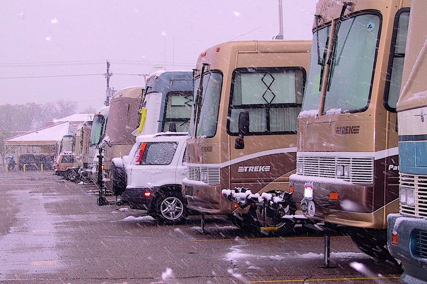
The rally was a hoot. Just over 200 Treks, all in a row. Never woulda believed it. And were we proud! We stayed in Pueblo a week, enjoying seeing friends, talking mechanics with each other, “how to’s” from all sides. A good time was had by all. And then it snowed……. Turned cold and rainy, got colder, and then it got white. But we didn’t care. Most of the events were held indoors, we didn’t care about seeing the new coaches all that much anyway, etc. You get the picture.
The rally was held at the state fairgrounds, and we were sharing space with a rabbit show and a rodeo; it all added to the ambience. We felt sorry for the rabbits in the very cold weather, but their handlers seemed unconcerned. We wandered among their cages, petting beautiful Chinchillas and Satins to our hearts’ content.
The snow had melted by the time we left and we started a wild and furious beeline back to the east. We were chasing a package or two of mail, which didn’t find us in time in Louisville, so we detoured a little further north than otherwise necessary, back to see the Wardells again. They were holding our packages up for us, we grabbed them in passing, and zoomed onwards to Georgia, our next destination.
But first, we went back through eastern Colorado, back through all of Kansas, back through Missouri, back across the Mississippi River (you get the idea). The path we cut going east was roughly 100 miles further north than that which had taken us out to Colorado. But the countryside wasn’t all that different. Halfway across Kansas we felt we had gone from Stetsons and cowboy boots, to baseball caps and work boots. We passed Burlington, KS, home of the Beetdiggers; the burg of Kanorado (guess which state line that little town is on); a huge billboard east of Colby, KS which advertised a five-legged cow; and decided that somewhere in Kansas must be the boyhood home of the man who invented cruise control. One very nice thing was that the wind had lessened and swung around so that it was now a lovely tail wind for us. The wind, plus the flat Kansas plains sloping ever so gently downward as you head east helped ‘arvey set a new mileage record at 13.1 mpg; Rick was pleased. Our path through the state led us through the scenic Flint Hills region (in the north-central area). This is tall prairie grassland, and mighty pretty. Even the dirt’s a nice shade of brown. We enjoyed this a lot. The fields were lush and green, the wheat up 3-4 inches; we passed the very small town of Gypsum, which displayed a sign saying “Gypsum, next 13 exits.” Significantly, the sign was home-made; local humor.
As you approach Missouri, the land gets rougher: hillier and rockier, with more trees and less development. We stopped in Peculiar, outside Kansas City, for fuel, and plunged ahead. The suburbs surrounding Kansas City are lovely and full of large homes on acreage; country estates, you might say. Quite nice. Missouri is a very attractive state. We stopped outside Knob Noster (really – no idea where the name comes from) for lunch, went through the towns of California and Rosebud, and camped for the night along the lovely and quiet Osage River, just east of Jefferson City, where it enters the Missouri River. Lovely area, with rolling green hills, forests, nice little towns; we love the Mid-West! We decided to save a visit to Jefferson City (the capital) for another time, as we were moving along as rapidly as possible. (You see, we had just five days to get from Pueblo to the mountains of north Georgia – that damn 1500 miles again!).
BUGS ARE EVERYWHERE. It’s spring; we clean (what do you mean, we, white woman? -- well, Rick cleans) the front windshield every few hours, just to be able to see where we’re going. And guess who’s running for Sheriff of Gasconade County, Missouri? Mr. Zelch; he lives in Rosebud and his wife has a daycare center. Would like your vote, if you’re ever that way.
A highlight of that day’s drive for us was passing through St. Louis. We have very fond memories of that city and will return to spend several days one of these years; we had to make do this time with getting an Arch fix by viewing the Gateway Arch from the freeway. What an incredible structure! Have you seen it? It is so much more than you can imagine from pictures; a wonderful, creative and imaginative monument.
We crossed the Mississippi River and entered Illinois. We were battling heavy winds and a very bumpy section of highway, making it hard to enjoy the countryside. The land was flattening out and more open, although still lots of trees. We were seeing larger farm holdings now and some open prairie; this is very productive land. We crossed the toe of Illinois and the toe of Indiana, with a bridge over the Wabash River somewhere in the middle. This is very pretty countryside, hillier as you get further east. We traveled through the Hoosier National Forest, close to the Ohio River, and marked it for a return trip another time. And then we turned south, crossed the Ohio, and were in Louisville again – also a very lovely city. After grabbing our mail (see above) and getting some shut-eye, we fled onward. Going through Bowling Green, we muttered yet again that we still hadn’t stopped at the Corvette Museum there; we also didn’t stop at one of Kentucky’s most famous sites, Mammoth Cave National Park.
We entered Tennessee, still beautiful two weeks later, crossing the Cumberland River at the same time we hit 80,000 miles on the motorhome, and noticed we were starting to see wildflowers along the roadsides. Dipping southeast, we went around Nashville (again), after enduring one of our worst roads yet, I-65 between Bowling Green and Nashville (yuck, yuck, yuck). But heading towards Chattanooga, the road turns splendid again (now I-24) and we were delighted. We zipped through the Choo-Choo City; it was too early for pizza so we just waved at Mellow Mushroom as we went by, and headed for Highway 64 east along the Ocoee River. This is a lovely, quiet (except on weekends) section of road that we have traveled before, and we had been looking forward to this part of the journey. The road dips very briefly into North Carolina after leaving Tennessee, and then drops down into the north Georgia mountains, at the southern end of the Appalachian chain. Being at a higher elevation, the dogwood was prime, now joined by rhododendrons and all the colors of green that mean spring is in full bloom in the mountains.
We spent 3 great days in Hiawassee, Georgia, at a BMW rally. (This, of course, is why we had literally sprinted all the way across from Colorado.) This was one of the several events we had pre-planned for ourselves this spring and they kind of drive our travels. Sometimes we make no plans and just wander, and sometimes we go on a scheduling frenzy and scurry about. We enjoy it both ways. The rally was very nice although we did have a fair amount of rain. Kathy got new boots and gloves and the bike got new handlebar mounts. We met some nice folks, saw some we’d met at the rally in Mississippi a month before, ate well, and generally had a good time. BMW riders are nice folks and serious motorcyclists.
Leaving the rally, we moved about 60 miles west to another part of the mountains and are currently encamped at Cherry Log, our favorite spot in all of Georgia. We’ve always been here in the fall before, enjoying the russets and oranges of that season; it’s delightful here in May, also. We are resting and doing projects, as well as taking motorcycle rides. We’ll be here about 10 days before heading (naturally) back to Tennessee to have a little work done on the coach in Nashville.
After that we have motorcycle races in Birmingham, Alabama before we start our annual trip northward. It turns out we combined our springtime in the South with a road trip out west. Was it a good idea? On the whole, probably not worth all the bother. Would we do it again? Of course.
Our “annual trip northward” this year will take us back to the Maritime Provinces. Our last commitment in the United States is a music festival in Vermont in mid-June. Then we’ll make a run for the border, up into Quebec and out to Newfoundland; we didn’t get there when we were in the area two summers ago. After that we’ll see more of Nova Scotia and New Brunswick, and visit Prince Edward Island; we expect to stay in eastern Canada until we either think we’ve seen everything – unlikely – or the snows start to fly.
Spring is beautiful everywhere, and we sure hope you are enjoying the lovely sights. If not, you’re working too hard; get up out of that chair and go outside. Smell the flowers and go wander a country road. See you soon.
Rick & Kathy
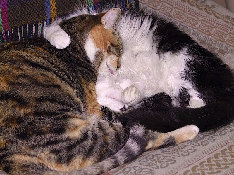
PS: As we finish this message, a real southern storm has hit us, Thunder and Lightning and Hail, oh my! The cats have gone to the closets.
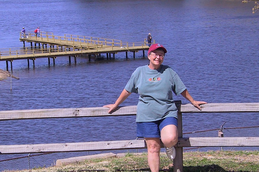
PPS: Couldn’t resist sharing a couple of photos of the chiluns
Best Friends Keepin’ Cool
See more photos from the US in 2004