December 2008
Home of the Border Bastards... (*&^%$*!+@*#)
Northern Chile
So what’s a Border Bastard you say? This message both begins and ends with them, so stay tuned…..
After far too many days spent there, we finally got out of Arequipa, Peru and headed south for the Chilean border. As we drove along the rapidly descending road (Arequipa is about 7,500 feet and the border is at sea level), we remarked at how Peru was such an amazing pile of rocks. Huge mountains, deep canyons, monster boulders, sharp stones and smooth stones, gravel and sand; all very-very-very dry in this southern part of the country. But we were going to leave this area and go somewhere new. Enough of Peru’s dry countryside; we would head to Chile’s dry countryside. But it would be new and different, we knew. Colombia, Ecuador and Peru are all rougher and less developed and less sophisticated than the countries further south, we had been told. We wanted to see for ourselves.
We arrived in Chile and were instantly jolted into a new era. The border crossing was unlike any over the last many, many months. Chile takes its agricultural products seriously, and also – apparently – its lack of fruit flies. For the last week or so we were in Peru we regularly saw billboards proclaiming Sin Moscas de las Frutas. This was cool; we are from California and know how important this is. We were used to eating all the oranges before coming back across the border from Arizona. But this was more than that: We knew what was coming and had concentrated on eating down our suspect supplies, but still… he (Bastarde de la Frontera Numero Uno) took my apples, my tomato, my lettuce, my carrots, my honey, my eggs, my raisins, my bag of dried fruit I use in muffins. He left me my cheese (really horrid Peru cheese I actually tried to get him to take), my milk, and my butter. It was brutal. (Normally we don’t arrive at a suspect border with this kind of stuff aboard; we crossed a day earlier than I had anticipated.)
First a dog came into the coach and (presumably) sniffed for drugs – he didn’t want the cheese either. Then this big, actually-quite-charming brute took over, opening every cupboard and drawer, pulling things apart, and finally asking me for a bag to put the contraband stuff into so he could take it away. It felt like a full body search. (Can you tell I’ve written this just after it happened?)
So that was our crummy start. But then we had a second jolt – this time a positive one. We headed on into the city of Arica, which is very close to the border. After a quiet night free-camping on the beach north of town we headed in, and were instantly delighted. The drivers were polite. No one honked because the light had changed. Pedestrians had the right of way. Taxis, and all other drivers as well, actually stopped at the stop signs. Rick narrowly avoided a few nasty rear end collisions before adjusting… just kidding. It was truly amazing! Chile did indeed seem somewhat more civilized, at least in this manner, and if a kinder and gentler traffic situation is one of the side benefits… Awesome, dude!
Something you might not know: skinny little Chile has its own time zone; it’s on Atlantic Time. When you cross on into Argentina, then you are on Greenland Time (doesn’t that sound exotic). With one caveat: during the summer, Chile is on the equivalent of Daylight Savings Time. Upshot is that when you cross from Peru into Chile this time of year (November) you jump two time zones; might as well have gone straight into Argentina (Kathy, you can’t go straight from Peru to Argentina; ed. Yeah, well, whatever.)
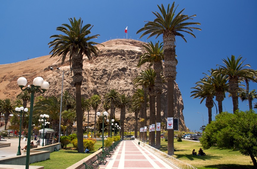
Arica is a pretty spot, and we had good days there. Our main goal was to get new tires for La Tortuga. We had tried in southern Peru, but they don’t carry the size we need, which are pretty heavy-duty. We decided to wait (and hold our breath) and try again in Arica, which is about 185,000 happy folks and large enough to accommodate us, we assumed. Conventional wisdom was that Chile would be better able to help us out.
Later: The tires happened. The local dealer had three on hand, joy of joys, and the others were bussed in from Santiago. You have asked us how our Spanish is doing these days? Rick was able to transact the entire purchase, including discussing kinds of tires, where they would come from, alternative ways of getting them here (or us going after them), all in Spanish with several people who spoke no English! You go, Rick!!
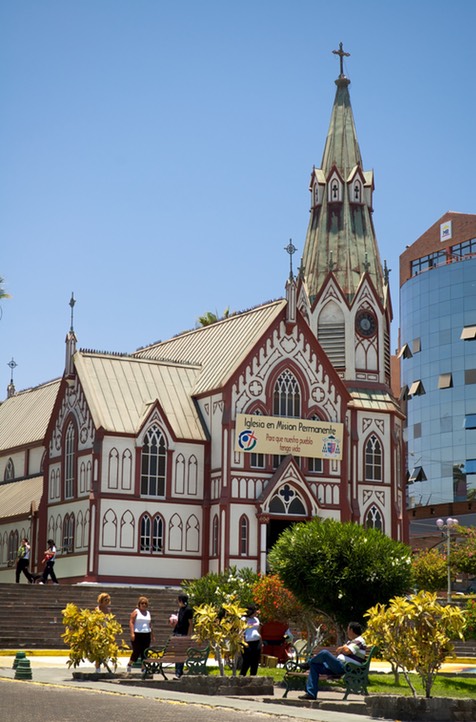
While waiting for the Santiago tires to arrive (4-5 days) we saw the sights of Arica (including our first fast food in over a month!) and visited a very nice museum right outside of town. It is a good archeological and ethnographical museum, and contains the oldest mummies in the world. We were interested in them, but weren’t as impressed as we had expected to be; we had been so enthralled with the ones we saw in Leymebamba in Peru that these seemed rather ordinary. Not fair to them! We also enjoyed the steel framed church pictured here; it was designed by Gustav Eifel of Eifel Tower fame.
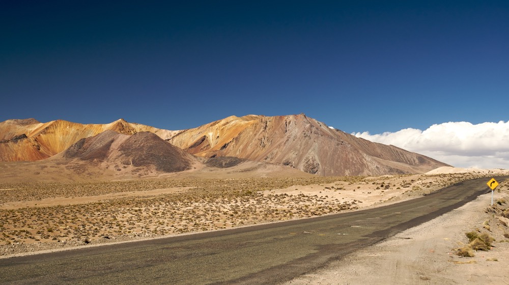
And then over the weekend we wandered in the wilderness of the far northern Chilean altiplano, in Parque National Lauca. This altiplano makes the Man with No Name in High Plains Drifter seem like he’s wandering around Palm Springs.
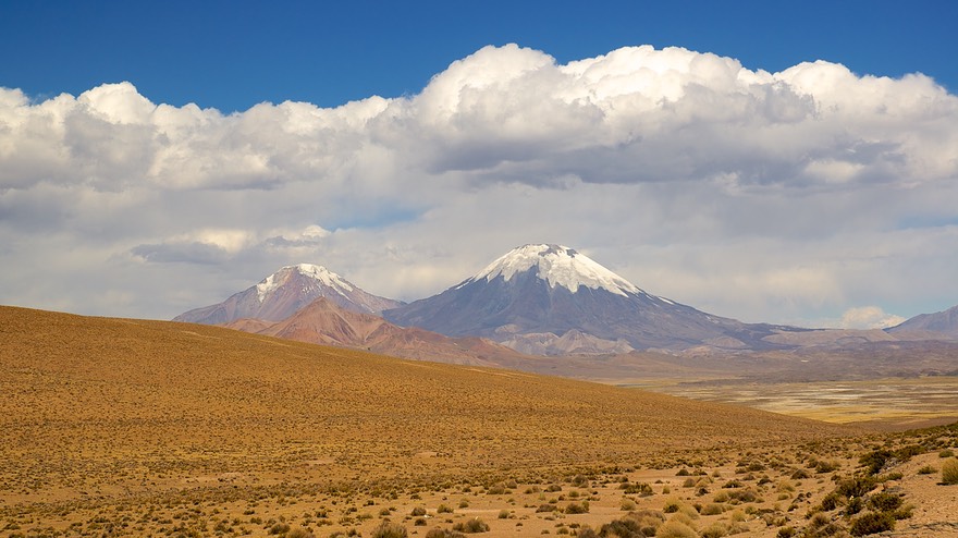
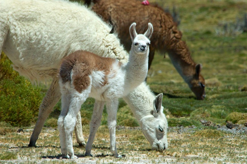
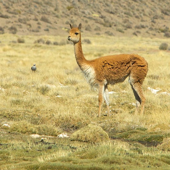
Think: 15,000 feet high, and those are the feet underneath you. The mountains are waaay up there; many of them are volcanoes; many are covered in snow all year round. The ground is barren except for this low grass stuff and something hard and green that looks like moss but bears no relation. It’s dry – very dry. Sound dreary? It isn’t. There are wetland areas with multitudes of birds, including flamingos in varying stages of pink. Have you ever seen the movie Winged Migration? We felt like some scenes must have been filmed right where we were camping. There are also llamas and alpacas and vicunas (part of the park is a preserve, which has brought the vicunas back from near extinction) – and sheep too. In one corner of the park is a salt pan, the Salar de Surire. We wandered and took pictures; I got to see my first salt flat. Rick, a veteran of the Bonneville Salt Flats generation, was unimpressed.
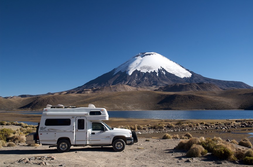
There were two downsides to our journey. The first was the altitude. We had left Arica (at sea level) and drove straight (only about 100 miles) to where we spent our first night, at 15,000 feet, right at the foot of 20,800 foot Volcan Parinacota. Too high for comfort, and we almost froze to death as well; but we had parked beside beautiful Lake Chungara, which was fantastic. The setting is beautiful, and the lake is a migration destination for many birds. We saw strange ducks and geese, and even giant coots. The coots were a hoot. We’d never seen any before, and now we know why elderly men who walk along bent over are called “old coots.”
This is a lovely corner of Chile. It is the far north corner, right on the border with Bolivia. In fact, in the morning, the road we wanted to take through the park started beyond a customs checkpoint almost into Bolivia. We skirted an enormous line of trucks waiting to be cleared, hoping nobody was coming in our direction on this wee road, then Rick talked to the police in order to identify our road, just in sight past the check point, so that we could start on the day’s adventure. This road would take us to the Vicuna Preserve and to Salar de Surire. We saw lots of camelids along the way, and even a new bird, the Nandu, kind of like a squirrely ostrich. We were enjoying ourselves.
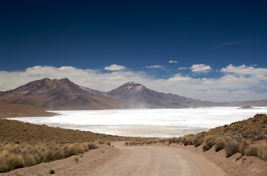
But we kept coming onto these huge trucks. They were filled with borax, which they were taking (presumably) to Arica to be sent off in ships. The trucks were an annoying constant, although all the drivers returned our waves in a friendly manner. They were hard on a very dusty, dry road, and we wondered what the hell they were doing here. Well, when we got to the Salar, a dry lakebed, we saw the operation in full swing. Yuck. This was our other downside. This lovely, pristine area is full of borax-hauling trucks. Bummer.
A delightful serendipity, though: in Arica, while shopping at the local Hiper Lider (lots of Safeway products should tell you who the parent company is), we had run into a couple from the Boston area. We had a nice chat, and found they were heading into the mountains for a few days. Waved good-by, and went on. Well, we ran into them again, on the road to the Salar de Surire. After more lovely chat, and hugs, we waved good-by, and went on. It had been delightful to see American faces and share experiences. They had flown in and were traveling by rental car; we wished each other well.
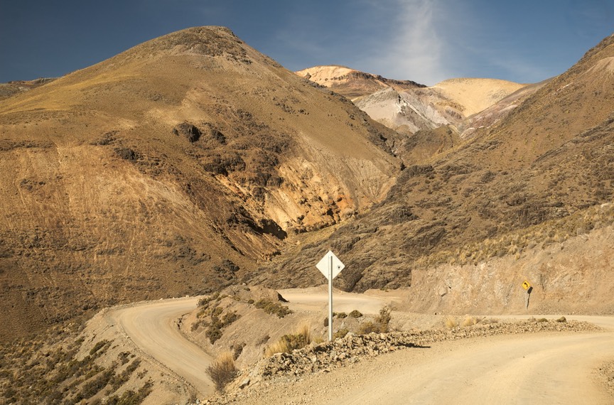
We didn’t spend much time at the salt flats. It was mid-afternoon and we really didn’t want to spend a second night at these high altitudes. So we tried to get down off the altiplano. Easier said than done. Our map showed a route we had in mind, relatively straightforward. Our Moon Guy (see below) talked about the same route. But uh-uh. No such road; not these days, anyhow. So we had to backtrack somewhere between 40-50 miles before we found a different road we could take that would send us in the right direction. When we found it, it was a good one; we ultimately realized we were on a road described in the book as “a secondary road that switchbacks vertiginously” down from the altiplano. It was cool; we like “vertiginously.” When we reached 11,000 feet, we stopped for the night, then returned to Arica the next day.
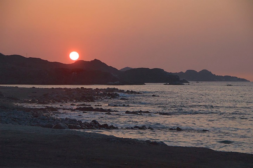
We spent one last night on this beach north of town. This is a great spot. We are just beyond where the pavement stops along this road; it seems we are just at the beginning of a military (army) installation of some sort. The guys don’t care that we are there. They jog by in the mornings sometimes. But mostly they drive their trucks back and forth from here to somewhere, very industriously, a few times a day. They look like outcasts from a Desert Storm movie. But cute butts. Anyway, the beach is quite lovely, and very quiet at night. The birds swoop around and make some noise; otherwise there’s little going on and we can sit and enjoy the stars, to say nothing of the lights of Arica in the distance. We have been very happy here.
I should also comment that, after ten countries worth of seeking out a cajera automatico when we needed funds, apparently in Chile an ATM is called an Autodinero. Easier to translate and to pronounce. Also diesel has been less expensive here than in Peru, and gasoline, for a change, is slightly less than diesel, making it much less than in Peru.
Preparing to go have the tires put on, and wanting to get rid of all the dust and dirt we’d picked up from following the borax trucks for parts of two days, we found a car wash. As we drove in, there were our friends from the mountains, having their car cleaned up before turning it in and getting on a plane to go home! How cool is that! We spent a long time talking while the rigs were made pretty, finding out more about each other and sharing adventures. They had spent a night in the Salar de Surire area, having to crawl in through a window to find a place to sleep at the park dormitory, which was all locked up. The carabineros came by, said they were cool, and then fed them, both dinner and breakfast, showing up in the morning in full uniform and hoping to have their picture taken. What an adventure! With last hugs, we sent them on our way and went off to the tire shop.
The tires had arrived on time, the fellows at Goodyear were waiting for us, and by early afternoon we were on our way, heading south. Wow!
Now no one needs to tell you that Chile is long and skinny; it has only one main north-south road, the Panamericana. There are east-west roads that pop you up into the Andes; some of them cross into Argentina. But you cannot travel south through the high mountains, as you can along the Andean spine further north. So the Panam it is, mostly. Through part of northern Chile there is also a secondary, coastal road, which we took when we could. The Panam sometimes travels along the coast, but more often it is up a few thousand feet, along the pre-cordillera plateau. This is not particularly interesting countryside, but the road is good, there is little traffic, and we can cover some ground.
“Covering some ground” is a change in mode for us. We tend to mosey along, poking around at things that interest us. But we have decided to make a beeline for Patagonia. It is now almost December 1st; the time of year to begin seeing Patagonia is now; we are waaaay too far north and want to get down there quickly. So how do you get to Patagonia? You go south, way south, through either Chile or Argentina. While waiting for our tires to arrive we spent some time looking at the maps. There are more things we really want to see in northern Argentina. But that will take us a lot of time. So, we’ll come back to them. For now, we will stay in Chile, which has a long and boring, but straight and well-built, road that will take us down to the town of La Serena. From La Serena, east to the border. For all you fellow travelers who have been in this area, we are skipping San Pedro de Atacama, Pan de Azucar NP, etc. They will have to wait.
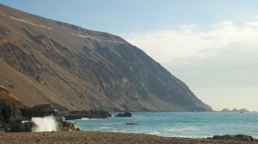
We were able to go along the coast for several days, which was great, a real treat. If you’ve stayed with us over the years, we really bad-mouth beaches. But Chile is different. We managed to spend several nights on the beach as we moved south, and enjoyed every one of them. They are clean, the weather is in the low 70s these days, there aren’t a bunch of flies, and the coast is lovely. Kind of reminds us of northern California and Oregon, without any trees. Very barren and rugged; it looked lunar to us, and we were enchanted.
We passed through several towns/cities along the coast, most quite uninteresting. We did like Taltal, which was quiet and clean, with lots of people out enjoying the evening air, and had a pretty malecon (boardwalk area) along the beach; we camped there for the night. And outside Tocopilla, we encountered their golf course, an amazing sight. It is completely sand, with no grass whatsoever. The “greens” are packed down sand, and they have plastic palm trees set in the ground around them. Weird or what???
Chile is a series of different regions as you move south; some of them have customs stops at their border. At one, Rick got an unexpected laugh from the young ladies handling the paperwork. They asked, in Spanish, if he spoke any Spanish and of course he answered muy poquito as we always do. They then rattled off a question he was able to recognize as being about how many personas we were. When he answered dos, they started giggling and carrying on that the gringo speaks pretty good Spanish after all. We do manage to get by.
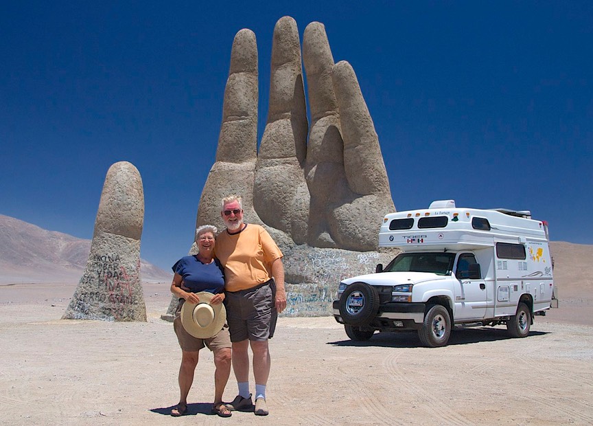
Shortly after this, we detoured slightly to get to the famous, oft photographed, Mano el Desierto, a concrete hand sticking up out of the desert sands. The Moon Guy, who has this photo on the cover of his Chile book, tells the story of how the sculptor put it out in the middle of nowhere so that passers by would have an excuse to stop, get out of their cars, and listen to the sounds of the desert. The story goes on to say that when he drives to see his sister in a nearby town, he will pause to clean up the unfortunate graffiti that seems to attach itself to the sculpture. It makes a great story, and certainly enough to get us to go there and stop. While there, we were having lunch in the coach when a group of military folks came up and started taking pictures of each other in front of the hand. We moved aside to give them a clear field and exchanged waves as we left.
Either on the coast or inland we just kept moving. Our last night heading south to La Serena, we didn’t quite make it. We stopped about 75 miles north of there, just below the crest of a hill, taking a little road that led to one of the observatories in this area. (The air is so clear here that many international groups have set up observatories; we will try and visit one next time we come through). We spent a beautiful, quiet night under zillions of stars, enjoying the high desert. We saw what we assumed was Orion’s Belt, but it had a bunch of funny stars around it and it was in a strange place, so who knows; the southern sky at night!
Early the next day we hit the road again. As we approached La Serena we realized that we had entered a very different part of Chile. The countryside was prettier, with more color in the rocks. There were some low plants, and even some small wildflowers; even mustard in bloom. Had we reached the end of the desert finally?
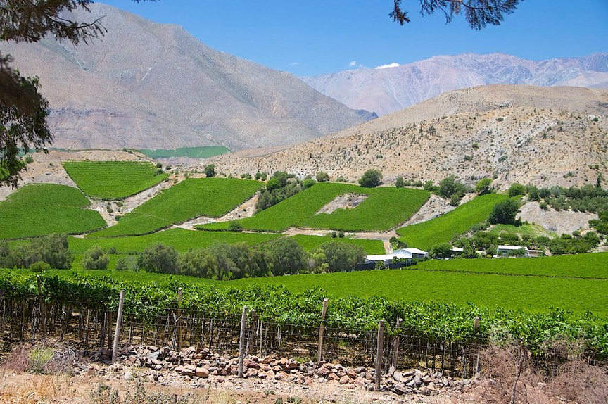
La Serena is a pretty town, warm and friendly. It reminded us very much of the Santa Barbara area, with jacarandas and hibiscus in bloom; tiled roofs over whitewashed stucco; and we had suddenly entered the wine region. Awesome! It has been over 2 months since we’ve been seeing green, in northern Peru. We were stoked. Rick says the women are prettier; I think maybe the fact that there was an international women’s soccer meet going on might have helped.
We puttered around town for awhile, doing internet and grocery shopping, and thinking that all the bookstores were closed at a weird time (this was when we discovered about the Chilean summer time change), then trekked on to Vicuna, halfway up this lovely valley, where we spent the night on a hillside looking down on all the vineyards. The next morning I visited the Vicuna Saturday farmer’s market, which so reminded me of the ones I was used to in the States; under tents, with the locals bringing their canvas bags to fill with produce, people hugging each other upon seeing them after a week’s absence, hippies selling weird stuff. Rick went back to the internet place and downloaded some iPod programs to listen to the next time we got bored driving.
We headed out, intending to drive over the very high Paso Agua Negra, into Argentina. As we started the climb, we were suddenly brought to a halt by the carabineros. Basically, it was “wherethehelldoyouthinkyou’regoing?” Apparently the pass was closed, until December 6, a full week away. We had noticed we had left pavement and were now on a road under construction, but that was nothing new. They weren’t interested in sharing info, so we never found out if the road was closed because of construction, or still closed for the winter. This is a very high pass, over 15,000 feet, and only open during the summer (Moon Guy said “by December and until April”).
So, to paraphrase The Stranger in The Big Lebowski, “Sometimes you choose the left turn and sometimes the left turn chooses you.” It seems we were going to have to take a different road into Argentina.
We had two choices: go back to the coast and come down far enough to pick up the next road across the mountains, or come down an inland road we’d noticed. We chose the inland route, which came with recommendations from the Moon Guy. (Moon Guy is the fellow who wrote our guidebook: Moon Books Guide to Chile; this series is our absolute favorite for information on the various countries we are visiting; we recommend them highly.) It seems this route would follow at least some of the old railroad line through the area, and would stay in the foothills rather than returning to the coast.
It was a good choice. We went south from Vicuna through the interior valleys and up over small passes; some of the road was gravel and really twisty, but most was paved and in very good condition. The scenery was great, we went through several tiny tunnels just wide enough for a train (and saw several old stone railroad bridges), and we were in and out of grape country most of the time. Avocados and citrus, too. With the rough, dry hillsides above the areas under cultivation, we felt very close to California, probably most akin to Ojai. Not too surprising, after all, as we were now in the 30 degree latitudes, the inverse of southern California.
As we got nearer to Santiago’s influence, there were more communities, more apparent middle class, and less of interest. We were dumped from our lovely little road into mid-town traffic in San Felipe, but eventually found Route 60, the road we would be taking over the Andes into Argentina.
After threading our way through the suburbs, we were out in the country again, heading up the pass. We spent a last night (for real this time) beside a mountain river, then climbed-climbed-climbed up the pass toward the border.
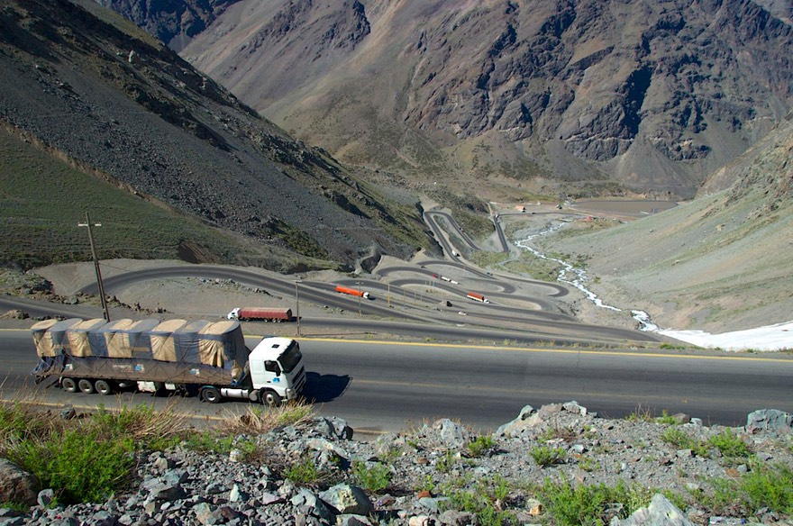
It was pretty all the way up; the pass is only about 10,000 feet, but the peaks had snow on them, and it was a lovely morning. It is a very steep climb, and includes at least 29 very tight switchbacks all in a row. Closer to the top there are several cobertizos, which are quite similar to the snow sheds we have in the Sierras. The whole area looked like the Alps in summer, with wildflowers and lots of running streams (this is the beginning of summer here). We were jazzed about heading into our 12th country since leaving the United States, one we would be spending the next several months exploring.
And then Bastarde de la Frontera Numero Dos got me. A basic repeat of when we entered Chile except that this time we did not expect it. Now you tell me why, when Chile won’t let any contaminated products in, and therefore everything we were taking into Argentina had been purchased in Chile and was, therefore presumably pristine and virginal, Argentina took it all away from me at their border. Why? Why? Why? I have recovered, of course, and life goes on and all that, but damn!
Anyway, we are now in Argentina, where we will stay for awhile. It was a short excursion into northern Chile, but we enjoyed ourselves. The northern part of the country is quite obviously different from the “heartland” (we don’t know anything about southern Chile yet, of course, except that is supposed to be exceptionally beautiful); much closer in feel to Peru, and very obviously quite isolated; actually it seemed to us that they were proud of their distance from the rest of the country – very self-sufficient and needing no one else. Nice to watch.
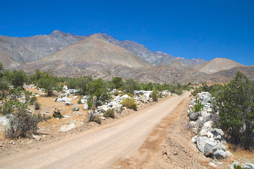
The northern third of Chile is also the famous Atacama desert, quite literally the driest place on earth. The land is so completely barren of visible life that we had to compare it to some of our least favorite desert areas in the states -- places like Mojave in California, or west Texas -- only this was even more barren. Then, as we moved further south and began to see a little scrub brush and cactus, we realized what a difference that made; how lively and colorful it all seemed by comparison. A mini education in different levels of desertness.
Ah well, we move on, adapt to new currency and customs, and continue moving south. Patagonia beckons.
Our best to all for a wonderful holiday season.
Rick, Kathy and La Tortuga con zapatos nuevos.
Click the link to see more photos from Northern Chile.