July/August 2008
Run, Kathy, Run
Ecuador Part 1
No….no….
after the taxi, silly….he’s much too fast for you! Now duck under that post, jump the gravel, dodge the street vendor and….wow! We’re across the street! And what are these crosswalks for, anyway?
The only thing more hazardous than trying to drive in the cities is trying to walk in them. We had always been told this was true, that Latin drivers drove like crazy and took no mind of who might be caught in their headlights. No one, repeat no one, stops for you in a crosswalk. No one cuts you any slack if you aren’t as aggressive a driver or pedestrian as the locals. They seize your polite hesitation and smother it. The three most ignored things in Ecuador are 1) Stop Lights, 2) Stop Signs, and 3) Crosswalks; once you learn that you will probably survive. Being a pedestrian down here is a bit like being a bull in a bullring, but without the horns, size, strength and fierceness.
But we have great and fun adventures to share about our time in Ecuador. Ah, Ecuador – the land of cheap gas and food, and a great place to hang out for awhile. When we left Colombia and crossed the border into Ecuador, we weren’t sure what to expect. Colombia had been so wonderful: colorful, lush, welcoming, a place of many pleasures for us. What new things would Ecuador have to offer?
Too, there’s a temptation, when starting to prepare to move on into a new country, to just decide to stay put. In the new country there will be new challenges: how are the drivers; will we be able to find the foods we want on the grocery shelves; how are the roads; will the folks be friendly to us; are fuel and propane going to be easily available; wouldn’t it be easier to just stay where we are – where we already know the answers to all these questions? This feeling is probably stronger in us than in some other travelers, because we are moving so slowly. We spent almost two months in Colombia; that’s sure enough time to get to feeling pretty comfortable!
But if you stay where you are, you never go anywhere… so new country, new sights, new experiences. Off we went.
We began our investigation of Ecuador at the northern end of the country, in the mountains. We were pleased to find that the border formalities were professional and organized. It would have been a quick passage, except that Rick found himself standing in line behind an enormous horde of folks who had arrived by tour bus (is “enormous horde” an oxymoron?), and it all took about an hour and a half. Still, not bad.
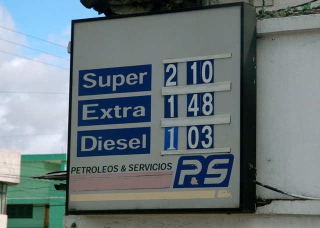
We approached our visit to Ecuador in a slightly different way than we usually do. For the last few months we have been following (in both a literal and literary sense) fellow travelers, Yasha and Juergen, from Australia, who are covering the same general territory we are, but who have been ahead of us. Until now, they have been so far ahead we’ve had no chance to catch them and become acquainted. Also, we were carrying some spare truck parts for them; items we had picked up on their behalf when we made our flying trip back to the States in May. But, now, we knew they were in Cuenca, about 325 miles due south, and were planning to be there for a couple of weeks. If we decided to head straight down the spine of the Andes, we could be there in a few days; while if we did not, we could not expect to see them until Tierra del Fuego at the end of the year. Now normally we would never consider such a plan. Fuel is too expensive, we would be skipping experiences we didn’t want to miss, and in order to see what we were skipping we would have to backtrack through most of the country, which is the antithesis of our general plan. Three no-nos for us. But, in Ecuador fuel is dirt cheap (we are paying $1.03/gallon for diesel, and gasoline is $1.48; it’s like a trip back in time.); we could figure out some alternate routes back into the north, see what we were missing, and then take an alternative route south again; and we really did want to meet Yasha and Juergen.
So we darted south. Three hundred miles; piece of cake, right? Wrong! (And “darted”? Ha! There’s no darting in these countries unless you’re trying to get across the street – see above!) As we have discovered over and over, the Panamericana is an extremely “variable” ribbon of road. It can be the equal of US standards, the absolute opposite (as described many times already), or anything in between. Mostly it’s in between, very between. Very not even hardly there at times. So… we began.
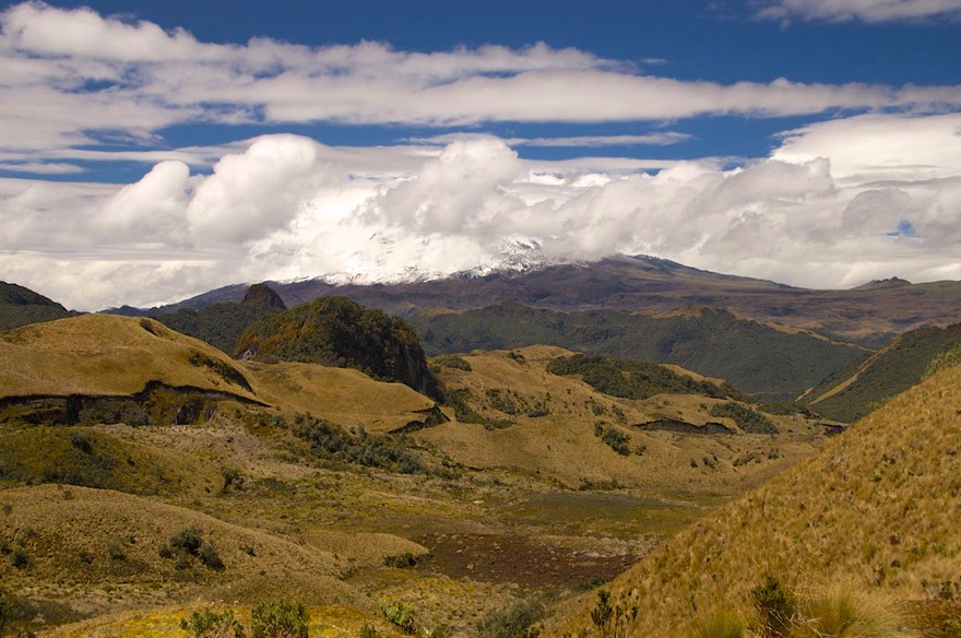
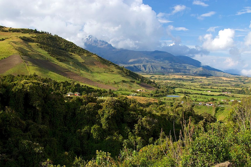
Not being coastal fans, we had crossed into Ecuador in the mountains, and we would stay at significant elevation all the way to Cuenca, i.e. between 8,000-12,000 feet. We started by trying to check out a road that was a back way into El Angel Ecological Preserve, supposed to be a great drive through pristine paramo country, a unique ecological system. You go due west just below the Ecuador-Colombia border, then drop down to El Angel and then join the Pana again. Well, maybe. We ran afoul of a military checkpoint (somehow I guess we simply were too close to the border!) and they firmly turned us around and said “Noop” – however you say that in Spanish. So we sighed and turned around and stayed on the highway. We did ultimately spend a few hours in the El Angel area, and it does look intriguing; another time.
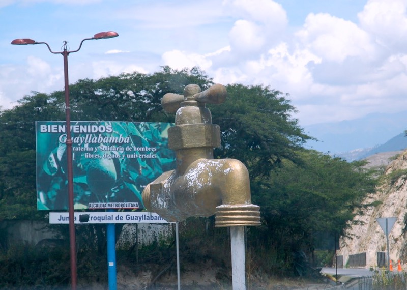
The little town of El Angel was our first introduction to one of Ecuador’s unique (read: peculiar) ideas -- wacky public sculpture at the entrances to their towns, and in various other public locations. Again in contrast to Colombia where beautifully wrought classical sculpture was the norm. They are universally yucky: very proletarian in nature, often with workers hoeing the fields or hauling stuff or maybe dancing; some statues are of ears of corn, or hummingbirds, or an enormous water faucet; to us it smelled of socialism. We have the pictures to prove it, so take a look if you don’t believe me!
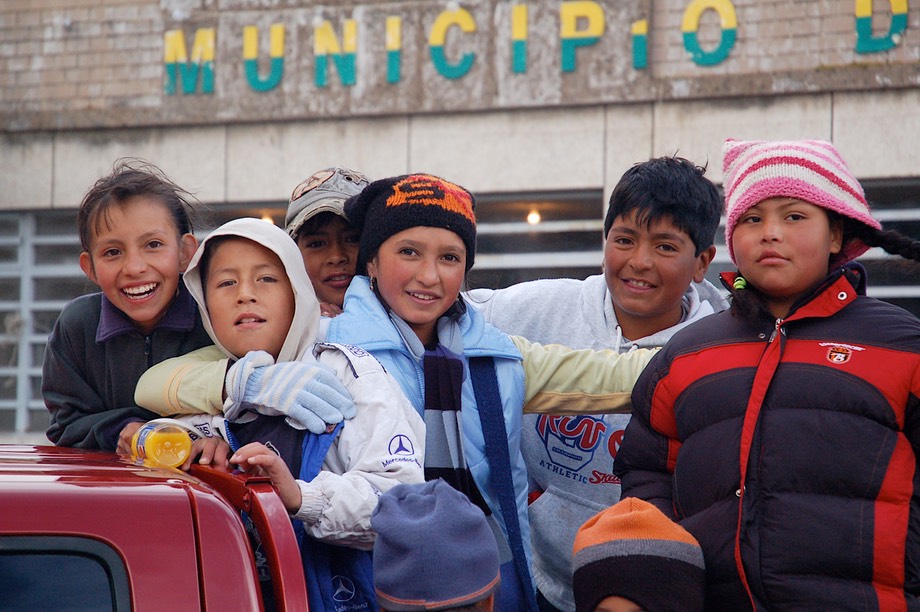
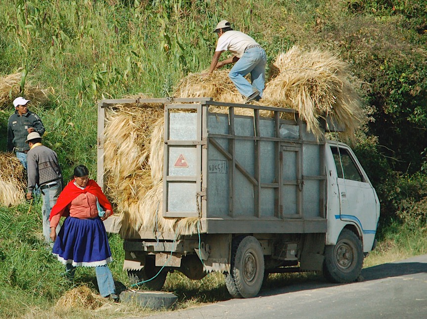
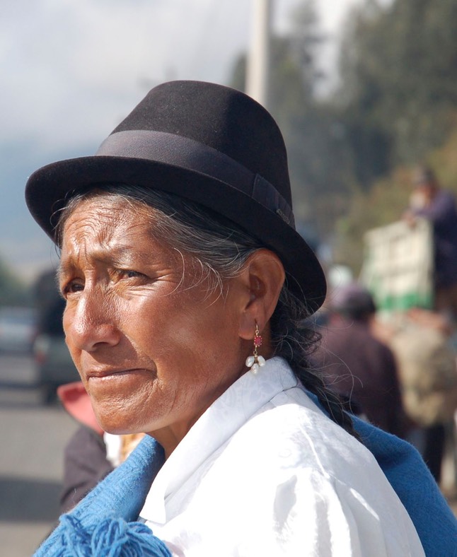
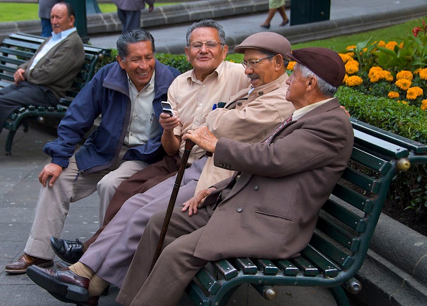
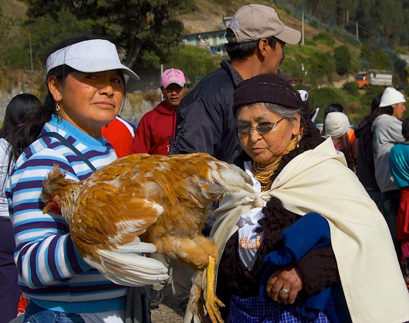
The Ecuadorians look different from the Colombians. This was quickly apparent. Their faces are rounder and always very ruddy-complected. (Somehow they remind me a bit of the early Aleutians we saw pictures of in Alaska.) The people are short and, the women particularly, seem rather squat. (In part this is because of the way they dress: the skirts bunch out from the waist, they wear loose blouses covered by sweaters covered by ponchos and scarves.) I like to comment on short people because I am so short myself; and Rick looks like a giant when he stands among them. Both men and women wear hats almost all the time, some Panama-hat-ish looking, but most often soft, dark felt hats that are very mannish in appearance. I covet one of those felt hats; they are cool. Even little children 4-5 years old are wearing them. When we got to Cuenca the hats the women would wear would often be white, otherwise the dress was very similar. Now, you must realize that this description is of the indigenous people. When you get into the cities, they are still in great evidence, but there are also many taller people of mixed extraction, wearing “western” clothing, whose origin would be hard to determine.
The mountain communities are almost entirely populated by indigenous people. They have not been assimilated (as we saw much evidence of in Colombia). They work the land, have an active community life, and seem to prosper. Ecuador is working to bring more facilities to the more isolated communities; electricity, at least, seems to be everywhere. Buses reach everywhere, too; it can be a bit startling to have one stop at the entrance to a town; the doors open and all these little people pour out, with all their produce and goods to sell at market, babies on the backs of women and older children, and big grins on their faces. These people appear to us to be happier in Ecuador than in many countries. If you stand near them, in the market perhaps, they are chatting and laughing and the children are chasing around having a great time. It seems a healthy culture.
By the way, Ecuador uses the US dollar as its monetary basis. It will be the last time we will be using dollars in South America, and it was nice to see old friends. In one case, a very old friend: Sacajawea. You remember all those dollar coins we minted back whenever, with her face on them? Then they disappeared? Well, they are alive and well down here in Ecuador. We get them as change all the time.
Traveling south through the Andes, we managed to bypass Quito (the capital), both huge and difficult we had been told, by circling to the east and taking a long road around. Quito is in a dry mountainous area, and our views weren’t overly interesting. We got close to the edge of the mountains where they start to drop off down into the Amazon area, and decided to come back later and see if it got more interesting further along.
The area south of Quito is also rather dry and relatively uninteresting; we were happy to keep moving. We crossed the equator (for the first of several times), stopping at a funky monument along the highway to record the event, but kept on. Not much going on here.
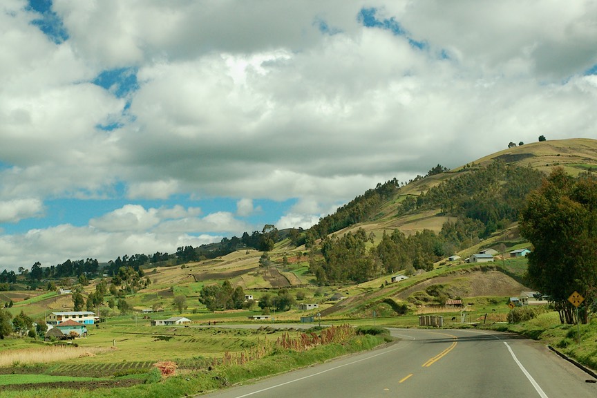
Further south the mountains get greener and prettier. The road was pretty good most of the time and we made good time. Then it got rough. Over the next two days we covered the rest of the miles, coped with two flat tires (with lots of people offering help – they are friendly here, too!), and landed in Cuenca.
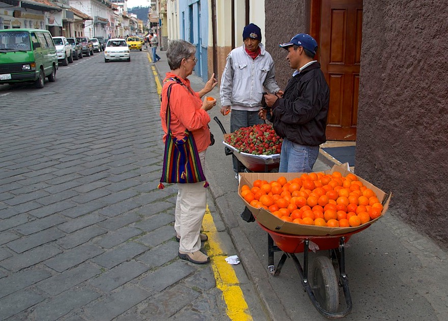
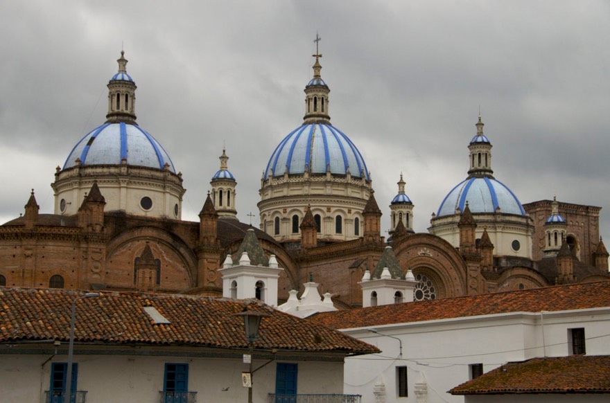
Now Cuenca – there’s a city for you. We like Cuenca; large, but accessible, with streets (even in the old town) wide enough for us to navigate. Shopping malls with internet available (too slow for much, but definitely wi-fi). The old town is delightful, filled with nifty architecture and pedestrian streets. Too, it is still very much of a “working city” area, and we were able to shop for stuff we needed, not just look at Panama hats (did you know they are made in Ecuador?). There are plenty of expatriates in Cuenca, so the city has a bit more of a familiar feel (blues in a restaurant, an American deejay on a local station, used bookstores with English titles, etc.).
And speaking of internet, Cuenca brags that it is “connected” and many areas really are. The problem, which we have also seen elsewhere, is that more and more people want to be “connected,” and whatever was originally installed cannot keep up with the demand. We were, at this point, still struggling a bit with our new Mac computers, and it’s still a Microsoft world; sometimes the interface was a bit difficult, but we’re learning.
You know what else Cuenca has? A True Value hardware store – complete with popcorn! I was dumbfounded. Here it’s called El Hierro. It had lots of cool stuff we hadn’t seen since we left the States; almost like going home again. One thing not like at home, they also stock Reunite (cheap wine if you don’t remember: “Reunite on ice, that’s nice” the old commercial). You find liquor in the strangest places.
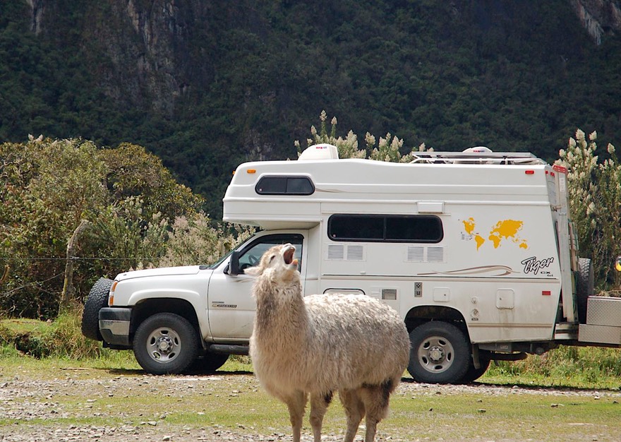
But more importantly for us, we found Yasha and Juergen. We hugged and chatted and had a good time. They are fine, friendly folks. And alongside was an American family who had also caught up with them: Bob, Susan and Evan, who were on the road and enjoying South America while they pondered where they would like to settle (seriously considering Argentina, where they had friends). We all enjoyed the chance to compare notes on our experiences, speak a lot of English, and share opinions on how to improve our “wagons” (Juergen and Bob suggested we install some fans in the back of our refrigerator and showed us where they might fit; we have since done that and our little fridge is working much better, thank you!). At one point we all trekked up to a nearby national park (Las Cajas) where we enjoyed a couple of days of solitude, lovely scenery, and a herd of llamas. A good time was had by all.
Eventually, the other folks moved on, heading toward Peru, while we hung out in Cuenca; all total, we were there for 2-1/2 weeks. In part we were waiting for a package that was taking its own sweet time. We won’t bore you with the details. While waiting we had tires fixed, continued our Tour of Welders of the Americas, and wandered Cuenca. Otherwise, we worked on computer stuff (you’ve seen some of the results in our new website).
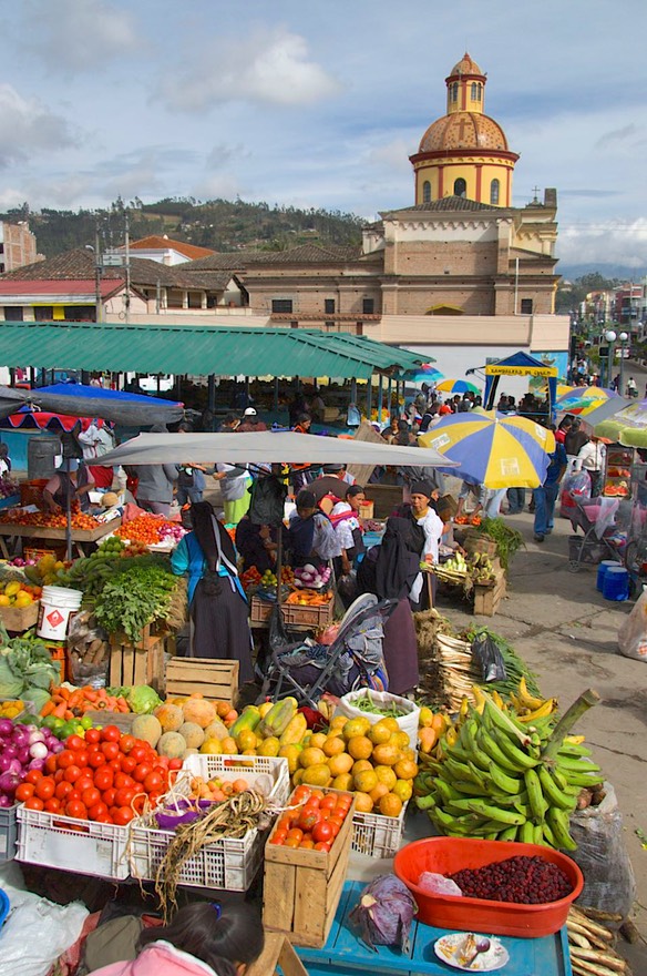
Over one weekend, we traveled out to some of the surrounding communities to visit local markets. We enjoyed the scene, generally, but realized we like our communities more isolated. These had too much “Cuenca” in them. So we contented ourselves with taking some pictures and simply enjoying the beautiful drive.
After much impatient pacing, our package finally arrived and we were ready to move on. While waiting, we had decided on a plan to see the parts of Ecuador we had missed by moving directly south; this plan was to head north by swinging out to the east, into the Oriente and the edge of the Amazon basin. We would use a new road we had been told about, go all the way back to where it headed back into Quito, and then use the capital city as a base to explore that area.
So, off we went. We managed to get propane before leaving town, after a struggle. The recommended place was right where we had been told. And yes, they had propane. But our rig? How to fill it? While we were sitting and waiting for them to figure out how to help us, we entertained ourselves by looking at a sign with safety warnings (in Spanish, of course). You know: must wear hard hats, trucks must have regular safety inspections, the usual drill. But one said must have arresta llamas. Now what the hell? I had visions of llamas with guns checking the trucks for illegal fittings. I finally got out the trusty dictionary and found that meant flame arresters.
After much chin scratching, the guys found someone who knew how to fill our tank, they backed us up to the truck, and got us taken care of. We were delighted, and quickly beat feet before anything else happened to keep us from leaving.
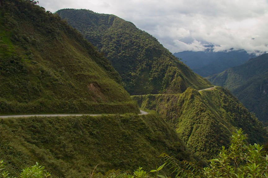
We went east from Cuenca (8,000 feet), through the mountains, taking a funky back road to Mendez, where we would pick up the Oriente road. It started out very dry through the first part of the mountains, and parts of it were even paved, and then two water crossings and a very long, very dark, very drippy and scary tunnel later, but also a splendid waterfall, we were at 1800 feet and into tropical foliage with wild orchids along the roadside. Quite a ride. And then we joined the Oriente road.
And this “new” road? Well, most of it is finished even. We kept seeing signs saying 2008 -- El Año de Asfalto. Basically this means the year of paving, of course. The country is very proud of this road, and where finished it is quite up to snuff. But they’ve skipped the “hard” areas. A very steep climb, for instance, or a section that goes through difficult, wet terrain and still needs drainage issues solved. And one bizarre section that appeared to go through an indigenous area where they were still solving the “political issues.” But this road is really opening up the jungle towns; they are getting paved streets, new housing, and being connected to the outside, in many cases for the first time. There is even a new big modern bridge replacing one that couldn’t take trucks or buses. All the travelers would have to get off one bus, walk across the bridge and get on another bus to continue their journey; but no longer.
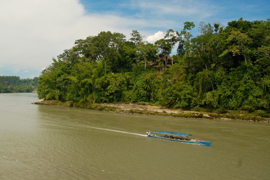
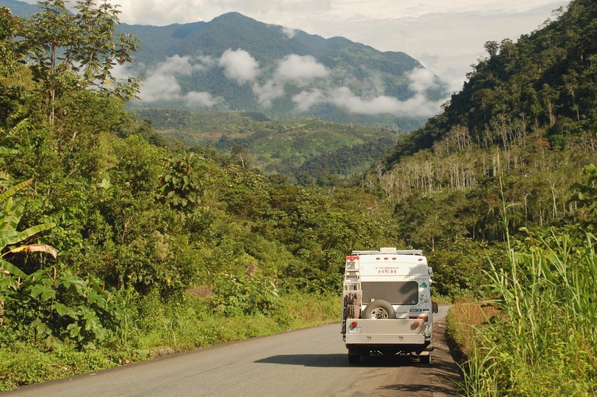
And we loved it. We were in the jungle; a completely new experience for us. It led to a complete change of mood. After all that time in (often) dreary, overcast Cuenca, we were in bright sunshine; it was warm (but not awful hot), and totally new countryside. We reached the point where the highway crossed the Rio Napo, turned east, and followed the river into the Amazon as far as Misahaulli, to check out the scene. This town is a big river rafting launch area, and it was lively. The Napo, further downstream, joins the Rio Negro and they subsequently become the Amazon. It was a very interesting spot, complete with a monkey wandering around ready to steal anything not nailed down. Boats were cruising along the water, taking visitors to jungle lodges, the bars were active, and I saw more pale tourists with sunburns than I’d seen in months.
Back on the highway, a little further north we arrived in Tena, the jumping off place for most of this river activity. You can fly here from Quito and enjoy the jungle experience, so it too is a very popular spot. North of there the road curves back to the west and begins its climb up into the mountains and another very spectacular, dramatic drive. Awesome.
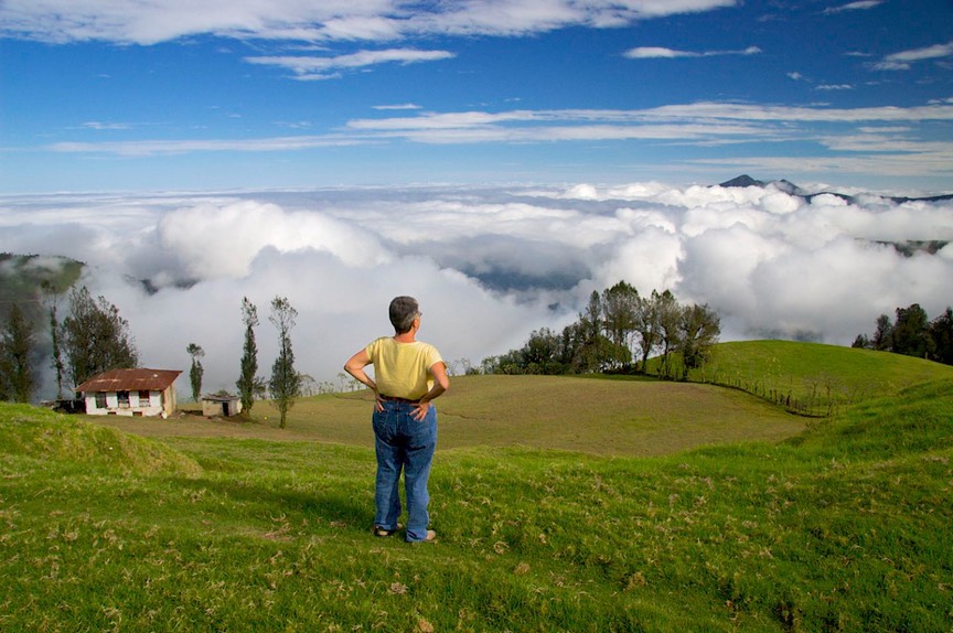
West from Baeza it gets ever more gorgeous, and we enjoyed some blue sky and sun on Volcan Antisana (5758 meters) to the south, all covered with snow. The road took us all the way to 13,400 feet at the summit (4064 meters); very barren and dramatic. Just east of the summit there is a new tunnel cutting through the mountain. We speculated the tunnel is here because this part of the road parallels the oil pipeline that goes east from Quito out to the oil fields in the jungle, but we don’t know. In any case, apparently the road to the tunnel is finished, but not the tunnel itself. So we all went around, driving over a “charming, scary, yucko” road. But what’s new?
Dropping back down the west side of the summit, we very quickly approached Quito. And there we found a wonderful spot for ourselves and settled in for several days. We stayed in a nice little parqueadero in a perfect location. It’s a few blocks from a large supermarket and even a Burger King; close to the bus line that would take us sightseeing; near enough to a restaurant area (with excellent wi-fi access) that we could carry our laptops, do our on-line work, and then have a yummy lunch before walking back; and quiet enough at night to sleep well even in the capital city. It was nothing fancy, but it suited our needs. Carlos lived there with his family, including a couple of happy children running around with the chickens and the dogs, and he was helpful, charged a reasonable price, and even washed the coach for us. This is what passes for heaven on the road.
We enjoyed our time in Quito. The traffic is scary and the road system is pretty complicated, but the public bus/trolley setup is very good (and quite cheap – we usually paid only 12 cents each as seniors; the regular charge was 25 cents) and goes good places. The Old Town is unexceptional, but we enjoyed a few hours there. And the New Town area really has lots going on, between shopping and eating and wandering the streets.
One reason for returning to northern Ecuador was to visit the Saturday market in Otavalo, supposedly the largest in the country, and a treat not to be missed. Otavalo is a couple of hours north of Quito, so on Friday we traveled up (crossing the equator for the second – and then later the third – time), found a spot in Otavalo to spend the night, and enjoyed the market the next morning. And it is a good one. We got up early enough to check out the animal market, which was a hoot. Pigs and piglets and baby chicks and lambs and horses and guinea pigs, for starters; the guinea pigs (a local delicacy) were the hot item of the day. We took tons of pictures, watched the scene, and had a good time. We spent a fair amount of time wandering the regular market as well, which has a good supply of produce, but the main attraction is items made of wool. It was quite colorful and enjoyable; I found a new bag to replace one from Guatemala that was getting worn out. We had a nice chat with the gentleman from whom I bought the bag, and ended up with pictures of him and his entire family. Lots of fun.
Leaving town about noon, we had been eyeing a loop through the mountains to the west of Otavalo. It would pass through Cotacachi, which we wanted to visit. Cotacachi is a pretty little town in a nice setting, and a place to buy leather goods; we wandered the shops, ending up with new belts and a new coin purse. We liked this town.
Then, to the west along this loop, we found Laguna Cuicocha, a major tourist destination in the area. But it was rainy and gloomy, so we didn’t stay. Just west of the entrance to the lake was the road we were seeking, a lonely dirt (and partly paved) road to the isolated town of Apuela. It was a splendid drive on unpaved, sometimes rather rough road, up over 11,000 feet and ultimately down to 3900 feet while we were following the Rio Apuela. We saw waterfalls up high in the cloud forest, many splendid views, and generally thought we were very clever to have found this road. We spent the night at an overlook above the lights of Apuela, wandered through the town the next day, and then tried to take an even more “secondary” road that would lead to Mindo, further south and also supposedly lovely. We really wanted to visit Mindo, and if we could find the right road, it would take us there directly and with no backtracking to Otavalo.
Well, that didn’t work. Despite many helpful folks who offered many varying suggestions, we found ourselves on the wrong road – actually we never saw a turn for any other road - without a good way of getting to the road to Mindo, and then ultimately we were back in Otavalo, from whence we had begun the prior day. Ah, well, so be it. It had been an incredible drive, and we had met many new and interesting people.
Probably the most intriguing was a visit from the village “president” when we stopped for the night, maybe 25 kms west of Otavalo, outside the tiny town of San Juan de Inguncho (name bigger than town). It was raining and very foggy, and getting late. We came around a corner and here was a grassy soccer field. It was so late (and so wet) no one could possibly have plans for the playing area yet that day. We decided to stop, and parked on the edge of the field. An hour or so later, in the middle of fixing dinner, there was a knock at the door. Probably a dozen people stood there, with the town leader in front; he was wearing a large black hat, which looked very cool and official. He very politely and nicely inquired of our plans. After discussion, it was agreed we could stay. We decided the entire village had come to check us out! We had fun trying to imagine their discussion together about what to do about these strangers who had plopped down in their midst on this dark and rainy night.
The next day we stopped in Otavalo for some produce I’d forgotten two days earlier, and hit the highway back to Quito. (We had decided Mindo would have to wait for another visit.) On our way back into town, I talked Rick into detouring up to Mitad del Mundo (the official center-of-the-earth site), which I thought sounded cool. It wasn’t. We had to trek through far too much of industrial northern Quito, the place was very dumb and touristy (although I did like the monument), expensive, and not a keen experience. But they can’t all be super.
So we went back to our spot at Carlos’ place, where we would spend the next few days finishing up some things (including second visits to the best bakery in all of Latin America and to Uncle Ho’s that has the best Asian food I’ve eaten in a long while along with really good wi-fi and cool t-shirts.). After finishing our chores we would continue moving south, back toward the Cuenca area, making several loops into the mountains to the west of the Panamerican highway.
Still having fun after all these years; Rick, Kathy and Herself
Click the link to see more photos from Ecuador.