June 2005
Two Yoke of Oxen and a Big Yeller Dog
Oregon, Washington, British Columbia
Or: How green are our valleys…..and our hills…..and our flowers.
As we prepare for our summer in Canada and Alaska, Rick and I are reflecting on our lovely spring in the Northwest, when we traveled through a portion of the country opened by settlers from across the prairies, sturdy folks who came through the mountains and down the rivers. It was easier for us.
This year, the region suffered during the early part of the winter, not getting enough rain and snow. But the gods smiled in the end, and during our visit there was plenty of water to go around, and more. As a result, particularly in Oregon, we saw more snow than usual on the peaks, and all the streams were bursting at the seams. We were delighted, of course, and the locals seemed pleased as well. The wildflowers were heavenly and we went past many a field with cows and horses up to their bellies in new grass.
We entered Oregon by way of Klamath Falls, just east of the Cascade Mountains. Klamath Falls is laid out rather peculiarly if you are trying to access its core. The highway whizzes past, the road that goes through the town doesn’t really take you anywhere, and you find you’ve come and gone and never even spotted the falls for which it is named. I know there’s more there there (thank you, Gertrude Stein), but haven’t found it yet, even after several visits. We stayed the night in a pretty little park north of town, complete with a lovely pond (and PELICANS, strangely enough), watched rain (and snow) come down in buckets, and then moved on in the morning. Cold, cold, cold.
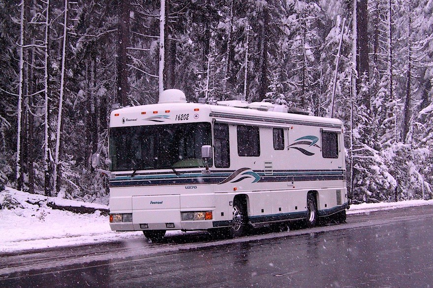
In planning our trip north, we had intended to stay east of the Cascades, exploring a bit as we moved into the eastern part of the state. But screech……………equipment problems with the satellite dish, again, dictated we were going to be around for awhile, having made an appointment in Bend for a week later (while a part arrived). So what to do? Easy as pie. Head west.We went over the Cascades by way of the Willamette Pass, which was quite an adventure. It was snowing on the pass and had been for some time. We messed around in the snow for awhile, taking pictures and grinning like mad. Then, as we dropped down out of the mountains, it got warm and sunny and we were in the middle of an Oregon spring day. Well let’s see, how shall we entertain ourselves for a few days…..Oh yeah, that cabinet maker who did such cool stuff for the Trek is around here, isn’t he! Super! We need a cabinet door made. Stopped by, he said no problem, got it done, and got gone. This was in Junction City, near the home of the EZ Stop that advertises espresso and biscuits & gravy. Something for everyone.
The broom is in bloom along the highways in the Pacific Northwest, and the grass is that lovely “new green.” What’s not to like. We mosey-ed on up Interstate 5, stopping in Eugene. We needed a wi-fi fix and we had the name of a pizza place with free access. Now remember, this is Eugene, home of the University of Oregon. And this is the Pacific Northwest. So we have news flashes: RICK MEETS ORGANIC PIZZA ….. AND SURVIVES! As with all university downtowns, the place was funky, the kids had weird hairdos, they had fruit juices but no coke, etc. etc. You get the picture. But it was fun, we got our Norton update completed, and the pizza was more than just okay. Later we went to the movies in an old converted church, even more weird, but really cool. Eugene is pretty uptown.
Then we were off to Salem. We ran into some rain, but not too much. We stayed outside Salem for several days, and managed a day trip over to the coast and around. The countryside was lovely, as expected, filled with fields of little dark red flowers. We swung past the museum where the Spruce Goose is, but decided to pass. We’d seen The Aviator recently, and besides, they wanted a ton of money to see the plane, which you could view for free through the window. It takes up the whole museum…..
And we also had a splendid daytrip to Portland. Now THERE is a great place to hang out. We could have come back several times, had the weather been better. We saw the beautiful rhododendron gardens, complete with lots of ponds filled with various ducks and geese and other, less common, water birds. It was too early for the rose gardens, so we skipped them, and I still have not had the chance to see the huge waterfall downtown (frump), but we saw THE LAST DIESEL SUBMARINE THE US BUILT. Nice tour. Bigger than the two WWII submarines we had toured at other times. Anything else you want to know? While we were in town, we rode around several of the neighborhoods, and Portland is a pretty, pretty place. A well deserved reputation. We ate FAMOUS HOT DOGS on a street corner and saved some other things for another visit.
But our appointment in Bend was beckoning. So back across the Cascades, over another beautiful (if not snow-covered) pass, down through the Sisters area (note-worthy for another time) and into Bend. Work quickly performed, we were off to ……. John Day and his fossil beds.
So who is John Day and why are all these things named after him! Some pioneer fellow who never did much, but got his name attached to the local river, which then led to the name of a town on the river, and then to the fossil beds found in the surrounding area. Just a case of being in the right place at the right time. The visitor’s center at the fossil beds is totally cool, by the way; brand new, it’s a working laboratory. You can watch the folks on the other side of the glass as they go about cleaning rocks and working on the fossil preservation. We enjoyed ourselves; worth a visit as you pass nearby, particularly when the weather is cool. John Day (the town), by the way, is the Home of the Monumental Truckers Light Parade. Not much else, she said with damningly faint praise.
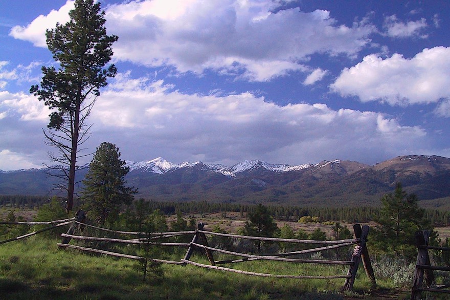
We were traveling east from Bend on Highway 26, with a destination of the small town of Sumpter (no, not the fort, silly; that’s in South Carolina and doesn’t have a P). It proved to be a very nice route. East of John Day is the delightful little town of Prairie City, worth a visit when in the area. And there was lots of grass with cows and horses and sheep; this time of year this is a very nice area. When we got to Sumpter, we knew we’d found a gem of a place. Sumpter is a small former mining town, in some very scenic mountains with very nice motorcycle riding. We stayed for several nights while we visited the area, camping in a little Forest Service campground with an incredible view of these same mountains across the valley. They were covered in snow, so much snow that one of the roads we wanted to take wasn’t even open yet.
Further east along Highway 26 you come to Baker City (didn’t it used to be just plain Baker?), where the Oregon Trail Interpretive Center is – and this is one killer spot! The story of the folks who came across the prairies to settle along the Oregon coast is quite a tale, and this museum really brings it to life. We have never seen such lifelike replicas of people and animals, down to dirt under their fingernails and mules straining to pull the wagons. And we found out what oxen are: simply any breed of cattle that has been broken to the yoke. Nothing exotic after all. By the way, Baker City is a nice little town, with a pretty library right on the river (that runs through it…..).
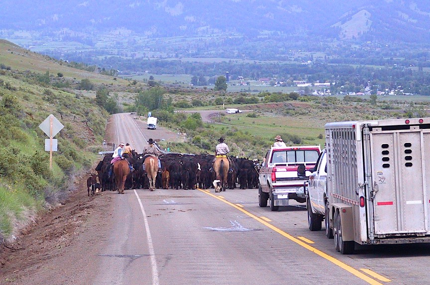
Our visit to Baker City was part of a day’s ride over to Hells Canyon. Don’t try this in the summer heat. But in May it was glorious. Nice country road through little cow towns and between rolling hills. At one point we ended up in the middle of a cattle drive. I’m quite sure the folks on horses, trying to move these spooky little critters from one pasture to another after being left alone all winter, would have been much happier if we weren’t anywhere nearby – but at least we weren’t an engine-revving Harley – and they smiled nicely as they herded us through the middle of the herd (we didn’t notice any smiles on the cattle however, and they were close, close, close).
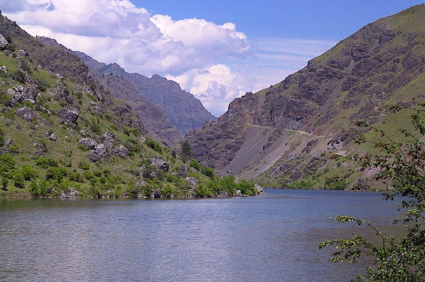
And then down, down into the canyon. This is home to the Snake River, further east than where it joins the Columbia, and one of the deepest canyons anywhere. And quite beautiful. We approached it from the south; you can also come in from the north (read on). At the bottom, you can ride along as far as the next dam (the road is actually in Idaho; the river forms the state boundary). It was neat, with lots of pretty views. In this section, the river is rather broad, with camping and boating all along, and at this time of year it is all a lovely green.
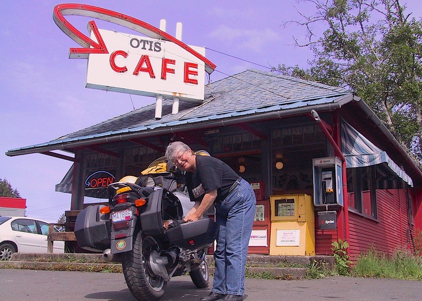
Heading back to our campsite, we stopped in the little wide-spot-in-the-road called Richland, at Annie’s Café, for a cup of coffee. We listened to the “afternoon group” chattering away (afternoon groups are female; morning groups are male – check it out for yourself), and found out the local gossip from the owner. Seems folks tend to marry within one valley, but recently have been having inter-valley marriages (“to improve the gene pool”); one fellow commented when he got a divorce that “he didn’t lose his spouse, just lost his turn.” Stuff like that. We recommend the cinnamon rolls -- and the banter.
Reluctantly leaving our beautiful campsite outside Sumpter, we headed over a lovely mountain pass, through LaGrande, and east toward Enterprise, Joseph and the Wallowa Lake area. Oh darn, still beautiful. Our intended destination was a small campground along the Wallowa River; but as we headed off the main highway, along a narrow gravel road, we knew we’d made a mistake. The road was too narrow, too full of potholes, too everything, and with no sign indicating how far we would have to go. We decided to nix this deal, but no way to turn around. So backwards we went, with Rick doing a superb job of confidently reversing our course and backing out for over a mile. We later found out that we’d made a good decision, talking to a ranger at the state park who said it was worse further back, and quite a ways in. We sure were glad when we got back on the main road.
We ended up at Wallowa State Park, reputedly voted one of the best state parks in the nation. We could see why, as it was lovely with green parklands, lots of trees, and right on the lake. More expensive than we wanted, which is why we had tried to choose a different spot for ourselves, but we ended up being glad we’d come. There were eagles nesting in the trees along the shore, other folks said they’d seen black bears a few days earlier (although we saw none), and since it rained a lot of the time we were in the park, we were glad to have electricity to augment our less-efficient-when-cloudy solar power.
I had heard from many people how lovely this area was, and we wanted to see it from the motorcycle. On the nice days, we rode. Joseph is a very nice little town just a few miles from the park. Back about 10 years, the town was dying, and decided to do something about it. They raised some money locally, got a matching grant from somewhere, and re-made themselves. It’s an area for artists now; there are bronze sculptures along the street (with a foundry close by), nice shops and storefronts, and a killer breakfast at the Mountain Air Café. This café has its own wildlife museum, by the way, with some amazing animals. Really a treat.
From Joseph, you can circle around and approach Hells Canyon from the north (see above), and it’s a great ride. Not so great for ungainly vehicles, we warn, but perfect on a bike. Before we started to drop down into the canyon, we saw a lot of snow, which added to the view. We talked to some folks who had tried to go beyond the paved road in one area, but got stopped because they ran into too much snow. In mid-May, in Oregon! Amazing! At least until you realize that the peaks around here get up over 9,000 feet. Of course, the quantities of snow we were seeing were the result of a late, wet winter. At this point we were above 5000 feet, in deep forest. We came on an elk standing in the middle of the road, deer skittering away, and wild turkeys. It was great. And then we started to drop down into the canyon. From this side, the way is forested for quite awhile, rather than the rolling hills coming from the other direction, but when you get all the way down you’re back where you were when you came in from the south. Complete circle. Hells Canyon is deeper than the Grand Canyon, although not as spectacular; this is quite a place. There are a couple of tiny towns down along the river, but not much else. Stark landscape, with a few willows along the water; that’s about it. Oh, and dams to visit.
Reluctantly we left this area, heading north along the Oregon/Idaho border. We went over Rattlesnake Pass, with a road to match its name. Over a distance of about 20 miles, we went from 4000 feet down to 1272 feet at the bridge over the Grande Ronde River, back up to 3965 feet, and ended up in the tiny southeastern corner of Washington. But not for long. Soon we’d found Idaho again, crossing the Snake and Clearwater Rivers as we negotiated our way through Lewiston.
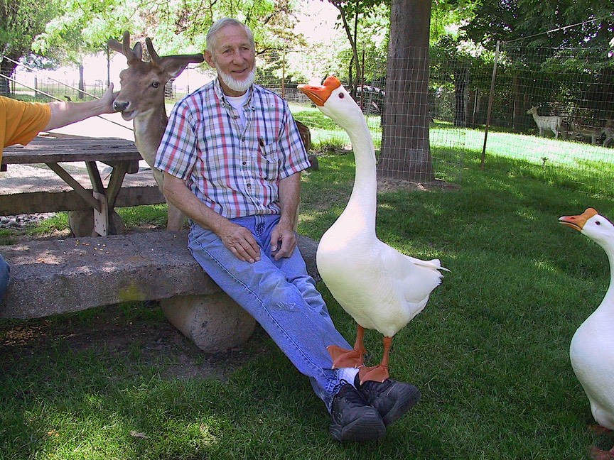
We were headed for Moscow. Not to be in Moscow, mind you, but as a jumping off place for a daytrip over to see the cats. And did we have a fun time! The cats live on a farm outside Othello; for those of you familiar with the state of Washington, this is in the great Columbia River Basin. Pretty dry and desolate area. But…..not where our cats are! They live in an oasis just outside town, where their new owners have lived for 25-30 years, and where they have created a cool haven among large trees, with grassy lawns and lots of flowers, and pets galore! These folks have geese, a herd of semi-tame fallow deer, ducks, chickens, one other cat, an old dog (a Great Pyrenees, Dick and Cathy), a donkey named Madison and a sheep to keep him company, twenty-four (count ‘em) little four week old chicks, and who knows what-all else in the way of critters. All happily getting along, well fed and comfy. The buck ate out of our hands.
And that’s only the livestock. These folks collect old army jeeps and other trucks; they ride speeders for fun (the little cars that run along railroad lines); their son owns a Pullman car, the oldest Pullman Car (1909) licensed to travel the rails, stored on a track near their house. This is the first steel Pullman car, number 001. They have a huge supply of old issues of Life Magazine from during the war and forward. Duck decoys, Indian artifacts, early toasters, an entire room of clown things; you begin to get the idea. They are lovely, gracious people, who seemed genuinely pleased to see us and spend time enjoying our presence. We had a lovely visit, despite getting lost trying to find them. We had relied on our computer mapping program. But the program was inadequate to the task. There’s just too much open space in “greater” Othello (pop. 5,847). So we ended up several miles in on a gravel road heading nowhere. We could see where we probably wanted to be, but there was nothing but plowed fields in the way. We were glad to be on the bike, which went back from whence it came; we asked for help from a passing farmer; and found our destination. We were out in the middle of nowhere; headed in the right direction, but “you can’t get there from here”.
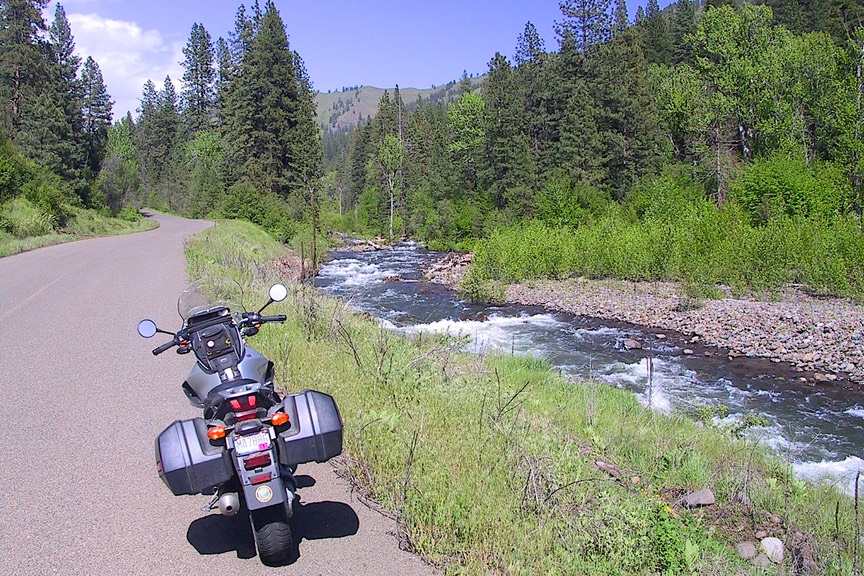
Cats visited (they couldn’t be bothered with us, except that Agnes looked worried that we might pick her up and take her away with us, back into that nasty old coach…….) we happily headed up into the Idaho Panhandle. What pretty country! Very rural, a little too full of junk cars tucked in odd corners to be a candidate for permanent residence, through lovely rolling hills and nice valleys with streams running through them. Delightful. Through Emida (but “’edidn’t”). We camped for several heavenly days along the St. Joe River, near St. Maries. We’d heard this was a very nice area, and the reality exceeded our expectations. A small Forest Service campground, hosted by folks who became new friends, a beautiful place for bike rides, a quiet spot for Memorial Day weekend. It was perfect, as was the weather. We were promised elk and moose (they lied), but we didn’t care. The river was lovely, with just a couple of small boats on it, the evenings were warm with just the beginnings of mosquitoes, the purple larkspur was in bloom. Wow! We took a ride along Lake Coeur d’Alene, up through the Potlatch Forest, past lots of little lakes and meadows. The roads were narrow and full of logging trucks. You know, you’ve been there. It was great. Could have stayed longer. Lots more to explore.
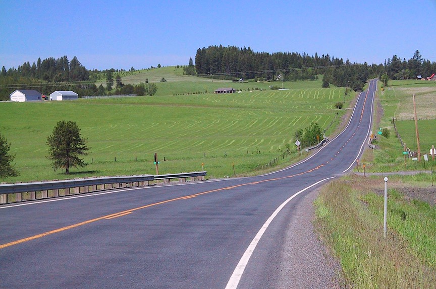
But we were on a mission, a mission to travel along the North Cascades Highway, across Washington to the coast. Another promise we’d always made that we were now about to keep. The road isn’t open until mid- to late-April, and we’d been here too early in the year on previous visits. So to get to the Cascades, we traveled through all the great towns with the great names: Kettle Falls (home of the 1992 Miss America); Colville, where we spent the night across the road from a logging yard operation what was fascinating – they weren’t sawing lumber, just sorting it, all day and all night, with huge cranes on rails, and conveyer belts; through the pretty little mountain town of Republic; across the Okanogan River at Omak, where the fruit trees are just setting fruit; and up the Methow Valley to Twisp. This is the northern edge of Washington, home to Indian reservations, Grand Coulee Dam, and the Columbia River (after it comes down out of Canada, before it moves down between Washington and Oregon). Dry country very soon, it was still green and very pleasant.
Twisp is the town with the Wreath Palace and the Twisp Chopper. Don’t ask. From there you pass on up the Valley to Winthrop, which we had enjoyed once before, in 1999. Nothing has changed. It’s a “created” western town, but a nice one, with a real mercantile to go along with the gift shops and ice cream stores. From Winthrop you head up into the real mountains, the northern Cascades, and it was worth the effort to have the experience. This would not have been a good place for settlers to cross the mountains. This area was set aside as protected wilderness in the 1970s, and the road completed some time after that. The countryside is magnificent, the mountains spectacular. This is alpine country, very glaciated. You go over Loup-Loup Pass (wolves?), then Rainy Pass (it did). Much snow on the peaks, tremendous amounts of water in the streams that the road follows, rustic campgrounds (we were virtually alone in the national park campground we stayed in part way along the road). We would have pictures to share, but the weather did not cooperate; it was rainy and foggy. We’ll visit again another time, and hope for better weather.
As you pop out the west side of the Cascades, all is different. You quickly drop down into meadows, with foxgloves and rhododendrons along the roadways. The forest gives way to brush, and you start going through towns: Rockport, with a very nice organic fruit stand; Concrete, home of Ponder Roses Lane; out to Sedro Woolley, one of the most fascinating word combinations I’ve ever known. And then civilization: Interstate 5, near Mt. Vernon.
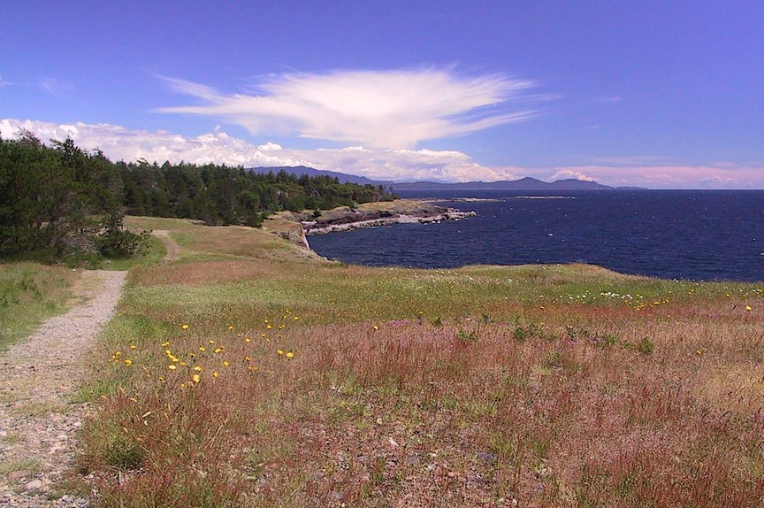
Well, here we were. And ready to kick off our trip further north; but it wasn’t time yet. We had a few days yet before we were to fly to Los Angeles to see Lauri graduate from college. And we wanted to do one more thing: visit some good friends who live on Vancouver Island. So cool! Off we went. We left the motorhome in Blaine, Washington, just below the border, and rode the ferry to Nanaimo, near our friends who live north of Nanoose Bay. We stayed with them for several days, having an absolutely splendid time. Syd and Sharon live on the end of a point out into Georgia Strait, on the east side of the island. Far enough from Victoria that it’s very quiet and lovely. They live down at the end of nowhere, right on the water, with bald eagles in the tree at hand, seals and sea lions in the water, deer coming through the yard day and night, and boats going past all the time.
Our friends are boating people, and another time we will get out on the water. But instead we contented ourselves with seeing their part of the island (Vancouver Island is quite huge) and taking a series of small ferries to a little island where we had a grand picnic and walk. We really enjoyed ourselves. I’m afraid to tell you just how nice Vancouver Island is, with its grand and rugged coastline, for fear you’ll all flock up here and overwhelm the place (just kidding). It reminds me a lot of islands you may have visited in the San Juans; not surprising, because they are very close at hand. We had lunch in a delightful real English pub, and a lovely dinner in a restaurant equally charming and similar, despite the fact that it didn’t say it was a pub. Rick had really good fish and chips, and I had some of the best grilled salmon I’ve ever tasted.
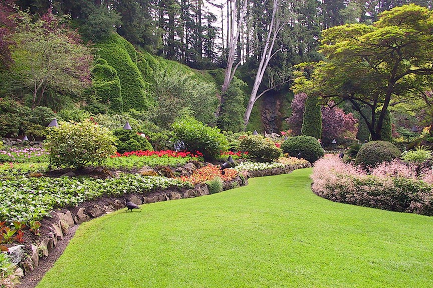
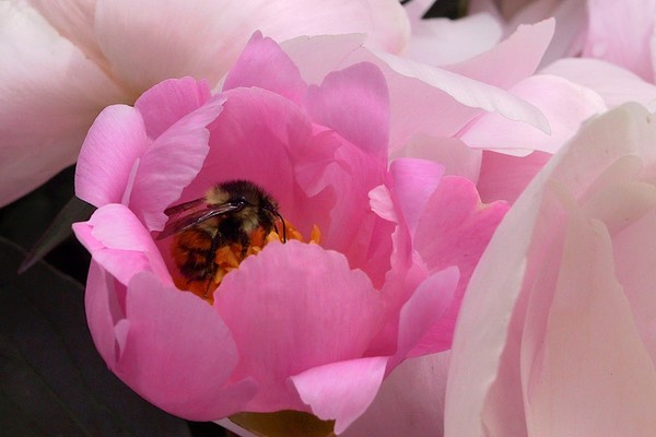
Leaving our friends at last, we made a stop at the Butchart Gardens outside Victoria, always a treat. The roses were coming on nicely, but the real show was from the delphiniums and peonies, quite stunning. Rick took lots of pictures, and the sun even came out for a few of them. We enjoyed ourselves, although the Gardens have become more commercialized over the years (this being our fourth visit), and quite a bit more expensive, and that was disappointing. But it is unique, and beautiful and worth the trip.
We scooted for the ferry back to the mainland as the weather started to threaten, getting back home just before it started in raining. We moved the next day to a campground near Sea-Tac Airport, easier to get to for flight-catching. After our quick jaunt to the wilds of LA, we’ll be off to the hinterlands.
We have spent our spring wandering in areas that were settled by hardy folk: Oregon, Washington, the Idaho Panhandle, lower British Columbia. This land wasn’t just handed to the inhabitants. They worked hard to get there, and then even harder to survive and prosper. All of our country was settled this way, but the West still shows the scars. The ruts are in the earth from the wagons coming across, people still are less “city-fied,” the land seems younger. I’ve recently been reading some of Wallace Stegner’s essays on the West, its dry and arid lands (try visiting Hells Canyon some summer day), its people, the environmental movements. Some of what he writes about I could see for myself as we traveled along. Reasons for enduring were all around us. It has been a lovely spring, in a beautiful area.
Now we are heading further north. Our plan is to travel up the length of British Columbia, west across the Yukon Territory, and into Alaska, where we will spend the summer. I have read Michener’s books on the subject (not his best, but he is good about giving you food for thought along with his treatise on the annihilation of the sea otter); we’ve bought our copy of Milepost, the bible for all travelers on these remote highways; and we are fully prepared for the cracked windshields and other hazards of poor roads. We are very excited about this trip, but assume we will have no phone coverage for most of it. So you may not hear much from us until fall. But we plan to visit libraries regularly, to pick up our e-mail, and sincerely hope to hear from you often. There’s nothing like news from home.
We love you and think of you often.
Rick & Kathy
See more photos from the US in 2005