July 2007
The Egg & the Sausage, but not the Duck
Wyoming, Montana, Alberta & the Northwest Territories
“The Real Shakedown Cruise”.
Following our trip West this spring, we arrived back in South Dakota in mid-May and settled into life in Rapid City. We intended a bit of a rest, but mostly we wanted (and needed) time to prepare ourselves to head north for the summer, followed by the start of our trek to Patagonia, at the southern tip of South America. We needed to figure out how to carry what we would need for a long-term commitment in a smaller rig, as well as begin to prepare to leave the country for an indefinite amount of time.
And most of that really did happen. We spent almost a month at Hart Ranch, outside of Rapid City. It took that long. But finally, one day, as always happens, we said “screw it, we gotta go,” and off we went. Everything was in its place (hah!), the new bike was loaded on the back, the laundry was done, and time was a wastin’. We figured we’d sort out our problems as they arose, and find solutions along the way. That’s what a shakedown cruise is for, right?
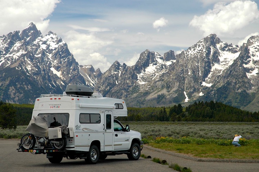
North we were headed, all the way to the upper end of the Northwest Territories, and then into the Yukon and Alaska; but first we wanted to spend some time in the Rockies. We have tended to see the Rockies in mid-summer or fall, and had promised ourselves some time in the Grand Tetons-Yellowstone-Glacier area in June, so we actually headed pretty much straight west, into Wyoming. And, we might add, into a Wyoming in full–dress spring. When we came east from California, Wyoming was still deep in winter. Well, no longer! The landscape was very green; the cattle and horses looked fat and sassy, the fields were littered with babies of all kinds; and pronghorns were in great abundance. So were Tigers (like our rig); we saw two the first day, and one more in Yellowstone! Wow! Presumably this proliferation was due to Provan’s (they make ‘em) presence in Colorado for many years prior to moving to South Carolina.
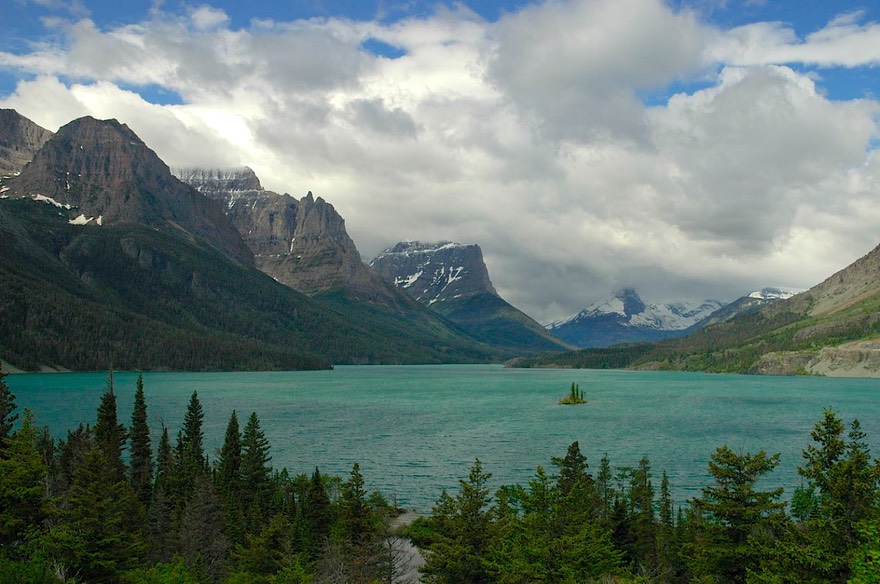
We stopped in Dubois, at the foot of the Rockies, because we’d heard of a terrific café there; sadly, it was no longer. But Dubois is the home of the Rocky Mountain Big Horn Sheep Centre, a small but very nice information center with lots and lots of stuffed critters to enjoy. After our visit we headed on up into the Tetons, spending that night (a very cold but lovely one) beside a lake at the top of Togwater Pass, all of 9658 feet high and with plenty of snow on the ground; here we crossed the Continental Divide for the first time on this trip. The next day was spent enjoying Grand Tetons NP, so very pretty and fresh. We hadn’t planned to spend the night, and went on into Yellowstone, staying in the same campground we had been in when we came through in 1994 – and the bison were still making the campground their own. It’s quite a sight, these huge beasties comfortably lounging on the grass next to your tent!
We enjoyed Yellowstone, more than on some other visits. The park is beautiful in June, very green and with new growth on the trees. We saw tons of bison, all very healthy, often with cavorting calves at their sides. Once, there was a large bull walking along the road by himself and seeming somewhat agitated. We were on the bike, and talk about feeling vulnerable! We gave him a very wide berth, waiting for a car to come along and run interference for us. We also saw big horn sheep and more pronghorns. And we even saw a small pack of wolves! They were running along a slope, in pairs, almost in formation. It was very unusual, and exciting.
The REAL reason we decided to come west before heading into Canada was because we wanted to again see the Beartooth Highway. Have you never done this? You really must. The Beartooth is the road that leaves Yellowstone going north-east into Montana; it comes out at Red Lodge, not far from Billings. It is very high (over 11,000 feet), well above timber line; very barren, following a series of ridges before it drops down into the trees again. It takes a couple of hours, partly because it is so awesome you have to stop from time to time to take it all in. We loved it. The weather wasn’t good, so we didn’t get any really striking pictures, but it was still great.
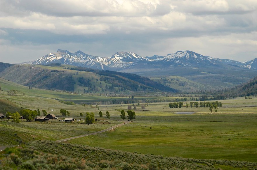
Dropping down, we headed into Billings for supplies, feeling sort of like the ranchers who come into town once a month or so for a touch of civilization. Not being overly fond of Billings, we didn’t stay any longer than we had to, and then headed west once more, pointed toward the east side of Glacier National Park. To get there we crossed miles of open plains, very green and littered with cow/calf operations along with sheep and horses. The countryside was, again, prettier than expected. Having always seen these areas in late summer or fall, everything seemed so fresh and vibrant this time.
This is nice country, too, with lots of rolling hills, plateaus, and outcroppings. Some wheat, but we saw no other field crops. Various critters, including llamas, and then in Fairfield MT, camels! Of the two-hump persuasion. So here’s a question for all of you: what are they called? One-hump camels are Dromedaries; are two-humpers Bactrians? I cannot find it in my trusty (sort of) Webster.
On beyond Fairfield, of camel fame, we came to Choteau, home of the Mighty Bulldogs and a great Ace Hardware. Truly a representative of the new west, the town contained both an organic grocery and several cowboy bars; oh yes, and the Meeting Ground Coffee Shop down the street from a huge smiling dinosaur statue and the old stone county courthouse.
Why are there so many casinos in Montana?
In Glacier, possibly our favorite of the national parks, we expected to stay long enough to visit our favorite haunts, and then move on into Canada. But we got to Glacier and sat….for a week…..waiting for mail. Our mail forwarding system rarely fails us, but this time was a disaster (no fault of the service). We had arranged for it to be sent to St. Mary, an actual town, just outside the east entrance to the park. Got there and checked in; were told it should show up in a couple of days. Then, after nothing appeared, called Browning (the main post office for the area): “Sorry, ma’am, the mail only comes to Browning (33 miles away from us, ed.). They haven’t had a post office over there for over a year. You’ll have to come get it. And no, we won’t tell you over the phone if it has arrived; privacy act, ya’ know.” Normally our mail arrives in about 3-4 days; after a few days of us traipsing over, Browning took pity on us and were willing to check for us when we called. “Nope; nothing for you,” was repeated too long for our comfort. “Ma’am, no mail marked St. Mary is going anywhere; it will stay here.” Hah! Two more days later, after talking to Browning several more times: “Well, did you check with Babb? Some things go there.” Yup; Babb had it. Why? Inquiring minds ask. Anyhoo…..finally got our mail and were ready to move on.
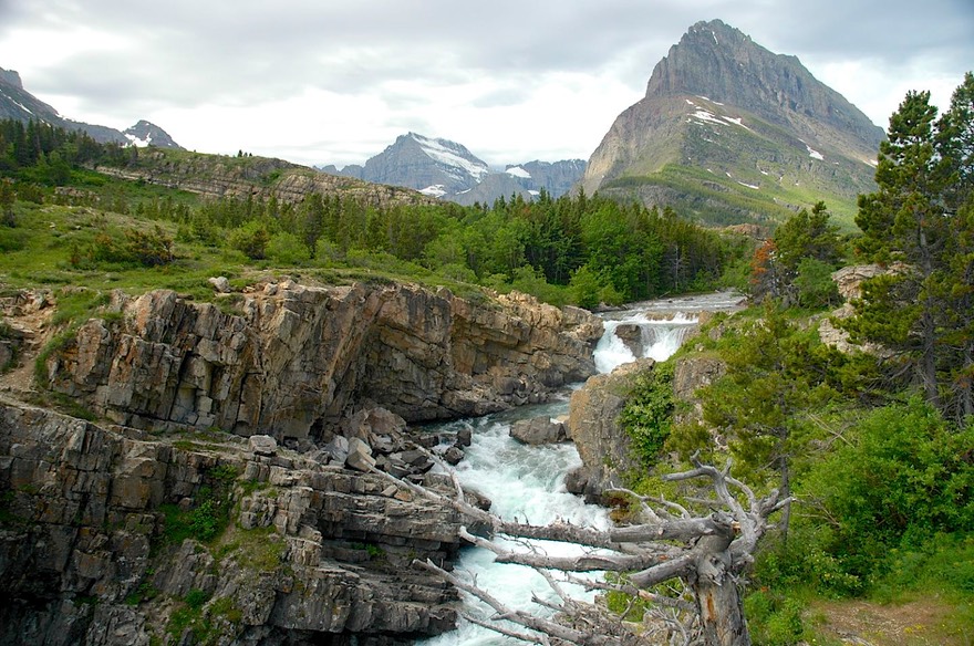
In the meantime we’d enjoyed Glacier. The Going-to-the-Sun Road was closed, unfortunately, due to a huge section (125 feet of it) having totally disappeared in the winter rains, and work being hampered by a late-May, very heavy snow storm that they were just now being able to clear away. It was pretty rainy while we were in residence, but we saw as much as we could, including a 200-mile roundtrip over to West Glacier. The crowds were light, which we enjoyed, and everything was green and fresh. We visited the Alberta Visitors Centre to pick up information on traveling in northern Alberta and the Northwest Territories. The fellow manning the desk was from the NWT, and was delighted to have someone come in who was headed that far up; he shared a lot of good info with us.
The East Glacier area had burned in the summer of 2006, a lot. But it was a quick fire and many of the trees had not been badly harmed. The areas that had been hit the worst were being salvage-harvested; trucks were everywhere. In any case, we took few pictures; the weather was gloomy and the trees were weird looking. We did visit Many Glacier, which we had not seen before; a lovely spot with glaciers up close, a pretty lake, and a Swiss-chalet lodge; it was the best sighting on this visit.
Babb visited and mail retrieved, we headed for the border, crossing at this puny little spot which is only open in the summertime, and where we were pretty much ignored, which is exactly what we like at border crossings!
Remember we said we’d figure out/deal with issues as they arose? Problem the First: coping with a taller bike on a taller coach; getting it on and off. Rick stretched taller and taller; still had trouble. Seems ramp we use to get bike on and off really needs to be longer. Find welder; lengthen ramp. Okay, that helps. But oops; when ground’s not level, bike tends to have mind of own. Hmmmm. What to do? (More later)
We were back in Canada finally! And were we jazzed! We trucked on up the road toward Calgary, a city we’d been promising ourselves as a first treat. As with the northern States, southern Alberta Province is also lovely in June; the prairies are green, the cattle chubby, the hills rolling and picturesque.
We spent a couple of days in Calgary, enjoying some of the sights. We arrived during lovely spring weather, and the entire town had moved outside. There were people sitting outside at all the downtown cafes, cars had their tops down, and shorts/tee shirts were in gay profusion. We wandered around, enjoying ourselves, visiting a really great farmers market and enjoying the peonies and lilacs in full bloom (in late June!). We hit one museum, the Museum of the Regiments; it was really cool. Canadians (and other parts of the British Empire) treat their military units a bit differently than we do in the States; units are named after people. Emphasis in this museum was on the Princess Patricia Regiment, which first saw action in the Boer War, followed by both World Wars, and has a very proud history. It was a fascinating display, and we spent as much time as we were given (they finally kicked us out at closing). Unfortunately, the flags were at half staff due to the death of three soldiers of the Princess Patricia in Afghanistan that week.
Calgary has several excellent used book stores, among them Twice Sold Tales, and Best Little Wordhouse in Calgary.
We’ve decided, incidentally, that interior Canada has two seasons: Construction and Winter. Every day we’ve been in Canada so far we’ve traveled on roads that are all torn up. The upside of this is that those roads not actually being worked on are quite good.
Here’s a quiz: when you leave Calgary, what other city is there in Alberta? An easy answer for hockey fans, but how about the rest of you? And no, Calgary isn’t the capital of Alberta Province.
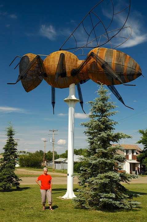
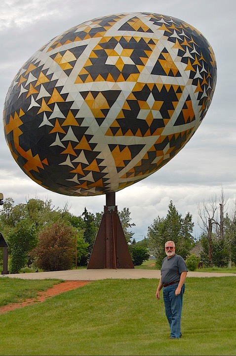
So, on to Edmonton. As we traveled further north, the countryside became less flat and more rippling, but still mostly farming. Between Alberta’s two cities lie a zillion small towns, each trying to attract your attention and a visit, often by erecting a huge-ness of one sort or other. So…..we went to see the giant Ukrainian egg (worthy of our attention), and the enormous link sausage (quite gross, actually), but someone put HIS foot down and wouldn’t detour (just an itty-bitty ways…..) to see the World’s Largest Statue of a Mallard Duck. Crumb-bum. The missing Mallard was, at least in part, replaced by a wonderful World’s Largest Honey Bee a little further on. A pause and detour were made, however, for the very-worthwhile Reynolds Alberta Museum of Transportation. Unique in its perspective, it is a private museum devoted to teaching about transportation as well as the preservation of machines, automobiles and airplanes. The real highlight was an enormous, working 1919 steam engine. Well worth the effort (which is not to say that the duck wouldn’t have been, too…)
In Edmonton we spent most of our day in the Royal Alberta Museum, which is excellent; not too big, with lots to see and enjoy. Two highlights were special exhibits: the first was the recent acquisition by the museum of a number of early Native artifacts that had been acquired around 1860 and kept in Scotland by the purchaser’s descendents until just now. The second was an exhibit of photographs by Galen Rowell, a photographer new to us, who was from California and unfortunately died recently in a plane crash. He was a mountain climber who took up photography in the 70’s to document his climbing. He worked in color prints using natural light, and they were absolutely stunning. There were pictures from all over the world, with many from the Sierra Nevada range in his native California.
We had intended to stay longer in Edmonton, but the call of the north was drawing us on. Not an hour out of town we saw our first Beware of Moose sign, and knew we were on our way. We started seeing signs for skiing opportunities, and we were still on the plains; what was the deal? Finally we realized that there was plenty of it available (downhill, even) because folks were skiing from the flats down into the river beds. Cool, and a tribute to Canadian ingenuity, ‘though certainly nothing to impress skiers from even moderately mountainous terrain.
As we headed into northern Alberta, we were very interested in seeing the Peace River country. This was reputed to be a lovely area; it was visited by Alexander MacKenzie early on, during his trip from Quebec to the Pacific Ocean in 1792. MacKenzie was a major explorer. We Americans are justifiably proud of the exploits of Lewis and Clark in 1804-5. They were equaled by MacKenzie, who traveled a bit further north, but who is less well known to Americans. He wintered in Peace River and wrote extensively of his time there. We wanted to see it. First we went through Falher, the honey capital of Canada and home of the aforementioned bee, and bought some super honey which we are enjoying very much. We happened to spend that evening in Fairview, a small town near Falher, in their town park. Pretty, and very low key, it featured (at least to us) a sign saying there was a bear nearby; “if the bear becomes too much of a problem, call …..” (the local Fish and Wildlife people); we thought that was pretty fun.
In Peace River we checked out the Centennial Museum, which had some MacKenzie stuff, along with a pretty damn complete history of the entire community, and a great chat with the museum staff. They shared cool stuff, including a picture taken when they were still doing motorcycle races on the ice (can you imagine?). The museum’s director said one of the great things happening locally these days was that the Aboriginals were just now beginning to discover their roots; she said it comes much later to the groups further north; she is starting to take oral histories from them, and it is very exciting.
By the way, sundown is about 10:30 pm by now. And another important factoid: in northern Alberta, every road crossing calls for a sign saying IMPORTANT INTERSECTION (you can probably guess why).
There are significant differences in Alberta as you move north. Southern Alberta is quite like the States; you can find anything in the stores and the people move quickly and are quite sophisticated. They seem happy, content, and well fed. Alberta is prosperous, with gas and oil development moving at a brisk pace. As you get further north, the countryside is more agricultural (very fertile land), more diverse ethnically, and more like you had expected. The towns became rougher, more basic, and sadly (but not surprisingly) the produce was becoming uninteresting. It was too early for local crops, and what was in the stores was not in good shape. We stopped in the small town of Manning, which had a moose statue and reportedly had a farmers market going; there was no produce, but we did find some yummy jam to buy, along with some homemade bread. We were managing just fine!
Then on up through High Level (with nothing to recommend it except that it was high up in Alberta and the last “big” community before the border) and then, and then, we crossed the 60th Parallel and entered the Northwest Territories, our first goal for the summer.
First thing we noticed was the increased size of the BUGS. Seems like there is a fence at the boundary line: only the biggest ones get to fly north. During much of our time in the NWT we were subjected to huge black flies, along with very healthy mosquitoes and little thingies that can get through the mesh in our screens. And just why was it we wanted to come up here?
We were here because we always want to see everything there is to be seen and we hadn’t been to the NWT yet. So where-all were we going to go? To Yellowknife, to Inuvik, to the closest we could get to Nahanni NP( you can’t drive there), to Wood Buffalo NP; and anywhere in between that looked interesting. And we now can say we’ve seen most of it. We’ve been stopped only once by a bad road, and once or twice by a feeling that there’s no there there (thank you, Gertrude Stein), but not by much else. And we’ve found it all to be worth the bother, at least for us “end of the road” travelers.
And there is lots of bother, you know: the NWT is a long ways from anywhere. Food and fuel are very expensive. And it really is, often, miles and miles of miles and miles. Also, you have to take all the visitor’s guides with a huge grain of salt; we decided a mandatory 60% hyperbole reduction factor was appropriate. Their pictures are always taken in brilliant sunshine, for one thing, and we’ve had mostly cloudy or rainy skies; and we realized that most of the best pictures are taken from an airplane because the land is so flat. But still a once-in-a-lifetime trip.
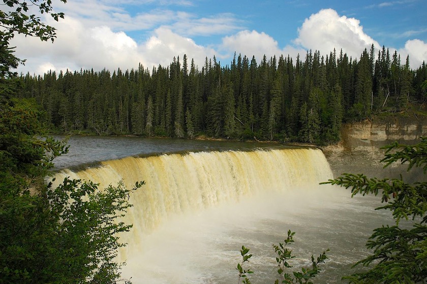
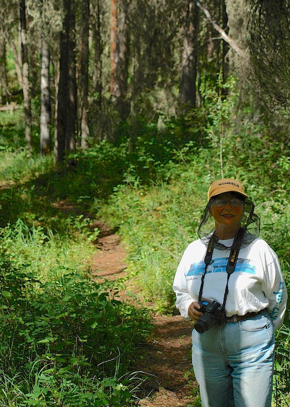
We began by crossing the border between Alberta and the NWT, which is marked by the 60th parallel. Our route through the NWT took us past many really pretty waterfalls, often only a short, lovely hike from the road, through forest. Short and VERY quick hikes; the bugs found us and attacked in squadrons. Very good exercise; hearts really pumping by our return. Musing: there are signs everywhere telling you Do Not Feed the Wildlife, but nobody told the bugs; ‘cause we are certainly a major part of their food chain. We’ve developed a new reason for cops to stop you: DWF – driving while flailing, as we frantically try to kill the critters who followed us inside.
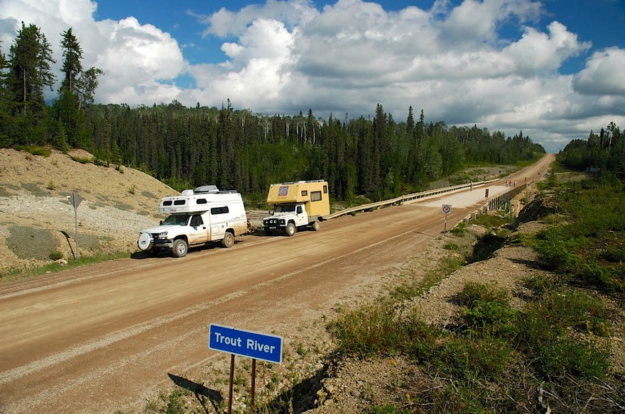
There is plenty of water in this area, moving fast. The rivers were the main mode of transport for centuries, and many of them are legends: the MacKenzie, the Liard, the Slave, the Trout; all major routes for the Aboriginals, the voyageurs, the fur traders, the miners, and then the steamboats. This remote country could not have developed without water transport. The towns grew up along the rivers, of course: Yellowknife; the various forts established by the trading companies and supported by the Mounties; and more recently the towns surrounding the areas being developed for oil and gas exportation. These days, the most remote areas are only serviced by air. It is a frontier country, with many charms, we found.
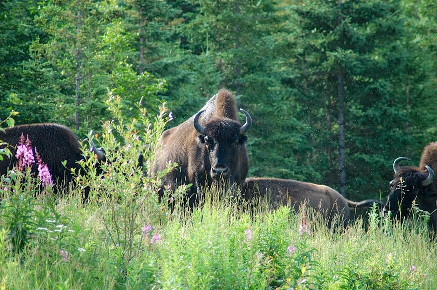
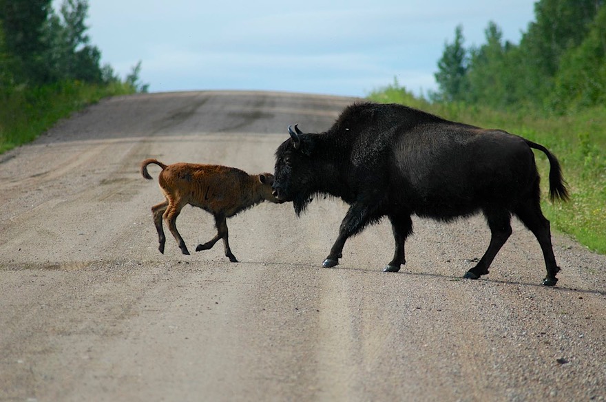
There are several bison herds in the NWT, and one of the largest areas set aside for them is Wood Buffalo National Park. Wood buffalo are a little different from the plains buffalo we are used to seeing, somewhat taller and leaner. We saw plenty, so had good opportunity to make comparisons, having just come up from Yellowstone. Wood Buffalo NP is a very interesting place, mostly for its geology; the buffalo there were mostly in hiding. But we saw tons of them on the road to Yellowknife, as well as in many other areas. One fun experience was watching a mother bison on one side of the road calling to her baby on the other side. We simply sat to see how it would work itself out. They met in the middle, and mama was urging the calf to follow her across; calf would have none of it. Being hungry, it insisted on nursing right in the road; mama would move a bit, baby would follow then stop stock still, butting until it got a chance to nurse; both making a fair amount of noise. Finally they moved on out of the way. Kids rule!
You tell me what a “Single Asphaltic Surface Overlay” is. The dirt roads up here (i.e. most of them) are really pretty good for the most part, and it’s a good thing as we’ve done hundreds of miles on them; but occasionally, in the middle of nowhere, there will appear a short paved section. One of these, on the road to Fort Simpson, had 37 kms of the above referenced SASO with signs proclaiming the fact… looked just like paved road to us, but we thought the name was interesting. Guess Canadians have “Your Tax Dollars at Work for YOU” moments just like us.
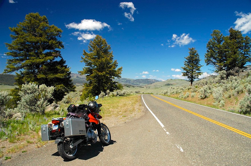
Problem the Second: The new bike has a very small windshield -- #$%^&*(*&^^%%%$$. MY MOUTH IS FULL OF BUGS. We have entered into the Worship of the Sacred Dragonfly – they are here to eat up those nasty huge black flies that are tormenting us so. Dragonfly Power!!!!! Those flies are making it very hard to ride the motorcycle and enjoy the scenery. Rick has to spend most of his time trying to head-fake flying critters; and when he’s successful, guess who gets hit.
We explored the “city” of Yellowknife, with about 20,000 happy inhabitants. Yellowknife is kind of unique. Despite a short summer and very harsh winters, everyone we talked to was quite pleased to be there. It’s so harsh in part because it gets very cold very fast. They get snow starting in October, but then the temperature drops so much that it doesn’t snow again; what’s there stays all winter. Many, many of the roads are for summer only; they have winter roads that are built on ice. (I was talking to someone in the visitors centre. She had helped us solve a problem. Using my highest praise, I told her “You walk on water!” She quickly responded, “Only in the winter!”) The town was founded on gold mining. Nowadays, there is diamond mining to the north, and the locals are making good money. Most of them are well-dressed and the town is pretty sophisticated. As usual, however, there is an underbelly to the town: about half the residents are natives, and too many of them look impoverished.
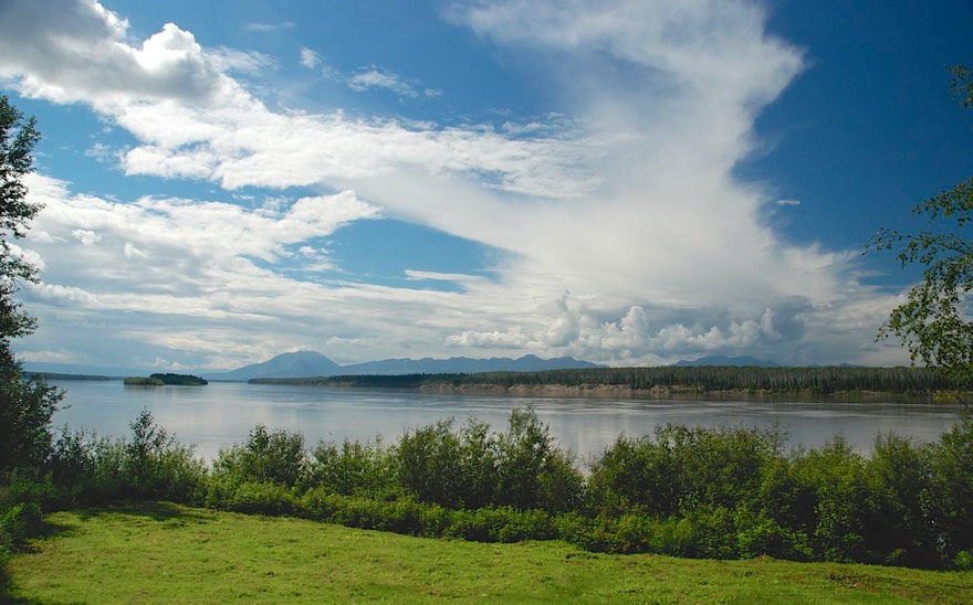
Yellowknife sits on the edge of Great Slave Lake, a pretty spot that sits directly on the Precambrian Shield. Of course, it’s the only thing for miles around; so having all the necessaries at hand is pretty important to those folks. There were shops and malls, and a nice library. In comparison to other towns we have seen in the NWT, it’s a hotbed of civilization! We stayed for a couple of days, enjoying some non-camp food and seeing the sights. The prices were high, not surprising.
On July 7, sunset finally arrived at 10:58 pm; sunrise was at 3:40 am, and of course it didn’t really get dark in between.
We had met a Swiss couple in the Wood Buffalo NP area, and having enjoyed their company there, were delighted to run into them again on the road to Yellowknife. We got to know them over the next several days, and have made some fine new friends! They are on a 4-month visit to Canada and the United States, having shipped their small rig over from Europe. We spent a lot of time comparing notes on all kinds of subjects, and have a standing invitation to visit them in Zurich when we get to Europe. They are great folks. We also were delighted to encounter a fellow Tiger owner (a ’93!), and enjoyed swapping histories as well as Tiger-tales.
The Northwest Territories has a new approach to garbage dumps: they call them Nuisance Grounds.
Did we say these rivers are huge? They really are, and even in July very full. There are more ferries than bridges in the NWT, so you really become aware of the force of the water. You drive on the little tub; the captain starts up and pulls away from the shore, edging gently out into the stream; then he points the ferry straight up-river, and using all the motor power available, sidles across the swiftly-moving water to a point well upstream from the landing, then slides sideways up against the far shore. Quite a sight. And since these are dirt roads we are traveling on, the landing area has to be repaired each time the ferry comes in; there are backhoes permanently placed on either side to make the repairs between times – all day long. Job security, that’s for sure.
And these rivers are only navigable part of the year. During spring break-up (about 3 weeks in April-May) and fall freeze-up (another 3 weeks or so, in October-November) no one is going anywhere. If people have to get across, they get together and get a plane or chopper to take them. During the winter, after hard freeze, they drive across on the ice. Something to think about!
The MacKenzie River Valley is huge, and a proposal has been submitted for an enormous gas pipeline project, one to rival the Alaska pipeline, presumably. Defeated in the legislature once, it is now being proposed again, with much whooping and hollering. It would cause huge changes in the NWT, both good and bad. It will be interesting to see how this works itself out.
After Yellowknife, we also visited Fort Simpson (on the other side of the MacKenzie River, one of the biggest and most powerful in the NWT). This town is the jumping off point for plane trips into the Nahanni National Park, a spectacular wilderness unreachable otherwise. It was very tempting, but we ultimately decided to pass, thinking we would splurge on a special opportunity later in the summer (we had a couple of things in mind). But Fort Simpson was fun; we hung out for a day or so, waiting to take care of a mundane chore. We needed to visit the Public Health Clinic and get a couple of booster shots for our trip to Latin America. After getting that taken care of, we hit the road to drop down and pick up the Liard Highway and back below the 60th parallel.
Once back below the 60th, we would be out of the Northwest Territories for the time being. We will return, later in the summer. One of our big goals for this year is to visit Inuvik, in the NWT, above the Arctic Circle and close to the Arctic Ocean. It can not be accessed other than by a road that goes up through the Yukon, so we were headed there. It would be a few weeks before we would reach Inuvik.

So, how do we feel about the NWT so far? It’s a long, long ways up there. And pretty flat when you get there. Lots of trees along the road, but the flatness of the terrain means that the trees are about all you can see. But…..ya gotta go! This is a real frontier; it’s very secluded, pristine, filled with tremendous bodies of water and wildlife (we saw bears, foxes, a wolf, sandhill cranes and all those mountainous bison). It’s rugged and harder than we are used to; but there’s a real feeling of accomplishment in people who are hardy enough to be there. The natives have great pride in their culture, and share of themselves readily. It’s a terrific experience. You’d love it.
Well, we loved it and are looking for more. The Yukon is next, of which we have seen some, and hope to see a whole lot more. So we remain happy and contented, far to the north of all of you, having a wonderful summer. We hope you are, too. Stay in touch, we miss you all.
Rick and Kathy
P.S. Problem the Third: Truck Conversions – we have switches for things that aren’t even part of the truck any more! Well, not really a problem; more of a curiosity.