August 2007
Northern Exposure
British Columbia & Yukon Territory
Or… lots and lots of dirt roads: shaken, not stirred, is the order of the day.
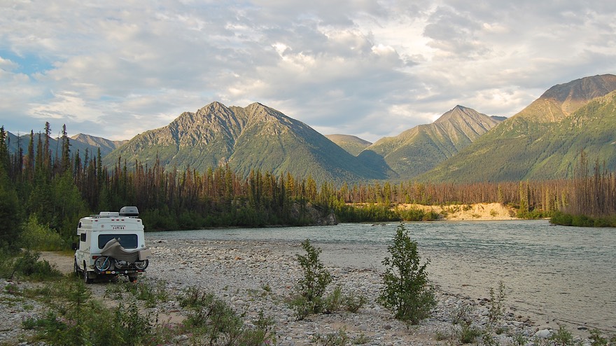
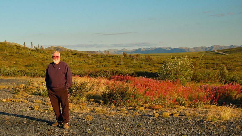
But also… what a difference 2 years makes! We are so very happy to have moved into the Tiger. We are covering some of the same country we visited up here two years back, in the Foretravel. Don’t get us wrong; we had a great trip that year. But this time we are far more relaxed; the rig is made for these roads! And we have every intention of tackling roads we wouldn’t even have given a second thought to last time around. So it’s a splendid summer and we hope it never ends!
We abandoned you on our way out of the Northwest Territories, heading for Yukon Territory and its treasures. Interestingly, you cannot drive directly from one to the other (except on the road to Inuvik, which we will explain about later on). The normal way is to drop down out of the NWT on the Liard Highway, a lovely stretch of road, and pick up the Alaska Highway; you briefly cross into British Columbia, and then, after dancing on the Yukon/BC border for a stretch, enter Yukon for good. The Alaska Highway is the route 99-1/2 out of 100 folks take when traveling to/from Alaska. There are variations, of course, but this is the granddaddy of them all. For us, after spending time in the NWT, where it would be unusual to see more than a dozen vehicles along the road all day long, and the majority of the other RVs on the road are little guys like us, we felt we had been joined by rush-hour traffic. We got used to it, of course. Even we know we cannot avoid all of the people all of the time. But we realized how much we had come to appreciate the solitude of the out-of-the-way. A phrase from Henry V comes to mind in reference to the colony of little RVs we had crossed paths with in the NWT: “We few, we happy few.”
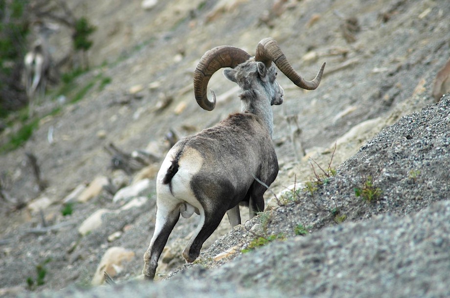
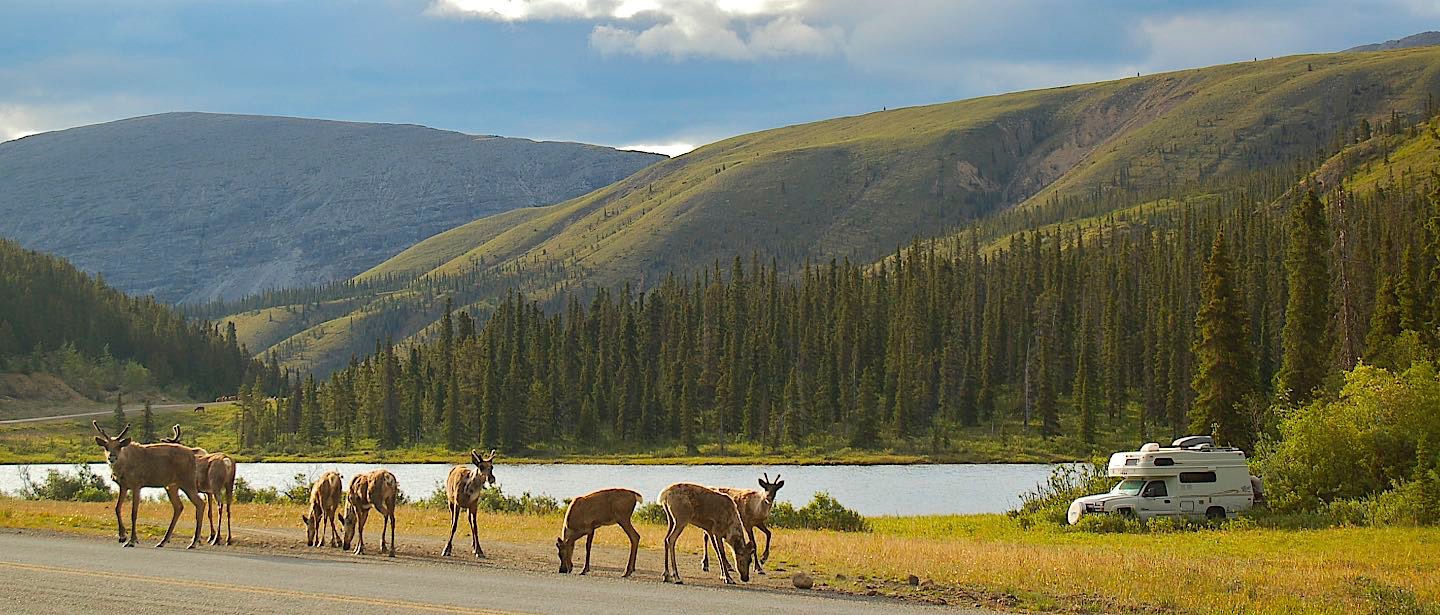
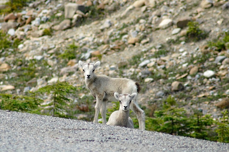
However! This part of the Alaska Highway, between say, Ft. Nelson and Whitehorse, is the loveliest section of the entire road. Leaving the flat topography of the Northwest Territories behind, we entered mountainous regions with beautiful streams, lovely vistas of far-away peaks, and greener landscapes. And critters! We spent a peaceful night tucked into a side road not far off the highway, and woke up the next morning with groups of caribou and sheep surrounding us. It was quite an experience, and we managed to get some nice pictures. Then, looking down the road a piece, Rick spotted a moose crossing the highway. Way cool!
A digression: Challenge the Fourth: (first 3, last message; come on! Pay attention: We are Living in a Walk-in Closet with a Hot Plate and a Wet Bar. You will remember from our last message that we were discovering differences between the Tiger and our larger coach. Problems and opportunities. So: you will remember that the Foretravel is 34 feet long, and the Tiger a mere 19. Thus the walk-in closet, etc. A real challenge at times. After five months, mostly surmounted. But you never, ever, make a move without looking first to see where your mate is at the moment. And when one is cooking something complicated, the other really must sit still and read a book!
Digression aside. We traveled west as far as Watson Lake of signpost fame (if you’re familiar with this area). It seems that travelers, passing through, have taken to putting up street signs and license plates from various places; there are zillions of them in a veritable forest around the welcome centre. Very popular. We stopped there because we wanted updated information on the condition of the Campbell Highway, which we were anxious to travel on. The Campbell is a dirt road that goes north from Watson Lake, and then west to join the main road, the Klondike Highway going up to Dawson City, touching in north of Whitehorse. You won’t care, unless you’ve been there. The Campbell is well known, but not taken by too many. We had been tempted before when on our way to Alaska, but had been put off by its length – almost 400 miles – and the little experience we had had to date on non-paved roads. But we knew there were several lovely lakes along the way, and also it would give us access to the Nahanni Range Road, also dirt, and supposed to be stunningly gorgeous. With the Tiger, you can tell that our new plan was to see as much of the Yukon as was possible and passable, by whatever roads presented themselves.
Reassured that travel on the Campbell would be quite fine, we started on our adventure of really taking the roads less traveled, life in the slow and lonely lane of unpaved highways; and we weren’t disappointed. The Campbell is mostly well maintained, and we had no problems. Our intention was to go northwest about 65 miles, until we reached the Nahanni Range Road, which would take us about 120 miles northeast toward the western edge of the huge Nahanni Preserve, ending at a (guess what kind of) mine in Tungsten, right on the NWT border. We had been sort of due east of here in the NWT when we were in Fort Simpson, the jumping off base for flights into Nahanni NP (get the picture now?). We wanted to get up into the range, by vehicle, as far as possible; it was supposed to be a lovely area.
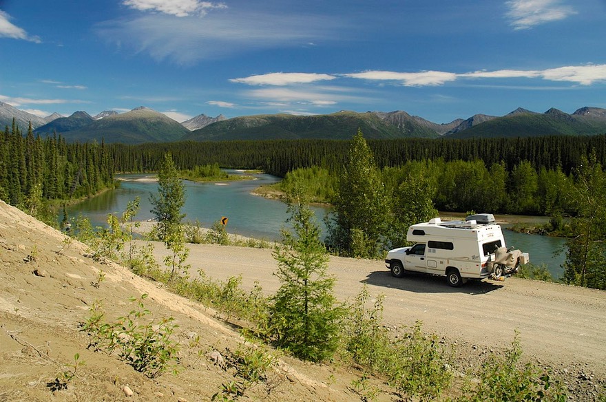
The Nahanni Range Rd is well maintained because of all the mine activity, and it was a delightful trip up a series of streams past several beautiful lakes. About 50 miles up, we found a place to camp right by a rocky stream. We spent two nights there, all by ourselves, enjoying the sounds of the river and the views of the mountains. We took down the bike to ride the rest of the way up to the top. And how filthy the poor beastie had gotten! The whole back of the coach (and bike, too, of course) was absolutely grey with accumulated dust and muck. Couldn’t hardly touch anything. But down the bike came and we washed it with water from the stream. Then off we went to explore. We cannot overstate how lovely this road is; and in good shape – a regular sedan could have made the journey up to the top. We took pictures all afternoon, and then found ourselves a long ways from the coach underneath a very threatening sky, and finally turned back about 20 miles short of the top. But a great experience, and some nice photos to show for it.
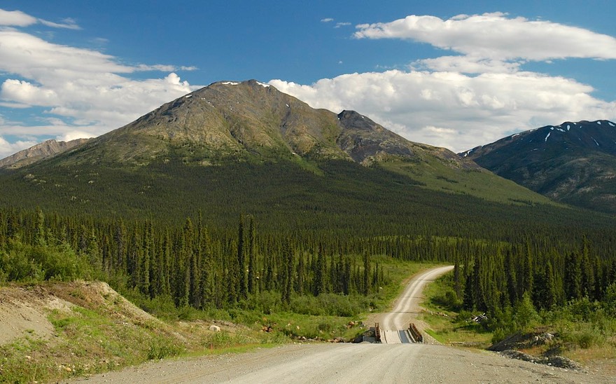
We next decided to bring the coach down the South Canol Road back to the Alaska Highway, and thence into Whitehorse, where we had some things to attend to. The Canol Road bisects the Campbell Highway, going north to the NWT border, and south as mentioned. It was originally built, as was the Alaska Highway itself of course, by the US Army back in ’42-’43 to bring CANadian OiL (CANOL) down from Norman Wells in the NWT to Whitehorse. So, big deal, huh? Well, the Canol is also unpaved. But gorgeous; particularly a high alpine valley of lakes connected by the Lapie River meandering through wide swaths of grass. Okay by us. And it really is a lovely drive. It was 150 miles south to the Alaska Hwy; about 50 miles down it started to rain. No downpour, just steady rain for the next 100 not-well-maintained goopy miles. And we were short on fuel, adding to the frustration as we slipped around on the clayey surface and practiced with the 4-wheel drive. But we made it, sliding into a gas station on our last fumes. We limped into Whitehorse, found a place to power-wash the coach and bike, and treated ourselves to dinner in a “real” restaurant.
So now a word about the current cost of traveling in Canada. Things are generally more expensive here than in the states regardless of what the actual currency exchange rate is. When we spent our first summer in Canada in 2002, the exchange rate was 64 cents on the American dollar. Life was great (and relatively cheap!) as the exchange rate advantage more than negated the higher prices. The relationship between those numbers has shifted each year since, with the Canadian dollar increasing in value dramatically. This summer, our exchange rate is different now than it was just a month ago, from 93 cents on the dollar in June to very near par in July. That’s even-Steven. No more advantage at all. Damn! And groceries are very expensive, particularly as you get further north. Fresh produce…….but I’m babbling. You don’t want to hear about it. And I don’t want to talk about it! Fuel is as bad or worse, currently averaging about $4 to $4.50 a gallon for diesel and a bit more for gasoline. We console ourselves by thinking we’re preparing for eventually traveling in Europe; and are thankful that our recent vehicle changes have moved us into much improved mpg ranges on both the Tiger and the bike. As always, we try to find ways to reduce those costs by driving less and eating out less; and these days we seldom pay for camping at all so that helps too.
But we had three nice days in Whitehorse, attending to both business and pleasure. We found a welder to make another change on the coach, found a used bookstore, got haircuts; you know the stuff. Whitehorse is a nice town. There are obvious comparisons between it and Yellowknife; they are roughly the same size (approx. 20,000 each); each is the territorial capital and is where you go to get things done and find things you need. Whitehorse is somewhat warmer, and the area is greener and of course Whitehorse sees far more visitors. Of the two, we probably prefer Whitehorse, but Yellowknife has a lot to offer as well.
Small last digression: Try having enough food available in a refrigerator that is no bigger than a shoebox. This has been a real challenge. No buying in quantity, and it’s hard to stock up for spending several days out in the “bush.” You can’t buy a head of lettuce until you use up the last one. Extra ice cubes? I think not! But even this challenge is being met; if you could see us it would be immediately apparent that neither of us is starving to death!!!
Finally we were finished with welder, chores, and had spent all our money, and we headed north out of Whitehorse. Our route would take us up to where the Campbell joined the main road, then work our way east through Faro (stay tuned for Keno a little later on…..) and Ross River, where we would rejoin the Canol Road and could explore it going north to the border. But ya’ know, ya’ know, the South Canol Road is soooo lovely, and it was soooo rainy, let’s go down it again (at least part way) and try to see it on a sunny day.
So we stopped and poked around in Faro, a really cool little burg. This is a town built in the 60s for lead zinc mining in the area. They still can (mine) but don’t unless, and won’t until, world prices are in their favor. So the town would die, except they have discovered ways to bring in tourists. It’s in a pretty spot, with interesting geology to go see, and ecotourism is doing pretty well. So it’s fun to poke around for a bit, and then head on out. On to Ross River, where we turned south again and enjoyed the South Canol Road for about 40 sunny miles. We had remembered a possible spot for camping in the Lapie Valley, found it and settled in for a couple of days. You see, by the time we got there it had turned rainy again. This was an area we really wanted to photograph in good weather; we decided to wait it out and spent about 36 hours catching up on chores, reading, and enjoying the rain. Then the sun came out again, we got some really lovely shots, and had a pleasant time retracing our steps back up to Ross River and the Campbell Highway.
Then we had a decision to make. Go up the North Canol Road, or get to Inuvik in time to catch their Arts Festival? We had already missed two significant summer festivals, one in Yellowknife, the other in Dawson City. We knew the Inuvik event was a REALLY big deal: music, art, educational demonstrations, native drumming, all the good stuff. But the North Canol Road! Well, hell. What to do.
Inuvik won. As it was, we couldn’t possibly get there before the last weekend of the festival, but if we missed the whole shooting match we knew we would be sorry. And besides; one of our great goals for the summer was to make the trip up to Inuvik, and what were we waiting for? Soooooo. Off we went. The turnoff lay just short of Dawson City, so we stopped there for a bit, gathering supplies, doing some internet work, having a restaurant meal, and getting fuel. Then we took a deep breath, turned left onto the Dempster Highway, and started up for Inuvik.
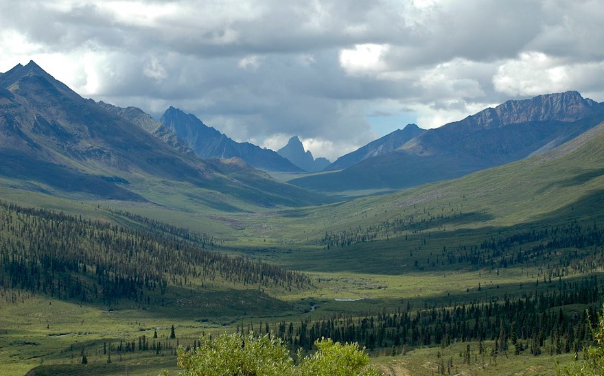
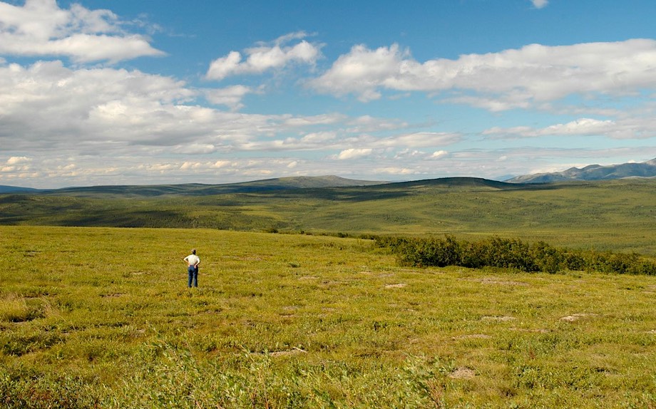
Inuvik lies at the end of the Dempster Highway -- 450 miles of gravel, due north of all pavement. You cross the Continental Divide 3 times. The last 160 miles lie in the Northwest Territories. About 300 miles up, you cross the Arctic Circle. This is like, man, way up there. It took us three days each way, although many do it in just two. It was the trip of a lifetime. For us, the best sections were in arctic tundra, above the tree line. Walking out on the tundra was unique. The ground is covered with plants, low plants, some of them flowered, some of them parts of bushes; it is resilient but gives underneath you, and we promptly named the tundra Sponge Bog. We spotted a lone caribou far off, a large bull; Rick walked out to get close enough for pictures, but the fellow kept edging away, so we weren’t able to get anything overly spectacular; but it was a great experience. The caribou are the subject of much discussion. The size of the herd varies, of course, but in recent years has greatly lessened. The arguments, not surprisingly, center around who is at fault. These arguments are similar to those surrounding the decimation of other wildlife and the end of the traditional way of living for the indigenous peoples of the area. Nothing new here.
The solitude of the tundra was wonderful; it was surpassed by the beauty of the area. Sweeping plains with vistas that went on forever, mountain ranges, endless variations on the color green. We were above the upper limit of the boreal forest, and there were no trees to limit our views. It was enchanting.
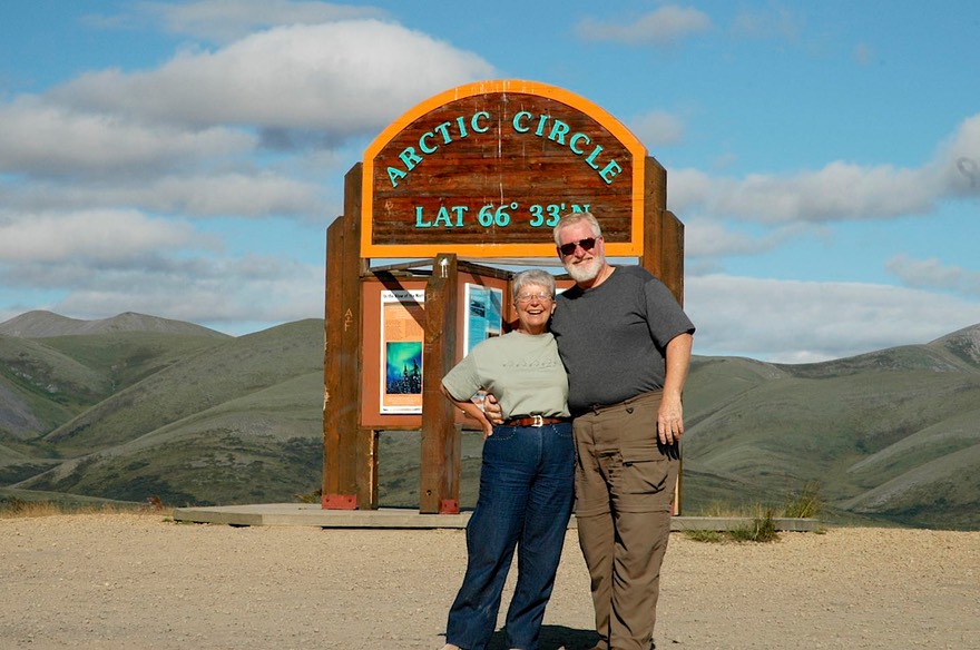
Reaching the Arctic Circle was a special event, naturally. “North of the Arctic Circle” has a real ring to it! We had naively assumed, along with others, that it would be cold, icy, and somehow snowy. But that’s not what Arctic Circle means. What we learned is that the Arctic Circle is simply a line drawn around the globe at the point (66 degrees 33 minutes of North Latitude) above which the sun never sets on June 21st, and never rises on December 21st. The Circle crosses eight nations on its way around. Quick, quick! Can you name them? (We can)
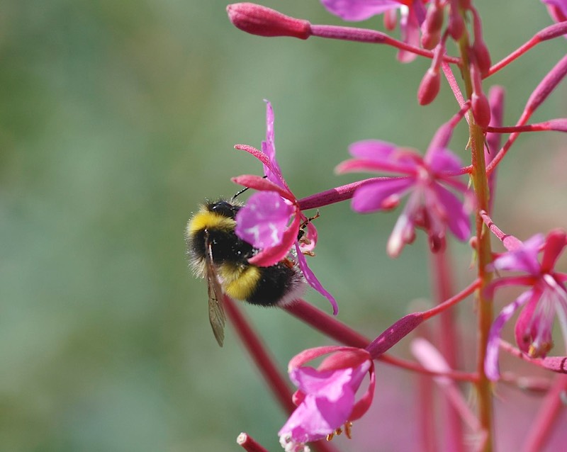
Up this far north, I had wondered what flowers would be in evidence. Still fireweed, amazingly; that rascal grows everywhere – we were still seeing it in Inuvik. Lots of low alpine flowers as well, and something called cottongrass, that looks like a messy cottonball when seen individually, but is beautiful when massed out in a field. And berries, out in the meadows: salmonberry, bear berry, soapberry, along with tiny strawberries and cranberries and blueberries. Everywhere, we saw people out in the fields picking; everything was ripening at the same time, it seemed. We knew that it was a short, intense season. Fire is a frequent visitor to the boreal forest, and particularly in recent years, with 2004 and 2005 being particularly dry, ending up as the 1st and 3rd worst fire years on record. The information signs everywhere tell us that fire is good, that it re-energizes the land and creates new habitat for different species, etc. We can’t comment on that, but the fires certainly open up the landscape for more flowers and create lovely mosaics of differing colors as the wildflowers come in abundance. 99% of the fires in the far north are caused by lightning and are allowed to burn out naturally as they do not typically threaten any buildings. One very well done pamphlet we found describes the areas along the highway and how long ago they burned. It made the statement that there are no unburned areas of the northern forests, it’s just a matter of when they burned.
The Dempster is the lifeline for the far north of both Yukon and the towns near and including Inuvik. It is an all-year road, contains two airfields right on the roadbed, and much of it is in very good condition. Naturally, it is being worked on every summer, with sections being rebuilt as needed. Of the 450 miles, about 100 miles were a bit of a struggle; this was split between two sections, one bad because they were working on it, the other because they weren’t yet, but needed to. There is one hotel along the road, in Eagle Plains, halfway up the road. Eagle Plains has rooms, fuel and water, a restaurant and small campground, and is a firefighting base. That’s it.
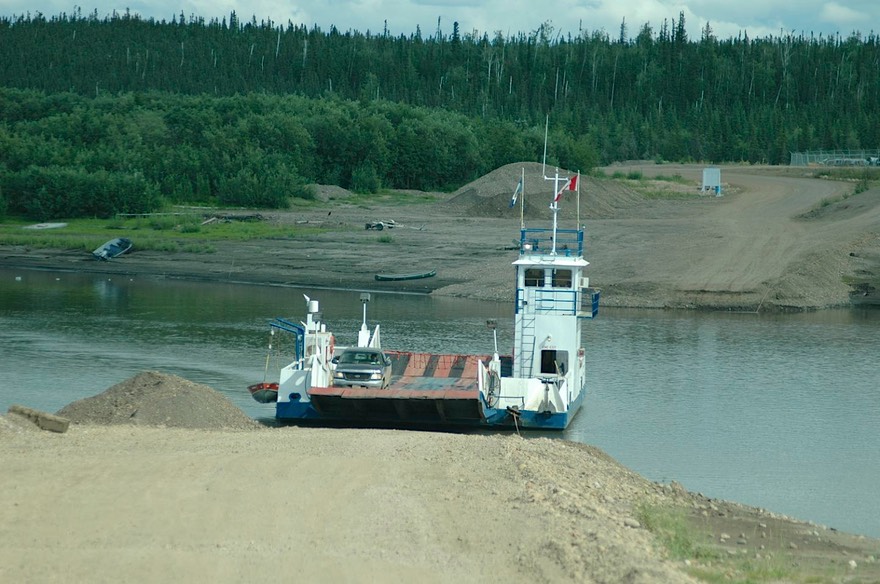
One hundred and sixty miles from the top, you cross into the Northwest Territories, and the terrain begins to change. You are on the east side of the Divide now, and have entered the huge MacKenzie River basin. The MacKenzie and its tributaries drain into the Beaufort Sea, which is part of the Arctic Ocean. This is like, major north, folks. So, as you drop down from the Divide this last time, you come back into boreal forest, and start your river crossings. First the Peel, then the Arctic Red where it joins the MacKenzie; these are huge rivers, flowing fast, even in late July. (Still true in mid-August as we finish up this message) This was the second time we’d crossed the MacKenzie, having traversed it near Fort Simpson in the NWT. As before, these are ferry crossings, with all that entails: the bravado of very adept pilots. We always enjoy the experience.
Fort McPherson sits on the eastern bank of the Peel River; we passed quickly by on our way north, promising ourselves a visit on our way back down.
Beyond the rivers the land becomes flatter (river deltas are like that….) and less interesting. We reach sea level as we approach Inuvik. Our plan is to camp about 25 miles shy of town, take down the bike, and ride back and forth between the two for the days we are in the area. But. The rig is filthy. By conservative estimate there is a minimum of 100 lbs of mud on the back, much of it attached to the bike. Yuck! And now we are in a predicament; we cannot find water. There is so much mud that we cannot get the winch to work, etc., etc. Rick coins the term MudRed (rhymes with Blood Red) and, understandably, one half of the group refuses to ride a bike she cannot tell the color of. We are stymied in our plan; so be it. We simply take the coach back and forth. Which has advantages, of course. No big deal.
So; Inuvik: 68 degrees 21.46 minutes N. All along we had known that the big deal was the trip up, not the town at the end of the road. And no surprises. But Inuvik is a real town, with nice people, an active arts community, an excellent library, and an outstanding visitors/intrepretive centre. The centre had great examples of indigenous arts and crafts, the coolest musk ox anywhere (Rick has a thing for musk oxen…..hmmm); great explanations of permafrost, etc. We spent a long time there, and it was a real highlight of our time in Inuvik.
July 25: fell asleep at 11:20 pm with the sun still shining on my face.
And we did enjoy what we saw of the arts festival. Unfortunately, we had been unable to get any concrete information about the schedule of events, and arrived in town directly after the huge evening event that was the highlight of the festival, but the artwork was very good, the crafts beautiful, and we saw a whip demonstration that was cool. These whips are about 30 feet long, and are used to bring down the caribou (as well as control the dogs on the sleds). The little elderly man demonstrating the techniques was a real kick; he spoke no English, but kept making jokes that would be interpreted by a young fellow by his side. Rick had a chance to try his hand at the art, and found it far more difficult than it looked; no surprise there.
We should mention that much of the highway to Inuvik passes through traditional Gwich’in lands. There are signs asking you to treat the land with respect; that if you are caribou hunting, you must follow traditional hunting laws and treat the animals with honor, and that the first law is to aim for the heart. No sense of “keep out”; just to be good to the land.
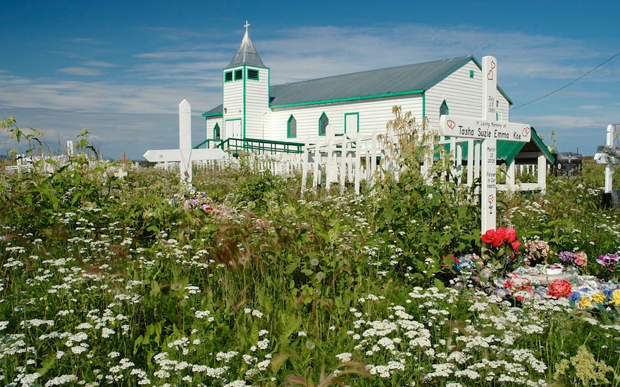
After a nice long day in Inuvik, we turned around and came back down the hill. Not as exciting, of course, but very satisfying. We made a short stop in Fort McPherson on the Peel. Small working town, with not too much going on, except there was reportedly a very nice canvas and tent shop that was worth a visit. We enjoyed our time there. Started by the government 20 years earlier, it had in recent times been taken over by the local indigenous group, who were doing a land office business. We bought a great new case for the laptop, visited a pretty little church with cemetery, had lunch, and were on our way.
After we had crossed back over the last river and started climbing back up into the mountains and into the alpine tundra, we entered the area we like the best, and enjoyed it just as much as we had going north. We spent our last night on the Dempster on top of the Continental Divide, watching a full moon; we could see forever. In our week on the highway we had noticed how quickly the season was passing; there was more yellow in the plants, and the flowers were reaching their end. As we approached the bottom of the highway, we felt sad; one of our biggest challenges of the summer had been met: it had exceeded our expectations, now it was over, and the likelihood of our returning soon was slim. We knew we would return, and next time it would be late in August in order to enjoy the fall color. But that could be several years away. We had traveled 890 miles on the Dempster Highway, spending 27 hours and 20 minutes in driving time at an average speed of 32.5 mph. (Damn electronic gadgets) Had it been worth it? You bet!!! Get it on your list!
Coming down off the Dempster means one thing to most folks: a car wash. It took us almost $10 at the powerwash to make the rig at least look familiar to us; and, more importantly, the motorcycle. We had spent hours traveling behind water trucks, going through mud, and dodging around workmen. (We managed to miss the calcium carbonate truck someone had warned us about.) But we were clean enough to rejoin civilization. We had a HAMBURGER. We drove into Dawson City and got on the internet; we had FISH AND CHIPS. You get the picture!
In Dawson we drove up to the top of Midnight Dome, which we’d never done before. We stayed up there two different nights. It’s up about 3,000 feet and has a wonderful view of the town, as well as the Yukon River, which flows past. The interesting story told on the signboard at the top was about the town folk trooping up the hill on June 21, 1899 to watch the sun not set… and being disappointed when it did. They had not had the advantage of reading about what the Arctic Circle means, as we had. While pretty far north, Dawson is not above the Circle by a long shot. You must remember that this was a really interesting gold rush town; very famous. We had visited it before and have reported on all the historic things there. The town seems pretty healthy, and there is even more going on than two years ago; we hope this continues. Dawson is a fascinating place. It has a very short season (they figure 100 days between thaw and freeze-up), and makes the most of it. A worthwhile destination.
Using Dawson as a sort-of headquarters, we backtracked a hundred miles or so to visit the mining town of Keno (no, not Faro, that was earlier; yup, hard to tell them apart), with its all of 20 residents. Now here is a town that has figured out how to stay alive after its industry has gone completely south; brochures, beautiful ones, in all the visitors’ centers, talking about the old mines, the butterflies that come in the summer, and the lovely wildflowers, and the signposts up on the top of a hill put there by scientists who participated in an IGY (International Geophysical Year) program there, stuff like that. Really makes you want to visit the place. Well, the reports of very good pizza in town proved true at least. And we saw a humungous beaver; a real, live one, not a roadside attraction type.
Rick, as is his wont (what the hell does that mean?), does a monthly summary of our activities. For July, we covered 4000 miles (gasp) an astounding 2,400 of them on dirt or gravel, at an average of $4.36/gallon for diesel, and $5.01 for gasoline. Gulp.
So with this depressing news at hand, do we decide to curtail our activities, not cover so many miles, try and be conservative? Hah! Of course not. We head for Alaska. Our plan is to head west from Dawson, over the Top of the World Highway (mostly dirt), through Eagle and Chicken (purportedly named by someone who couldn’t spell Ptarmigan) to Tok (like those names???) and then investigate the eastern part of the state. Our plans are very loose; we feel as though we have all the time in the world. When we are done (or Alaska is done with us…..) we’ll head back out into Yukon Territory for a few last roads as yet unexplored, then down-down-down and back into the States late in the fall.
Alaska fuel costs less than Canadian fuel, that we have been guaranteed. Our salvation?
Our best to you down there in the lower 48 as you (hopefully) enjoy your summer as much as we are ours. See you later!
Rick and Kathy