October/November 2008
A Day in the Life...
Southern Peru
We’re in southern Peru, having a ball. We’ve been wandering in and amongst the highest peaks we’ve ever seen, often sleeping at 14,000 feet or more. This is a grand adventure. And… we have a new name for those speed bumps you see on either end of a country village: here they are often called rompemuelles. A word that translates as spring breaker. Just too, too appropriate.
Thought you might enjoy sharing a typical day with us. We had spent the night at 12,900 feet at a nice pull-off just north of the town of Espinar (also known on the maps as Yauri), on Highway 28, stopping as soon as we hit pavement for the first time that afternoon. During the evening, we could see the lights of the town below, and we watched a storm cross the valley and pass beyond the peaks to the northwest of us. We were on the back road between Cuzco and Arequipa. It was a quiet night, broken only by occasional honks from passing trucks and busses saluting us.
In the morning we stopped briefly in town for fresh fruit from a stand on the street, and then, after asking directions from 3 different locals and thinking maybe we had the right road, plunged ahead. Pavement ended as we left town, not to be seen again that day or most of the next.
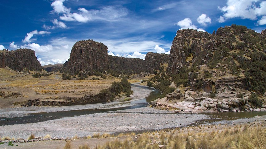
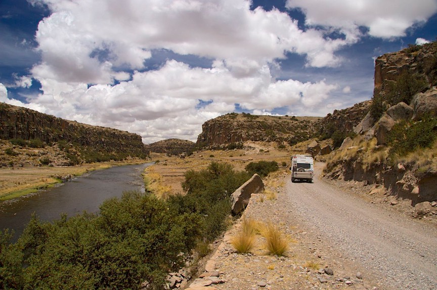
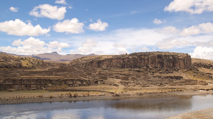
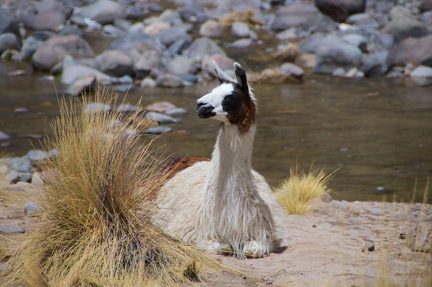
Our dirt road meandered along the side of a river in lovely morning sunshine. And at first there was a fair amount of traffic. After aways and several road choices, we stopped seeing other vehicles, and Kathy became somewhat uneasy. Rick, more sanguine, assured her we were still going in the right direction, and not to be concerned. The scenery was incredible. We traveled through the canyon of the Rio Apurmac, with rocky sculpted bluffs like we had never seen before, and fields of alpacas and cattle. We passed ruin sites visible on the hills across the valley. The road gradually ascended as we followed the river further into the canyon.
Then, around noon, we reached the small town of Suycutambo. Now, mind you, we had never been able to confirm we were on the right road. No signs, no Km markers, no busses coming our way, nada. Hmmm, Suycutambo, huh? THIS TOWN IS NOT ON THE ROAD WE ARE SUPPOSED TO BE ON. The map shows it is nearby, but not on our route. Well, let’s ask.
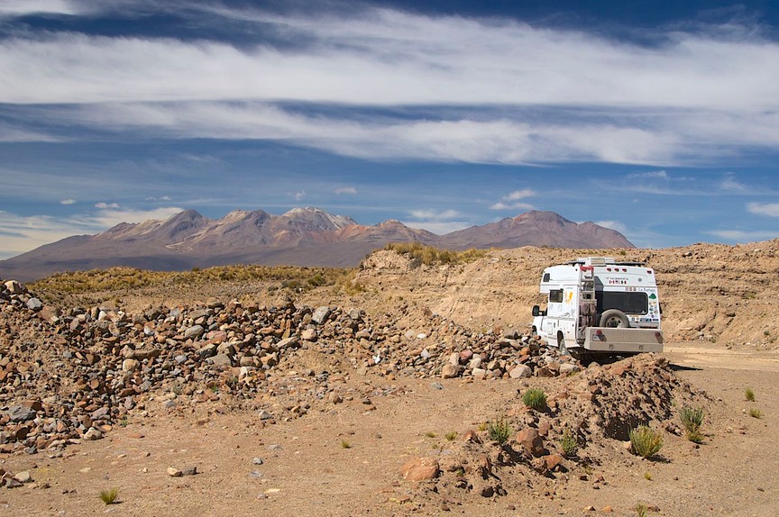
But oops; we’ve just sunk into a hidden hole on the edge of the road. We had been consulting the map as we went along, and trying to make the right road choices, and wondering aloud if we were really in this town that was supposed to be much further along. Suddenly we had encountered a new drainage system being dug throughout the entire village. Someone had covered this part over – loosely. Well, we uncovered it again. We were stuck with one rear wheel not even touching ground and the truck sitting on its frame on that corner.
People started backing up behind us and in front of us; no one could move, as we were blocking the road; a very narrow road under the best of circumstances, and not passable at all by now. Busses in our face (where did they come from); trucks and taxis behind us; people coming from the plaza to join passengers and drivers and men on motorcycles and bicycles (where could they be going?), all come to check out the action. The folks in the picture below are not angrily telling us to leave, or calling forth some mystical incantation; they are just some of our rescuers celebrating our escape.
It seems we were indeed on the correct road, and busses do use it, a lot. Suycutambo is about halfway between somewhere and wherever, and there were probably a dozen busses stopped around the town plaza, everybody eating lunch at stalls and buying produce from the vendors. The tiny square was a madhouse.
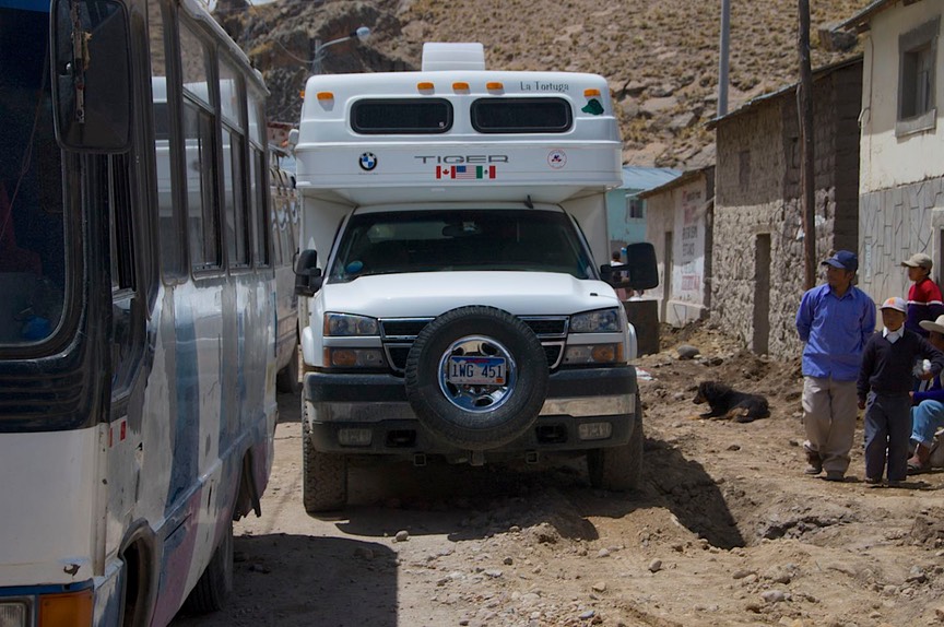
After much consternation and consultation, and several people either taking charge or looking like they might, a group of construction workers from a nearby project came along heading for the plaza for lunch. With them as reinforcements, a dozen or so folks gathered behind the truck, heaved, and got us out of the ditch. Now all we had to do was get through this tiny town with its tiny streets. We had to convince folks to get up from lunch so we could move the benches and stall coverings and slowly creep around the square. Busses moved for us; people smiled and were helpful when we urged them. Good, got around the square. Now just go down this “street.” Yabbut, there are two busses and some motorbikes in the way, lining the right side of the road, and there’s this damn ditch on the left side. We were stuck “in traffic.” Well, about half an hour later, people finished their lunches, climbed back aboard, the bus jockeyed around a bit, and we got the hell out of town.
Now Rick will tell you that once the rig was out of the ditch without damage, getting through the village was just an adventure. Kathy will tell you she almost lost her mind: walking along backwards in front of the truck, guiding Rick as he crept along, moving people and stall coverings, almost having to pick up someone’s food and move it for him (never a her), and taking the bench and setting it somewhere so he could sit down on it again, and trying to find the bus driver (unsuccessfully) to get him to move the bus so we could get going. Bonkers, totally bonkers. And they just sat and grinned at this ditzy American female, trying to organize the hell out of them.
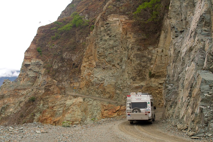
Finally we were able to leave; and then the road quickly deteriorated to probably the worst numbered highway we had ever been on. On we went, bumpy mile after bumpy mile. The road got worse and worse, but at least we’d been told we were going the right way. It turned to rain, then snow, then cleared again. We climbed to 15,400 feet. Very little traffic now. We were reminded of eastern Wyoming. Tooling along, avoiding the worst of the huge holes in the road (some filled with water), taking each water crossing in stride as we chose among several options to get across, we actually decided we were pretty happy campers. The road was deserted, the high altiplano countryside lovely. We had faith in La Tortuga to get us through or to protect us overnight if we had to stop. We felt good about challenges met and survived, about being loco enough to venture out where even other overlanders hadn’t gone, and just plain lovin’ our life on the road.
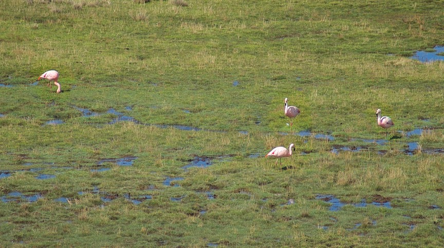
Late in the afternoon we bagged it for the day, and stopped beside a marshy area for the night. We were at an elevation of 13,900 feet, in a pretty valley that was surprisingly wet, and there were lots of birds to keep us company. We even saw wild flamingos. It was a great ending to a very difficult day.
The next morning the road wasn’t any better, but we knew we were getting closer to civilization (as we had come to know it); about 9:00 am we came around a corner and encountered two bicyclists from Alaska, stopping for a snack. We had rejoined the rest of the world. We shared with them what we always say to ourselves when we see cyclists out in the wilds with us, “and we thought we were crazy”.
Now I really must tell you that all days are not like the above; do you believe me?
* * * * * * * * * * * * *
So, with that tale told, perhaps it would be smart to go back and pick up where we left you, in Lima. We had been to the Galapagos Islands, and returned to Lima to spend a few days before heading back into the mountains.
Lima is not a city where we would want to spend a lot of time; it is much too big, much too noisy, very dry (only 1-1/2 inches of rain a year), and it seems to be overcast most of the year (called garua). We were staying in the Miraflores area, which is considered both upscale and relatively safe, but Lima has a bad reputation. It also has a lot of very poor people (connected to the bad reputation for tourists). For instance, when we flew in from Guayaquil, we took a taxi to our hostel. The driver had to stop for fuel; Rick watched as he put less than a gallon of gas in the tank, the amount needed to get us across town.
The traffic is appalling. The most dangerous multi-tasking sight we have ever seen was in Lima: a man talking on his cell phone while jaywalking through heavy downtown traffic. And the traffic rules. Since the streets are generally one-way, pedestrians have a continuous crink in the neck from watching the traffic coming from the left or the right. If you want to cross a street, look for one with speed bumps; even Lima traffic slows for them and you can dart across. A good rule: move fast and maintain lots of eye contact. We last wrote about pedestrian peril in Cuenca, Ecuador, but Lima is in a whole other league.
When driving, be aggressive; you will be acknowledged instead of ignored. Remember that stop signs are only suggestions; traffic will only stop for the light. Taxis honk at every corner and don’t really ever slow down. If it is a two-lane street, there will be three lanes of traffic; four at the corner, as three of the lanes will want to turn right, or left, from any of the lanes.
We spent one day out in the truck, fighting the traffic as we looked for a propane adaptor for the rig (at the end of the day we emerged victorious, but it sure took its toll). En route we were subjected to a scam with various people pointing at our tires and indicating something was wrong. It was nerve-wracking and we stopped a couple of times to be sure all was okay. When we saw the same guys for the second and third time, several blocks away, we knew they were just working the streets, and stopped being concerned. But it left us uncomfortable.
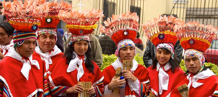
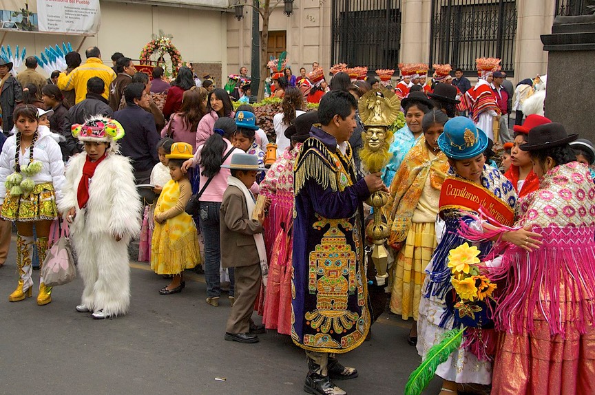
But Lima has its charms. We set out to see them on a Sunday, our preferred day for sightseeing in cities. Often, interesting things happen in a city on a Sunday. And we were rewarded with a unique opportunity. It happened that the day was a special one: it was the anniversary of Lima being declared the country’s capital. We came around a corner into a small square and here were these tons of people in really weird costumes. Mass confusion. Small bands competing with each other for everyone’s attention. Did I say the costumes were weird? Groups were in everything from bare-chested fierce garb to gangster outfits (long black leather trench coats, brown suede scarves, and black leather hats, with wooden machine guns); to women in various traditional dance costumes; to men in a costume we can only describe as a wedding cake. All of these costumes very nice and very expensive; the people highly professional in movement and demeanor.
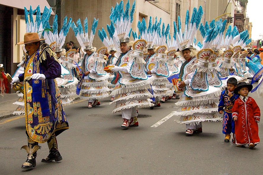
Old people and small children; these wonderful costumes must be passed down between the generations. Ah, and teenage girls in high-heeled boots that laced to their knees, and skimpy outfits above. To say nothing of the guys in full animal costumes. Please look at the pictures on our website for some idea of what we saw. It was amazing. For a long time the entire group milled about, with people passing among them and pinning on sashes saying the name of their organization; then suddenly they had achieved critical mass it seems, because they formed up, the bands began playing but a single piece of music, and they marched on down the street. No police controlling traffic, no barriers, the marchers simply took over. Even the taxis were forced to stop for them. We followed them for blocks, enjoying the action, before finally becoming sated with the excitement and color and music; a wonderful experience.
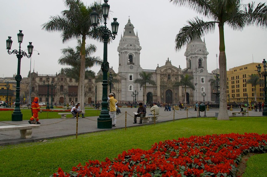
We also spent some time in the large Plaza de Armas, where the seat of government is, along with various other old buildings. The president had just been exposed in a major scandal, and was expected to appear to make a statement. There were riot police and tanks galore, and we were shooed away from getting close to the action. We wondered just how stable this government would remain.
Several days later, we were ready to leave Lima, and trying to pick a route. Peru has its unrest (most of the countries we are visiting have trouble spots), and we had been inquiring about an area we wanted to see. After spending time along the coast, we were now quite anxious to get back into the mountains. There is a road that heads east from Lima, directly back up into the Andes and then south to Cuzco, our next destination. Unfortunately, we found that in the last few days there had been soldiers killed somewhat near our proposed route; despite the fact that we thought we would probably be just fine, we decided to play it safe.
So we tooled south from Lima along the coast. Lord, do we hate the Peruvian coastline. But anyway, we eventually went through Ica (wine country) and Nasca (of The Lines fame). Lots of people have really enjoyed this area, but it didn’t do much for us. Kind of reminded us of I-40 without the cactus and not as nice; sort of like Kingman, Arizona, but less interesting (?).
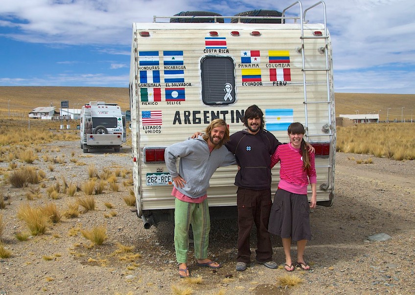
Just south of Nasca you finally turn inland and head into the mountains, up a dry valley; up-up-up to about 8,000 feet (looks like Avenal, California to us); then on up to 11,000 feet – over a total of about 45 miles. By now it’s pretty barren; the top of the pass (13,600 feet) is quite near the beginning of the Reserva Pampa Galeras, which is a vicuna preserve. We spent the night there; it got down to 37 degrees and was pretty high for altitude adjustment, having just come up from sea level, but we were okay. Shortly before dark we were joined by a funky old American motorhome being driven to Argentina by some twenty-somethings from South America. They had been in the States for awhile and were driving the motorhome back. We had a grand time with them, comparing notes and just enjoying their enthusiasm. They were also headed for Cuzco; we hoped to see them there, but had no luck. It was a one-time encounter, although we recalled having seen the motorhome once back in Ecuador. In the morning we all enjoyed the vicunas grazing nearby. Our new friends were short on gas, as was the area we were traveling through. We stayed with them until they found a supply, then waved goodbye.
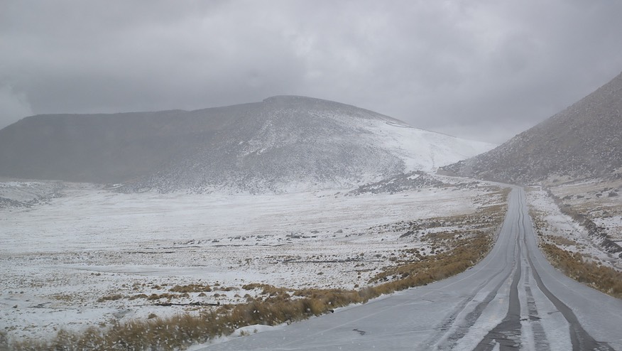
For awhile we dropped down from our high altitude, hitting a low of 10,400 before beginning to climb again; in the early afternoon the second pass topped out at 15,000; it was very bleak, but there were several small lakes (tarns?) to enjoy. We were now crossing the altiplano. The sky darkened; we saw lightening. It began to rain, then hail, then snow. The temperature dropped to 33 degrees. We found ourselves in 6 inches of snow. Trucks were stopped by the road and a van was in a ditch; but once again, La Tortuga rules! We plunged ahead; eventually we dropped far enough down from the pass to be out of the weather entirely, and it was lovely again. We spent that night beside a river, at 9220 feet, sleeping much better, thank you.
A word about high altitudes. Frankly, we’ve been in the Andes long enough now that we are just fine up to about 11,500; higher than that all the usual bodily maladjustments apply. But above that height the coach isn’t as happy, either. The microwave-oven is very inefficient; the water heater won’t stay lit. You know, the water heater manual says it’s about 40% less efficient by the time we get to 14,000 feet. (Rick says he is, too.) The manual says the water heater needs to be de-rated (us too?). A story from friends tells how they had bought a bag of Doritos at sea level, then made a rapid ascent to high altitude. At some point the bag burst. Now we’ve not had that problem – probably because no bag of Doritos in our coach ever remains unopened for that long a time!
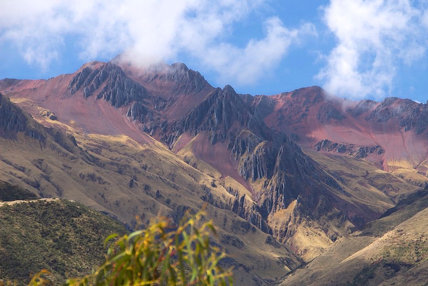
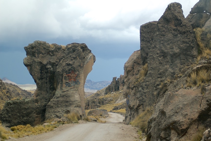
But I digress. I forgot to tell you that for the first 100 miles in from Nasca the road is pure yuck. But then it got paved and was absolutely lovely, so long before we hit the snow we were on new road and could enjoy the scenery and all the action. And this continued the entire rest of the way into Cuzco. I cannot overstate how pretty this area is, and as you get closer to Cuzco it gets better and better. Nazca to Cuzco is about 400 miles, so it’s mostly an incredible journey. We went over 4 high passes, with steep drops in between, following beautiful streams between steep, dry canyons. We were still missing the road we had wanted to take, but realized what we were doing instead was just great, too. Between two of the passes we dropped to 5900 feet and lush farmland, then back up to 13,200 – in a distance of 33 miles. (This last climb was pretty steep; Rick figured it equated to about 33 miles of Cuesta Grade, if you know California.) We saw lots of local people at all elevations, even the most barren. They were working the fields if possible, or watching the herds, if not. This area truly deserves to be seen by all.
As we approached Cuzco, we entered a very fertile valley; the earth was a lovely rich brown; we would see this color in the adobe bricks of the houses and the tile roofs all throughout the Cuzco area. During the time we spent in this area we saw very few poor people; between the fertility of the soil and the abundant tourism, the local population seemed to be doing well.
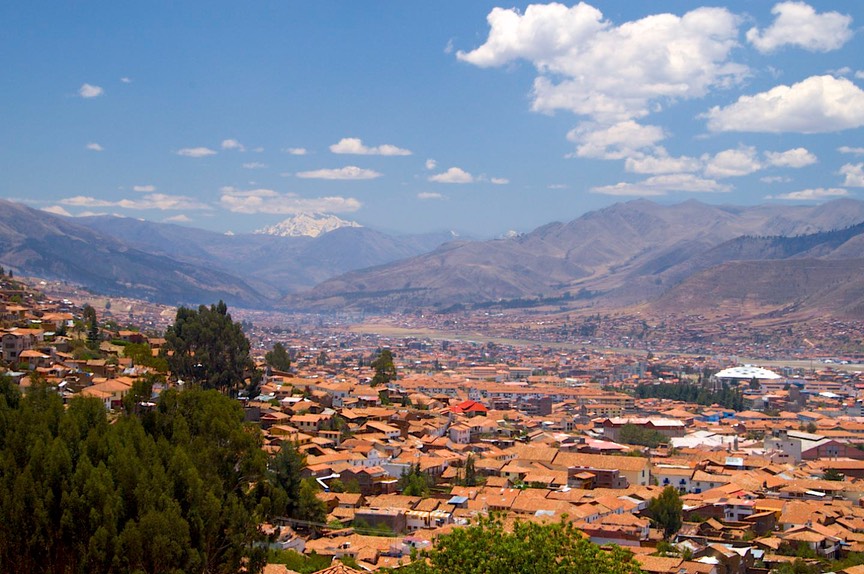
So, Cuzco. One word – splendid. We had a great time. Cuzco is a cool city, with remarkable colonial architecture (using this same rich brown we were seeing everywhere) in a lovely valley setting. Good restaurants and bakeries, lots of sites to visit, nice weather (even though we visited at the beginning of the rainy season); plenty of shopping. We enjoyed ourselves a lot. We were able to stay in a campground above the city (near the Sacsaywaman ruins, if you’ve been there), a place that overlanders use as a headquarters for visiting the area. We were, at various times, joined by rigs from France, Germany, and Canada; a German-Argentine combo; and a Swiss-Uruguyan couple on a BMW motorcycle that was on its second around the world tour. And we had a reunion with a Swiss couple we had first met in Ecuador. A meeting-ground.
One thing I really enjoy in Latin America is being able to shop in the open markets. The produce is fresh, the people are often colorfully dressed, and the interaction with the sellers (mostly women) is great fun. I still have relatively little useful Spanish, but we always make it work.
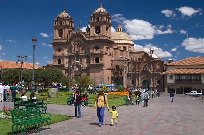
In Cuzco I had a super exchange with a woman selling potatoes. Now this, mind you, is potatoes. Bags and bags of different kinds; in many markets the potatoes take up a whole area all by themselves. Anyway, I found some I thought would work well for German fried potatoes (boil them, cool them, slice them, then fry them up with onions; one of our favorites). I bargained for what I wanted, then had to answer some questions. As other curious vendors gathered around to find out the answers, the woman I was negotiating with wanted to know why I wanted potatoes. I was obviously a tourist; tourists stay in hotels; they eat out; what the hell was I going to do with them? A lengthy discussion ensued, during which I explained that we were driving a casa movil, that it had a kitchen (cocina) and that I wanted the spuds in order to cook dinner. We talked about where we had driven from, how the journey was going; etc. Enlightening for all; we had a great time!
We thoroughly enjoyed wandering the city, but also made a major trip out into the Sacred Valley, to see Machupicchu. We had hemmed and hawed about this; Machupicchu can be quite expensive and we weren’t sure it was worth it. We had just spent a ghastly amount of money going to the Galapagos. But everyone said you had to go. So we did and we were very, very glad we went. But we managed to do it on our terms.
You cannot drive to Machupicchu; a train has to be involved. The train ends up at Aguas Caliente (AC). You can take the train from Cuzco to AC, or pick it up along the way, driving to an intermediate town (e.g., Ollantaytambo). Or, you can make a longish, somewhat difficult drive on a largely unpaved road to Santa Teresa, and take a bus/taxi to a spot where you grab a local train at Hydroelectrica (it’s a power plant stop), which goes to AC. In either case you want to spend the night in AC so you can take an early bus up to Machupicchu. You got all that? There will be a quiz on Friday. The most expensive way, taking the train from Cuzco, at this time, costs about $520, not including food; we saved $235 by driving to Santa Teresa…
And had a killer adventure. It was a long and dusty road, but the scenery was terrific. We stopped in Ollantaytambo for lunch; well known as one of the best preserved Inka towns, someone was – of course – shooting a movie. Chaos, but we persevered. We kept passing these small dwellings that had long poles sticking out into the road; they had red or blue plastic bags tied onto the ends. Later, we found out that the area produced a lot of corn beer, and these were “flags” saying the goods were available for purchase.
The road went up and up - don’t they all (?) - to over 14,000 feet, but for a change it was beautifully paved. To all of our motorcycling friends, if you ever decide to ship your bike down to Peru, we’ll tell you where this road is. We didn’t quite make it to Santa Teresa the first day, but spent the night on a soccer field in the tiny burg of Huyro (pronounced sort of like E-ro we think). We started out parking along the square, but a local suggested we check in at the police station, and they led us down the hill to a lovely enclosed field. We shared it with a pick-up futbol game and some sheep, and had a delightfully quiet night.
The next morning we trucked on into Santa Teresa, a burg of no repute, and left the rig at a campground cum funky hostel. We took a taxi to the train; it was the “milk train” to Aguas Caliente. It was full of locals with big bundles of goods, and also with touristas on various personal quests. We talked with kids carrying all their possessions in backpacks, some older folks who had been out hiking, and even a couple from Vancouver who had been hiking the Inka Trail for the last four days. That was fairly grueling, they said; they had a lot of rain, and one night slept at 4600 meters (about 15,000 feet) – in a tent. She said it was difficult, but they were glad they had made the journey.
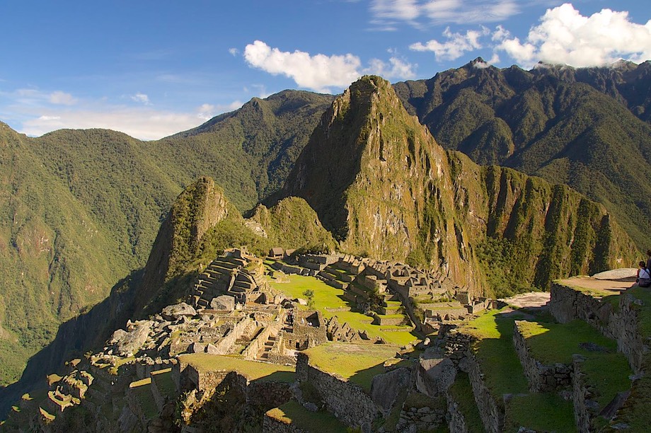
But in the end all roads lead to Machupicchu. And yes, you must go if you get the chance. It was incredibly interesting. What an amazing culture to build such a place in such a glorious location. Absolutely stunning views; we caught a break with, we were told, the first sunny morning in many days. We wandered and took pictures until we were exhausted. We could have rested up and returned later in the day, but we felt we had seen all we wanted, so we moved on.
If you can, spend the night at AC and take an early bus up to the site. The busses go constantly, so there are plenty of opportunities, but the early light and fewer other visitors are worth getting up for. We were there by 7:00, although many folks had gone up about 5:30; the good light was gone by probably 8:30 and wouldn’t be back until late afternoon. The day trip hordes begin arriving around 10, and are gone by 2-3 pm. We were whupped by 10:30; we caught a bus down the hill, and made the noon train back toward Santa Teresa, from whence we began the journey back to Cuzco.
We could have stayed in Cuzco forever; but you just can’t do that. We wanted to go into Bolivia, and then start working toward Argentina and Chile. Quickly, Bolivia started looking more and more doubtful. We started learning about roadblocks along the road, serious fuel shortages (some folks waiting a week for fuel to arrive in a town), unrest in La Paz; and Santa Cruz has been a hotbed for a long time, etc., etc. So we took Bolivia off the table for the time being. (We have since had reports from folks saying the roadblocks are real – 22 hours for a 6 hour trip -- but otherwise they’ve had no trouble. And there was a general strike in La Paz a few days ago.)
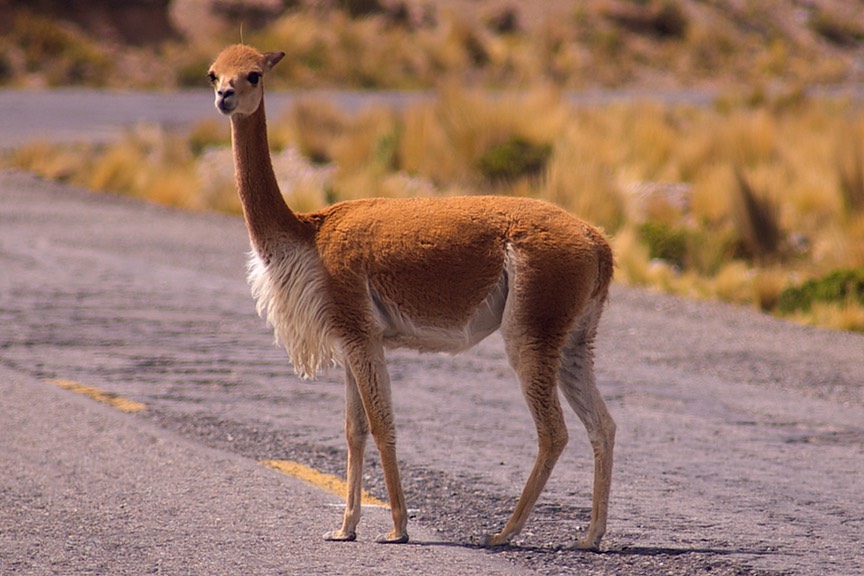
So we took off for Arequipa instead of Lake Titicaca. You have to go a ways on the road that has been blocked, but then we turned south onto a secondary (read lousy and only sometimes paved) highway that goes due south. And that’s the adventure we have shared with you in our “day in the life” section above. It was a great and splendid journey. At one point our road was at 15,400 feet, where the terrain was mostly lichen and a low, dry grass. The herds were mostly mixed – alpacas, sheep, and token llamas. The road took us to the Colca Canyon, where you can see condors. We decided to go on down to Arequipa first; the truck needed servicing, Rick was concerned about the brakes, and we wanted to look at tires in the second largest city in Peru. So we dropped south out of Chivay (the jumping off place for the Colca Canyon), picked up some newly paved road for a change, topped out at a personal record 16,000 feet and joined the Panam on into Arequipa. Along the way we saw herds of vicunas; we really like these high plains areas.
Arequipa served us well. It is at a lower altitude (about 7,600 feet at the hotel where we camped), and it was a good place to have the truck attended to. There’s a Chevy dealer in town, and they took excellent care of us, including relining brake pads and replacing shock absorber bushings. In the states, both of these items would have required finding new parts, but here, as in all of Latin America, mechanics still fix things. The front shocks went off to the grommet shop for new bushings and the rear brake pads off to the relining shop for new pad material. Instead of waiting at least several days for an expensive shipment of parts from the states, we were on our way by the end of the day, and the folks could not have been nicer. The total cost for the complete service was less than $175; the cost of the oil was more than the labor!
We spent four nights at our camp/hostel, enjoying wi-fi, wandering the city, and taking in the sights. It’s a pretty city, with clear air and balmy weather, in a valley with volcanic mountains standing out on the horizon. Arequipa is known for its alpaca offerings; we bought a new blanket (it is really beautiful!). It is also known for its chocolate, unfortunately… And I will admit it was great to be parked two blocks from a large, well-equipped supermarket. Pickings had been pretty slim for far too long!
But onward and upwards – again. The Colca Canyon is quite a draw; we also wanted to try and see the Cotahuasi Canyon, in the same area, and drive through the Valley of the Volcanoes. While in Arequipa we asked at several locations, wanting to get a decent map of the area; nothing was available. Evidently, folks who wander into these more remote areas tend to go with tours. Our Peru map was very vague, but would have to do.
We started in Chivay, filling the tank and checking email for the last time, as we were headed where there were no services. We went west along the canyon, and stopped for the night at the Cruz del Condor, a mirador where most folks spend some time looking for the birds. And we saw several, with our best viewing in the afternoon. It seems the condors nest along the steep sides of the canyon. In the mornings, when it starts to warm up they ride the thermals, and then go off hunting for the day. Mid-afternoon they return, and then settle down for the night. In the afternoon, we had the place pretty much to ourselves, only being joined by a Swiss family who were staying in a hotel nearby. The next morning, however, when we stuck our heads out the window about 6:00 am, there were already groups of folks standing around, waiting for the action to begin.
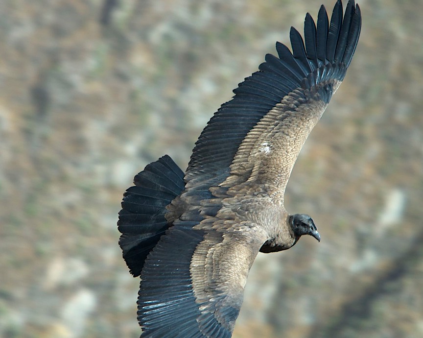
By about 7:30, we were in the midst of swarms; our empty lot filled with buses. But it was a happy, lively, international group; the condors started flying around and the cameras starting clicking: great excitement prevailed. The condors are truly magnificent, and wondrous to watch. Damned hard to take pictures of, however. But it was great fun, and all over by about 9:00. The tour busses departed and we were back on our own. We hung around for a little longer, and were rewarded by one last sighting, a pleasant encounter with some American tourists, and a wonderful few moments with a bunch of local school kids on a field trip.
Before we moved on, we spent some time talking to some of the tour bus drivers, whom we knew would be most familiar with the Cotahuasi Canyon area, where we wanted to go. After awhile, we got agreement on how to do what we wanted. So we started out going further west along the canyon. And talked as we drove along. The road was (and had been for some time) dry and very dusty. We knew this would be the case for probably another 200 miles or so. Rick had not been able to get new tires in Arequipa. Did we really want to do this? Well, no, not really, it seemed. Screw it; another time.
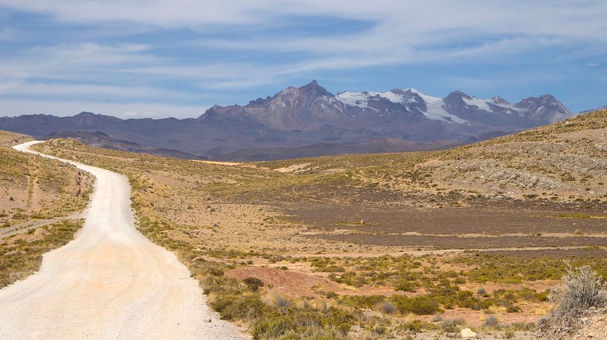
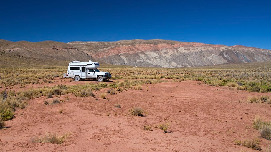
But we didn’t want to backtrack; we knew we could stay on this road for awhile, and it would eventually rejoin the Panam. So that’s what we did. Some of it was gorgeous. In the Colca Canyon there was a great deal of fertile land being irrigated from the mountains above by means of channels. It was a lively area, with several small villages along the edges of the canyon, and much activity. Later, we climbed out of that canyon and spent many hours in the high barren openness we love so well. The road varied between better and worse, mostly quite fine. We spent the night at about 13,000 feet in the middle of a plain. No one anywhere; we had seen three vehicles all day, one of them a lemon-colored VW bug, for Pete’s sake! The night was quiet and clear, with a full moon to enjoy in our solitary splendor. Early the next morning we saw a fox out hunting. That was it. The hills around us were a kaleidoscope of colors and the higher mountains had snow-capped peaks; it was a beautiful spot. Cold through; got down to 29 degrees (-2 degrees C for the rest of you).
In the morning, I checked our GPS listings for the last two nights. We had traveled a distance of 52 miles on the day, but had altered our GPS location so minimally that you could have said we hadn’t made any progress at all. That’s what happens on these winding roads; we’d practically been going in circles!
We made our way on back down the mountains, unfortunately spending the last 40 miles or so in the middle of very boring, dry, unfertile, desert-y countryside. This was followed by pure yuck as we approached the Peruvian lowlands, which were even drier, more sandy, and less interesting than we had dared to hope. Eventually we arrived back in Arequipa.
We will leave here in a few days, and make our way to the Chilean border. We’ve loved being in Peru, but it’s time to move on. We are only staying here long enough to make arrangements for vehicle insurance; it seems that the rest of South America is more concerned about this item than Peru and Ecuador have been.
In Chile and Argentina we will be starting the main part of our South American journey. We’ve always considered Colombia, Ecuador and Peru as the “appetizers.” We’ve spent far longer in each of these countries than we had ever thought possible. And we’ve been so glad we have; Colombia and Ecuador were simply great, and Peru has been just as rewarding. So we leave you here, recommending a visit. The mountains of Peru are incredible, and offer much to enjoy. Come see for yourself!
Rick and Kathy and La Tortuga, making our way towards Patagonia. Yikes, It’s the middle of November already.
Click the link to see more photos from Southern Peru.