September/October 2018
So Now What Do We Do?
From Kruger to Namibia via the Great Circle Route
After you’ve seen all the animals in Kruger (and spent nearly a week in recovery from the driving and the photo shoots!), what’s left?
Well, as we quickly found out — a whole lot of really interesting things to see, places to visit, and adventures of many sorts. We have used the remaining five weeks of our South Africa visas poking around several parts of the country: visiting battlefields, enjoying lovely landscapes, scrambling up and over passes that are (just barely) accessible in a 4WD with high clearance… meeting a new breed of penguins, locating the southernmost point on the African continent, learning more of South Africa’s history, and actually seeing the arrival of honest to goodness Spring, complete with green grass and wildflowers.
Oh, and once again working our way through the almost impossible chore — having any sort of vehicle part shipped from the States — you’ll just love that story — Ha Ha.
But all in good time. Having tidied ourselves up, we left the Nelspruit area, heading for war zones, past and present. South Africa has a history of bloody battles over the years, between various factions and governments — along with some continuing unhappiness concerning historical “accuracy” on various sides of various wars. It makes for an interesting visit, and a certain amount of bemusement for the traveler.
What are we talking about here? Well, let’s chat about some of this fighting (not all, by any means). In 1838 there was the Voortrekker-Zulu War, represented most famously by the Battle of Blood River (which is actually the Ncome River). In 1879 was the Anglo-Zulu War; you may have heard of Isandlwana or Rorke’s Drift? Then we have what Americans call the Boer Wars: the 1st South African War of 1881, followed by the 2nd South African War of 1899-1900. There were more, of course; it seems colonialism requires subjugation of those deemed less important, and they tend not to go quietly. But we’ve listed the biggies.
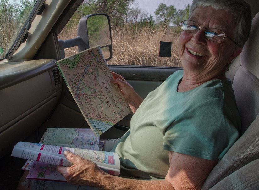
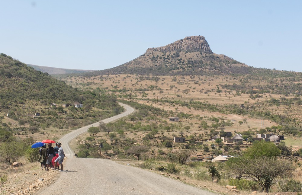
We thought we’d start with the Zulus, as we were in KwaZulu-Natal Province. At some point we crossed the Vaal Rivier (as in Transvaal). We spent several days wandering in this open, dry countryside. We visited various battle sites, monuments, graveyards, and cultural centers. As we went we learned more and more about the relationship between Zulu and colonial. Over a long period of time, ongoing distrust and misunderstanding led to many pitched battles — some won by each side — with Gatling guns and artillery pieces finally bringing an end to it all. This is a large generalization, but not inaccurate.
There are poignant monuments and remembrances, and some very interesting museums and cultural centers. The ongoing unhappiness to which we refer was most evidenced when we visited the museum and battle site at Blood River. The Voortrekker museum had great possibilities of explaining and illustrating the battle that was fought here. But the museum manager was a young man (late 20’s) who was so outwardly off-putting with his attitude about the way things “ought to be told”, and so blatantly unhappy about the fact that he wasn’t carrying a gun at his hip because his belt was broken, and the short film shown was so completely one-sided in its approach — well, we walked out without having the chance to actually learn anything.
On the other side of the Ncome River was a Zulu Cultural Center. Checking it out, and being warned strongly by the fellow representing the Voortrekker point of view that I should be “careful of what he says over there and report back to me if he says anything racist”, I anticipated a less than satisfactory experience there as well.
My guide was a very pleasant, older man who was a bit more helpful, explaining the history behind the battle and how it had come about. But he also had a position to present, even though summed up it was that both sides were wrong; and indeed he wore me out with his persistence. I would have enjoyed just wandering the centre, with its many artifacts and costumes and historical information, but he just kept on talking. Ultimately I thanked him, walked back across the bridge that had been built over the river, now called the Bridge of Reconciliation, went past the various Voortrekker monuments, and we left. Not everyone in South Africa is “reconciled”, it would seem.
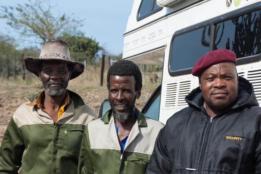
But that’s a small blip in an otherwise very pleasant experience. The Zulu people are very hospitable, welcoming us as we wandered; we even were able to stay overnight in the parking lots of two different sites, which was super. We made friends with the staff at both locations, and at the Mgugundlovu Centre we ended up with some nice group photos.
One ongoing problem was that it was very hot, dry, and smoky.
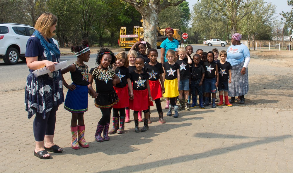
The countryside reminded us of Latin America — goats everywhere, plus chickens and cows and donkeys ambling along. Crops already harvested, and the fields being burned, otherwise not much going on. Rick was wondering where all the kids were, one Saturday afternoon; then we came around a corner and found a music and dance festival just ending, with kids in costume all over the place (had we only known!). The next day the soccer fields were very busy.
We had been headquartering above the hill town of Volksrust, at about 1700 meters elevation (about a mile high); we were out of most of the smoke and it was cooler than down in the valleys. Volksrust is a pleasant town that used to be a major stop on the roads between Johannesburg and Durban. But back a ways they built a big highway that circumvents this entire corridor so the towns are drying up. We saw too many poor people struggling to get by, and for the first time, many of them were middle-aged whites. It was quite sad.
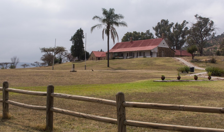
After a couple days’ rest we descended back into the smoke and heat, and went south to Dundee and Ladysmith, big stops on the Great Battlefield Tour. These towns have nice museums and monuments and battlefields to visit (and they are prettier than what we had been seeing); for us the highlight was the Siege Museum in Ladysmith.
A short bit of info about nomenclature: the Voortrekkers were Dutch (mostly) who had come to Cape Town from Europe seeking a better future; they moved out into the countryside to get away from the rigid English colonial powers. Voortrekkers — travelers. When they settled, they generally became farmers (Boer means farmer). Basically the same people. This is a generalization, but perhaps it helps to explain some of the words being used.
At the height of the 2nd Boer War the city of Ladysmith underwent a protracted siege before being relieved. The museum in the town had a ton of info to peruse, lots of artifacts, and plenty of photos taken at the time. This was a well-covered war, with Britain throwing her best at the locals, and the locals surviving just fine for a long period of time. It was covered by the London news (including sending young Winston Churchill down as a war correspondent) and turned into an important war for Queen Victoria to win. So: lots of documentation from newspapers and photojournalists.
A fun museum and a nice area. We poked around for a few more days, looking for monuments and plaques and graveyards associated with all these wars. Many of them were hard to find. We had maps to help us, but roads had been changed, many places were over-run with weeds, and sometimes we think the signs were just plain wrong. But we had some successes. I was particularly interested in finding the plaque commemorating the place where Churchill had been captured at one point. Yes! So all was not lost.
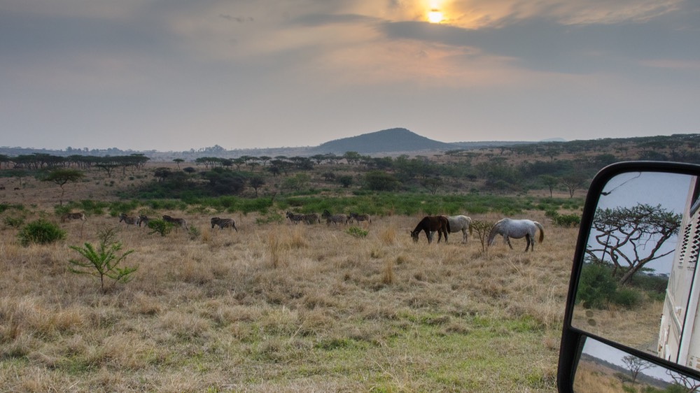
Between these jaunts, we spent a few days out at Speionkop Game Reserve, a bit southwest of Ladysmith, out by a dam, and complete with zebra, giraffe and antelope; it even had its own battlefield. It was quiet and very pleasant, and not too hot.
Ending our time in the immediate area, we swung south to Winterton, A friend had told us there was an interesting museum there, complete with (perhaps) the world’s first overland vehicle housed on site. So of course we went to check it out. The museum was closed for the day (despite the signage and website, of course) but we wandered the yard, checking out old motors and farm equipment, etc. — and found the very rig nicely housed (and well taken care of) in a barn on the property. A nice man in the adjacent tourist information office was happy to get a security person to unlock the barn and we were free to explore.
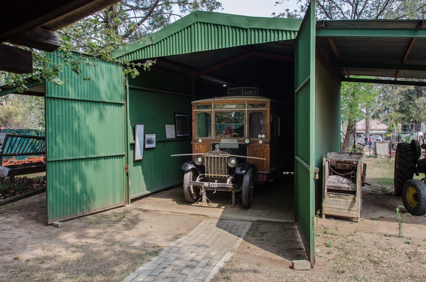
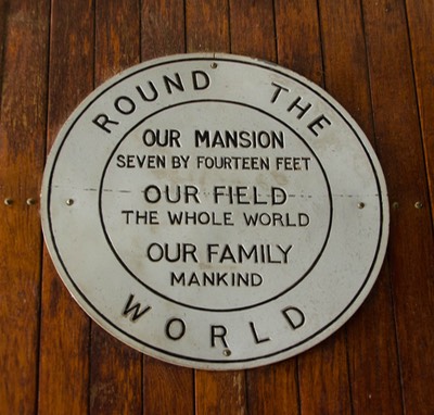
The vehicle dates from 1918 and was designed, built, rebuilt, modified and traveled in by an amazing South African fellow named John Weston. And this was not Weston’s only project; he was also a pioneer aviator who designed, built and flew his own biplane; an Admiral in the British Navy; and after retirement from the navy, a farmer. He was a prolific inventor with many patents to his name and was actually the person who installed the very first electric lighting in the Paris Opera House. In the early 1930s, he and his wife with their three children drove the length of Africa in this vehicle — from Cape Agulhas (near Cape Town) all the way north to Egypt and then on through Lebanon and Syria to Turkey. An astounding accomplishment at that time.
The friend who told us about the museum, Les Brook, has compiled a treasure trove of information on John Weston and posted it all to a wonderful website, www.johnwestonaviator.co.uk, so rather than attempting to share any more details here we encourage you to visit Les’ site for more amazing information on this man, his travels and his many accomplishments.
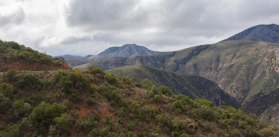
By now we were on the edge of the Drakensberg Escarpment, one of South Africa’s loveliest landscapes. We began our visit, anticipating several days here in order to drive all the roads, see all the views, and enjoy the beautiful area. Then Rick looked at me, and said he wasn’t sure this was the time for this. This was the first part of South Africa we had driven to specifically to enjoy the beautiful scenery, but it had continued to be extremely hot and smoky. The same issue we’d been putting up with for the last 6 weeks or so. Did we really want to continue on in this area? When we could go somewhere else, somewhere that would be cool and, more importantly, have clear blue skies?
Totally a no-brainer really, but we confirmed our thoughts by asking a nice South African couple. Cape Town was the answer — the south coast and the Cape. So? No surprise; off we went. We had a bit more than a month left on our South Africa visas, then would be leaving for Namibia, with a plan in place to return to SA sometime in the first half of 2019; we could pick up where we had left off. (For those of you who know SA well, we will come back to the Drakensberg area, Lesotho, Blyde Canyon, and environs, and a return visit to Kruger in order to see more of the park at a greener time of year. So there!)
What we do best — an abrupt left turn. We headed northwest out of the Champagne Valley (visiting an absolutely splendid bakery, the Valley Bakery, along the way) and out into the Province of Free State, past Bloemfontein, spending a night in the small farm community of Winburg, staying at the Danke Schön Caravan Park owned by a very nice lady named Brunhilde (we kid you not!)
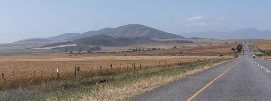
Moving through enormous farming areas, we headed south now, always south. Our first goals were three national parks we were very interested in — Addo Elephant NP, Mountain Zebra NP, and Camdeboo NP. The sky is slowly starting to turn blue during the day, and the evenings are starting to feature beautiful nighttime skies. And now more change — each of the last three days have had some rain late in the day and then again during the night. This is much better!
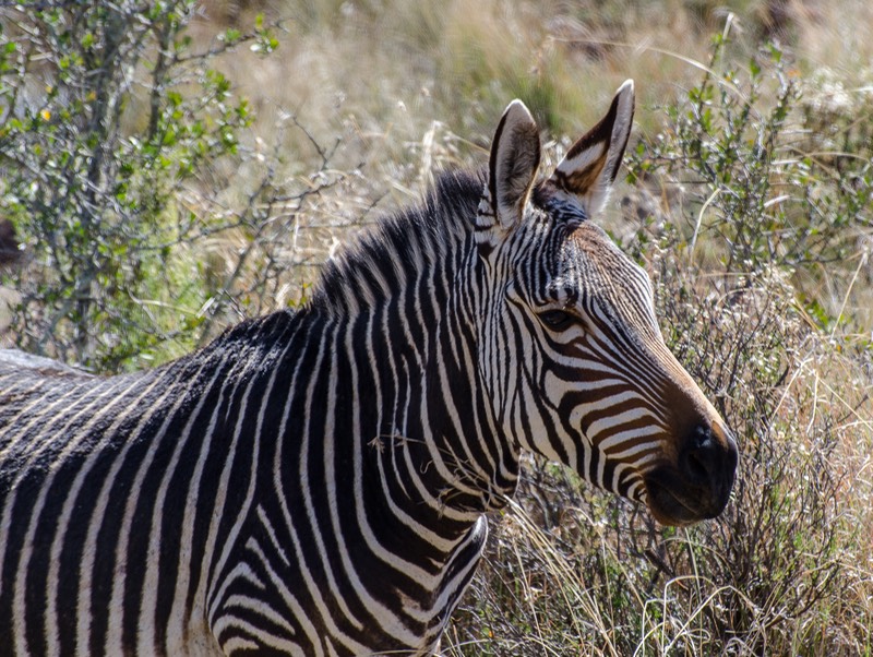
Cradock is not far from Mountain Zebra NP and here it was definitely springtime. The fruit trees and wisteria are blooming; the air is filled with the aroma of all the blossoms.
At the park, we were able to enjoy the very different zebra that inhabits this area. We’d become quite accustomed to seeing the Burchell’s (plains) zebras, with the black stripes interspersed with a gold “shadow” between; the Mountain zebras have just the black stripes, but the distribution of stripes is different and the animal has other aspects that set it apart. It was cool.
This is a lovely park, and the campground was super. We made new friends there, Duncan and Andrea, who invited us to join them for dinner in the restaurant on site. We had a lovely evening, and will hope to see them again down the road. There are lots of monkeys in the park, and they can be quite audacious. One of the little rascals stole a couple of cookies off a plate I was carrying down to share for morning coffee! Hmmmph.
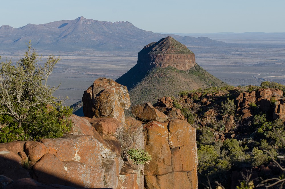
Moving south and west, we crossed over Wapadsberg Pass, at 1761 meters, then dropped down to Graaff-Reinet and on into the Camdeboo National Park, well known for its hiking trails, but most famous for the Valley of Desolation. It’s a lovely little park, and we would have liked to stay for several days. But we made do with an afternoon’s game drive and a trip to the Valley of Desolation, which was dramatic, although we have seen lots of escarpments with overhangs and isolated rock formations. Best seen at sunset, we were told, so we did, and it was; quite nice, actually.
We exited through Graaff-Reinet, for shopping. We’ve not commented much about the African towns, which we enjoy. Very chaotic in the center, with little control over the crowds/cars/donkeys, etc. Plenty of shopping, much of it at street-side, although with a very good SuperSpar to boot. We did just fine.
Then we started to drop down to lower elevations, moving through the small town of Jansenville, featuring the Angora Hotel and Inn, and even a Mohair Museum. Do you think this is a sheep-raising area, perhaps? We were heading southeast towards the town of Addo. More and more wildflowers along the roadside now.
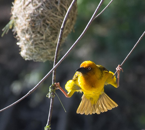
Having decided to visit the elephant park on a sudden whim (because we hadn’t expected to be coming this way), quite naturally we couldn’t book a campsite in the park. So we researched and stayed at the splendid, lovely, charming Homestead B&B on the edge of the town of Addo, perhaps 10 kms from the park entrance. We enjoyed this spot very much. The garden was in full bloom, and there was a pond at one end, with weaver birds busily making nests simply everywhere. They were fascinating to watch. Their acrobatic balancing acts while they wove their nests amazed us.
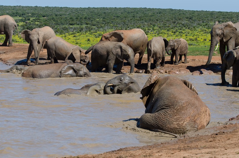
So was our day at Addo Elephant National Park. We sort of had thought — “Man, we’ve seen a zillion elephants already; why do we need to go find more?” Well, because these come in huge bunches, they arrive at a waterhole and take it over for playtime in the water and mud baths and snorting at each other.
A couple of charming things about visiting Addo. We had been told that arriving at Hapoor Dam at 10 am is a really good idea. Settle in and wait. The elephants will show up shortly and stay for a half hour or more. It was good advice. (And if you can start at the northern end of the park and work your way south, you will be facing away from the sun as you drive, making for an even better experience.) At one point we were at the top of a hill, looking south, and could see the Indian Ocean; we thought that was pretty neat.
It’s totally cool, lots of fun, and… the park was green-green-green and full of wildflowers and blue skies and soft warm sunny days and every single thing we’d been hoping for. Awesome, dude!!
Continuing our jaunt across the southern part of South Africa, we wanted to do some shopping as we left Addo, but couldn’t find a place to stop. So on we went to Uitenhage; couldn’t figure out why it was so much bigger, then realized the shopping mall was on the edge of a humongous casino. I guess the one feeds off the other; or maybe they are all owned by the same conglomerate. Food for thought.
After doing all the shopping our cupboards could handle, we headed into the hills of the East Cape, heading for Baviaanskloof Wilderness Area. And here we need to pay homage to two sets of friends. Frank and Annie Cartwright, during their extended trip into Africa a few years ago, talked about going into this area and how spectacular it was.
I’d almost forgotten about it. But then, a month or so ago, German friends Petra and Win also talked about this drive, saying they had decided not to go because their rig was too tall, but….” You aren’t too tall and you should go.” We went and we were so pleased that we did.
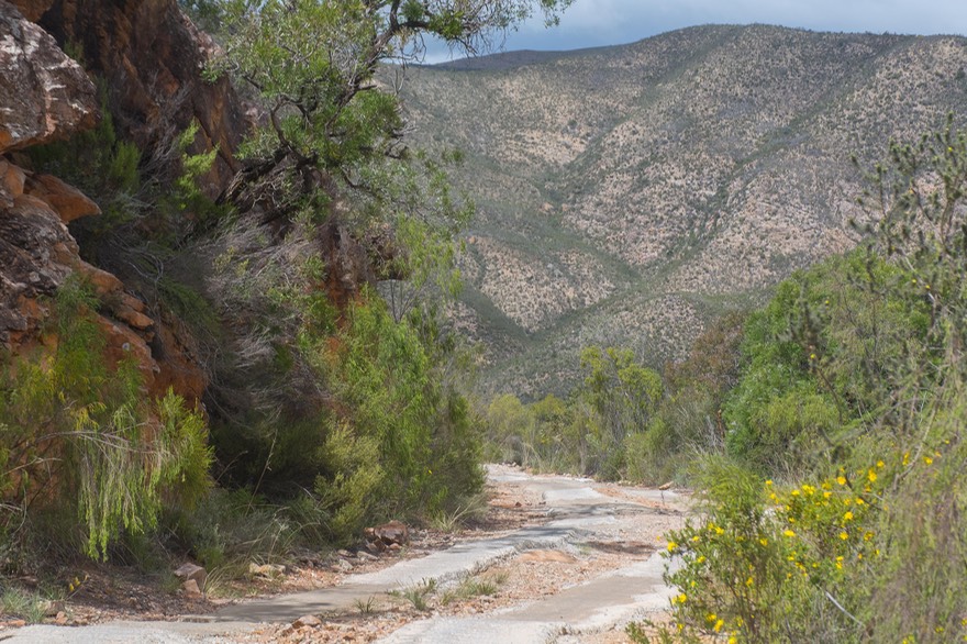
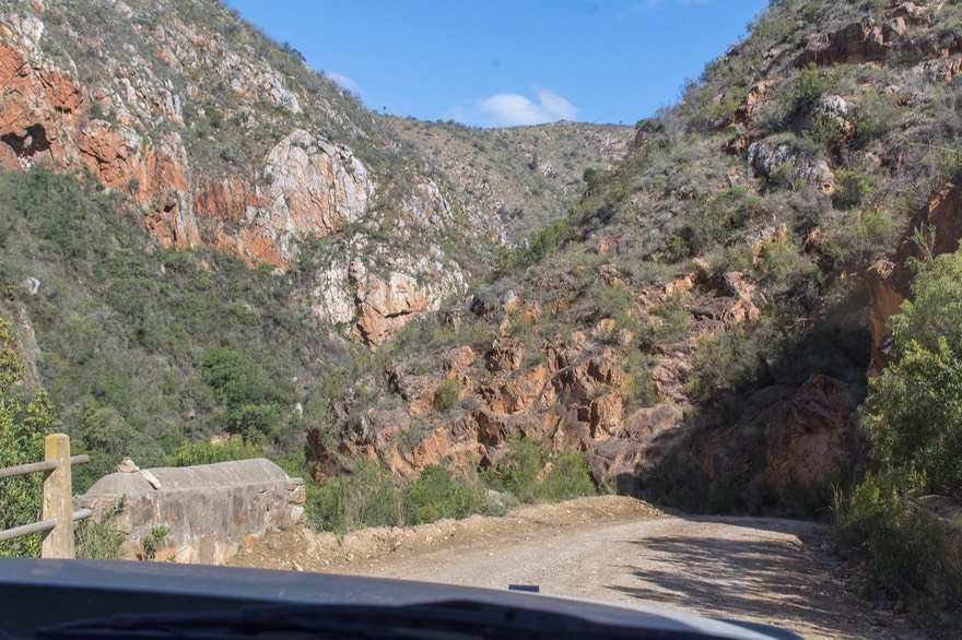
This is real wilderness. Baviaans, we are told, means baboons; kloof means ravine. So, perhaps, Valley of the Baboons. Anyway. This is a rocky/gravel/dirt road trip through ravines, over mountain passes, through some lush areas, with campgrounds filled with baboons (so we’ve been told; we didn’t stay in the park itself), dangerous cliff-edge moments, etc. In other words, very cool. And very pretty too.
We stayed our first night at the Bruintjieskraal Camping at Glencoe, next to a stream, a few miles east of the park entrance. It was so lovely we wanted to stay for days. But with the clock ticking, we got up in the morning, got our permit to enter the park, and spent the day traversing the area, enjoying ourselves no end. Remember the “Glencoe” part of that place we’d stayed last night? The mountains we drove through looked just like Glencoe NP in Scotland. We had significant water crossings, very rough narrow passes, and lots of excitement.
By nightfall we’d negotiated 80 kms of delightfully hellish track (took us 7 hours, we might add), had exited the park on the western side and then gone on until we found a spot for the night in a 4WD bush camp called Doringkloof Boskamp. What a day! But the camp was just as nice as where we’d been the previous night. Such fun.
The next day we kept on truckin’; the road was better now, and we made some decent time. We opened out into a farm valley with far more tourism and places to stay. We suspected many people stayed here the night and made day trips into the park. There were lots of river crossings still, and caves and waterfalls to explore. We went over Nuwekloofpas at 1093 meters and then out onto flatlands, with the road heading toward a meeting with the N9 at Willowmore.
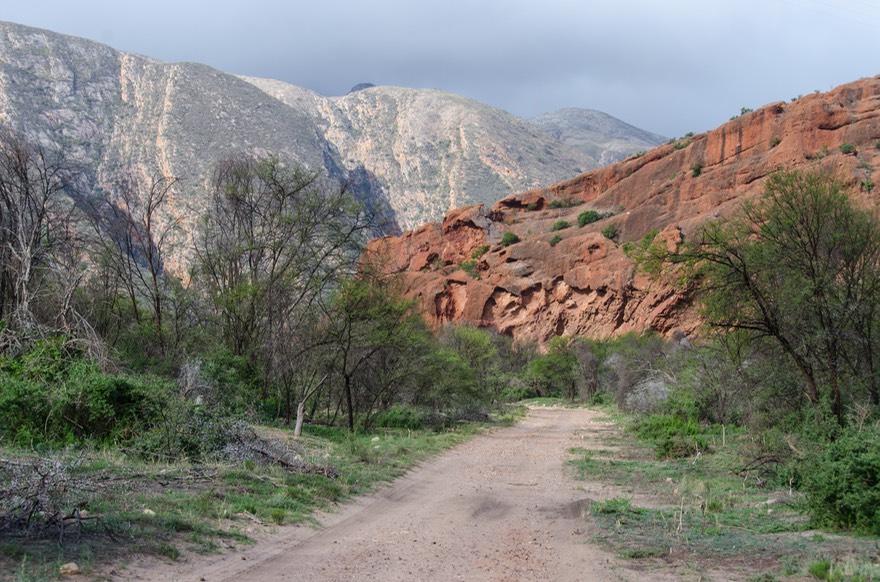
We needed to continue heading down to the coast where our package was supposed to be arriving in George, a coastal town southeast of us. But that didn’t mean we had to take the highway; no, not us! Looking at the map, we knew that the charmingly named Prince Alfred’s Pass road (R339) would take off from Uniondale, south of Willowmore, and then wind its way through the mountains down to the town of Knysna on the coast (hard enough to spell, it’s even more difficult to pronounce — ). So off we went.
It began well, a nicely maintained gravel road, down to De Vlug (sometimes spelled De Vlugt) and then on down to the river, which it follows for quite aways. This is a splendid, lovely drive through steep and narrow canyons with beautiful rock formations. Further along we saw signs referring to the area as a nature reserve; super. Great trip. At the bottom you come to a joining of two streams; the road continues and then after a bit starts to climb back up out of the mountains. We stayed the night at the bottom, at Angie’s G Stop, a bikers bar/restaurant and casual campsite. Loved it; resident yellow lab mix adopted us and tried to leave with us. Angie thanked us for returning him (‘Daf’ or maybe ‘Def’ was its moniker) and waved us off in the morning.
We passed a sign saying this was the end of the nature reserve area, and the road began to get rougher. But we made it up and out of the canyons, then kept moving south across the mountains, through Buffelsnek and finally into Knysna and then on to George (see below) and our hopefully waiting package.
We pretty much kept hustling along on this remote wilderness adventure. Buddies Jack and Jo Cooley had been traveling in Africa for the last 6 weeks or so, and were now wandering along the south coast, not too far from us; another one of those truly amazing coincidences. We knew we’d all be driving in the neighborhood of the town of George (wait for it), on the same day; maybe we could manage to meet up?
Well, duh! Of course we could! Through the wonders of various modern devices, we hooked up, at the splendid Salinas Beach Restaurant right on the N2, in the town of Wilderness, not far from George itself! Amazing. We had some of the best F&C ever, enjoyed a couple of hours of giggles and hugs, and then went on our separate ways. Absolutely amazing!
But about that package that was (not) waiting for us. As it turns out, once we dropped down out of the mountains, regained connections to the rest of the world and conferred with the PostNet in George, we found that our package was stuck in Customs. This has happened to us before, so we weren’t really surprised. But it always catches us anyway. What have we done to deserve this? Well, there’s a story behind the Customs debacle, naturally, and Rick will tell you all about it in just a bit.
It was going to be a few days while Customs got sorted. So what to do while we waited? Go to Oudtshoorn, of course. Wouldn’t you? It was back up in the mountains, for starters. Even better, the area was billed as the Ostrich Capital of the World. Up for debate, perhaps (and you could even say “Who cares?”), but a very nice area and there certainly were a zillion of those silly critters around to stare at (and feather dusters of all sorts of design colors a dime a dozen); driving out in the countryside we even saw them in feed lots. But enough of that.
We had four lovely but increasingly hot-hot-hot days in Oudtshoorn (such a great name, although impossible to spell), during which we enjoyed a Saturday afternoon accompanying a boisterous crowd of campers clustered around 3-4 TVs showing the Rugby Finals. The Boks were playing the NZ All Blacks. As the game reached the end the crowd fell silent; the Boks lost, 32-30. It was a quiet evening.
When the heat got to be too much we returned to the coast, settling in Mossel Bay, about 30 kms west of George. Much cooler, and along a nice part of the coast that’s frequented by surfers who are fun to watch.
So what was it we were waiting for? A Chevy part coming to us from the States. We’d been having some engine coding issues for awhile and this was thought to be the fix. Well, what a challenge is international shipping! Each time we try it we never know what the outcome will be. We’d been told by several people to not trust the regular SA Postal Service with anything (and definitely do not even try to have our prescriptions sent here because they simply won’t arrive). With car parts? We’ll just have to see.
First of course is the cost of any sort of courier service — in this case DHL was recommended. Just because Amazon will happily ship anything to you for free in the US doesn’t mean it applies overseas. To the contrary, this is where the shippers make it all up. Don’t worry though, surprisingly, Kathy says I don’t look too bad with neither an arm nor a leg on one side; and I’m beginning to get around pretty well too, all things considered.
Next, there is the dreaded Customs Office and their sticky-fingered ways. We’ve regaled you before on these pages about our experiences in Argentina — fugeddaboutit — and Bulgaria — no problem, just jump through this long line of hoops; oh and don’t forget to pay the translator and the notary. So, really this wasn’t so bad, sort of like Australia actually, though with less confidence in a happy eventual outcome.
But patience and virtue win out and we did indeed receive our part, which we will now happily carry with us as a spare in case we need it — the engine HAS NOT CODED ONCE in the month since we ordered the part. Life goes on, and enuf for now about international shipping.
Eventually we were able to pick up our package and we now had about a week’s time left before we needed to skedaddle out of South Africa. We had several ideas of how to spend our remaining days, and picked out a few that we thought made sense.

“Route 62” is an paean to modern tourism. The phrase evokes charm, memories, and a pretty drive. All true, even if you aren’t on a Harley and you aren’t in the American southwestern desert. R62 is a lovely road that parallels the southern coastline, but is up into the hills. It passes through pretty towns, beside vineyards and olive orchards, over passes and through tunnels, has plenty of greenery, cows and wildflowers, and even gives you the occasional ostrich to wave at. We drove part of it, enjoying every moment.
The point of our drive was to visit the town of Montagu, supposedly quite lovely and with some nice Art Deco architecture. It was all of that, along with an extra treat: some trees in town had been taken over by nesting Black Ibis birds; it seems they are regular visitors, and we really enjoyed them. We found the nice little De Bos Guest House on the edge of town for an overnight spot. It was a rustic farmhouse, with donkeys, horses, chicks, etc., run by a very nice couple, he from England, she from Botswana. Montagu gets our vote as a splendid place to settle down.
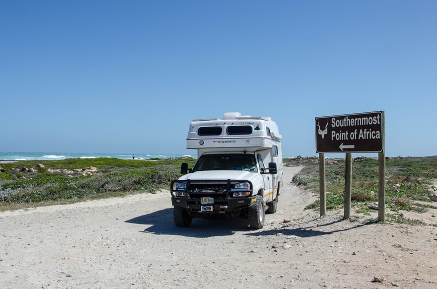
The next day we continued a bit further on R62, going over dramatic Kogmanskloof Pass. Soon we turned south onto R60; we were now headed for Point Agulhas, the southernmost point on the African continent. Heading “down” we traveled through large farming areas, with wheat and sheep. It got increasingly windy (I kept looking — in vain — for wind farms down here). We reached the southern tip, at S34.83247 E20.00173. Very nifty. You could look one way and the water was crashing into the rocky shore to your left (the Indian Ocean); if you shifted your eyes you could see the water crashing into the shore going the other way (Atlantic Ocean). From the air it is probably quite a sight, but from ground level it just looked rough and choppy.
And also very-very windy. So we didn’t camp the night; we aren’t that nuts. We headed further west on along the coast, heading for Hermanus, looking for whales (we were unsuccessful, but that’s no surprise), and then off to see the penguins!
African penguins (formerly known as Jackass penguins) are only to be found in the Cape Town area. The Stony Point African Penguin Nature Reserve at Bettys Bay is a brilliant spot, and that’s where we went.
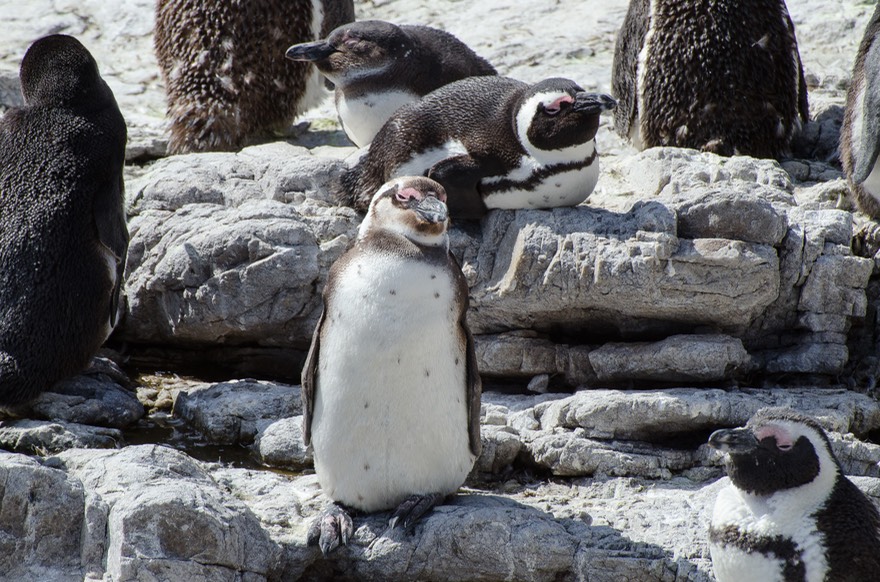
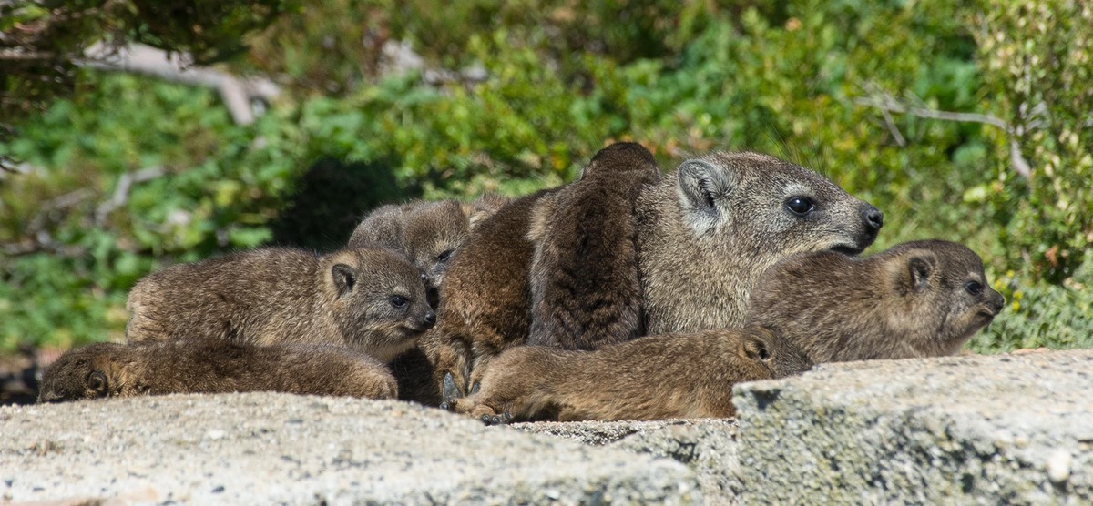
It was absolutely super; we saw zillions of them, learned about them and their ways, and saw cormorants nesting there as well. With a little imagination (we do have plenty of that) we looked west and just a point or two south about 4200 miles and gave a shout and a wave to the colony of Magellanic penguins we’d so enjoyed on the coast of Argentina nearly ten years ago. And, we finally saw Dassies! These furry little critters, also known as the Rock Hyrax, nest in the rocks and spend much of their time asleep. Rather sluggish, but quite cute. There are also baboons in the area, and we even saw a sign with a picture of mother (with baby on her back) saying Caution — Baby on Board. Pretty cute!
The penguins were splendid; we could have stayed for days, but tempus was fugiting, as we say at Tiger Central. Reluctantly traveling onward, we started toward the Cape of Good Hope. This is another iconic spot to visit. Leaving Betty’s Bay we pushed on, around enormous False Bay, toward Table Mountain. But then we bailed on the whole project. The traffic was icky and a horrible slog, the bottom of the Cape is a looong ways down and then right back up again, we were getting really short on time, and did we really care? No, decidedly not. We’d stopped having fun, deciding Cape Town and environs were better visited from within the city. Maybe we’d fly out of here when we left Africa.
Taking an abrupt turn northward, we started heading towards Namibia. We traveled up the N7 towards Springbok, and once we’d left the city environs knew we’d made the right choice. With more time we would have come up the coast, visiting nature reserves, lovely bays and scenery, poking around in wilderness areas that contained interested craggy rocks and ancient rock art, but that would have to wait until another time. We knew we’d be coming back down into South Africa for a second visit, and apparently it was going to have to cover some of the North Cape area along with other places we’d missed.
As we moved up past the Citrusdal area, the countryside became filled with fruit trees, vineyards, avocados and farm stalls selling all of the above. We were following the charmingly named Olifants River, which was dammed at Clanwilliam, making a whole lot of this produce possible. Further on, the river turned toward the ocean, exiting north of Lamberts Bay.
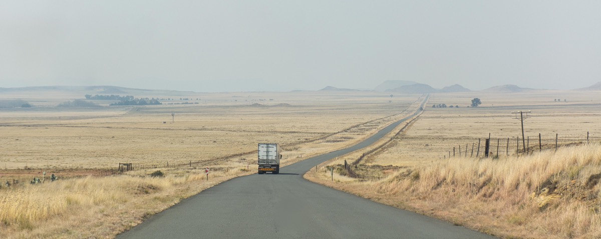
Immediately the scenery changed to dry and rugged terrain, filled with rocks and becoming increasingly mountainous. Up and down, with our highest pass on the trip north toping out at 886 meters. A few wildflowers, but mostly barren; mining country. And thus it was to remain, with isolated small spots of green surrounding the occasional town, all the way to Springbok, where we sit, gathering ourselves before crossing into Namibia.
Heading into Namibia, we thought perhaps there would be a time change when we crossed the border. We checked in our trusty (hah!) Lonely Planet’s Southern Africa guidebook. It said that “”All Southern Africa is GMT+2 in the southern summer months and GMT+1 in the southern winter. Except Namibia, which turns its clocks forward one hour in September and back again in April.” HUH? We’ve never felt less informed. However, the phone and the GPS will know. Stay tuned.
We close with an old quote from Winston Churchill recently brought to our attention by a correspondent.
Rick and Kathy in La Tortuga, where we just, “Keep Buggerin’ On”!
Go to the Photo Page for this message to see the rest of the story,
and to the separate page for Addo Elephant National Park