July/August 2020
La Tortuga Goes Boomerang
We Leave Wyoming… and then Come Right Back
Welcome back to “Rick and Kathy Prowl the Bighorns!” (Oh, lord, they say! Are those guys still hanging out in the wilds of Wyoming?) Well, duh… Of course we are! We did leave for a bit, spending nearly a week in Montana, but we found that we couldn’t stay away and turned right around and came back.
About a month ago, we closed off while we were parked up on Pole Creek Road, where we’d settled after returning from our trip to Gillette to get a new heater. Are you with me now? We really like this spot, and hung out for a few days; but eventually we always run out of food and need to replenish our water supply. So off we went, running over to Sheridan to get a tiny bit of work done, allow the quartermaster to fill the cupboards, and catch up on correspondence and other online tasks.
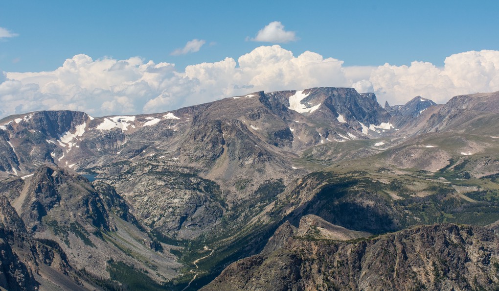
We had decided next to explore a new area of the Wilderness, as recommended by friends Ken and Carolyn Kimpton — so when we left Sheridan we drove west from the little town of Big Horn, back into the mountains along a new (to us) road, Rd 335, which soon turns into dirt and becomes FR 26, a well traveled road that cuts straight across the Wilderness from east to west, meeting up with Highway 14 on the other side of the mountains (for anyone out there who is familiar with the area). This is a well maintained road and we enjoyed wandering along it, pausing for a couple of days at a place that our Sheridan solar guy had recommended, Park Reservoir, before continuing on.
Ultimately we decided that for us this section of the mountains wasn’t quite as special as where we’d been further south, off Highway 16 out of Buffalo. It was more crowded and is heavily used by ORV folks in great numbers (particularly this year it seems), and once off FR 26 the roads are quite rough and not as well maintained. They seemed overused and very dusty. The area was also drier than where we’d been and there was much less green around and about. So we kept going, still enjoying but not quite as delighted as we had been.
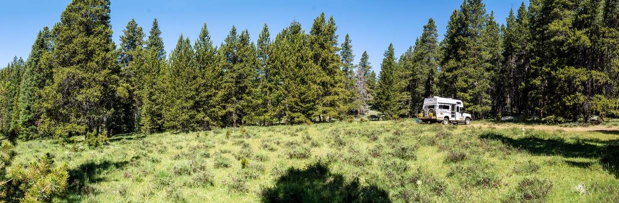
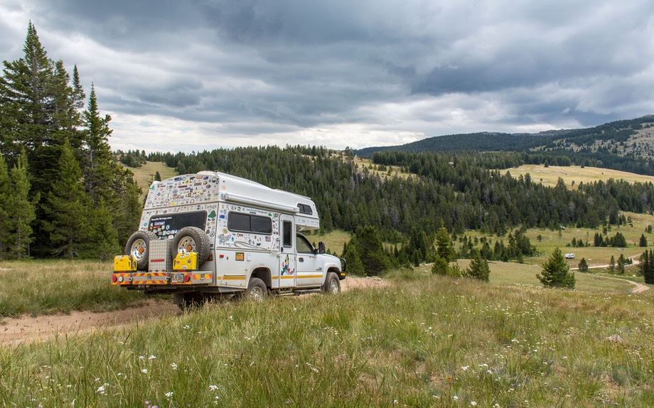
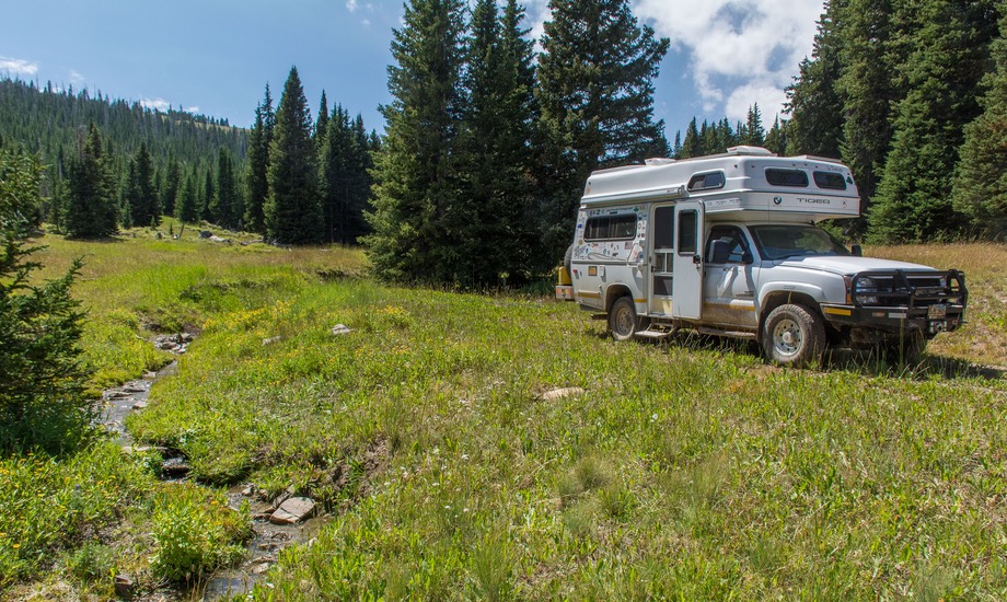
Heading for a different spot, a short detour off FR 26 (onto FR 231) took us to a rougher but more isolated area where we found a lovely little glade that suited us perfectly and we stayed there for most of a week. We were still seeing some ORVs, but far fewer than before. They were also a lot quieter here as it was a steep and winding track they were following, one with lots of rocks and other obstacles, so they were moving slowly and being very careful. We also saw groups of horses on trail rides, and the occasional motorbike. Lots of them had time to give us a wave in passing. We had seen elk in the distance along the way, and here we had deer wandering through our campsite. It was very nice. One night we had a strong thunder and lightning demonstration, a bit scary and exciting out here in our isolated woodsy spot. We’ve started hearing about nasty fires in California and other spots, much caused by lightning, and hoped there wasn’t trouble ahead.
Eventually we were running low on water and grub, so we headed off for a reluctant return to civilization. Shortly after we were underway, we drove up onto a plateau we’d unknowingly been pretty close to where we were camped: the land flattened out and opened up a bit. This was actually the spot we’d had coordinates for and had been heading toward when we found our little glade. It was very nice, but like many other large open areas we’ve seen in the mountains, it was also full of people and RVs of various types. In this case it was home to a large contingent of horse trailers, thus explaining the group of riders who’d come by our campsite. This would also have been a nice spot for us, but we were sure we’d been better off on our lonesome in the quiet and undisturbed spot in the woods.
Heading back to Buffalo was the good idea for today, as we wanted to get back into the area off US 16 that we loved so much, so we looped on up through Burgess Junction, then past Dayton and Sheridan and on back down to Buffalo. We like it here, much more so than Sheridan. We enjoyed a nice lunch, some online time at the lovely Jackson County Public Library, and took care of needed shopping. We also took advantage of the local PieZano’s and picked up a pizza for dinner (good choice).
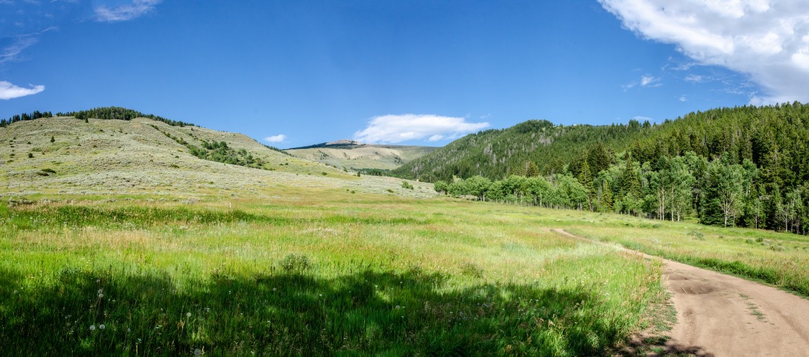
Then it was back into the Wilderness again, this time exploring the bottom end of Pole Creek Road. We found a pretty meadow to enjoy, with cows coming through a couple times a day, and parked up for awhile. It was quiet and breezy, with lots of sun but cool temps at night; we were at about 8200’. This became one of our best spots… at least for now.
But finally, once again it was time to move on. Earlier in the summer, we had decided we wanted to drive the beautiful Beartooth Highway in western Montana, one of Charles Kuralt’s favorites if you remember him on CBS back in the day. We’d done it before on a motorcycle and were ready to do it again. Since we were committed to this drive we’d arranged to have mail delivered to the post office in Red Lodge, Montana, at the north end of the Beartooth. We’d also made plans to hook up with a buddy somewhere along the road between here and there (“hook up” with social distancing, of course), so we had a bit of a schedule to consider as well.
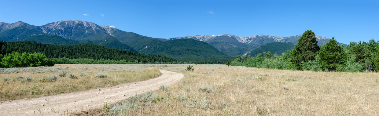
So off we went to new adventures. We took a new route, still continuing along Highway 16, but now heading south and then west, up over the Powder River Pass (9680’ elevation), then back down-down-down about 5000 of those feet, into the appropriately sleepy little town of Ten Sleep, following along Ten Sleep Creek. This is a terrific drive, down through splendid rock formations and is pretty much as famous as the Beartooth. We’d also done this trip some years before, but it was great to see it again. We ended up at about 4500 feet, in open farmland — it looked as though we’d made a wrong turn and were in Utah!
Ten Sleep is a quiet little spot, except in the summer, when the tourists overwhelm the place. But we found the library open (with splendid wifi) so we could get caught up, and Dirty Sally’s indeed does have some really great ice cream, particularly the homemade huckleberry, so we did just fine; even picked up a sticker.
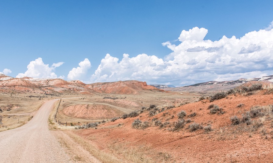
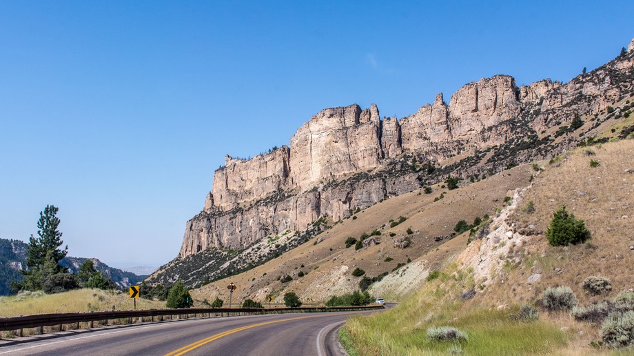
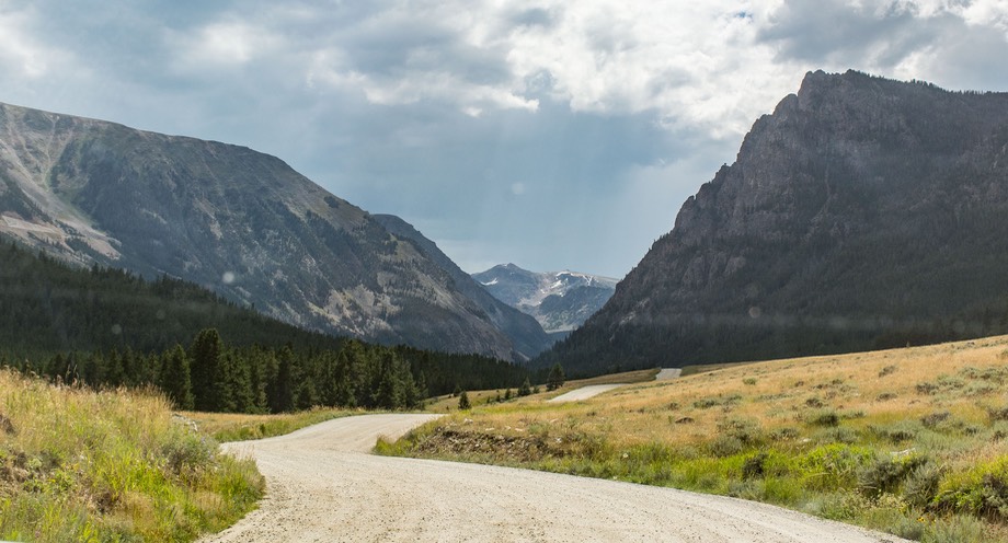
Then we spent the afternoon on a spectacular dirt road drive back up into the mountains. At Ten Sleep, we were at the southern end of the massif that is the Bighorn Wilderness, and from there we started north along the western side. During part of this drive we were on the Red Gulch/Alkali National Backcountry Byway, which took us through Wyoming’s version of a “Painted Desert.” Stunning rocks and little else. It was quite a sight, and we’d had no sense that this area existed in Wyoming. Wow! As we climbed higher, dark clouds began to take over the sky and after a time we got a little rain. Not too much, but enough to make the clay-based road slippery and shall we say… interesting.
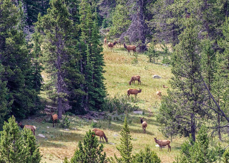
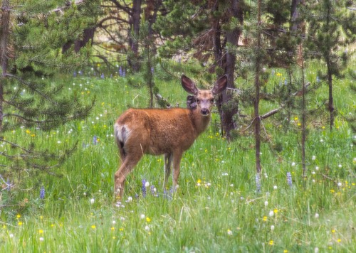
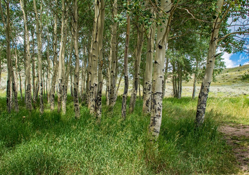
By late afternoon we’d gotten back into the Bighorn Wilderness area, and we settled down for a few days in a lovely little glade that wasn’t far off US 14; in a way we’d come full circle as this spot is less than five miles below our FR 231 spot. Over the next couple of days we heard elk calling and saw deer, while we were parked on the edge of a stand of aspens with a small creek running through the grass and surrounded by mountains. So very pretty. As is typical in these mountains, many days we started out sunny and ended up with rain; others it was just the reverse.
But the mail was calling and we needed to stay in touch with the friend with whom we were playing tag. We trucked on into Burgess Junction (that’s the corner where, going west, you have a choice between taking US14 or US14A — both lovely drives), then turned west on 14A. Goes up over 9440 feet, then heads down to pretty little Lovell along the Big Horn River, and then to Powell (both around 4,500 feet in elevation). We spent two days in Powell, catching our breath, finding out how close our friend, Mabelle, had gotten, and organizing how and where to meet up.
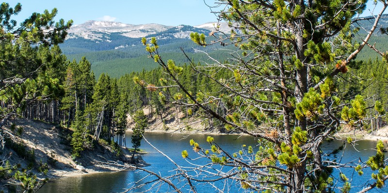
Our mail had arrived in Red Lodge, and it was becoming important to get it pretty soon. From Powell we originally had planned to take a quick route over to Red Lodge, intending to come down over the Beartooth afterwords. But we changed our minds and instead took the wonderfully dramatic loop along Chief Joseph Highway and over Dead Indian Pass (8048’ at the top) and then on to Route 212, the Beartooth Highway, which is 10,977’ at the top of the pass.
The Beartooth is a real ‘Top of the World’ type of road as you can see; well above tree line and always (still) patches of snow not only on the peaks, but right along the road in places. It took us into Montana, and then dropped us down-down-down to Red Lodge (in the 5,000 feet range) where we met our friend (and, yes, we got the mail).
That’s the short version, but what was really fun was that we knew Mabelle would be taking the same route that day, leaving from Cody, and in the end we actually met up right there on the Beartooth.
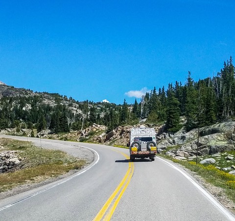
We were keeping our eyes peeled, assuming she’d be ahead of us, as we are notoriously slow starters of a morning. We were stopped at a road construction backup and Rick walked ahead a bit, looking around without seeing her, but it turned out she was behind us in the queue and could see us just fine — we do sort of stand out in a crowd. After we all got moving we pulled off to let other vehicles go by and there she was right behind us. She even took a picture of the Tiger in his natural habitat. We don’t get many pics of LT on the road. Cool!
We spent a very nice couple of days together in a camping area above Red Lodge, parked alongside a stream and enjoying the views of the mountains. But as the weekend approached, the area got so jammed we bailed on the pretty spot we’d found; by Friday afternoon it was full of ORVs and motorcycles and folks stopping here for a few on their way to the huge Sturgis motorcycle rally just getting underway.
A couple we’d just met there at the site said they were moving to another spot about 20 miles northwest of Red Lodge, on the edge of the Absaroka-Beartooth Wilderness. He made us a very good little map — we followed it — and suddenly we were on the edge of a forest in a lovely spot, parked in a meadow. There were others passing through, mostly heading into a trailhead a mile or so away, but no one camping nearby. The new friends went on further into the forest, while the three of us stayed put and enjoyed each other’s (somewhat distant) company for a couple of days longer before going our separate ways. How to enjoy a friend’s company in a pandemic? Go camping!
So here we were — we’d abandoned Wyoming for Montana — and all of a sudden the quiet, out-of-the-way camping spots we’d been enjoying for months were gone and the spots we were finding tended to be full of people. We had known we were going into a more popular tourism corridor between Yellowstone NP and the mountains of Montana but hadn’t expected to be quite so impacted by the change. We were spoiled by the relative quiet of the Bighorns and now were on one of the main roads heading into Yellowstone N.P.
By this time I was desperately in need of a laundromat, and we were thinking that we should be exploring some of the state of Montana. So after a few days we drove back into Red Lodge where I’d spotted a laundry on our way through. I did manage to complete the project, sharing the space with a bunch of bikers who kept forgetting where their masks were. Life can be complicated! In talking to the woman who ran the laundry, she said that Red Lodge had been very busy ever since early April — people were really anxious to get away from home and be out in the open. Good for business, hard on the locals.
While we were still in camp, we’d organized a route that would take us through the mountains near this area, so we could do some exploring. We would start by driving up to Billings for some “major” shopping — we’d been making do with a series of very good but small grocery stores, and were scraping the bottom of the barrel on a lot of staples; plus, it was time to find Rick some new sandals. So Billings would be the cure. Then back into the hills!
Well, Billings. Too many people, too hot, too-too-too. It was still over a 100 degrees late in the afternoon. In researching southern Montana we had quickly realized that we would not be able to easily get back up to higher elevation the way we could in the Bighorns. So guess what we did? We decided to bail and go on back to Wyoming and the Bighorn Wilderness. Montana’s a nice place, don’t get us wrong, but we’d left a cool, relatively quiet region and come to an area with more people and more heat. NOT! We weren’t having any fun. But before we headed back out, we ordered up and stopped to grab a great pizza from the Mackenzie River Pizza Co. One for the road before heading back down the hill. They make a pizza that just cannot be beat. Gotta go to Montana to get it though! Yes!! — made the trip worthwhile (and Rick got his new Keens). Needless to say we didn’t take any photos in Billings, so this one is a spot we stopped for lunch on the way back up to the mountains.
We made the circle drive from Red Lodge to Billings (shopping/dumping/taking on water at Cabellas; grocery shopping; and pizza) to Powell all on the same day. It was still too warm in Powell, but not devastating. We’d taken the short way, through a low pass in the mountains instead of back over the Beartooth, so we were “home” before dark and being later made it a bit cooler.
The next day we moved back east on 14A, back again through the pretty little town of Lovell, then up-up-up to the high plateau that signals re-entry into the Bighorn Wilderness. We shortly came to an area we had earmarked as looking like an interesting camping spot, and started looking around.
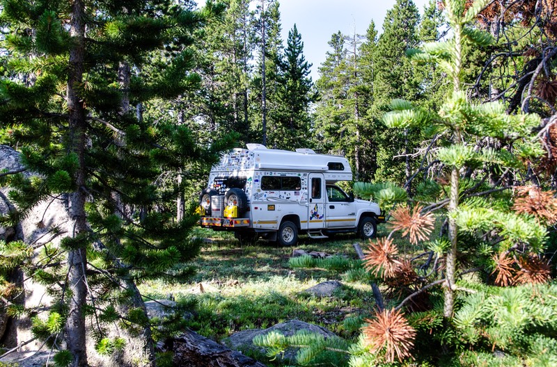
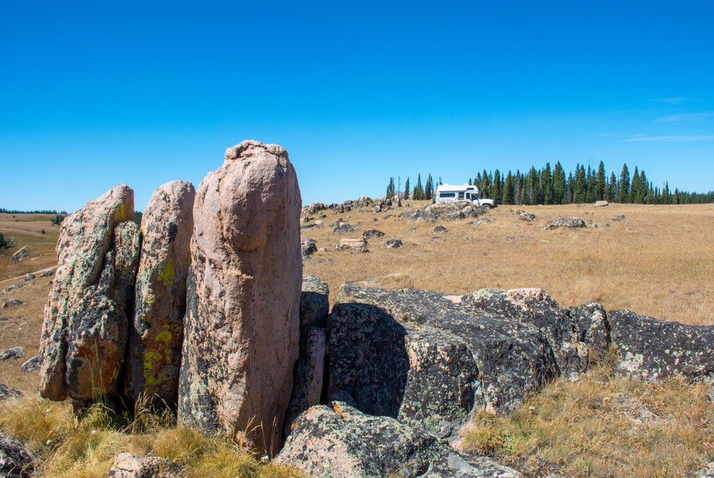
We found a lovely open knoll about a mile off the highway, and simply sat down for most of the next week. Strong, cool breezes and lovely clear skies were with us every day and we were at 9170 feet — just about perfect. We weren’t all alone, of course, but other folks always seem to prefer the edge of the forest, while we like the full-time sun we can get out in the meadow. And there was plenty of room for all of us. The ORVs would pass us by along the roadbed, but that wasn’t too close, and we all waved and wished each other well, while keeping our distance. And one morning we saw, well we’re not really sure — we think it must have been a coyote, although he seemed pretty big. Probably not a wolf. The only other critters that passed by were small groups of cows, often followed awhile later by a lone heifer bringing up the rear looking for its mates.
Finally, having again built up a lengthy list of things that needed doing, we made the long drive back through Burgess Junction and on down to Sheridan. Yuck — hot and smoky and uninteresting. (Gee, sounds like Billings —but add the smoke). A good town to get things done, but not nearly as pleasant as Buffalo. The smoke was new, and not a positive addition. We didn’t stay any longer than necessary, and then drove further south down to Buffalo, where we spent some time at our favorite library, picked up some of our favorite scones, and then headed back into the mountains.
The smoke that we encountered when we dropped down to Sheridan followed us to Buffalo, although it wasn’t as bad there. We had high hopes it would dissipate when we got back up into the forests, but we weren’t that lucky. We had decided to return to a spot we’d really enjoyed back a couple of weeks earlier; it’s still there, still nice, but now blue skies have been replaced by hazy sun.
Also, there were even more groups of folks with all kinds of off-road vehicles camping in the area, and they had discovered a hillside next to us that was just perfect for slalom runs and wheelies and practicing other tricky maneuvers that all involve making noise. We moved on, and found that probably our most perfect spot in the whole area was vacant and waiting for us with open arms. So here we are, happy as clams. We even had some rain last night, helping to clear the air. Just great.
While in Buffalo this last time we’d stopped in at the Forest Service office, and learned that there weren’t any local Wyoming fires at all, but that the smoke was all coming from other states: Colorado, Utah, Arizona and even California. Whew! We know we are very lucky not to be in California right now, or any of the other parts of the world that are in flames. What a difficult year we are all having! We also had a local, in the know, person (the Forest Service lady) once again tell us that yes indeed there were many more campers and travelers in the mountains than is normally the case. She estimated about three times as many!
Round and round and round they go; where they stop, nobody knows — We do know what you must be thinking. These guys are going around in circles! Well yes… but in a way that is one of the wonderful things about the Bighorn Wilderness. Picture a beautiful set of mountains covered with green pine forests interspersed with golden meadows all at nice cool elevations — and then add in really good access from multiple directions. Sounds pretty terrific doesn’t it.
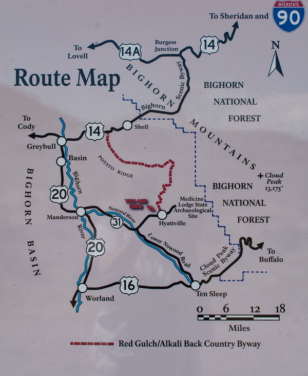
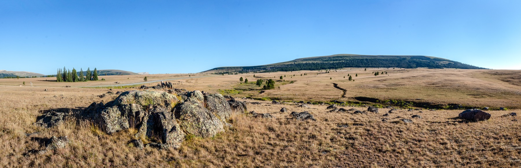
If you get out your atlas (or map program) and look at this area of north central Wyoming you will see kind of a figure 8 of roads: I-25/I-90 on the east side connecting Buffalo and Sheridan and points beyond; then US 16 connecting Buffalo with Ten Sleep and Worland across the south side; US 14/14A crossing the north side from north of Sheridan across to Lovell and Powell; and US 14 dropping down from Burgess Junction and connecting over to Greybull. Finally, Lovell, Greybull and Worland are all connected on the west side of the Bighorns by US 20. Add in the numerous unpaved roads that criss cross the region and you’ve got a really great area for camping.
There are multiple Forest Service campgrounds scattered across the region, as well as more of the wild camping spots that we like to use than we can even begin to count. Further add in good shopping and libraries in all the above named towns on the periphery of the area as well as half a dozen really good dump and water stations… In a word, Paradise. We very happily have gone round and round the area for the past six weeks or so and could continue doing so almost indefinitely — or at least until the snows come.
For now though, we are closing in on the end of August, and thinking strongly that it’s time to see another part of Wyoming before we move on. We may head down into Colorado — but we’ll have to look into the wildfire situation. In a few days we’ll start that ball rolling — and see where it takes us. Stay tuned.
We hope and trust that our little tale finds you well and happy, or as happy as you can be these days. We have always counted ourselves very fortunate in our ability to wander about as we do, but right now we feel that way even more than usual. We are free to meander about this beautiful part of our country as we choose. We can keep our distance from others and put on our masks when in public, so we feel pretty safe from the virus. We have the sun for electricity, ample opportunities to find water and internet, and if the neighbors (on the rare times when we have any) get too noisy we can just move on. So yes, we feel lucky indeed.
Be good,
Rick, Kathy and the Boomerang-Mobile wishing you all the best.
Be sure to check out the photo page for this story for lots more pictures