May-June 2022
A Veritable Fit of Whimsy
Wherein we make a flurry of sudden changes in direction
(Whimsy? Defined as “playfully quaint or fanciful behavior”)
We know, we know. It’s been forever since we’ve been in touch. We wanted to wait until we could give you the whole skinny on our time over the last two months. It has been quite a trek — since we left Nevada we’ve been in Arizona, Utah, Idaho, Montana, Colorado, Kansas, Oklahoma, Missouri, Illinois, Indiana, and pant-pant are finally in the Great State of Michigan, preparing to cross into Canada. Whew! And it’s not even the first of July.
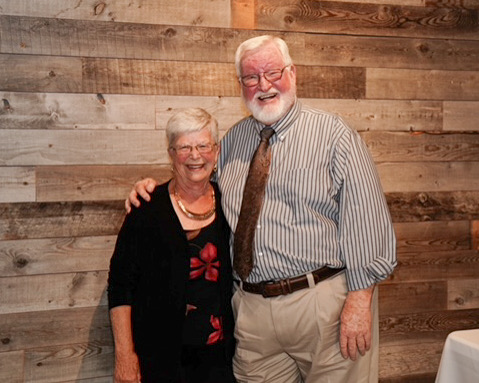
We arrived in Las Vegas for the wedding of a granddaughter at the end of April, and it really was quite lovely. Caiti looked beautiful, all others were suitably spiffy, and even we, who own very few clothes even suitable for just visiting with friends, managed to turn ourselves out sufficiently well (some borrowed, some new, nothing blue) that we both felt comfortable and had a marvelous time, dancing the night away. We saw folks we’d not seen in at least 15 years; it was grand.
After recuperating overnight, and sending our “good duds” off to friends with sufficient storage facilities (and my borrowed ones back to their owner — thank you again, Lynn), we wandered off to spend the next three weeks in Utah and bits of Arizona. We were staying in the area because (first fit of whimsy) Rick had adopted the idea that he would like to attend the Overland Expo to be held in Flagstaff the middle of May. This was going to hold us back from moving on towards our plan of heading north and up into western Canada; however, after reflection, there was consensus between the parties that it might just be a lot of fun and was worth waiting for. Stay tuned for the rest of that story.
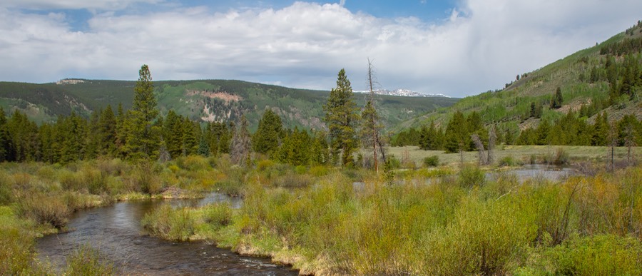
There’s lots to do in southern Utah, defined by us as the area surrounding but not actually in — well, maybe just a little — Zion National Park; and it’s all smashingly beautiful in May. Having seen Zion rather thoroughly back in earlier years, and knowing it’s one of the most visited NPs in the United States, we chose routes that would skirt around the edges, would explore places we’d not seen before, and give us a chance to stretch our legs while also recovering from Vegas-itis.
So, to get out of Nevada and get to Utah, you go through a tiny corner of Arizona. Rather bizarre, actually, but possibly organized by the highway commission to allow you to climb some steep hills without falling off any ledges. And some of it is a very pretty drive. Ultimately, due to various noises from our refrigerator, which led us back and forth to Vegas a couple of times, we made this trip more times than we had wished. But eventually, after consultation, we determined that the fridge (probably) could be put off for awhile, and we resumed our happy wanderings.

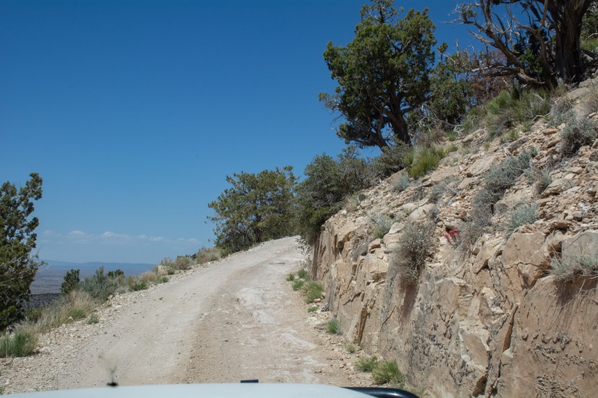
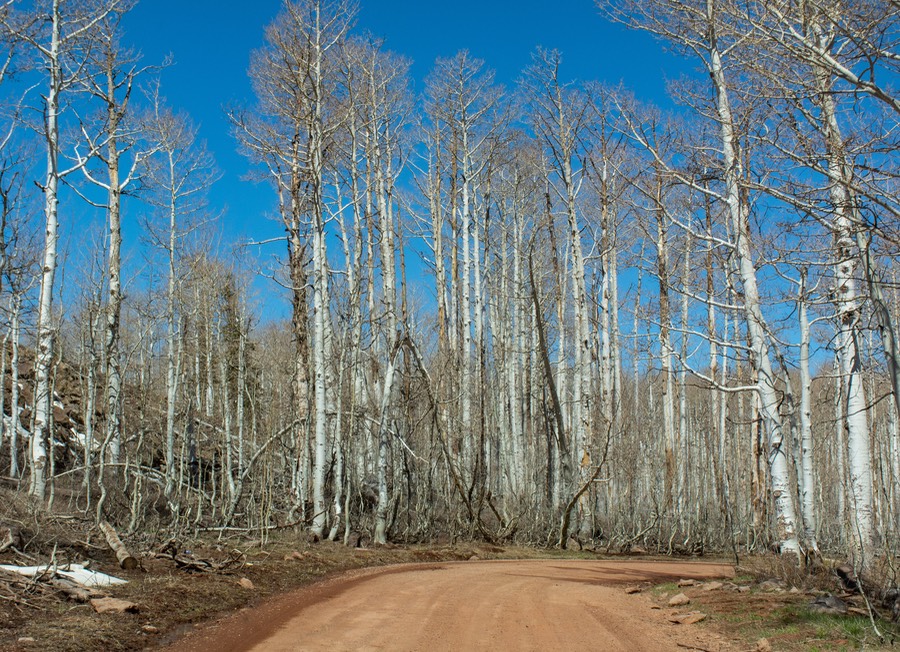
Northern Arizona was also calling us. We had long wanted to return to Tuweep, in a remote area on the north rim of the Grand Canyon which we had visited in 2007 when the Tiger was new. So (more whimsey), even though we were now in St George UT, we dropped down into AZ, and started down a long dirt road to begin our first adventure; and were promptly swallowed by dust. We’d not done much in the way of dirt roads in the last while, and hadn’t fully realized just how bad off Arizona is in terms of how dry things are. But we carried on, climbing up over the rocky Mt Trumbull pass, at 6463 feet. Part way in we stopped for the night a bit off the road in a grassy clearing. It was quite lovely among the trees.
Frustratingly, when we reached the turnoff to the Tuweep Campground the next day, we found an unwelcome sign declaring the area “Not available; Reservations Required, Otherwise day trip only”. Well nuts. In 2007 it had been one of our most exhilarating adventures; we were able to just drive in and camp right on the edge of the North Rim, looking down-down-down, and loving it. But no longer, now Tuweep has been, “Overed”, over discovered, over used, and thereby over restricted. Bah!! Moving on, we reached civilization at Jacob Lake and turned back north to Utah and Kanab. Kanab, just across the state line, is a great place to hang out, with plenty of camping, hiking, The Wave nearby, and very good Mexican food at Escobar’s; be sure to stop if you’re heading through.
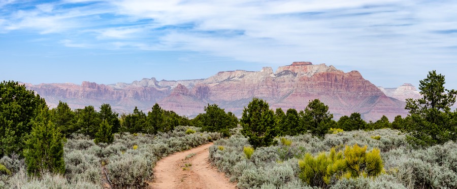
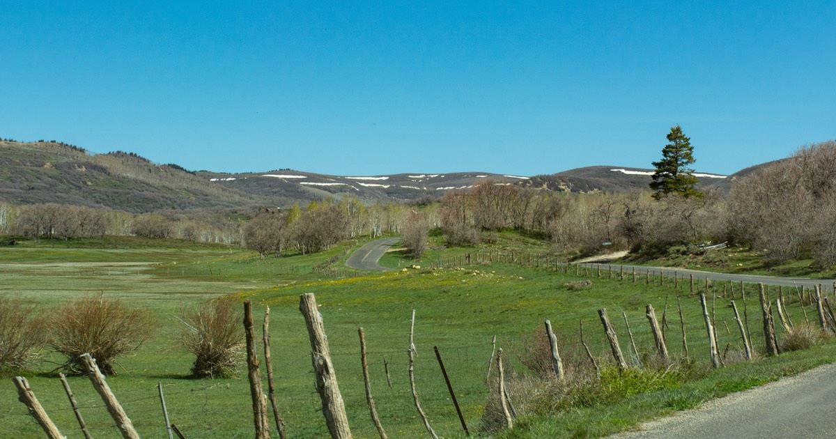
By now we had found a route heading further north that we wanted to take, but first we wanted some down time in a quiet spot. With this goal in mind, we moved just east of St George, outside Hurricane (which locally is pronounced her-i-cun we’ve been told). You take Hwy 59 east of town out a few miles, then turn north on a dirt road that leads up into the Gooseberry Mesa area. You are now out on a huge flat area covered with greenery that sets you in the middle of tremendous views of the southern edge of Mt Zion; open space with no one around. We followed a track for a mile or so then found our perfect space — and stayed for 6 days. It was so peaceful and awesome, at about 5000 feet.
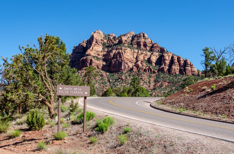
And then, here’s the really cool deal; this road north we wanted to take. After you finish in Gooseberry Mesa, you go back through ‘Hericun’ for shopping and such, then find the nearby town of La Verkin, and out of there you can get onto the Kolob Terrace Road (Utah 317) which takes you north. A little ways up, before actually starting up into the mountains, we stopped for the night in an open camping area off of Smith Mesa Road, which cuts left off Kolob Rd soon after you leave La Verkin. The cliffs were behind us, the weather was quiet and pleasant, and we stayed a couple of days. Small digression: there are two towns, Virgin and La Verkin, not to be confused with each other. We suspect they compete well at football.
Then we began up the mountain. The winding, paved public road dips in and out of the western edge of Zion NP, and you get to enjoy the majestic cliffs and canyons of the park, along with tremendous views of the area. And then you come onto very pretty Kolob Reservoir, sitting right next to the road, shortly after you get north of the national park area. (Fishing starts May 21.)
And this is only the beginning. You are still in the high country, although things have now leveled out a bit. The road becomes good dirt but winding with steep sections, and above the reservoir we ran into a sign saying road closed ahead. So what to do now? Hey, lets ask the people around here! “Nah, you’ll be fine”, they say, and “it’s a lovely drive.”
Lovely it was. We quickly ran into snow, at about 8000 feet. The aspens were starting to leaf out, and looking spring-ish. the road got rougher. We saw a marmot (we think) at about 9500 feet. It was quite grand! Eventually the road became paved again, starting at Black Mount Road, after 17 miles of dirt. Ultimately we dropped down, and hooked up with Highway 14 going east from Cedar City.
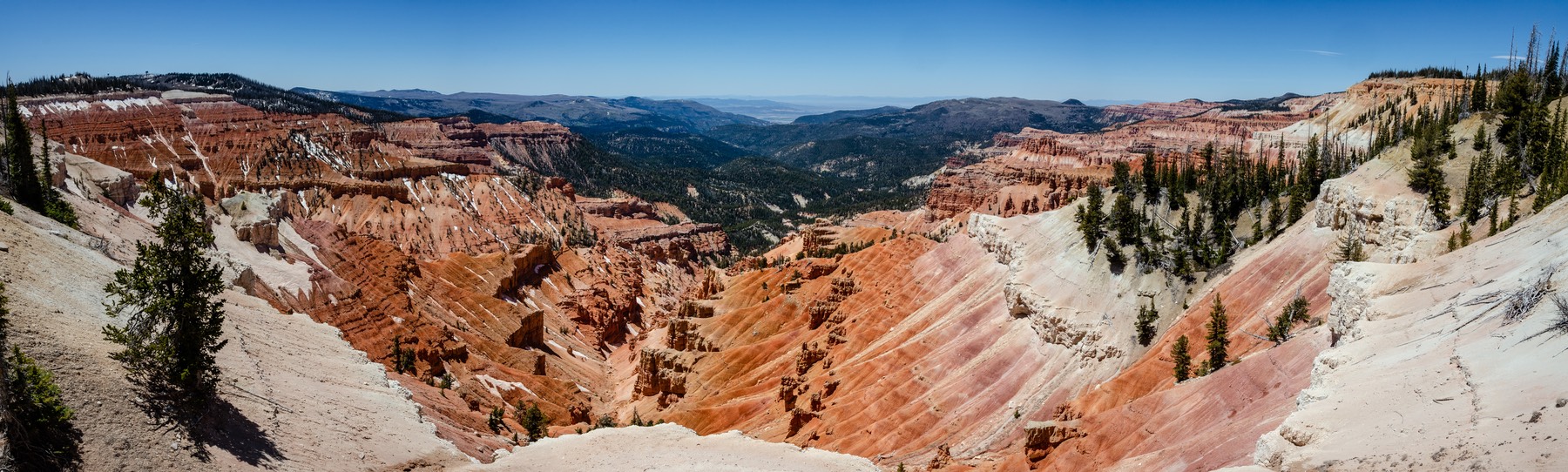
Highway 14 took us over Midway Summit at 9910 feet, and then to the turnoff heading for Cedar Breaks National Monument. I think a lot of people skip this monument, but you shouldn’t. In its own way it’s a one-shot opportunity to be stunned by the view, rather than going through Zion or Bryce NPs, and it’s a lulu. At 10,362 feet we were surrounded by snow and a breathtaking view out into a beautiful canyon. The visitor’s center was still closed (late May) so we couldn’t get details, but we had a great time of it. Still in the park, we encountered a Porsche Club on an outing — one of the group had gotten itself stuck in a bog near the edge of the road. But a fellow traveler had already stopped, gotten out his “sand ladders” and hauled the car back to safety. More excitement by the minute!
Our last stop of the day, on up into Utah a bit further, was at the petroglyphs site near Parawan. There was lots of cool stuff to be investigated, and it makes for a nice explore. This area had a strong native presence: there is evidence of Paiute, Kiowa and several other groups represented in the rock drawings.
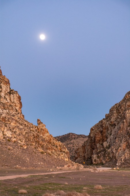
We stayed the night in an open meadow nearby, west of the display, with great views of the outcroppings, and the full moon rising right up over the gap between the cliffs where the highway runs through. If you’re on a day trip, there’s a parking lot on the east side of the site, best for viewing the drawings.
After a discussion the next morning (Topic: We don’t do “retrace”) we did decide to go back up into the Cedar Breaks area in order to pick up a road we wanted to take east to Panguitch; from there we would be able to pick up Hwy 12 and travel through the northeast part of Bryce Canyon. Just a heads up — the early part of this road, up as far as Brian Head ski resort, has a 13 degree grade part of the way; perhaps not recommended for folks pulling trailers!
Up at the top of the mountains, we turned east on Hwy 143, at 10,630 feet, into the Dixie National Forest. Immediately we started dropping down again. Lots of camping up here, but we were only driving through, and enjoying the peaks and meadows as we traveled along. We passed Lake Panguitch with lots of campgrounds open and very active. This is a popular summer area, and Memorial Day was approaching.
By now we were finishing up a 3-week gap between our Vegas wedding and our next commitment, down in Flagstaff. But we still had time to drive through some of Bryce Canyon. And it was a really nice choice. This northern area isn’t the most spectacular part of the park, but well worth the time. Fewer people; and certainly no shortage of great views.
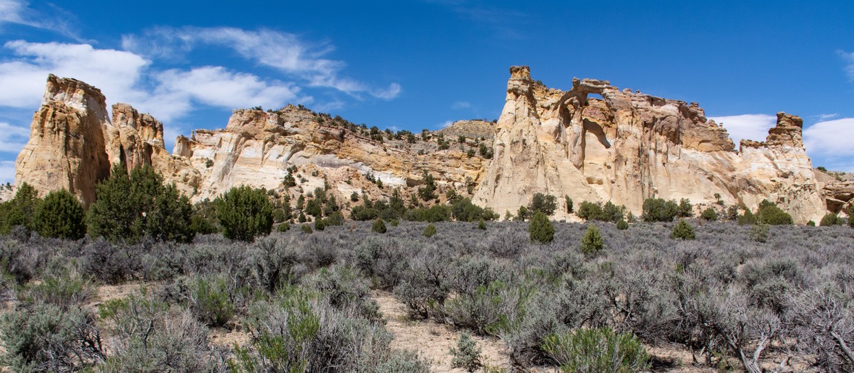
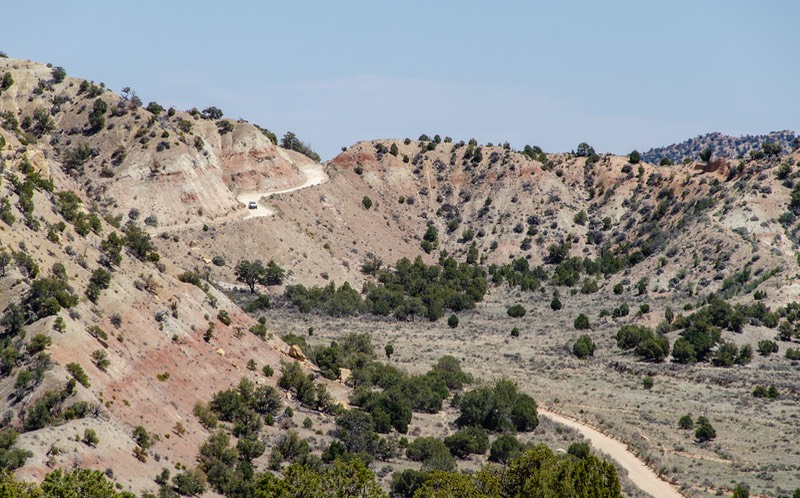
From Bryce, we dropped on down to Cannonville, a neat, typical Utah town, and headed out to our last (and maybe favorite) road decision (aka: fit of whimsy) so far in all of Utah. East of Cannonville, the road is paved as far as Kodachrome state park. Kodachrome is a lovely continuation of the splendors of Bryce Canyon, and shouldn’t be missed. But we were going further. The road now became dirt, and not too much further along you can stop at the really interesting Grosvenor’s Arch, a lovely and delicate arch in the midst of a great rock formation.
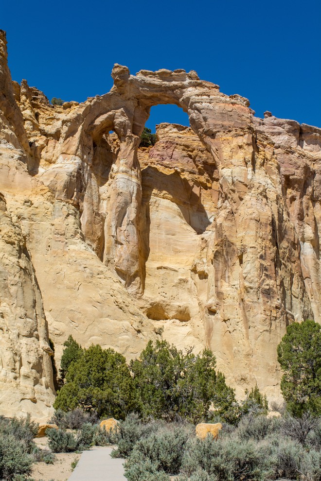
We stopped and explored this beauty and ended up chatting with a retired couple from Arroyo Grande (California), very near our old stomping grounds. It turned out that the fellow was a retired auto shop teacher; well, Rick taught auto shop too, back in the day when he was just out of college. Small world indeed.
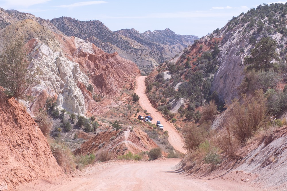
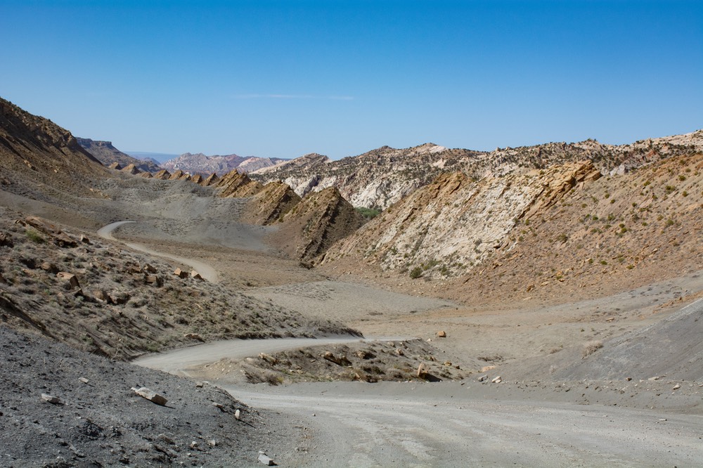
And then we continued on along. We were now on Cottonwood Canyon Rd, which runs southeast along the lower edge of the Escalante Formation, and goes down, down, down into this great canyon, following Cottonwood Creek. It was pretty warm, and got quite hot as we dropped down. We found a lovely little spot under some cottonwood trees about halfway down the (maybe?) 30 mile trip. We were parked next to the water, although there wasn’t much of it left to be found. But regardless, there were plenty of frogs to listen to during the night. The next day we drove the rest of the canyon, leaving the Cottonwood River and joining the Paria. Both of these streams empty into the Colorado River, further down the way. We had been paralleling the Great Escalante National Monument, and even passed through a corner of the protected area. We then joined the regular road through this neck of the woods (Highway 89) and back down into Arizona.
We were getting lower in elevation, and eventually drove through Page, full of people but little water in the Colorado, sadly. Spent some time at a car wash cleaning up the Tiger after all those weeks of dust. And you should have seen the dust inside - yuck!!! We continued south down Hwy 89 through beautifully-colored rock formations as we left Page, along the edge of the Moenkopi Plateau; then at lower elevation traveled through the Navajo Indian reservation, before climbing into the forested area above Flagstaff.
We spent a couple of days among these trees. Some of the area was closed off because of recent fires (and preventive work being done against future problems), but we were able to find a nice spot. Since our time there some very bad fires have erupted in the area; we are very sad about this.
And then we pulled into Flagstaff, our reason for being back in Arizona and not exploring more of Utah. The next several days were both fun and exhausting. We were there in order to attend and participate in Overland Expo West. We were invited to put the Tiger on display in the Showcase Vehicle section. Rick gave a very well received (and attended) presentation on shipping your vehicle overseas; and we both participated on several panels covering traveling on various continents, suggestions for successful travel, and even one for women only on traveling as a solo woman.
Overland Expo is a very big event with about 30,000 attendees anticipated for the weekend. It offers a mixture of worldwide adventure travel, adventure camping in the States, exhibitors for gear, and skills training for both 4x4 enthusiasts and adventure motorcycle folks. Plenty of stuff on display, but lots of training opportunities too, both classroom and on riding/driving courses. We had last participated back in 2015 and ’16 and were happy to be back. We made some new friends and renewed acquaintances with some old friends as well. There are now four Expos each year, with others in Oregon, Colorado and Virginia as the year goes on. You might enjoy trying one sometime.
By Sunday afternoon we were done in, so retreated into town to spend the night, then hit the road on Monday morning. By now our next bit of whimsy (aka: Abrupt Left Turns) was a decision made to attend the mid-June Tiger Rally in the mountains above Leadville, Colorado. We weren’t planning to go, but then we were; not much surprise there. We shifted some other arrangements around, and started plans for occupying ourselves until the rally started on June 10th.
By now those of you who thought we were heading towards western Canada and Alaska must be wondering what in heaven’s name had made us change our minds. Well… to make a long story short — (1) we had refrigerator problems that we had been unable to solve in Nevada, and our favorite refrigerator guy is in Shipshewana, Indiana; (2) Kathy really roughed up her neck and shoulder in Flagstaff and we know a great chiropractor in Sheridan, Wyoming; and well, (3) at least one of us really wanted to go to eastern Canada in the first place. So we chatted, decided to ignore the fact that we were choosing to take routes that would cause us to use more costly fuel than otherwise, consoled ourselves with the memory of paying $8-$10 per gallon of fuel when we were in Europe, and once again rearranged our lives to accommodate our whims. And yes, by now we’re both getting excited about eastern Canada. Yukon and Northern Territories? Another day.
To be perfectly honest, one of the things we like best with our lifestyle is to ignore the practical and most efficient, and choose what we really want to do at the time.
Therefore, the route we chose would take us back up into Utah to see more of that lovely state and visit friends, then on to Idaho to visit more friends in another pretty place; then on to Montana for pizza at the Mackenzie River Pizza Company in Bozeman, and then over to Sheridan Wyoming to see the good doctor and get Kathy straightened out again. Just your normal set of errands ‘around town’ so to speak.
And that’s about what we did. A big highlight was to re-enter Utah, staying on Highway 89 all the way from Flagstaff to Ogden. This is a beautiful route, and a real treat. You pop off now and then to connect with major roads for a bit, but generally it was US 89 the whole distance. We were able to stop in Kanab for a second lunch at Escobar’s, and then troop on to enjoy the green valleys and plentiful rivers (Utah seems to have more water than Arizona).
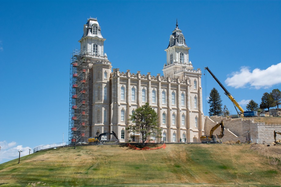
Along the way, we stopped in Manti to take pictures of a Mormon temple we’d been seeing for miles and miles and miles as we drove towards it. It had some reconstruction underway, but that certainly wasn’t a detraction. Quite a building. Later we got hung up a little bit trying to skirt around Provo, but it’s still a nice area, and BYU looks to have grown by leaps and bounds in recent years. Otherwise, nice roads and easy traffic. We slinked (slunk?) past Park City, land of ski condos and cute cartoons, and then onto I-80 for a tad.
In Ogden we reunited with old friends who’d recently moved from San Jose, then shuffled north into Idaho, where more old friends were awaiting us, a couple whom we’d first met in Oaxaca, Mexico, a million years ago. It was approaching Memorial Day by now, and it had begun to be rainy, a real bummer for us as the area we were heading for was also lovely. Not our decision; the Rain Gods were not smiling on us. But the mountains were lush and green thanks to the rain and snow coming down, and it was really nice to see all these friends; it had been far too long.
The onset of the rain marked a real transition in our spring/early summer travels as we were suddenly confronted by the realities of our current climate. The La Niña effect, familiar to all west coasters, causes the jet stream to move further north, carrying the seasonal rains/snows with it. The result is drought in the southwestern US and heavier than normal precipitation in the northwest. We had been so dry for so long it was rather startling to suddenly be immersed not only in the actual rain, but even more so in the lush greenery that follows it.
We left Idaho in rain and then got more rain and heavy fog over one of the passes; we were glad we’d decided to forego a road we’d wanted to take — it was unpaved, much higher and already had snow warnings posted. So we stayed on the interstates and were in Sheridan well in time to be attended to. In Montana we had followed the Madison River for a long ways; it goes through a beautiful valley, and stops briefly in Ennis, Montana, a favorite of ours, before continuing on. It was there we saw our first pronghorn of the season. We did make it to Bozeman for the night, and did have some of the most splendid pizza anywhere. But we were exhausted; we really should have stopped in Ennis for the night, pizza or no. We were reminded of something that Napoleon said, about armies traveling on their stomachs; oh, well.
From Bozeman we began gently weaving our way further south toward Wyoming. Then, from Sheridan we dropped down to Buffalo, on the edge of the Big Horns, where we had spent the last two summers. What a difference on the first of June! We were intending to park up for a few days on a bluff we’ve enjoyed, but were greeted with closures until June 15, accompanied by realizing (just look up, silly) that the Big Horns were covered in snow and likely to be receiving more soon.
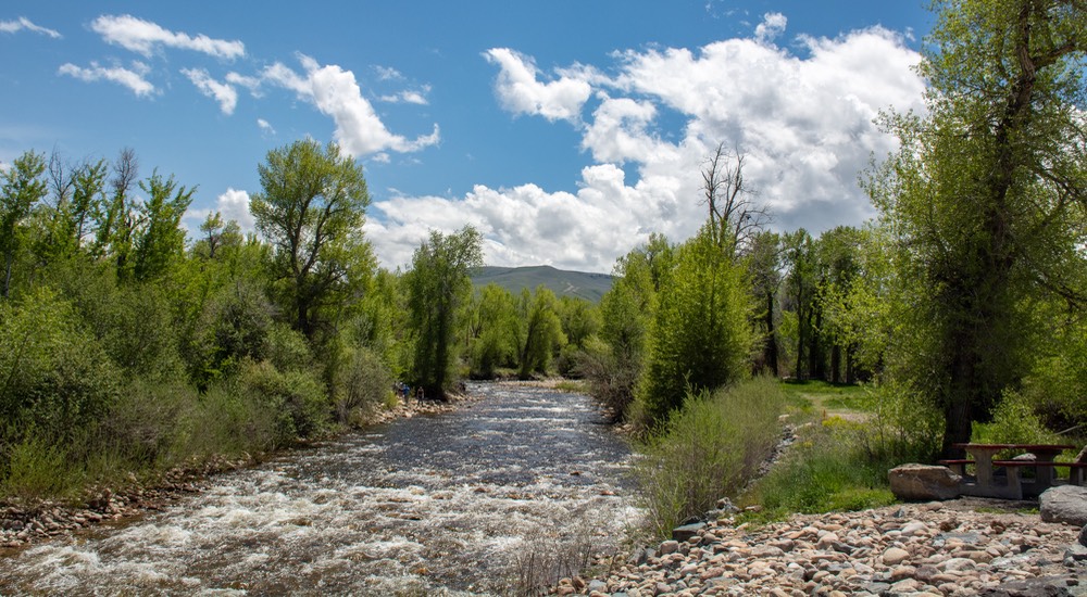
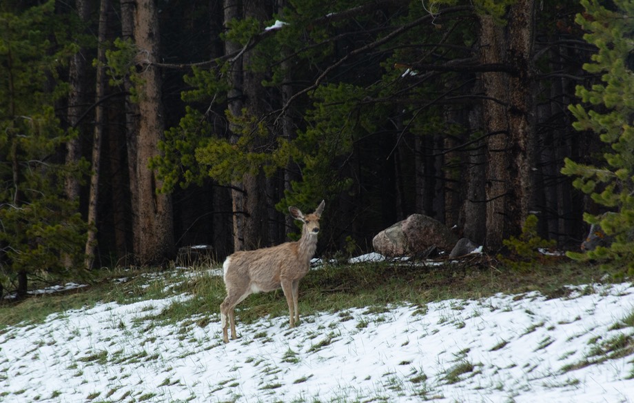
So we drove on, up over Highway 16 through both snow and sunshine; it was very pretty, the roads were good, we saw a lovely deer near the road, and we made it all the way down the hill to the little town of Ten Sleep by mid-afternoon. Ice cream at Dirty Sally’s helped us keep on for a couple more hours, followed by a good night’s sleep out in the countryside heading toward Thermopolis, and then on to Lander, where we parked up for a few days in their city park, right next to a snow-fed stream. It’s a lovely spot and a very nice town.
Leaving Lander, via the charming Wild Iris Mountain Sports shop where we were able to fill our tank with water (many thanks to them), we headed east along Highway 289, a road the Mormons took, according to the map. It was quite pretty in early June, and it was a lovely day. Further on we turned south through Muddy Gap, and on down to Rawlins. Wyoming in its “green” season is very pleasant. There are 3 different historic trails through and along this road (Hwy 289) — the Mormon trail, which leads to Salt Lake City; the Oregon Trail through both the Rockies and the Cascades; and the Pony Express Trail, which terminated in Sacramento, California. If you look at the topography, you will understand why. The pass through this area is at the relatively low elevation of 6720 feet. We saw pronghorn, deer, and even some buffalo, presumably a domestic herd.
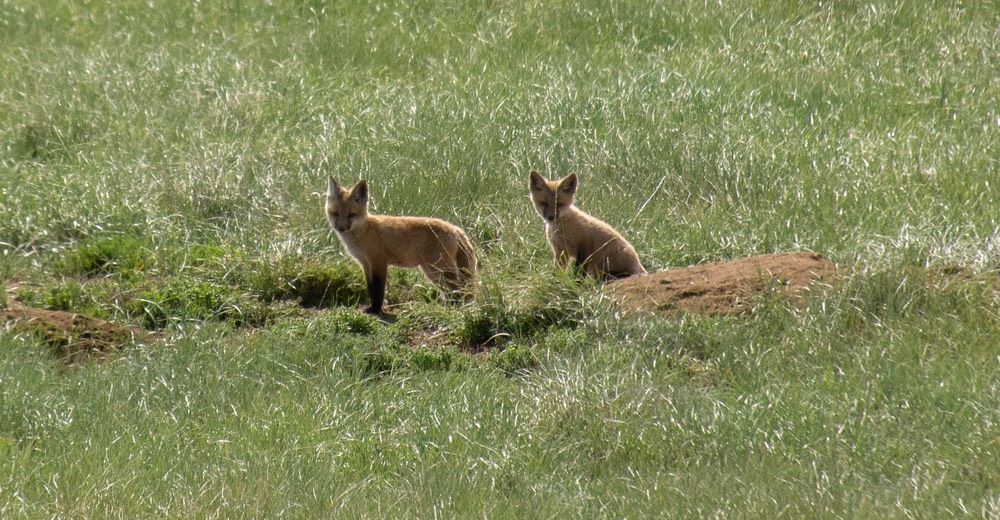
Moving south we entered Colorado on Highway 230 (it promptly turned into 125 as we crossed the state line). It is lovely through here. We dropped down through Encampment and then arrived at Walden, where we stayed for several days, at about 8100 feet. We were surrounded by snowy mountains , and right next to a small lake filled with ducks and geese, the occasional heron, and even a pelican. Nearby was a family of foxes, including two kits. It’s hard to take photos when you are keeping your distance, but we did our best.
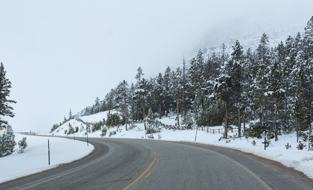
As we continued to drift south, the road down to Silverthorne is quite lovely, you cross the Continental Divide again and again, and the Colorado River too; there are great views of the Rockies. The town itself is quite touristy; it’s a shame the area is so crowded. We were heading further south in Colorado, toward Leadville, up and down over one pass after another — once up to 11,318 feet (Fremont Pass over the Continental Divide); it was raining at first, then snowing higher up, then we dropped down into Leadville at 10,152 feet. We were really up there!
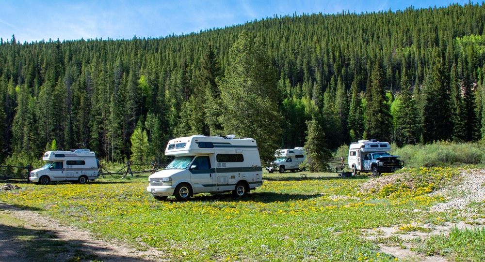
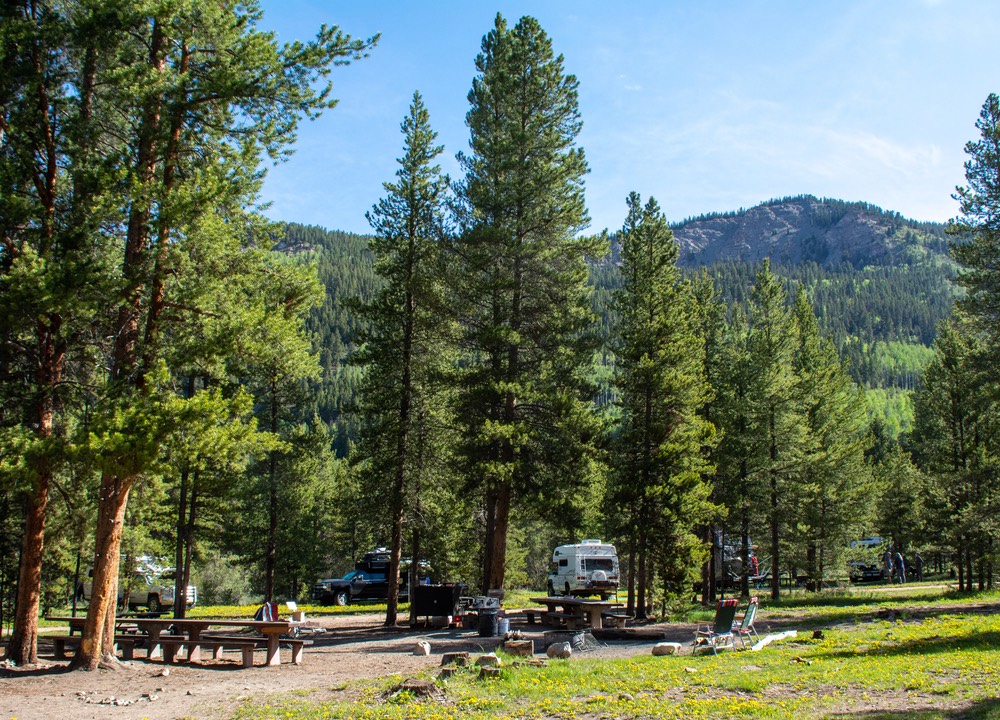
We had arrived in the Leadville area to attend the Tiger rally, which would start in a few days at a campground north of town. We had been asked to give a talk on the last day of the rally and wanted a few days to acclimate ourselves to the increased elevation. It’s hard to talk when you’re totally out of breath! It worked out pretty well, and our chat was well received. There were more than 40 Tigers in attendance and as always, we had a nice time with a great group of folks. Tiger owners rule!
But eventually we had to get going, and “going” this year meant heading east through Kansas and Missouri and Indiana before we could turn north and head across the border into Canada. As we left the coolness of the Rocky Mountains we knew that our cool temperature period would be ending as we slammed right into the icky weather of the Mid-West and right into a tremendous heat wave. The weather started to influence how we traveled, how grumpy we got, and led the refrigerator to decide enough was enough and it wasn’t going to keep its “charges” healthy and yummy, “no how, no way, no sir!” It pretty much gave up the ghost one day in Tulsa. We’ve been doing our best to nurse it along ever since; it does recuperate a bit when parked in the shade for a day or two.
We wanted to see a friend in Tulsa Oklahoma. We stopped and stayed the nights at a couple of very nice Kansas fishing lakes along the way. They have been very nice spots for us in the mid-west in prior years — quiet, filled with birds, and very green and grassy. Good spots. Nearing Tulsa, we pulled in to a wildlife area outside town, but it was on the river and had suffered major flooding over the last week or so. Several of the areas we’ve traveled through these last few days have very high water in their lakes and streams, so we weren’t too surprised. The park was closed so we moved on into town.
Our visit with our friend, Gloria, the next day was a treat. Gloria is on our favorite persons list, and we really enjoy her company. To top it off, we were meeting in a restaurant for lunch, and the staff didn’t mind one bit if we arrived an hour early and enjoyed the comforts of air conditioning. After Gloria had to leave for afternoon commitments, we moved on down to the nearby little town of Porter, where we had found excellent jam (and fresh peaches) on an earlier visit. Still there, still yummy, and our larder is full again.
We went back into Kansas and stayed at a fishing lake out of Independence. An absolutely super spot — beautiful with lots of trees and lush grass; we stayed 2 nights and were able to park in almost total shade the whole time. Unfortunately, Rick was reminded that even full shade does not protect against sunburn for fair skinned folk and his forgetfulness was rewarded with a bad sunburn, mostly on his legs. Ouch!
On our way there, we had stopped and I bought an enormous bag of ice to try and save the food in the fridge. Fridge was pleased by the help and recuperated for the moment. After we left, however, it died again (and soon after so did all the ice) and I got worried. But we stayed with friends outside Springfield MO for two days; they parked the Tiger in complete shade and the refrigerator is now limping along again. At this point, we were only about 4 days before our Shipshewana refrigerator appointment. We will survive!
Our friends live in beautiful country south of Springfield, and they took such good care of us. In better weather it would have been great to hike around among the trees and through the grass and along the stream. In the icky heat we sort of vegged out. We’d been planning on an overnight stop, but due to the heat we asked if we could come for the weekend. They fed us, loaned us a car for a drive into town one day, left us to catch up on some computer stuff, and were entertaining and supportive of our lifestyle. What more could we ask.
These friends are Mike and René Van Pelt, who own and operate Global Expedition Vehicles, a major overland vehicle manufacturing company in Springfield. We’ve known them since 2009 and had run into them most recently at Overland Expo. That meet up resulted in the invitation to come by Springfield for a longer visit.
On the Sunday morning, we went into town to meet up with some more old friends from California. Ken and Cheri had been touring around in the eastern time zone for a month or so, and were currently spending the weekend at the BMW motorcycle rally in Springfield. We met up on Sunday morning, laughed and enjoyed our way through a yummy breakfast, and then we sent them on their way. They are on their way home now, but will be heading for western Canada/Alaska later in the summer. It was a treat to see them, and we promised to share with them all the notes we’d been making for our own trip up there.
Monday we spent a very nice morning at GXV, where Mike and René showed us around the factory and we gave a short talk about overland travel to their employees; sharing pictures and stories about where we’d taken our Tiger, problems we’d had, experiences we’d enjoyed and things we’d learned.
We could have stayed in southern Missouri longer, but it was waaay too hot, and we were anxious to get up to the Refrigerator People ASAP. We also still had one last visit that we didn’t want to miss. Fellow Tiger guys Dave and Susie live in a charming older area on the northeastern side of Indianapolis. They’d been unable to make it to the Tiger Rally and we wanted to see them, so we kept on, crossing the Mississippi River as we dodged around St Louis and into Illinois. We’re really in the Mid-West now — lush fields of corn getting taller on all sides, lots of huge old trees, barns and tractors, all in their element. There are lots of caves to explore here (not our style, but plenty of advertisements), and all very Republican.
We hustled across into Indiana, and abruptly found ourselves in the Eastern Time Zone — oops, lost another hour! Man have we been moving along! We kept trucking and soon were in Indianapolis, where we spent the night inside their nice, cool house while we shared many very happy hours talking about everything under the sun. Good people. We’ll keep in touch.
And then we zoomed north to Shipshewana, arriving the evening before our appointment. It was super, although too hot yet again; we just parked up for the night, with sheep next door, green fields everywhere, horses clip-clopping by with their small carriages carrying the local Amish. A beautiful part of the country for sure.
(You realize, of course, that the real reason to talk so much about the fridge’s problems is to practice spelling “Shipshewana” — I now can do it in my sleep!)
The next morning the fan on the fridge was replaced, the puppy started working just as well as when we’d first bought it in 2009, and we were outta there and back on the road, all before noon. Even though the repair was simple we were glad to have made the trip. There is a big difference between someone saying, “well maybe it just needs a new fan”, and someone who really knows the unit saying, “we’ll just put a new fan on her and she’ll be right as rain.” The confidence level is much higher when you can talk to an expert. We were happy.
And now we’re moving north through Michigan, up into the U.P. (Upper Peninsula) heading for Sault Ste Marie and the border crossing into Ontario, Canada. From there, we’ll be on to James Bay, then Baie-Comeau, and on up the Trans-Labrador Highway to new sights unseen, all on our way back to Labrador & Newfoundland, where we last visited in 2004, eighteen years ago; my goodness how time does fly.
So wish us a happy summer, and we say Likewise to you.
Love from all of us at Team Tortuga