September/October 2021
Dancing Across the Divides
Time Zones and Water Drainage Seek to Define Our Fall Travels
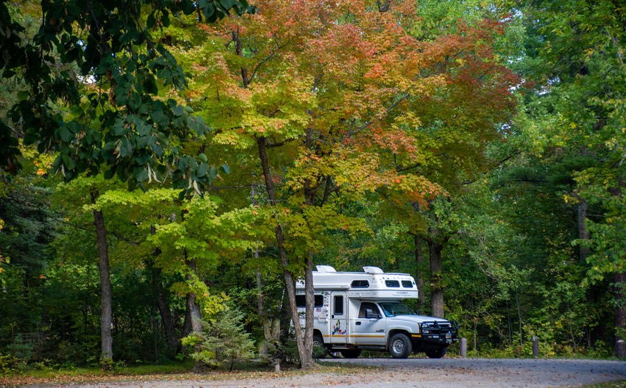
It’s now the end of October, and we have settled into our winter “home” in southern Alabama. It’s been a delightful fall, with lots of beauty to enjoy and plenty of sliding back and forth across the many areas that comprise the middle part of the US. We moved between states, across various mountain divides, and between time zones. It almost felt like the Tiger was a lovely, graceful snake, freely meandering along as we drove further and further south. Hmmm… the Tiger as a slithering snake? A bit too fanciful? Well, you can come up with your own image!
As we traveled, we were thinking about the whole idea of leaving home and hitting the road, and how we’d jumped at the idea back in October of 2001. We left on Halloween, just as it was getting dark, on a motorcycle pulling a tent trailer. And here we are, 20 years later, still out there, still having a super time, celebrating all those years on the road, and making plans for next year’s travels.
So as we write this, the 187th message we have sent from the road, (WOW!), we beg your forgiveness if we seem a bit more light-headed than usual. We think we’ve earned it; well, either that or we’re simply getting batty as some of you may suspect.
* * * * * * * * * *
We had been looking forward to traveling through the north-central part of the country for several years, and had decided on a rather widely wandering route. Some of these places we had never seen before, other areas we’d not visited in more than 15 years. We were glad to be up here. We would be at least touching on Minnesota, Wisconsin, Michigan, Indiana, Ohio, Kentucky, and Tennessee, and then diving south into Alabama — hopefully before the snows fly or a hurricane crosses our path. You’ll have to read on to find out if we were able to manage it all.
Much of this area is in the Central Time Zone, but not all. So, along the way, we would be dancing back and forth with the Eastern Time Zone as well. I know, total whoop-de-doo. But we take our pleasures where we can, and for us, changing time zones can be hard on these increasingly elderly bodies (and brains). Why doesn’t the sun come up at the same time as it did on Thursday?… you get the drill. More on all this later.
Okay, yeah, but stay with us. We left you a couple of months ago, as we crossed into Minnesota, leaving North Dakota behind. Somewhere in that state (actually, just east of the Teddy Roosevelt NP — you know, where all those bison are?) heading eastward, we crossed out of Mountain Time into the Central Time Zone. Of course, most folks cross it on the Interstate a bit west of Bismarck, but that’s not the point. And, when we finish this trip in Alabama, we will also be in the CTZ. Which suits us well, much more than the Eastern TZ. So, if we are trying to keep on task, and move in a generally southern direction, we’d prefer to… wait for it… stay west of the time line cutting through each of our maps. As it happens, that’s not as easy as it sounds. We’ll show you more when we get to Kentucky and Tennessee. That’s where the real fun starts.
But back to the pleasures of the season. We hit Minnesota about mid-September. We crossed out of North Dakota at Fargo, over the Red River, and started moving further and further north. Just as an aside here, Rick was doing a crossword puzzle recently and came across the clue, “Town on the Red River”, with five letters. Hoping to put his newly reinforced geographic knowledge to work he put in “Fargo” but pretty quickly he saw that wasn’t going to work. Turned out the answer was Hanoi. Hummmph… guess there’s more than one Red River out there.
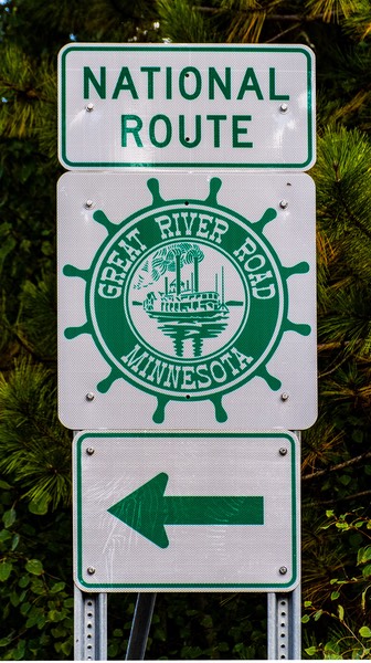
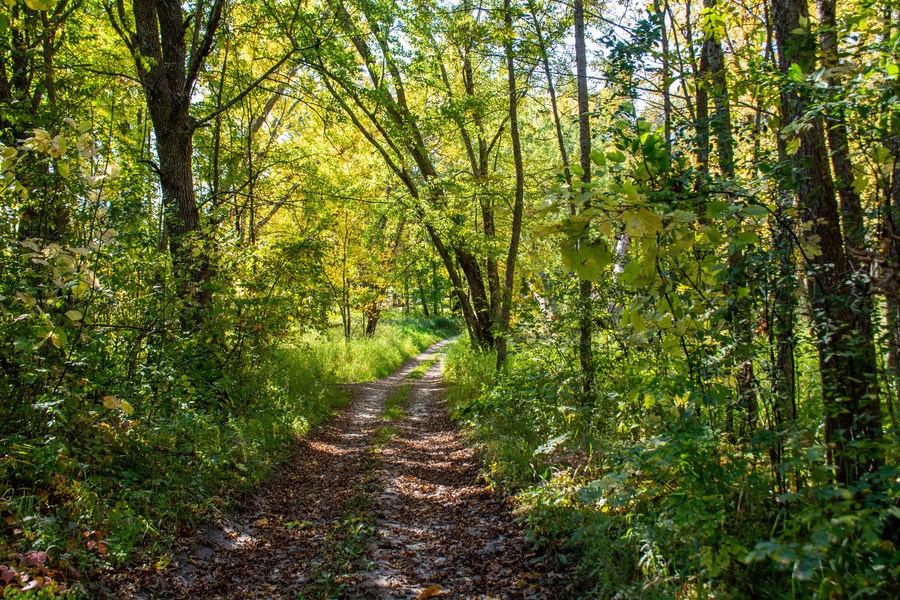
Anyway, back in Minnesota, at times we were following the Great River Road, a super choice. As promised by all, there were little ponds everywhere. You do know that Minnesota is known as the land of 10,000 lakes, don’t you? Seems possible. The countryside was as lovely as the early fall weather we were enjoying, full of bits of water surrounded by forests, occasionally broken up by small towns, all under a clear blue sky.
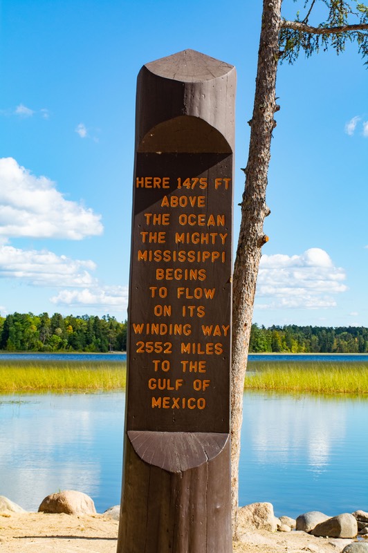
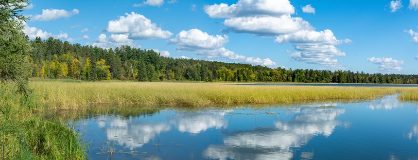
We were headed for Lake Itasca State Park (they pronounce it Eye-Tasca), which contains the headwaters of the Mississippi River. Which was very cool, we have to tell you. All major rivers rise from some dark, small place in the middle of nowhere. Well, this river’s origin takes the cake as one of the loveliest we’ve ever seen. Lake Itasca is worth a visit all by itself, but among its pleasures you get to see where the Mississippi begins, in a spot where you can stand straddling both sides of the stream, feeling like one of the great explorers of history. Well, sort of. Unlike in the explorers’ days, the park now has an excellent visitors’ center, with lots of information, history, pictures, and what have you… and good ice cream to boot. We had a swell time, spending several hours there and then wandering off to a quiet spot nearby where we hunkered down for a couple of days to enjoy the lovely weather and the even lovelier trees.
We have to tell you right now that northern Minnesota was the best fall color we saw during this whole trip. We were lucky up here; the trees were in good color, the weather was great, and there were plenty of squirrels to enjoy. We saw lots of birches (or are they aspens this far east? Or is the other way around?), and we crossed the Mississippi River several times as we moved through the area. In order to do so we generally stayed on secondary roads, which worked really well. We have never been in this area before, and picked the perfect time. Awesome!
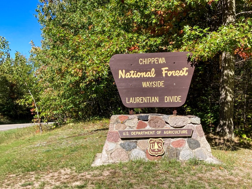
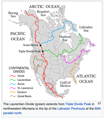
Moving along, we were starting to pass by indoor skating rinks in the towns. We’re pretty far north! We crossed the Laurentian Divide near Marcel. The Laurentian is similar, in a general way, to the Continental Divide, only it generally runs west to east. Waters north of the Laurentian flow into Hudsons Bay, far to the north, while waters below the Divide flow south to the Gulf of Mexico. The Divide is extensive; we had crossed a section of it in Canada, back several years.
We puttered along, staying one quiet night near a beautiful boat launch area at the town park in Coleraine. Many towns were having garage/yard sales, maybe because people were closing down their summer cottages and heading south for the winter?
Along the way we made an unplanned pause in the town of Floodwood. We’d decided it was time to stop for lunch and on arrival discovered they were having a car show as part of the Floodwood Fall Festival. Well, that kept us around for quite awhile; pretty, brightly colored cars, mostly from the 50’s and 60’s, scattered around town on a lovely fall day made for a nice little visit.
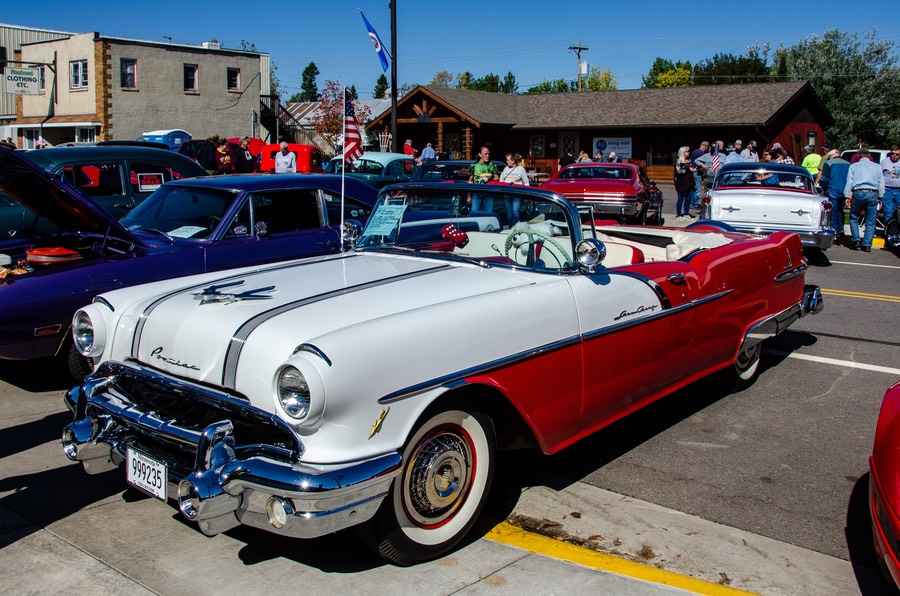
They were giving out free corn on the cob that was really, really good; the pancake breakfast had just finished up and gyros were advertised for lunch; there were bunches of old cars parked on the street and in the fields; and lots of older folks sitting out enjoying the day, many of them showing off their own old cars. We heard a conversation between two quite elderly women about changing from a stick shift to an automatic. “No, never switched to an automatic; once you’ve got a 5-on-the-floor under you, you never will want to”, she said. Oh, and in another chat one person told someone else they were paying $1,000 a gallon for paint for their historic vehicle. So there!
We had lots more we would have enjoyed exploring up here, but found ourselves on something of a schedule and so kept on truckin’, headed for Duluth and the crossing into Wisconsin. Our aim was to cross into the Michigan Upper Peninsula (UP to everybody, and apparently some call the locals Yooopers), and move across that area toward Sault Ste Marie, where we were meeting up with friends in a week or so. So, Minnesota goes on the list for a return trip.
We like Wisconsin, and have spent lots of time in the southerly parts of the state, but on this trip we’d set a specific, short route across the top, just touching its northern edge. We’d been told that the village of Cornucopia was not to be missed. It seems there was syrup and honey and cheese to be found there.
So where’s Cornucopia?
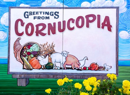
Time to get out your map. You start just east of Duluth, taking a lovely large bridge (called the Richard I. Bong Memorial Bridge) over the waters of the St Louis River, enter Wisconsin, and then shortly turn left to follow the shores of Lake Superior along its edge, up the arc of the state towards its top — and Cornucopia. Which does indeed have splendid syrup, honey, and even jams to love. It’s the home of the northernmost post office in Wisconsin, and the Apostle Islands are nearby. A nice little village in a pretty spot, with food and water views and a very peaceful atmosphere. And we can definitely vouch for the experience. There were places to stay, in a quiet resort atmosphere, including a lovely city park with camping right on the shore. A good spot for a longer visit when next we come by.
Continuing on down the east side of the arc, we spent the night at a bicycling trailhead on the edge of a forest, then the next day continued on towards Michigan. We are now seeing Canada geese in all the fields. They look haggard, and seem to be asking if they’d ever be able to go home again. It’s a long flight south… but perhaps we’re just projecting.
We really like being in Wisconsin, and would have enjoyed staying longer, but ‘miles to go before we sleep’ and all that. So, after only a short time, we waved good-by and angled ourselves further northeast, crossing into Michigan at the western tip of the Upper Peninsula. And, then, startlingly, once we’d driven about 25 miles eastward, we crossed the line into the Eastern time zone.
We call that line the “Orange Divide” you see, and you are wondering what’s that all about? Well, okay, here’s the deal. As you know, our continent is divided into four different time zones: Pacific, Mountain, Central, and Eastern. We have good maps to use; they mark the dividing line between each time zone. Mark, yes, in tiny-tiny little crosses; do they help you to easily spot the dividing line, well not so very much! So, when we open a new map, and see that we are going to be shifting time zones, Kathy takes an orange marker and highlights the line. Now wasn’t that thrilling, to be part of such a scientific, time-consuming process? Yeah, we know, BFD. (But wait until you get to Kentucky and Tennessee.)
We’d enjoyed wandering around this area a number of years ago, and were happy to drive through again. The UP is still quiet and pretty darn rural. Marquette, with its lovely library with a large collection of stuffed wild animals, is a highlight; and there is a lot of copper mining in the area’s history. The trees are pretty, and so are the rivers, but our first impression was that the area seemed a little worn down. Not run down, maybe just dry.
As we got further east, closer to Sault Ste Marie (SSM) the countryside was increasingly lovely, with more and more fall color. We had some rainy days and cold nights as we drifted along Lake Superior. We had strong winds and big waves out on the lake. But the sunflowers were still in full bloom; lovely to see.
Amazingly, we were right on target to find our friends. They had just crossed back from Canada into the States at SSM, and were parked waiting for us. They have family in Canada and over the years have found a great spot to overnight along the edge of Whitefish Bay, near where a part of Lake Superior becomes the St Laurence Seaway. We laughed and giggled and had a good time, but then collapsed for a quiet night along the water, gathering again for another visit in the morning. We’d all been working hard to get here at the right time.
We waved goodby as they started down toward their home in Texas the next morning. We were also heading south, but much more slowly. We spent a few more days up here in the UP, camping along the very northern edge of Lake Huron, north of the Mackinac Bridge. It was so lovely, and stormy some of the time. Nobody can say that northern Michigan doesn’t have enough water on hand, and plenty of pretty beaches too!
We parked in a quiet spot near the water and just enjoyed the birds and the waves and sunsets. It was pretty cold along the lakeshore and we wondered a bit if we shouldn’t be moving south more quickly than we were. False alarm, it turned out that we were just on the edge of a major cold front coming down out of Canada and affecting the whole eastern half of the country. A few days later things had warmed up again into lovely Indian Summer weather. We ended up parked in some fairly deep sand, which gave one of us a bit of concern, but when the time came, Rick just started up and drove right out. My hero!
It was time to cross the Mackinac Bridge, with some very cool statistics. It has the world's 24th-longest main span, and the longest suspension bridge between anchorages in the Western Hemisphere. Its total length is 26,372 feet and the longest span is 3,799 feet (thank you, Mr Wikipedia). Impressive.
With the blustery weather we were experiencing, it was no surprise that there were “High Winds — Reduce Speed” warning signs on the bridge. Gave us no trouble, but the big trucks were proceeding with serious caution.
So we proceeded to march down the middle of the great state of Michigan. Somewhere along the way, we crossed the 45th Parallel. And then took a zag back into the Central time zone. It was in mid-Michigan, and there was still plenty of corn in the fields, along with some signs of leaves turning, but not that much.
A few days later we saw an article in the news discussing how the fall color was just plain not happening very well this year, in the middle of the country at least. (Other places were having a better time of it. We saw photos of Vermont and Maine that had just been taken and they were stunning. Hummmph.). One article we saw in the news showed pictures taken from the same spot in northern Michigan on the same day every year for ten or so years; it was amazing the differences in the amount of color on various dates. You just never know which will be good years or bad, and when to find the best color in a certain place. Shouldn’t there be some kind of reliable schedule? Repeat Hummmph.
We don’t usually dwell on where we find to park up for the night, unless it’s a beautiful campsite beside water, or some such. But I want to mention that we found ourselves down into sort-of-central Michigan, stopping over at the Mt Pleasant Casino (John, you are correct; no mountains to be seen). For starters, we aren’t casino goers. And can give a good frown when asked about the politics of the idea. However, we found ourselves in a large, quiet parking area with lots of grass and trees, nobody pushing us to take part, and only the lawns being mowed to wake us in the morning. It was a very pretty place, too. A great success. And Mt Pleasant is a very nice town.
One of the reasons we had decided on this route for our trip south was that Rick wanted to visit some car museums, and Michigan and Indiana have really good ones. The original list called for stops at eight or ten museums - both car and aviation - to be seen, but in the end we cut the list down to just five, primarily due to Rick’s back continuing to act up. This has been something of an ongoing theme this summer, ever since he hurt it repairing the Tiger’s oven back in Texas. By this time he’s visited five different chiropractors in five different states, each of them being very helpful, but with us moving all the time none of them having the chance to accomplish anything in the way of a longer lasting fix. Ah, life goes on for all of us; once we settle for the winter in Alabama he should be able to make better progress.
Our two museum stops in Michigan were a revisit of the small R.E. Olds Museum in Lansing, and then a wonderful two-day discovery of the spectacular Gilmore Car Museum in nearby Hickory Corners.
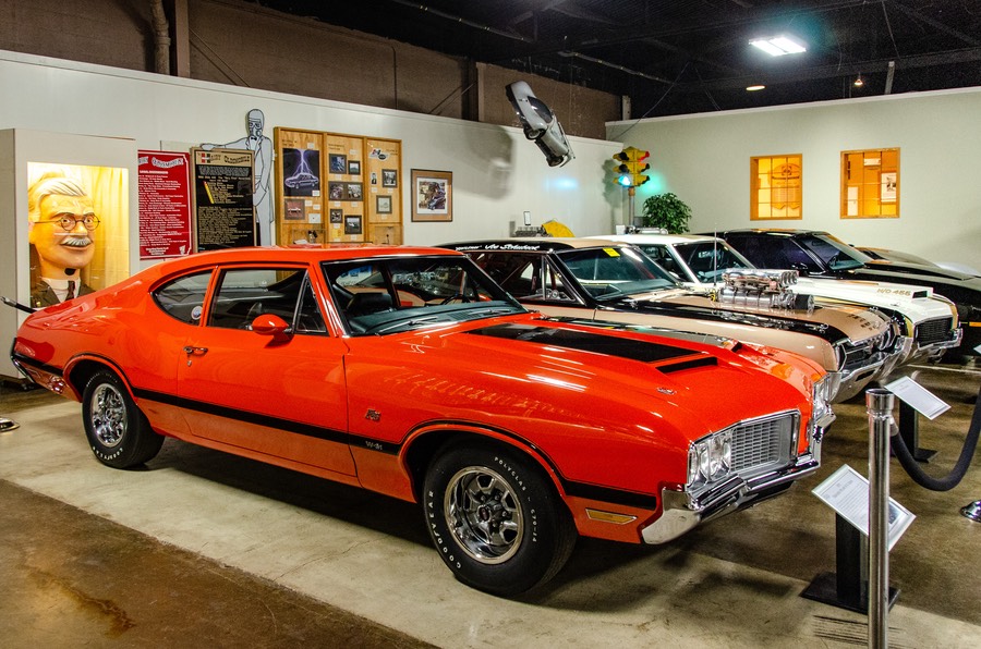
The Olds museum is a nice, low key spot that we had remembered fondly from an earlier visit. It’s still nice, but has suffered some from the addition of too many cars to fit the space and is now rather crowded. We suspect this is a recurring battle for many museums, as the collections continue to grow while the exhibit space may remain constant. Still, it’s a nice museum and a great place to learn about Randolph Eli Olds, who was the founder of both the Oldsmobile and REO companies. Lots of nice machinery to be seen here in Lansing.
The real find of the trip in terms of museums was the Gilmore Car Museum in Hickory Corners. This is an enormous collection of vehicles in a group of buildings spread out over ninety acres of beautiful, slightly rolling farm land.
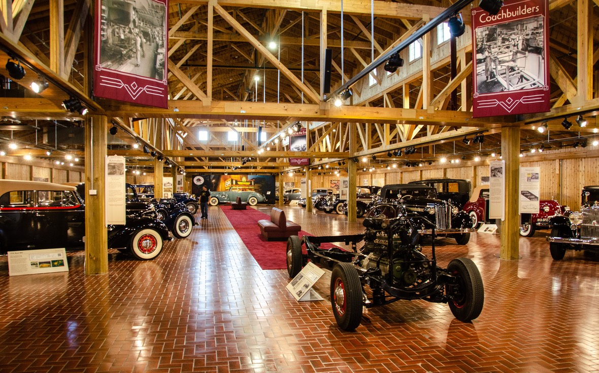
We spent about five hours over two days wandering through and could have easily used more time. The Gilmore houses cars from its own collection, plus providing space for separate displays from clubs and organizations such as Pierce-Arrow, Lincoln and a whole building set aside for Model A Fords. It’s quite an amazing site. The most special of the outside group displays was in the recently opened Classic Car Club of America exhibit. Wow! Both the building and the vehicles on display were absolutely stunning. It will take me most of the winter to process the more than 600 pictures Kathy and I took at the Gilmore, but in time they will appear on our motor-museums.com site. If you like old cars, you will definitely want to include this museum on your must-see list.
From there, we drove through Battle Creek, passing all the Kellogg buildings and the Post factory. You could smell the cereal baking. Rick had turned off “highways” on our GPS, so we were wandering through a lot of the smaller bits of the state. Rural Michigan is charming, full of trees and water and very green grass. We saw plenty of downturn, though; old cities that weren’t able to keep up, empty storefronts, stuff like that.
We crossed the Kalamazoo River for about the third time, accompanied as always by Canadian geese. A bit more color now, but nothing worth stopping the car for. Oats and rye were for sale in a farmyard, and there were mostly drying cornstalks in the fields; lots of farming operations were getting ready to do their winter plowing. The land had opened up and the fields were larger and flatter; lots of irrigation equipment standing quiet for the moment.
We drove through the small town of Sturgis, reminding us of infamous motorcycling events in South Dakota, and then we crossed into Indiana, noticing that directly ahead was the village of Howe. Every town was surrounded by more farmland. The towns in much of the Mid-West were platted some 150 years ago; each has had some development, but the farmland is generally still being used as originally intended.
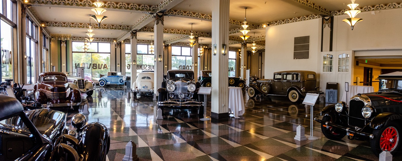
It was now early October, and we were headed for the small city of Auburn, home of the Auburn-Cord-Duesenberg Museum, one of our favorite museums anywhere. It is housed in the gorgeous, art nouveau-style former showroom of the Auburn factory, and a real treat to visit. We have spent some lovely time there, prowling around the cars and enjoying the atmosphere. Our earlier visits dated back to the ‘90s when our camera was not digital, so while we had lovely memories of the museum we had no photos to share. We were pleased to have gotten back where we could do a better job of photographing this lovely site. Again it will take some time for Rick to process the pictures.
Driving into the city, we were detoured around the town center because of a traveling circus, and the Women’s March. We didn’t realize the purpose of the parade, or we would have stopped and cheered them on. It was quite an event-filled day, and fun to see all the activity.
We spent a couple of days in Auburn, and would have stayed longer just to enjoy being there, but all was brought to an abrupt halt by the refrigerator deciding to stop working. That took a couple of days to sort out. Not a huge deal as it turned out, at least in part because we were only an hour from Elkhart, Indiana, where lots of RVs are built, and plenty go to be repaired. We found a refrigerator-specific repair shop maybe 50 miles from Auburn in Shipshewana, just outside Elkhart, and took off to get help. A new circuit board and a good cleaning of the area were applied, and we were back on the road. An interesting side of things was that the repair shop was in an Amish area, with plenty of horses, carriages and sheep. We enjoyed being there, and being in the area.
Oh, by the way, in Indiana a Party Shop is a liquor store. Who Knew?
Earlier, making up our route, we had decided to skip the Elkhart area, despite it being the home of the RV Hall of Fame and, more interestingly, the Studebaker Museum nearby in South Bend. We quickly decided to put Studebaker back on our list of stops since we were now in the area, but still skipped the Hall of Fame —figuring they probably wouldn’t have any Tigers so what good were they anyway (please don’t take that comment seriously!).
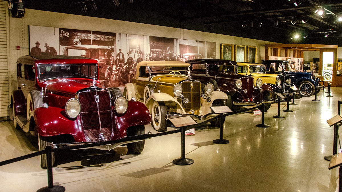
The Studebaker museum turned out to be well worth the time. It has been owned and operated by the city of South Bend since the demise of the Studebaker brand back in 1963. Back then, the factory donated the thirty cars it had in its collection to the city and they form the basis of the museum’s collection to this day. For a long time, Studebaker was a big deal car maker, with roots going all the way back to the 19th century when the Studebaker brothers were renowned makers of quality wagons of all sorts. Several Presidents including Abraham Lincoln had them and of course Studebaker was one of the main makers of the Conestoga wagons we all remember from our school classes about the pioneer days.
Studebaker cars developed an early reputation for quality and longevity, setting many long distance speed records; one car on display, a 1919 model Big Six, put on 475,000 miles in five years; an absolutely amazing accomplishment for a vehicle of that time and driven on the roads of the day. This information absolutely changed my thinking on what was possible back in those early days of automotive history. It’s always good to learn something new. So anyway, we are glad our fridge conked out and gave us a second chance to visit the Studebaker museum.
The cars were great, we enjoyed our visit and highly recommend this museum as a worthwhile stop for anyone interested. One of the things we liked about the museum was the sense of family throughout the premises. There were drawings and photos of some of the workers, and a mural on the outside of one of the buildings that showed a scene of 15-20 of the workers gathered around a car and perhaps a picnic about to get underway. It was great.
Right about now, we crossed the North/South Continental Divide, also called the St. Lawrence Divide, as we were heading west between Elkhart and South Bend. We don’t quite understand (Ha! Read this as meaning we have no idea) exactly how all these divides were originally established, we just report ‘em as we see ‘em. Check out the map we found that shows them all and then you’ll know as much as we do.
Along the road, a sign was announcing: FREE RANGE CHRISTMAS TREES.
Soon followed by another sign that, strangely enough, said: MUMS
PRODUCE
PUMPKINS
That one really set us giggling. We thought Mums produced children; different in Indiana? Ah, me, they’re getting silly again.
Indiana is a great state to wander in. It’s full of enormous old community cemeteries, farmhouses with verandas all around, and huge barns. The old towns have lots of ancient buildings and enormous trees. We traveled along the very pretty, small Indiana Route 19, zigzagging across the state through small towns and open fields, and passing by a turnoff to Mississinewa Reservoir (try spelling that 12 times without looking). Still not much color, though. The cornstalks in the fields are just about finished drying out. There are Halloween mazes alongside the road. In Winchester, Indiana plow day is October 23rd.
And suddenly we were in Ohio. We had friends we were going to visit in Indianapolis, but first we were going to duck across the line into Ohio to head for Dayton and the National Museum of the US Air Force. Still in the Eastern TZ.
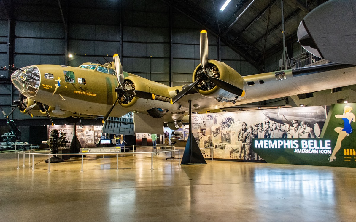
We’d visited the Air Force Museum waaaay back in our travels, maybe seventeen years ago. Back then our Motor-Museums website wasn’t even an idea, so we would typically just take a few photos for posterity. Rick really wanted to spend some time here in order to do this large museum justice, but it just didn’t work out for him. His back was really bad on the day so that he couldn’t even attempt to walk around. Kathy did the honors and went in by herself so that we’d have the photos we wanted to use in order to update the website. Later in the afternoon (a Friday no less) Rick managed to find a chiropractor who was open and could do a quick adjustment and that helped a lot going forward.
There’s also a Packard museum listed in Dayton, but needless to say we didn’t make it to that one. Next time. Leaving Dayton, traveling on the freeway for a bit, we spotted a sign saying we were leaving “Distracted Driving Safety Corridor” — what a relief! Or not? Some day we should write a book about highway signs we’ve encountered in our travels. Remember the one about… OK, we’ll stop.
Crossing back into Indiana, we made a beeline for Indianapolis and our friends there who also own a Tiger; we’d met at the rally in June. We had a very nice visit, including a bit of a gathering with a pair of soon-to-be Tiger owners in the area who have one on order and are hoping for delivery in a few months. It was a fun time, with good discussions, great food, and just enjoying their lovely garden. They have beautiful red fox squirrels!! And chipmunks. The squirrels were hauling mouthfuls of walnuts away to their nests.
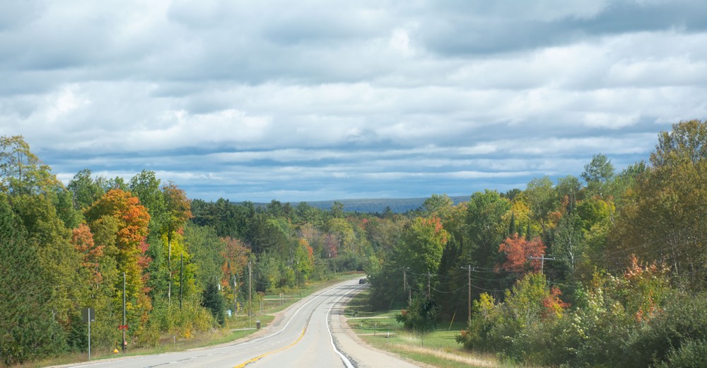
By now, we were heading towards Kentucky; as we got closer to the bottom of Indiana, the land got drier and browner, the crops pretty much all harvested, the fields barren by now.
And soon we crossed the Ohio River and into Kentucky. The two states are very similar in many ways, but quickly we found we had entered “cavern country” — the caves and open exploration areas were everywhere — and ready for you to COME ON IN. There were huge “adventures” available. We drove past Clarkville, home of Superman. If he were alive today, perhaps he would be inviting you to join him in exploring a cave.
As a side note, we have always been accustomed to stopping at visitors centers when we enter a new area or state, with staff to answer questions, give advice, and welcome you. These days, we find that the structures are still there, but usually unstaffed and with no pamphlets and maps available. It’s sad, and gloomy. But there still are restrooms available. Usually.
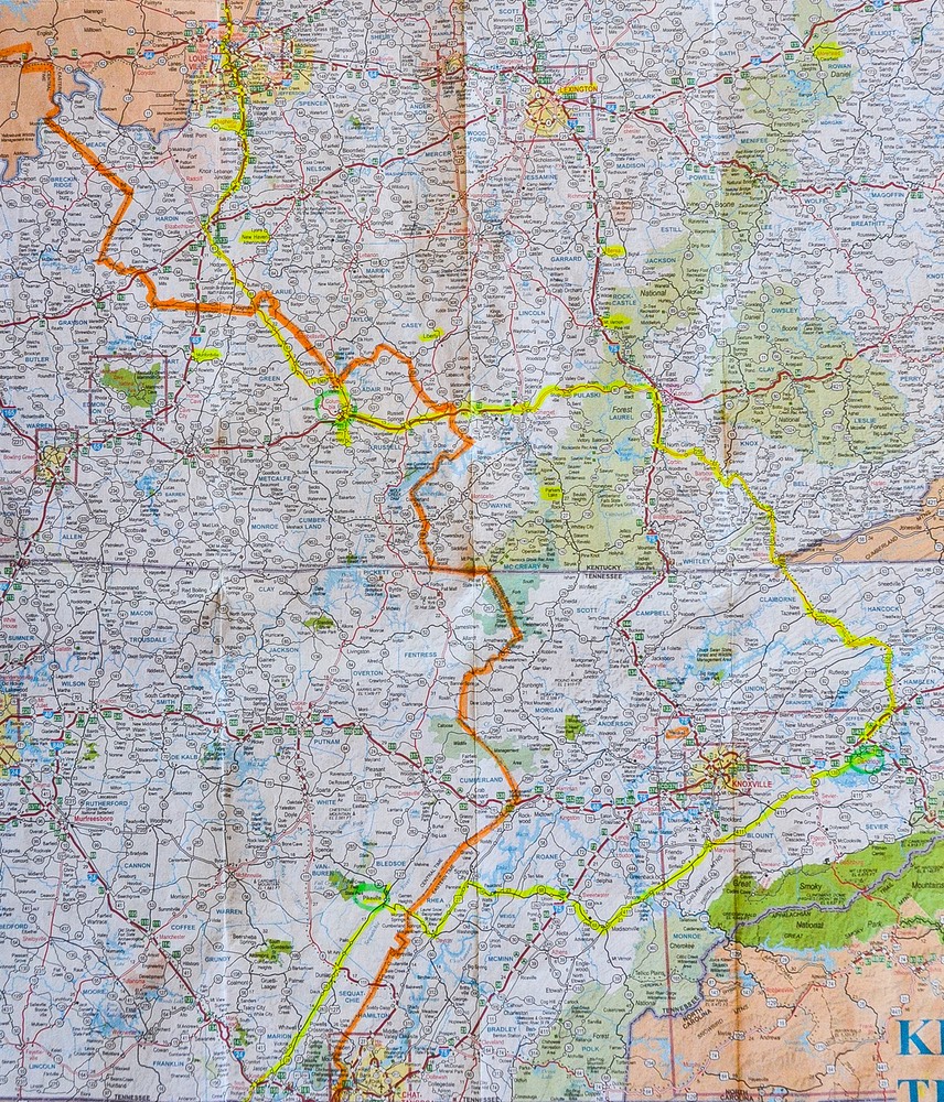
And here is where the whole Central-Eastern Time Zones thing becomes intrusive in travel plans. Looking closely at the map of Kentucky & Tennessee, the Orange line is the Time Zone marker dividing Central Time from Eastern Time. You can see how it wanders around from side to side as well as trending mostly North-South. Then the Yellow Line is the route we drove on this trip, and you can spot the Green Circles that denote the locations of the three visits we made with friends. OK, the Yellow Line Connects the Green Circles and in doing so it must repeatedly cross over ( AKA Dance Across) the Orange Line.
Got it? Good, ‘cause that’s the last time we’re going to mention it - maybe - probably not.
Right after crossing the Ohio River into Kentucky, we wandered through Louisville. They have a new toll bridge now, but it didn’t take much of a detour to skirt it by going over the perfectly nice old bridge and through some of the downtown area (which is quite pleasant). It was very quiet that afternoon as we drove on a bit, through an area of lovely farmland. And then we crossed the Orange Line once again and were officially back in the Central Time Zone!! Hooray!! We spent the night in a COE campground even closer to the line; some of our electronics had trouble figuring out whether or not to change their clocks, but once the panic died down, they all settled in.
The next day we spent hooking up with some school friends of Kathy’s. It was lots of fun catching up on old times, and learning about rural Kentucky, and they took us out to dinner at a splendid Mexican restaurant in nearby Campbellsville, Pepe’s Mexican Grill. Yummy spot.
It has been a very long time since we’ve traveled through this area, so part of our plan for this fall has been to explore some of these middle of the country states in order to see if we might like to find a new place for us to spend more of our time.
So we poked around a bit in Kentucky and Tennessee, thinking they might be possible choices. From Columbia we went further east on the lovely Cumberland Parkway, down through the Cumberland Gap and into Tennessee. We crossed the Cumberland River, went through the Gap Tunnel, and crossed the state line. It was a beautiful drive. Somewhere along the way we passed by Cowboy’s Mexican Grill and Pizzeria — something for everyone (?). Many parts of eastern Tennessee are just gorgeous, although if you get way far east, you begin to approach Pigeon Forge, home of Dollywood and who knows what else and pretty soon there are just way too many people.
So, back across the Orange Line. And lost an hour. We had plans to meet up with two sets of friends in eastern Tennessee. We first spent a lovely evening with fellow travelers who have settled down for a time in Dandridge, not far from Pigeon Forge; this is lovely country. It was fun to see them; it seems we’ve known them forever. They’ve bought a house, but have kept their travel rig; not sure what’s next. What I do know is that they’re delighted to have a bit of land around them… and a riding lawnmower. Pretty neat!
Cherohala Turnpike at Madisonville took us back into the Central TZ, where we regained that lost hour, and a visit with more friends who live near Pikeville, a bit further west and south, and not far north of Chattanooga.
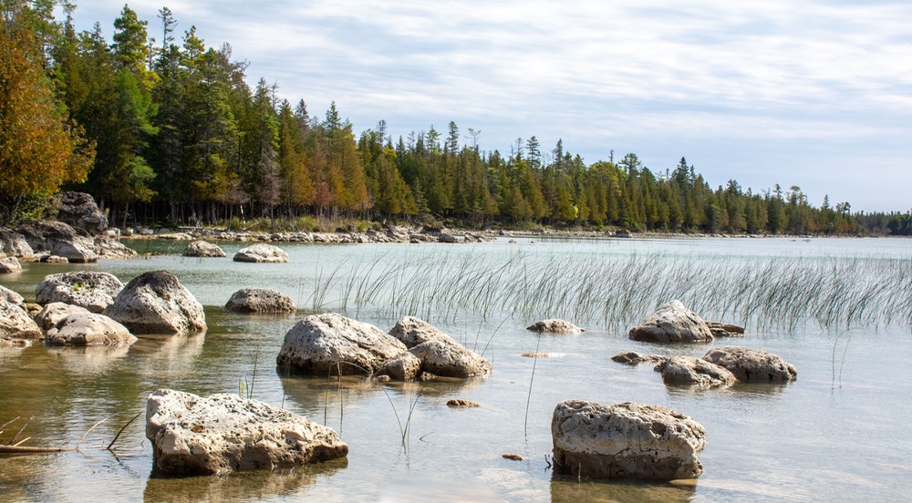
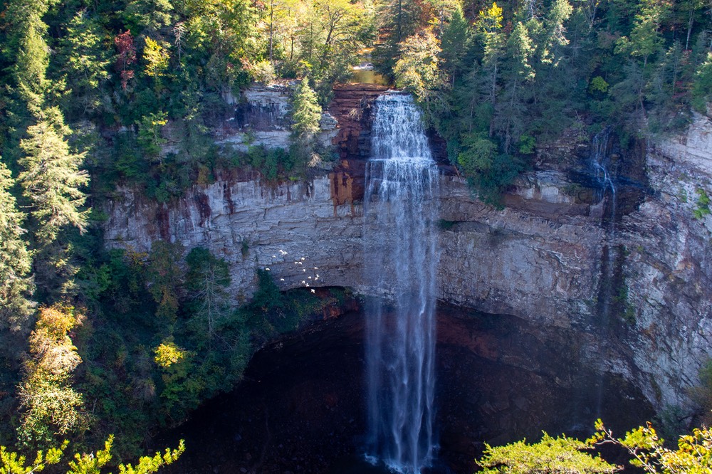
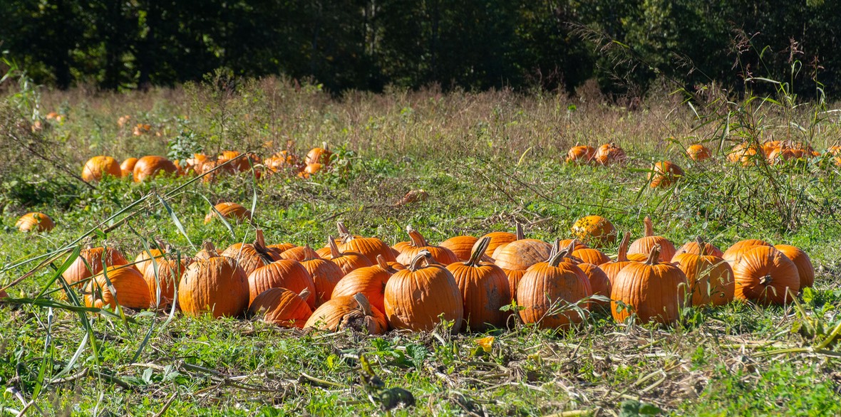
These are also folks we met waaaay back, at one of our earliest RV rallies; they took us on a drive to see some of the area, including Fall Creek Falls SP shown above. We continue to think that this part of Tennessee is a rather special place to visit. It’s full of open countryside and farmland and small towns with plenty of charm. Pumpkins are in all the fields. There’s even more fall color, perhaps because we have a little elevation now (almost 1000 feet!). And plenty of red squirrels. We love red squirrels; they are our favorites. There are Amish here, too, another really nice addition. We couldn’t stay very long, and had, in fact, adjusted another visit in order to get to them before they had to dash off on a sudden trip.
So off we went, dropping down into northern Alabama, where we rather quickly sensed a change. The countryside is still very pleasant, but had become drier and a little less interesting. We crossed the woodsy Black Warrior River Watershed south of Birmingham, then drove through the Talladega National Forest, both nice areas. There is a fair amount of logging going on in these woods, with plenty of trucks on the road, but still seems like plenty of forest left.
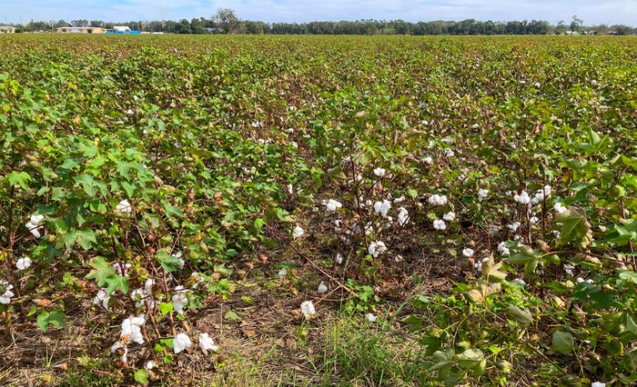
The kudzu is rampant wherever there is sufficient water nearby, and then, all of a sudden cotton in the fields. The area around Selma and Montgomery is a tad weary-looking, then further south things get greener and begin looking up again.
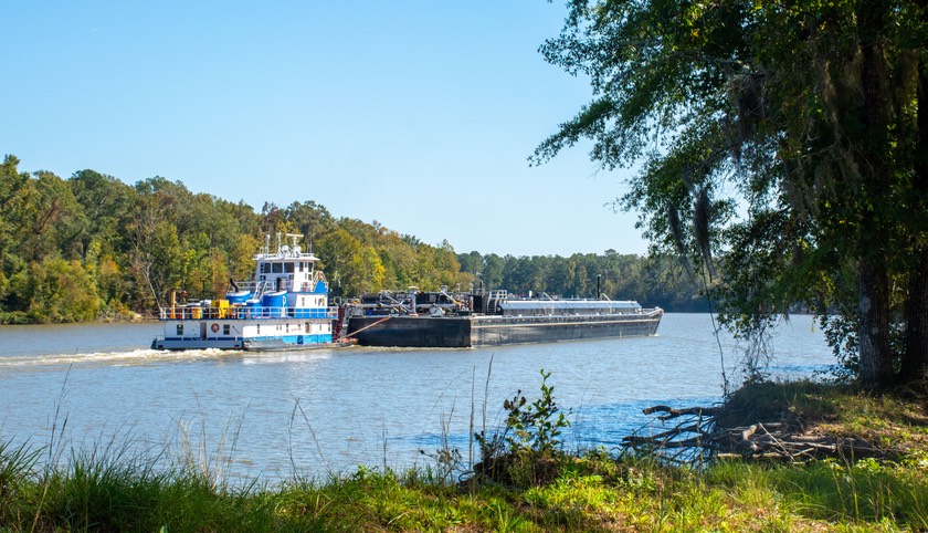
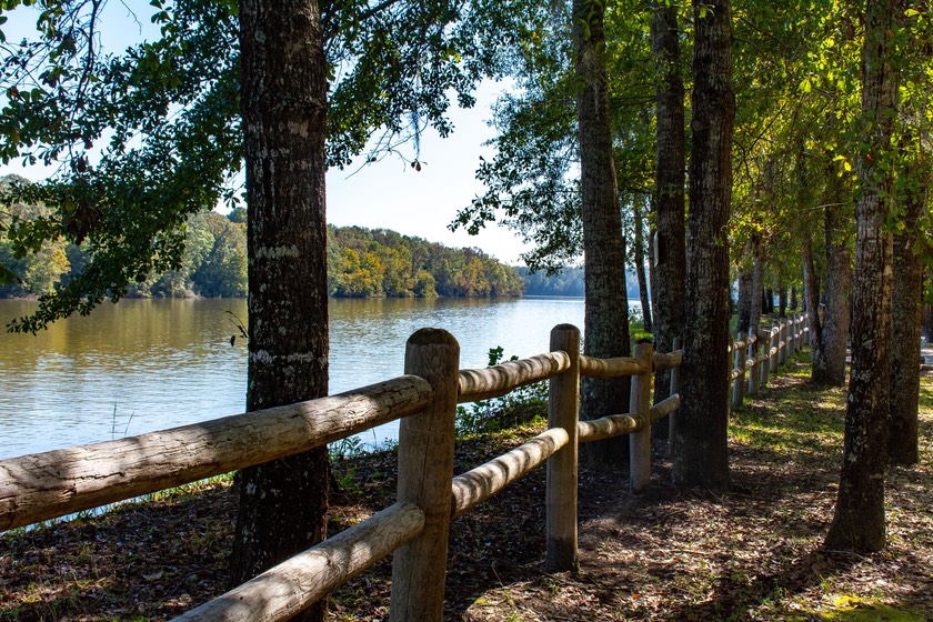
We reached our penultimate destination later in the day, a Corps park outside Coffeeville, sited right on the Tombigbee River, a major north-south watercourse that empties into Mobile Bay. We stayed here for about a week, watching the barges go by along the water. It’s very nice here, and gave us a nice spot to gather ourselves, finish up some work that needed attention, fit in some rest and recuperation following our many visits — and prepare to move down closer to the Gulf Coast, to the campground where we have spent a fair amount of time over the last two winters. On arrival, we would collect our car and little utility trailer and head for the Rainbow Plantation near Summerdale.
And now we are settled in. We like the Plantation; there’s still plenty of cotton in the fields, the magnolia trees are starting to bud out, and the nearby Fish River is just as lovely as ever. Before too long, the pitcher plants will be blooming in the Nature Reserve down the road.
And so, we have completed our major traveling for 2021, and will spend the winter working on photos and making plans for what’s up for ’22. We are hoping to spend as much of next year as possible in Canada. The current discussion is whether or not we can see the whole country in just one season, or if it will take us two years to do it all. And where to go first? Our kind of talk! Keep in touch to get all the answers. And, if you end up in southern Alabama over the next few months, y’all stop on by! We’d love to see you, and we’ll take you on over to the Biscuit King one morning for breakfast.
Rick and Kathy along with Tiger and Friends
Yes, you will want to visit our Photo Page for this story