February 2009
Josh Aike
Patagonia Part 2: Live from Argentina’s infamous Route 40, La Cuarenta
Josh Aike (Hōsh Ah-EE-kay) --- a place of wind. Truer words were never spoken. We’ve seen Patagonia from both the east and west sides now, and whichever way you look at it – it’s windy. But I’m getting ahead of myself. Let’s pick up as we leave Ushuaia.
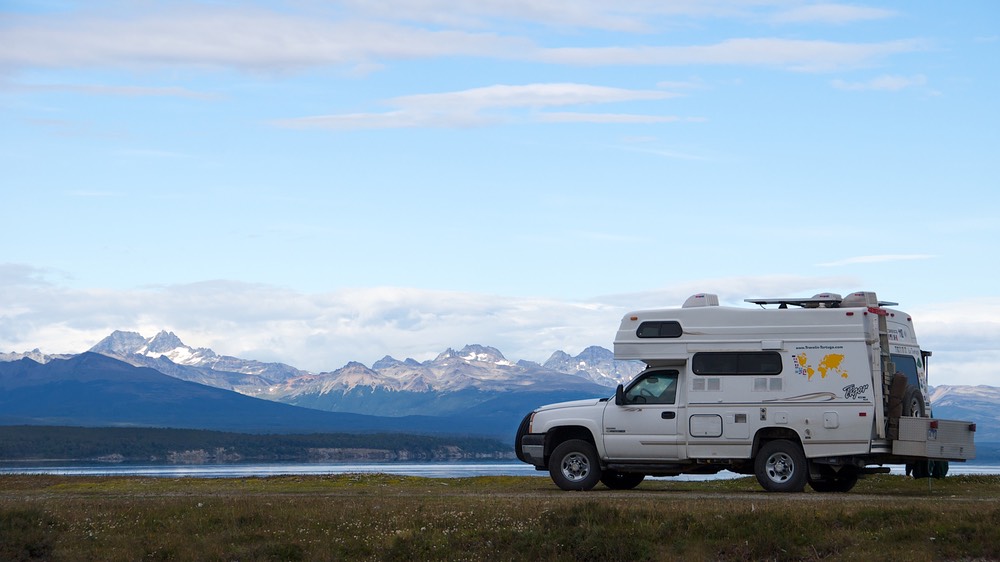
And… Well, golly, after you’ve been to the end of the road, what do you do next? Turn around and head back up the hill, of course. And that’s what we’re doing. It was with a certain degree of pride and more than a little relief that we were no longer on a schedule (we certainly would have felt terrible had we missed meeting the cruise ship when it docked in Ushuaia) and a great feeling of anticipation that we steered our course toward Chile’s Parque Nacional Torres del Paine, by reputation one of the most awesome sights in the Western Hemisphere.
First we wended (went?) our way back out of Argentine Tierra del Fuego, back up the road we had come down about 10 days earlier. We stopped for a couple of days in Tolhuin, parked beside pretty Lago Fagnano, while we caught up on computer work and sent messages from the delightful bakery in town (La Unión). This required more than one visit, of course; boy those pastries are good!
We entered Chile by way of the tiny little dirt road crossing at Paso Bellavista. It was a hoot. You travel across several miles of estancia country, surrounded mostly by cattle but some sheep, and guanacos by the yard, until you reach this bar across the road, with a couple of small buildings nearby. Rick found the guard and they took care of the paper work, then the guard started poking around, looking for the customs agent. Finally located, that took another minute; then the guard raised the bar across the road and we were through. Cool.
Then you come to the river crossing. We had been warned that this river (Río Rasmussen) can be very high, and somewhat dangerous. But we had no problem; the water only came up to about the middle of our tires, and we were followed across by a German couple in a rented pickup.
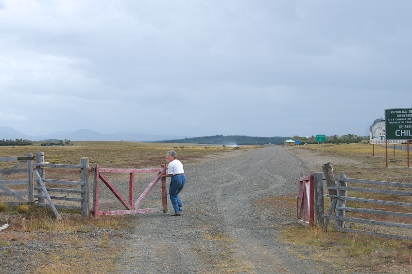
A couple miles further on we came to a wooden fence, with a chained gate. Beyond the gate was a sign saying “Welcome to Chile.” Jiggling the chain, and moving the gate around, Kathy figured out how to get it open, swung it wide, and Rick drove the truck on through. We were back in Chile. We called this the “Do it Yourself” border crossing.
Then we came to customs (home of the B.B.s, you will remember). And this guy was more thorough than any we had seen before. Damn! But rest easy. By now we had given in just like all the others, and were carefully hiding all of our fruits and vegetables, cheeses and eggs, and anything else we thought they might be interested in. This really goes against the grain with us; we are responsible people and not fond of trying to outwit officials; but you know the history of this situation and we hope you will forgive us.
Other than the B.B., we were done and gone in just a few minutes. Soon we left estancia country behind and entered a pretty forest which led us to our destination, lovely Lago Blanco in a remote corner of Chilean Tierra del Fuego. We met up with some buddies, and had a nice evening comparing notes of where we had hidden stuff, how he had looked under our mattresses even, and how intrusive it all had seemed. The night was cold, with a sharp wind coming off the lake. There was a nice sunset, perfect for a walk before dinner, and then we settled in for the night. The next day we went on, but the others stayed behind, eyeing a volcano that they thought needed to be explored. Our road was in good shape, pretty for the most part, and certainly full of guanacos; we even crossed an area called the Pampa Guanaco. In this area it seemed be the time of the year that was shortly after the babies were born, as they were everywhere.
Our intention was to drive to Porvenir, directly across from Punta Arenas (PA) along the Straits of Magellan. At this town, you can take the “long ferry” directly across to PA, or travel alongside the water to where we had taken the “short ferry” a few weeks earlier, and then down the other shore of the Straits to get to PA. (Geography lesson: remember that TdelF is a group of islands. We needed to get to the Chilean mainland, by one of these ferries, in order to continue our trip.)
We knew we were short on Chilean funds, and planned to hit the ATM (there’s only one) in Porvenir. Ah, no; Mr. ATM wasn’t pleased with our choice of cards and wouldn’t provide any largesse. Without more cash, we felt we were short on fuel for the long trip up and then down the other side. The Porvenir ferry was happy to accept Argentine funds we had in reserve (yes, by now well hidden from possible thieves), so we sprung for the more expensive ferryboat ride. And as it turned out, the long ferry wasn’t much more, given the mileage to go the long way around. So neato.
The ride was very nice; the ship left about 6:00 at night and the evening was very pretty. Dolphins kept us company for part of the way; the sharp wind finally drove us back to the truck, but the fresh air had been very nice. The water was smooth and the trip uneventful. We spent the night in the ferry terminal parking lot, with no problems.
Why Punta Arenas? It’s the biggest city in the area, has several old mansions/cum museums to visit, has an actual grocery store or two, and is a duty free port (Zona Franca). We enjoyed it all. We were able to take care of some purchases (new windshield wiper blades – aren’t you excited?) for one thing. We’ve been in the boonies for long enough to have some needs.
Punta Arenas is a nice city (about 115,000 people, biggest around here). The people are friendly and don’t seem too harried. There are several nice neighborhood parks, including Parque Antoine de St.-Exupery, named for the French explorer and author (Le Petit Prince); it has lots of child-sized replicas of old cars and airplanes. Among the museums, we were most impressed by the Naval Museum. It had lots of interesting exhibits, a historic photograph of the day the Great White Fleet came to town (1908), and was in pristine, very-ship-shape condition. But the coolest deal of all was a film showing footage taken in 1929 by a fellow who worked as a seaman on a huge sailing ship going round the Horn. The film was narrated by him, in a 1980 oral history, and was incredible. The ship, one of the last pure sailing cargo carriers in operation, was enormous and this fellow climbed to the top of the masts to show the violent movement of the ship in the storm and the water rushing over the decks far below… absolutely riveting and of particular interest to us confirmed readers of Patrick O’Brien’s series of novels following the career of British naval captain Jack Aubrey during the Napoleonic Wars.
We spent a couple of days south of town, wandering down the “southernmost road on the continent.” This is pure foolishness, says Rick. Falsely pretentious, as Tierra del Fuego extends far below the continental mainland. But it was a lovely drive. We passed a large number of fishing boats, all in drydock and looking like they hadn’t been out to sea in years. We wondered if this was a permanent condition. The coast south of PA is very nice, unspoiled and attractive. As we got further south, the forest became denser, and we arrived at Fuerte Bulnes and Pointe des Hambres. Pointe des Hambres is where an early group of Spaniards arrived in 1580 in an attempt to claim the area for Spain, and most of them died very soon (hambre means hungry); you can guess how they perished. Much later, Chile sailed down and took possession of all the area, and built a fort for defense purposes. It’s a nice area and lovely to hike around in.

The weather here is very changeable. Squalls come through frequently, followed by bright sunshine and rainbows, which are always very low in the sky, presumably because we are so far south, ‘though we don’t recall the rainbows in the far north being like that. Whatever; if you want facts you’re probably in the wrong place. Observation, opinion, or our favorite word… surmise, we’re your team. If you feel the need to get the straight skinny, Wikipedia is probably a better bet!
I found a good green grocer in PA and was able to stock up on fruits and veggies – and some homemade rhubarb jam. I remembered that the last time I’d been able to buy such a thing it was in Alaska; I’ve now bought rhubarb jam at both ends of the Western Hemisphere! Rick couldn’t figure out why I’d bothered the first time, and definitely thinks it was a waste of time this go-around; the man has no taste.
Incidentally, in case you think we’ve forgotten – on the appropriate day, we wished you all, and each other of course, a happy Dia de los Enamorados.
Several days later we finally got out of town – all of about 10 miles up the road, where we settled for the night along the shore of the Straits (of Magellan of course, you silly goose; did you already put your map away?). Just us and about 3 million South American terns. They were fun to watch, if noisy, and kept us good company. When it got dark (about 10:15) they all went to sleep, as did we.
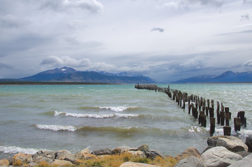
So off we went, to Puerto Natales, where we again spent the night along the water, this time the Seno Última Esperanza (Last Hope Sound); this time we were watched over by a flock of black-necked swans. They were so beautiful! We understand they are very common in the area.
In case you are wondering, we decided to skip the Cave of the Milodón, where a Pleistocene Era sloth was found. Couldn’t drum up enough interest between us to go down that road (and go see the site). But we did take a picture of his statue at the entrance to the town of Puerto Natales; that will just have to do. You want more? Come on down and check it out, or at least see the photo on the photo page for this story.
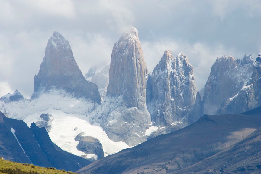
The next morning, bright and early, we headed up the hill to Torres del Paine (we were curious as to how this is pronounced; it’s easy, kind of like it would be if it were in Canada… pine-eh… no question mark sound at the end though) National Park, a highlight of anyone’s visit to Patagonia. It was raining, of course. Torres are towers. So towers are what you want to see, but they disappear in the mists much of the time so it can take some patience. Torres del Paine NP has these magnificent granite formations as the centerpiece of the park; there are towers as well as horn-shaped peaks (cuernos); they are dramatic and overwhelming. These formations are younger than the Andes, and not part of that chain, although geographically they sit at its foot.
Shortly after entering the park the weather cleared to a large degree, and we got splendid views of the towers along the road to Laguna Azul, along with a zillion guanacos intent on eating their way through the day and not at all concerned about our presence. So we got great pictures. Over the next two days, it mostly rained and we were never able to equal our first afternoon’s experience. But rain occasionally turned to mist and we did get some interesting views of the cuernos.
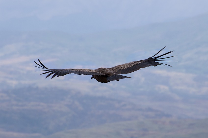
We very much enjoyed being in the park; it’s quite lovely, with many glacier-fed lakes, mountain peaks, and even a resident glacier to go and check out (you can even walk out on a strand to visit it up close and personal). The park is also full of tiny wildflowers of many kinds, as well as charming wild fuschias. (would someone please let me know if that is spelled right?) There were condors, including a large group that rose into the air right in front of us one morning; they circled on the thermals for quite some time and we were able to really enjoy them. (A digression: are they still called thermals when the temperature is only about 50 degrees?)
In case you are wondering, it’s true; we now have so many guanaco pictures we have sworn not to take any more unless one of them comes up and offers to shake hands.
Eventually we decided it was going to rain forever, and we moved on, out of the park. We crossed back into Argentina at the tiny border crossing of Cerro Castillo, out in the middle of nowhere. Turning north, at the first settlement we saw our first stand of poplars, a welcome sight. We had been enjoying them in Argentina, and didn’t realize they had disappeared from view until we saw them again. We were delighted to find them this far south.
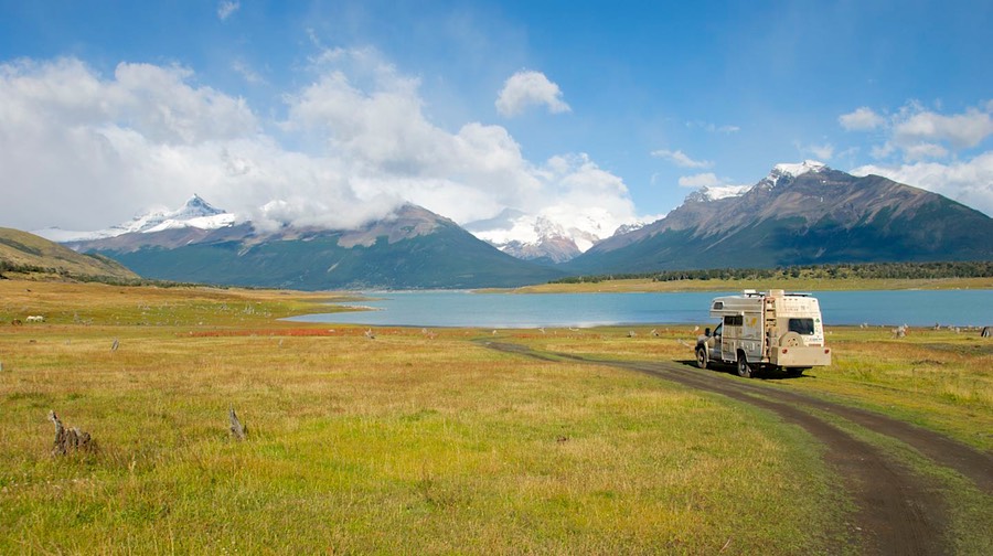
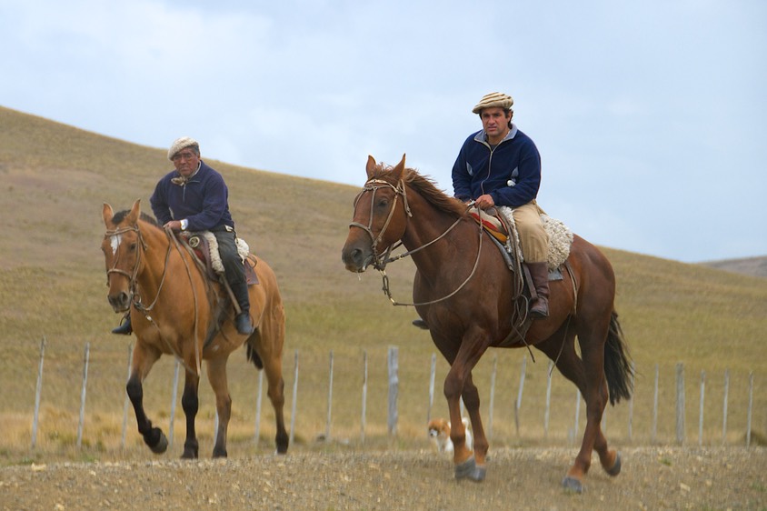
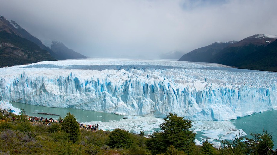
Next stop, El Calafate and Los Glaciares National Park. About 30-odd miles west of El Calafate, Los Glaciares is a huge park, and much of it is under ice. Cool! There are many glaciers, hiking trails, and one enormous draw: the Perito Mereno Glacier, which you can get quite close to, close enough to hear it breathe – and sigh – and break off little bits. Glaciers are neat. Überlanders like to spend the night in the parking lot nearby. We contented ourselves with a daytime visit, and spent our night in an area down at the end of a rough road that gave us stunning views of the mountains across an arm of the lake. We had the area to ourselves, except for some lovely grazing horses who allowed us to take their picture early the next morning.
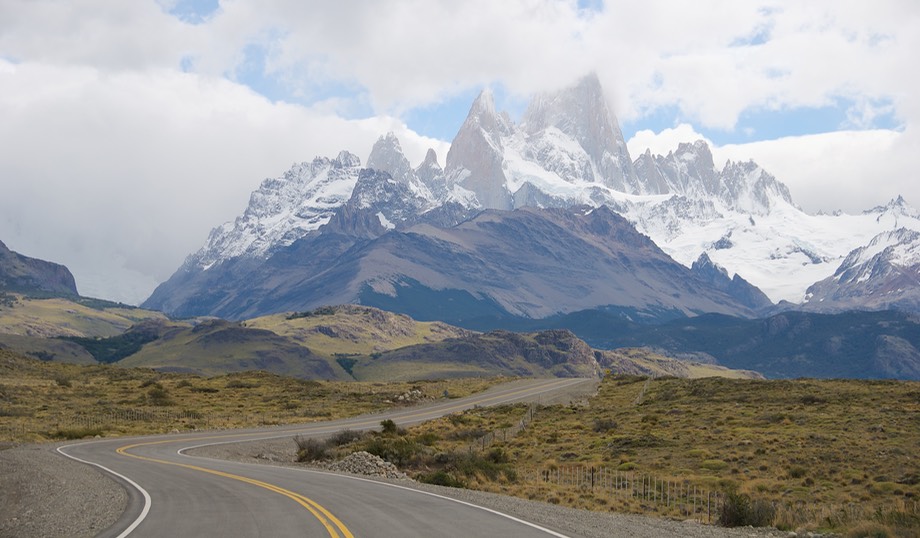
Too many folks for us in this part of the park; bumper to bumper traffic in parking lots just isn’t our style. And we hadn’t been impressed with El Calafate: too many folks, too expensive, and kinda with an attitude problem. But we knew there was another area, further north but still in the park. It’s the Fitz Roy sector, and wow!
To get to the Fitz Roy area you go back out to El Calafate, then east to pick up Rte 40, and up north a ways, then in to El Chaltén. Along Rte 40, by the way, there is a famous spot, La Leona Roadhouse, well spoken of for their pie and torte, but most famous because of visits by Butch Cassidy and the Sundance Kid. The place dates from 1894 when a ferry was established to get across the river. The lemon pie definitely lived up to its reputation.
After filling our faces at La Leona, we headed on up the hill. Now the best part of this whole drive is driving west into El Chaltén. As you drive along, Fitz Roy himself looms up at you, and you just get closer and closer. This mountain is enormous, and it sits there all by itself, inviting you to come and visit. It’s really not all that big, only about 10,000 feet, but the town is at about 400 so the peaks are a long way up. The town isn’t all that much, but it, too, is friendly; we found the best pizza we’d had in months (fresh tomatoes, ham, onions and – hang onto your hat – rocquefort cheese); dynamite!
As we drove into town we spotted our old friends Yasha and Jürgen, fueling up before leaving town, and they joined us at the pizza place (Chocolatería Josh Aike) in time for pie and coffee. We caught up on the news, they hit the road, and we headed further into the park to go exploring. We shortly ran into this amazing couple, from San Francisco. They have been living in their car (with a tent so they can camp in favorable weather) for the last 18 months, as they have traveled south from the United States, essentially covering much of the same ground that we have – but in a car, mind you. Astounding! Quite heroic, actually. We had a lovely long chat, and then parted. They are headed further south, to Ushuaia, so quite likely we won’t see them again. Must look them up when we all are back in the States.
The next day we were heading out of town, looking for new adventures, when we stopped to talk with other familiar faces (there’s only one road down here to see everything; once you meet someone, if they are also traveling clockwise, you are bound to see them several more times). They told us that about 30 miles out of town Yasha and Jürgen were stranded at the side of the road, with mechanical trouble. We did, indeed, shortly come up on them. We stopped for awhile, to commiserate. Yet another couple had shortly arrived, and they were getting ready to tow Yasha and Jürgen back into town, where the local mechanic would hopefully be able to take care of them. We all hugged, reminded ourselves that none of us were secure from the possibility of similar trouble, crossed our fingers and went on. (Yasha and Jürgen were able to get a quick fix and were back on the road the next day.)
The next possible interesting stop was to be Perito Moreno NP, although no one knew much about it. We trucked up Rte 40 to the turn, and even went in a ways; but it all looked very familiar, and not really exciting enough for the long detour, so we eventually turned back to La Cuarenta.
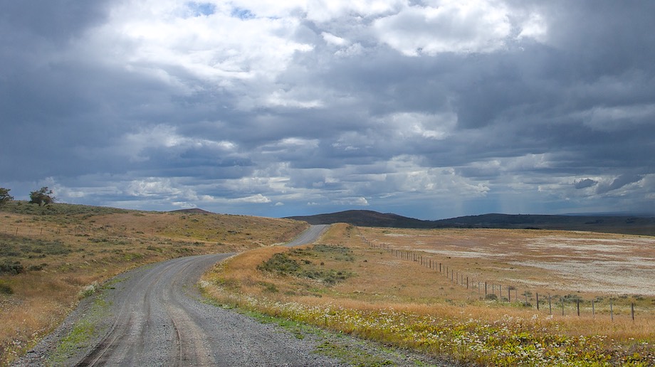
And ya know, this road really is pretty boring, and even pretty bad in places. Short distances would be paved, and then it was back to the old rocky ripio (their version of wash-boarding that goes on forever). At one point Rick was entertained enough by what he saw in the road to turn around, go back, get out his camera, and take a bunch of pictures of – a dead hairy armadillo. (“You’ve got to be kidding,” I said.) Just as ugly as the ones in Texas, but with a furry belly.
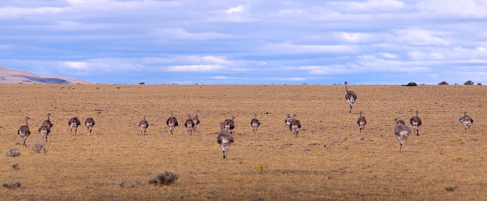
Two things going for this area: incredible sunrises and sunsets (they last forever and take over the entire sky – 360 degrees); and rheas. Now your rhea is more fun than the average bird. They look like small ostriches. They don’t fly. They flap and run around like crazy; I think we’ve mentioned this before. Rick says they remind him of a housewife in bathrobe and curlers, scurrying off because she isn’t dressed.
We still are traveling north on Rte 40, but a bit further east of the mountains, in order to check out the Cuevas de Las Manos UNICEF site, an interesting early (about 7,000 BC) cave that was decorated with hands (and some animal pictographs). Well, no one told us they had increased the entrance fees to such a sum (up from 5 pesos to 50 pesos) that we didn’t have that kind of Argentine money left, since we were headed for the border. Being out in the middle of nowhere, there were no banks within 50 miles. Wouldn’t accept Chilean money, either. So we regretfully had to pass. This was a genuine bummer.
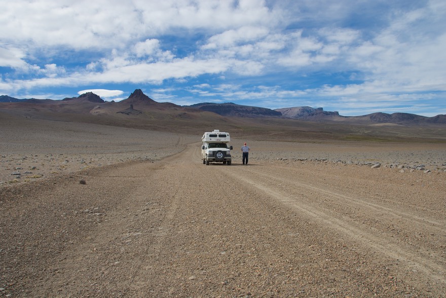
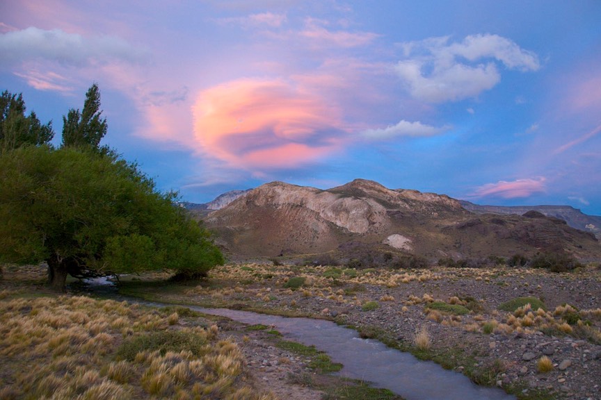
From here, La Cuarenta keeps heading north as far as the town of Perito Moreno, then you take a paved road west for Los Antiguos and the Chilean border. But….there’s another route, and that’s what we took. We headed west on (unpaved and nasty) Rte 41; you end up smack dab back up against the Andes. But this part of the Andes is different. It’s much lower here, no glaciers, no snow-capped peaks. Looks a lot like the lovely national parks of the American southwest. It was quite fascinating. Then, when you reach the mountains (and basically are right next to Chile), you turn north on Rte 41, and beat your way up to Los Antiguos along the base of the mountains.
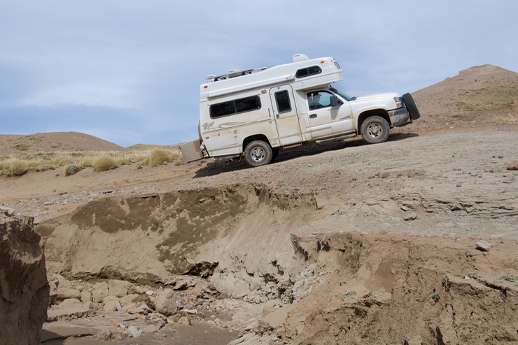
It was grueling, but quite marvelous. Not for the faint of heart, but we enjoyed it immensely. Along the way you travel through highland meadows and wetlands, badland areas and some forest; at one point we were almost up to 5000 feet; it was quite a journey. Only one really awful spot where the river had totally taken out the road. We were concerned, but others had “developed” a new road that drove over some (very) large boulders. Rick drove it while I took pictures of him at a wild tilt. Afterwards, I discovered that this is officially a 4-wheel-drive only road; so take that as a caution if you start looking into it. The main thing for us was that there is a huge difference between slogging along on an endlessly washboarded highway with nothing of interest to see and picking your way slowly along a difficult road surrounded by beauty. We really enjoyed this road a lot.
Well, after a couple of days we finally arrived in Los Antiguos, and were pleasantly surprised. For southern Patagonia, this town looked out of place. It was more like a valley town in northern Argentina (maybe a small version of San Rafael?), or even one of those tiny California Central Valley towns (like Ceres). Quite warm, very open and friendly, with a rec center where the kids were playing basketball. This area is a small banana belt in southern Patagonia, and fresh fruits are plentiful in season. They have the national cherry festival here early in January. We bopped around, enjoying the warm sunshine after all those weeks in a much colder climate.
Then it was time to head west, cross the Río Jeinemeni and the border, to Chile Chico (in Chile, of course). What would Chilean Patagonia have to offer us?
We are certainly enjoying our time in Patagonia – thoroughly. It is, however, hard work. The roads are bad, and often tricky. The distances are long. We cannot stay in touch very well; internet is scarce and often unusable when located. But the views are terrific, the people we are meeting are super, the weather has generally been as advertised, and it’s all worth it. You need to come and see!
Rick and Kathy and La Tortuga, still going strong.
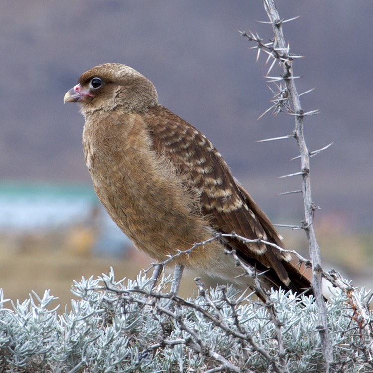
(I can’t close this message without one last picture. It used to be that I took all of our pictures, but about two years ago Kathy started taking some too and over that time more and more of her photos have appeared in our messages. The beautiful hawk below is one of them. Ed.)
Click the link to see more photos from Patagonia, Part2.