June/July 2021
Farenheit 105
The Search for Cooler Weather in the Rockies
As you can tell from our title, it has been Hot, Hot, Hot here in the Western USA these past couple of months. And anyone who knows us knows that we don’t really like hot weather all that much. As a result, during much of this message you may find that we return to this theme of things being just too darn hot for comfort, together with our ongoing search for cooler temperatures. You will recall that the western US has indeed been much hotter than normal for much of the past month or more and is still struggling through that condition. But, and we want to stress this as much as we can, for the most part we have been able to find those cooler places and have been able to cope fairly well, continuing to enjoy our travels most of the time. High temperatures aside, we’ve enjoyed generally very good weather, and as you will see from some of the photos, in mid-June we even had some clouds and a bit of rain.
Fortunately for us, it seems that for whatever reason, the wildflowers of the Rocky Mountains are having a banner year, particularly at those very same high elevations where we’ve been hanging out whenever we can. So along with the occasional hot, dry, uninteresting day — such as the recent drive across northern Wyoming that inspired our title — we have also experienced some extraordinary beauty. Mountain views, isolated camping spots, grassy meadows and blooming wildflowers of all shapes, sizes and colors. Plenty to enjoy along the way.
In our last message, we left you after the Tiger Rally north of Leadville, Colorado, sort of mid-June. After we cleared our desks of the aftermath of the gathering and caught our breath after a few days rest, we started wandering in Colorado and New Mexico, spending several weeks doing our best to enjoy ourselves at cool, high elevation. We had found a map showing several of the “best” passes to climb over in the Rockies and wanted to check out a bunch of them.
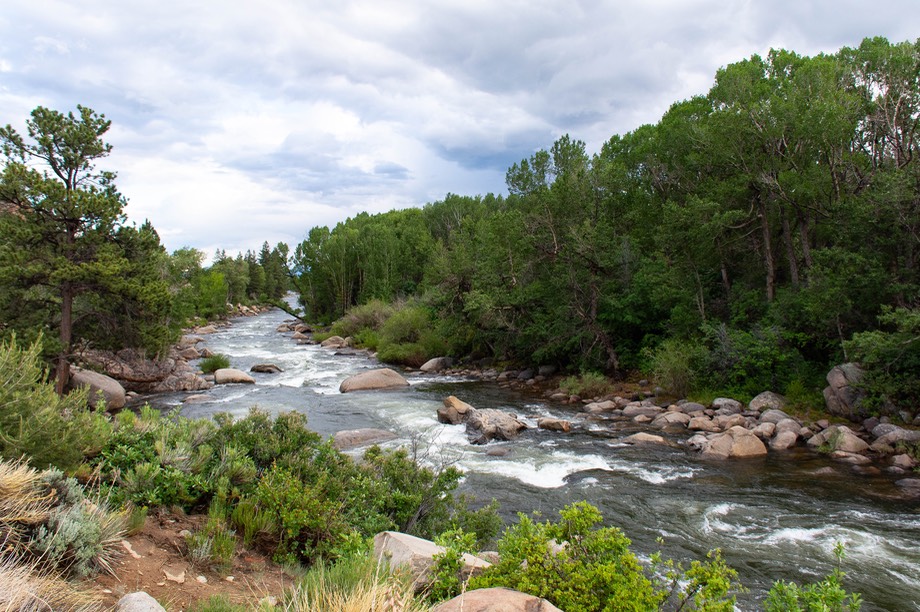
We started out traveling next to the Arkansas River north of Buena Vista, and camped alongside it. We were near a take-out spot for kayakers and rafters. No surprise, it was a very busy area, but the river is lovely and we enjoyed a quiet night — after dark all the adventurers have collapsed for the night and we had the place to ourselves. Oh, and we now know what happens with old, retired school busses — they are used to haul people and equipment to and fro along the rivers. If the busses could talk, I suspect they would express real pleasure in their current job.
Before heading out into unstructured wandering, we had decided it was time to mail our passports in for renewal. This was a bit of a decision — and also a bit of a headache. Our passports expire this year, although not until almost Christmas, but we knew that they would take some time to process and we didn’t want to get caught being ready to set off on an adventure (well, at least into Canada!) but still be missing our documents. And would we need them if we went to Mexico over the winter? So now had to be the time. There were hassles getting “proper” photos taken, getting forms filled out, etc. But finally, they were mailed, and we’ve at least received notification that they’ve arrived in Philadelphia. Even now, as we write this about a month after we sent them in, we are reading news articles warning travelers about the extended processing times needed this year due to high demand. Wish us luck.
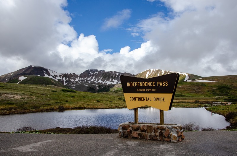
While heading toward Independence Pass and the Continental Divide (12,177 ft) we stopped for a minute to check on how many different crossings we were making this year — it looked like 7 different places were in our plans. Not too shabby. The Continental Divide may not be as big a thing as it once was, but just stop to think of what it means in this country: the Continental Divide does just that — it separates the eastern part of the United States from the west. All water flows to the Atlantic, the Pacific, or the Gulf of Mexico, and the top of the Divide is the (duh) dividing point. Of great significance to the explorers who developed our country, if perhaps not so much to modern day travelers. Even after our many years of travel, we still think it’s pretty cool.
When we reached the top, we stopped for a bit to enjoy the moment. It’s a lovely spot, surprisingly arctic looking, with cairns, a bit of remainder snow still at the melting stage, and all very rugged and dramatic.
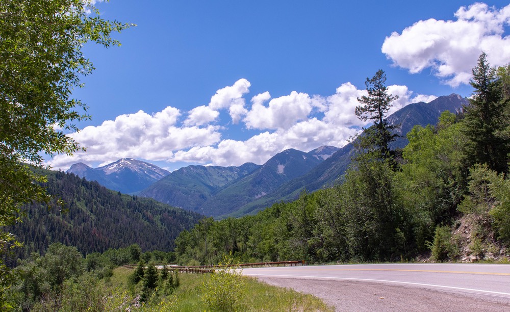
West of the Divide we dropped down into Aspen, whose wild and crazy commercialism never fails to startle us as we drive in out of the wilderness. We survived, and spent the night further south, in Carbondale, named for its mining history. Despited its mundane sounding name it is actually a charming historic village. We continued south through Redstone, a cute little touristy spot. Its main attraction is the Redstone coke ovens, used back in history to make — you guessed it — coke, which they used in to burn impurities out of the coal they were mining. We wandered the area for a bit before continuing south and climbing out of the valley on beautiful Hwy 133.
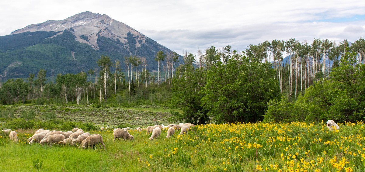
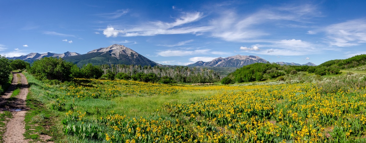
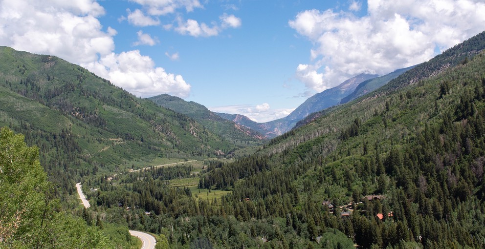
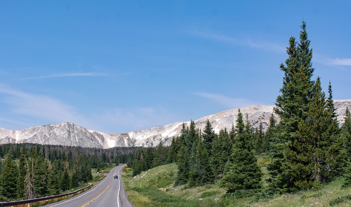
Below Redstone, we turned east on unpaved Colorado route 12 towards Keebler Pass. This is a great road. We found a terrific spot high off the road bed and spent several days enjoying the quiet beauty of the Rockies. The top photo of this message shows the view from near out site. Just before leaving there, we watched a herd of sheep wander past, encouraged along by two huge white sheep dogs. They settled nearby in the middle of a field of yellow daisies, disturbing the chipmunks but little else. By the way, the chipmunks rule, up here. Tiny, but mighty! They gave us a lot of company.
We really like being at high elevations — 8,000 feet is about as low as we want to go in mid-summer in the US. But something that I keep forgetting is that up here using the oven for baking can lead to a fair level of frustration. I’ve read and taken notes from articles talking about adding and subtracting this or that, based on every 1,000 feet above 3500 feet that you travel. Yeah, well, maybe; and good luck. But I keep working on it. Some really funky looking (but still tasty) chocolate chip cookies have set off this current tirade — check in with me later!
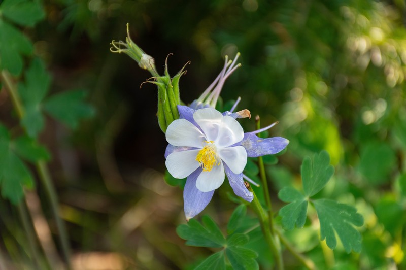
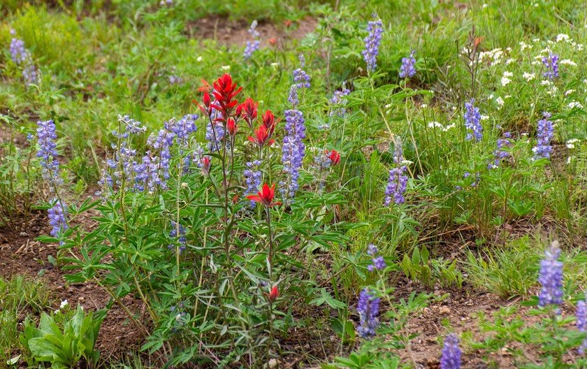
One change we’ve noticed since last summer, here in the Rockies, is that there seems to us to be less snow. The mountains this year are pretty bare, whereas last year, even in mid-September we were seeing tons; and even got snowed on ourselves. We may be reading too much into this, but still... But, and it’s a really big “but” — the wildflowers are incredible! All summer long, we are seeing gorgeous flowers around every corner. They arrive later in the Rockies than at lower elevations, and their summer flowers are our spring blooms down closer to the coasts. A total delight.
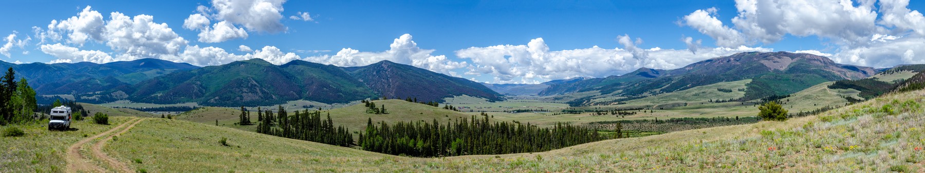
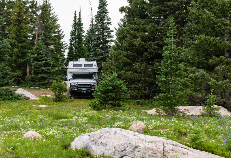
We dropped down into Gunnison, enjoyed a terrific lunch at a local BBQ joint, then wandered down Highway 149, a long winding lovely piece of scenery, through Lake City, and then up over Slumgullion Pass (11,579’) then over the Divide (10,898’). This route is a new favorite for us; absolutely super, and you can camp along the way. We eventually ended up finding a wonderful open spot for the holiday weekend in the hills above the town of Creede, which was preparing for their 4th of July parade and rodeo. As you can see in the photo below, well… we feel so fortunate to be able to find spots like this to camp in our National Forests. What a treat! While we were camped above the town, we met a Swiss couple traveling here in the states with their European camper. Their plans are to head down into South America as soon as it is considered safe. Until then they will carefully be wandering in the states. They hope to be able to ship to SA before the year is out. We are staying in touch.
As you can see, we’re working our way south through Colorado. There’s a plan afoot here — we are going to meet family in Santa Fe, New Mexico in a couple of days. They are passing through between Oklahoma and Nevada; so why not! Amazing as it seems, even to us, despite our many years of travel, we’ve not yet been to either Santa Fe or Taos. Huh! So this year we’re making it happen.
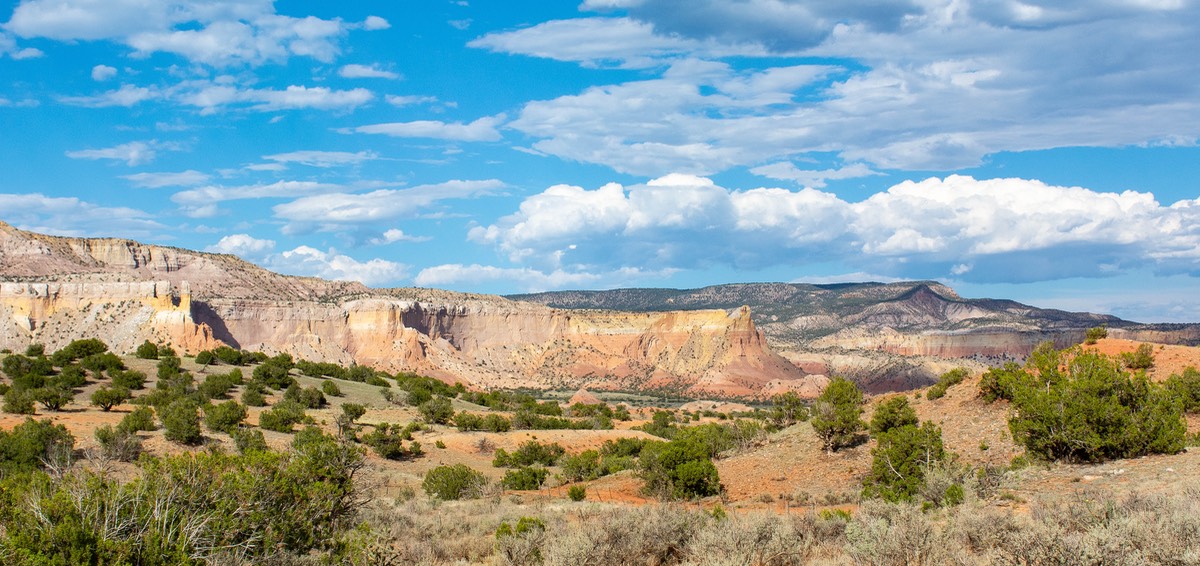
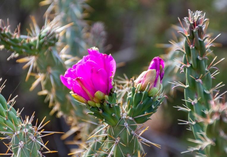
We crossed down into New Mexico and, although the heights were less than in Colorado, and the temperatures a bit higher, the scenery was lovely. We spent our first night in a desert area quite a ways north of Santa Fe. It was hot, and we ended up in a bit of a sheltered area so we had no breeze and we sweltered our way through the night. But early the next morning the bluffs across the way were lovely to see, and the nearby cactus plants were in gorgeous bloom. We want to go back to this area and spend more time exploring — when it’s cooler.
The next day we moved on south, on into Santa Fe, and everything worked out just fine. We had a great visit, a great lunch — at a really yummy spot called Los Magaeyes (3100 Burro Alley if you’re planning to be in the area) — saw some of Santa Fe together, and then waved them off on their way homeward. Our original plan had been to drop further south, seeing more of northern New Mexico than we’d had a chance to at other times. But it was — you guessed it — too damn hot. We did decide to poke around Taos a bit as we headed back up the hill, and we were able to check out a couple of historic churches along the way, but that was it. Northern New Mexico will have to wait for another time of year — maybe next spring. We have lots we want to see, but not in July; not Rick and Kathy anyway!
In the Santa Fe area we camped for two nights up at the ski area parking lot about fifteen miles and 2500 ft above the city. It was perhaps a longer drive than we might have liked, but the road was good and it was wonderfully cool up there. Well worth the effort and we were not alone either night. During the day we dropped back down into the city, where we were able to find a parking lot with plenty of room for us right in the historic downtown area. From there we easily walked to Los Magaeyes where we were meeting for lunch and then to stroll through the town. There is a great looking museum we checked out and will plan to visit next time.
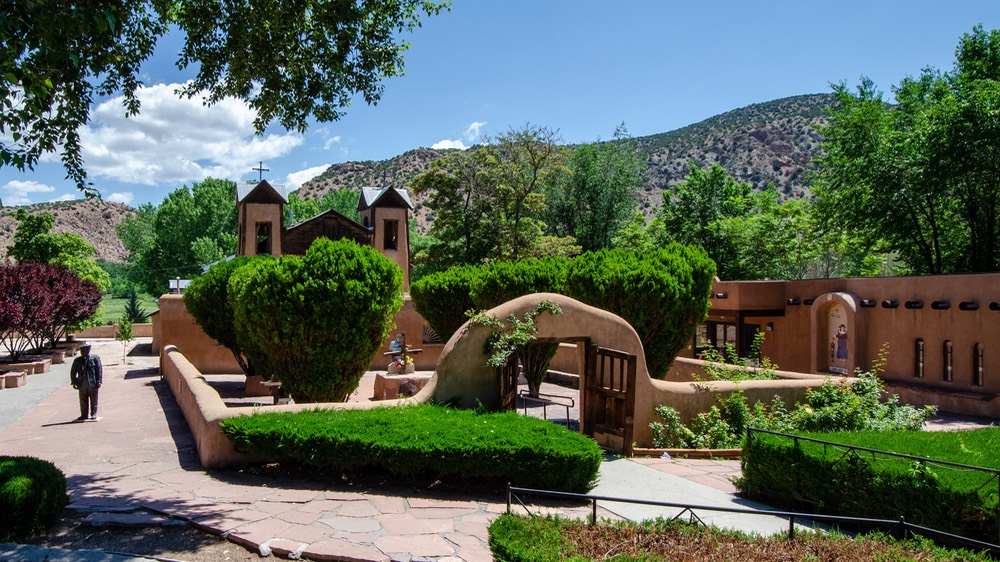
Moving north toward Taos we took a scenic back road and stopped at the Santuario de Chimayó. This is a lovely complex of buildings and is a pilgrimage site for people seeking healing. It was quiet when we were there, with few other visitors, and we enjoyed our visit. Unfortunately, photography was not permitted in the sanctuary, but the outside was lovely and we can share that part with you.
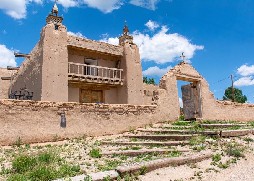
We also stopped at a second tiny community, Las Trampas, where we made a brief visit to their local church, the San José de Gracia, one of the most beautiful of all the colonial-era churches. Not open at the moment, but we will definitely come back another time.
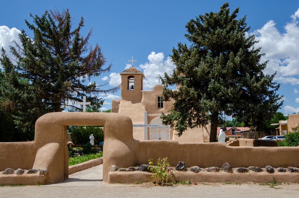
Further north, on the outskirts of Taos, is the community of Ranchos de Taos, which is home to an eighteenth century mission church familiar to anyone who is a fan of the paintings of Georgia O’Keefe. San Francisco de Asis is an amazingly beautiful church surrounded by well tended gardens, and fortunately we were allowed to take some pictures inside as well.
One of the things we enjoyed most about these churches was the soft look of the buildings themselves. In California, the mission-style churches are very hard-sided, and seem more angular. Here in New Mexico, the walls are hard, but give a sense of being made out of marshmallows. Don’t believe me? Go check ‘em out! They were a delight.
We had planned to spend more time in Taos, and definitely intend to return again, but at this time, in early July, the heat, the traffic, the road construction and the ever present smoky haze just sort of did us in. Call us wimps if you like, but when we have the ability to return at a better season in order to more fully enjoy an interesting place… well, that’s what we do. So we started out to do the Enchanted Circle Scenic Byway that runs out from and then returns to Taos, but after struggling some to find an open dispersed camping site for the first night we decided to call it quits and return to Colorado. There is a ton of things to do and see in both Santa Fe and Taos; museums, famous buildings, plazas, etc., and multiple scenic road loops to explore. But not in mid-summer — at least not for us.
Oh, and we never found anyone to tell us how to pronounce the name of the town of Abiquiu, so there’s another reason to go back.
So, after only five days in New Mexico, we jumped back across the border, returning to Colorado with Durango as our next destination. It was still too hot, and smoky as well, although we bought some wonderful peaches at a local farmer’s fruit stand. This little spot proved to be a real kick because not only were the peaches great, but while Kathy was shopping, Rick was talking to a very nice lady whom we had met six years earlier at Overland Expo in Arizona in 2015! Wow! A major advantage of traveling in such a distinctive looking vehicle. Kim and her husband live in Durango and she just happened to be heading to the fruit stand when we were there. Too cool.
We’d been planning on spending a week or so exploring the backroads in this southwestern corner of Colorado; wandering around in the triangle-shaped area defined by Durango, Cortez & Telluride. But once we arrived we changed our plans due to what we call TMF. That’s Too Many Folks if you’re not familiar with the term, as well as the aforementioned HHH (Hot, Hot, Hot) problem.
Still looking to get cooler, we headed up through Silverton then over Ouray Pass (11,018), back in mining country now. This whole area is very busy, with tourists filling the streets and campgrounds, and rental off road vehicles just everywhere, but we managed. It’s definitely lovely, and the whole mining scene is pretty cool. Imagine; just think about horse- and oxen-drawn carts hauling your stuff (or rocks) over these passes. But the dirt is beautiful — it shows all the minerals in the mountains. This is a nice area and there are lots of campgrounds and dispersed camping areas around. But there are so many RVs of all types out traveling these days that we must constantly relearn the most basic rule of our wandering existence. If lots of people want to come to visit an area, we really need to be someplace else. Here, along one of the more famous roads in Colorado, paralleling the famed Durango to Silverton Railway, every dispersed camping spot we had any information on already had folks in it. We’re having some great success with wild camping again this summer, but in each case the special places we’ve found are pretty far removed from the beaten path. The photos above of our spots on Keebler Pass and above Crede are testaments to this. In popular areas, to quote Johnny Depp’s character in the movie, “Donnie Brasco”: “Fuggetaboutit”.
They are still logging these areas, but there are changes from the old ways. We saw a helicopter, off in the distance, with something hanging below it. Immediately we thought we must be approaching a fire and it was bringing water or retardant. But the helicopter had a huge log dangling below, attached by chains. We watched it for a bit, and saw the copter approach where they were stacking the logs; it quickly lowered the log, then flew off again to get another one. It was interesting to watch and it sure is a big difference from the old days of dragging the logs to the stream and floating them to the mill.
By mid-day we’d dropped way down in elevation again (sigh), and drove through the towns of Montrose (total haze had taken over by now) and then Delta. Yuck! Delta is a nice little town with a city park where we’ve spent the night before, the Yuck refers to the heat and all the smoke this area is now experiencing from forest fires further to the west. Trudging further north, we turned east at Grand Junction (which we usually avoid like the plague, but we had some shopping to do), and continued on I-70. The winds started getting stronger and stronger along the highway, and soon we came to flashing signs saying road closed ahead to commercial traffic. We decided we fit the bill and the weather was looking threatening so we spent the night in Rifle. Nice little town. Windy.
Like many travelers, we dislike interstates, and stick to secondary roads as much as possible. We’d planned to turn north at Rifle in any event, so in the morning we did and headed north to Craig and then east on lovely, lovely Highway 40, one of our favorites. This is a beautiful drive, and such a pleasure. It takes you through Steamboat Springs, which is very popular of course, and then over that great Divide (again!) at Rabbit Ears Pass (9,426’). About 4 miles past the top there’s a pretty little forest service road that takes you up-up-up to the top of a peak overlooking the entire world, and that’s where we spent the night among a field of wildflowers. Super!
We could have spent several days there. But… we had a meet-up planned with California friends for the following day. They were on their way home and heading west into Utah, we were going north into Wyoming. So! Through the magic of the (occasional here in the mountains) internet, we managed to meet up for lunch near the intersection of Highways 40 and 14.
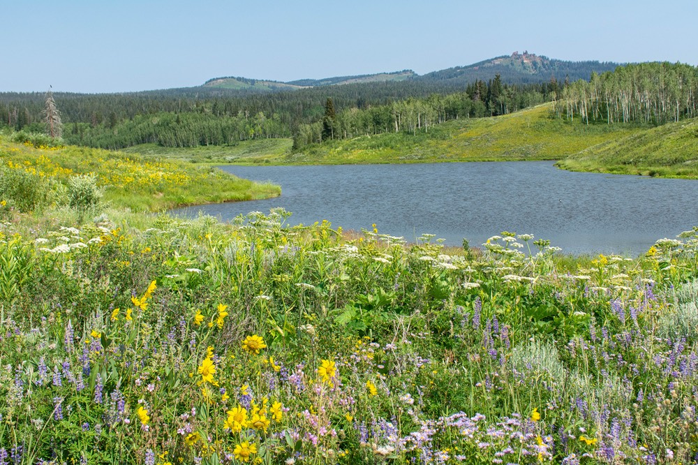
As it turned out, the highway department was working on that corner when we arrived, but nearby we were able to find a lovely turnout right beside a pretty lake. Shortly after we arrived, a friend we’d seen at the Tiger rally drifted by, and we had a great unanticipated chat with him. Soon after he moved on, our friends showed up. We sat and enjoyed lunch together, checking out the scene around the lake and catching up on the news. Nifty. Soon we parted once more, with the usual plans to stay in touch. Serendipity strikes again.
And on towards Wyoming. Before crossing the state line, we spent a couple of very pleasant days at a local reservoir near Walden, catching up on emails, downloading photos, and watching the waterfowl. We even saw storks!
We’d spent a lot of time in smoky Colorado, and were hoping we’d find clearer skies further north. And, delightfully, the air got cleaner as we started on up the road. We were heading for Laramie, and it was a lovely, clear day. We had a package coming (containing a thermocouple to replace the one I’d broken while defrosting the freezer — life in the fast lane). We had some time to spare so we’d decided to do some exploring in the Snowy Range pass area, a bit further west. This is a glorious area, and we had about 4 days available for poking around while waiting for the package.
The Snowy Range is a real treat. Part of a northern extension of the Colorado Rockies, they are lovely, often covered with snow (although pretty bare this year) and have lots of places to poke around and stay for a few days. We had a good time.
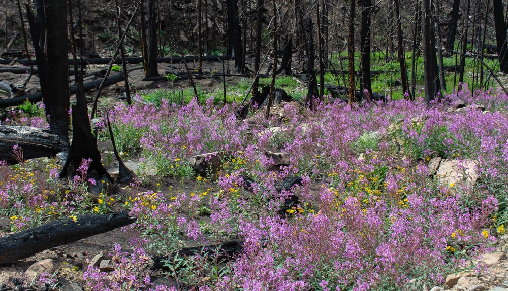
Spent a night with another friend who was wandering through on her way up to the Big Horns; explored some places we’d not seen before; and examined the aftermath of a large fire that had burned up a huge part of one of the forests — a sad sight to see, although the fireweed (beautiful pink flowers) had arrived to start the recovery process. It was a nice few days.
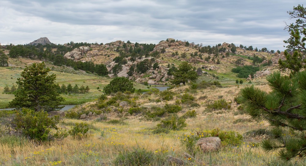
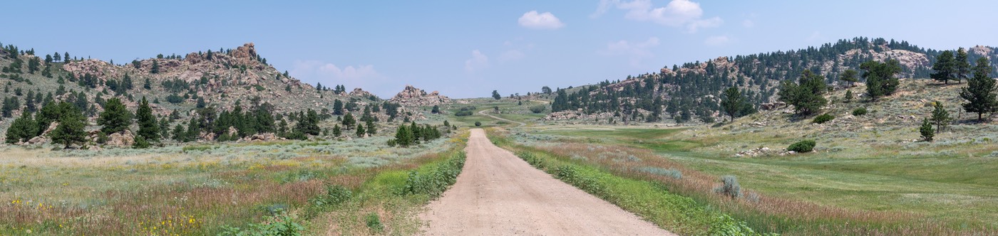
Then, with even more friends about to spend time in the area, we returned to Laramie, picked up our new thermocouple, and went out to meet them where they were rock climbing east of town — at a place called Vedauwoo. Now that was a cool place (although the weather was still pretty hot, actually). Enormous boulders scattered all over the landscape were perfect for Tod’s rock climbing adventures, and great for folks who wanted to hang out for a few days. There was also a lake handy in nearby Curt Gowdy SP; Lisa took their two super-friendly dogs and went out paddleboarding every day. We had a very nice visit with the whole crew and a visiting nephew, then parted company and moved on, heading further north.
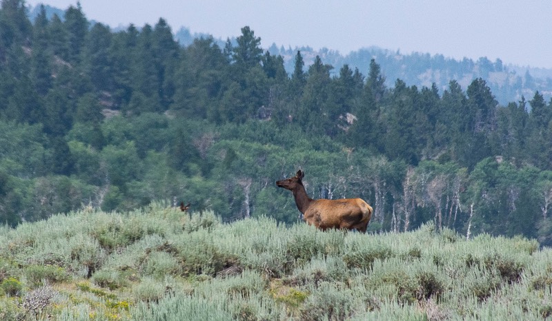
We moved on only because of an appointment to fix our furnace, in Gillette, due north from Laramie. There are only a couple of paved road routes to choose between Laramie and Gillette, and much of the terrain is not terrifically interesting — to put it mildly. While in this area last summer, Kathy had actually inscribed the word ‘Yuck’ along one of the crossing routes on our Wyoming map. Thus inspired, this time we took a very nice back road route starting off from Hwy 34 west of Wheatland and moving through a section of the Medicine Bow National Forest surrounding Laramie Peak. Gosh that is a nice area. Given more time we will return here again to do more exploring. Our enjoyment of the area continued to be hampered by an overlay of hazy smoke, just enough to give everything a gray cast and to lessen the colors of the grasses and wildflowers. Still, we had some mountains to see, along with rock outcroppings and the occasional pronghorn and even a pair of elk, so all was not lost.
So why Gillette you ask? Because the shop there had replaced this very furnace last summer, and because we could get an appointment; every other repair shop we’d contacted was at least 6 weeks out. Why do it now, in all this heat? Because we could get an appointment — and also because we were slightly out of the warranty period for the furnace and hoped to get some consideration by not putting the repair off any longer than we had to. So okay. Turns out they could get the replacement part overnight and yes, we did get some warranty assistance. So we stayed two nights in Gillette, sweltering, and survived. Even had a nice dinner in a restaurant to pass some time indoors and air conditioned; but then practically died overnight. Got up to 105 degrees the next day. But we were gone and up in the mountains above Buffalo — finally in the Big Horns — before the day had faded. And it was only 60 degrees that night. Whew!
So we’ve returned to the Big Horn Mountains, in north central Wyoming, where we spent much of last summer. We expect to stay here until mid-September or so. We won’t leave until we think the worst of the summer heat is over. Why? Because our plan for the fall is to head east into the upper Midwest. We want to visit some motor museums Rick is anxious to see (in some cases to return to) — in Indiana, Kentucky, possibly Michigan; places like that. Then we’ll probably drop down through Tennessee to explore some areas we like before heading to Alabama by the end of October. We think we’ll be in the south until the end of the year; then, who knows?
We hope you are being able to enjoy your summer, and that climate issues are not affecting you. We know that many are having a much hotter and more miserable time than we are, and we fear for anyone who lives in wildfire country. When we whine about 105 degrees, we know that some are living through temperatures much higher, and without our ability to move around to find cooler places to be. Our hearts go out to you, and we know that you too are hoping for cooler weather soon. We think of you often.
Rick & Kathy together with an often panting but still indomitable
La Tortuga
Yes, you will want to visit our Photo Page for this story