December 2017
Beedelup, Peerabeelup, Gnowangerup and…
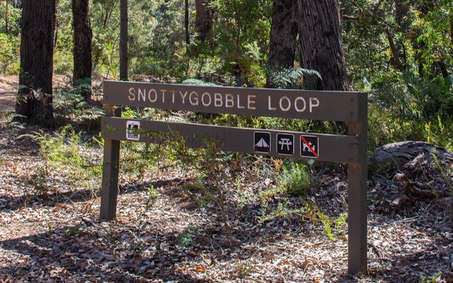
the Snottygobble Loop
The Snottygobble tree, Persoonia longifolia, is known for its long, narrow, bright green leaves,
dark yellow flowers in summer, and distinctively flaky red bark.
— So there. Just in case anyone still thinks we make this stuff up. —
Having abandoned you last time while we were still in the midst of the Axle Saga, we must provide a quick finishing-up. The wheels were finally released from customs in Perth, had their new tires mounted and were installed, along with a few other final minor adjustments. We hit the road in good spirits, but after a couple of days realized the Tiger was sounding suspiciously like a crow — issuing various squeaks and squawks when encountering bumps. The noises were from cranky leaf springs and were only going to get worse. They’d been on the list of work to be done, but repair efforts had not been successful. After calling around some, we made an appointment for a week or so hence with a recommended leaf springs expert in Bunbury (yet another town south of Perth). So once again we had to plan a travel loop that would allow us to continue along our way, but return to Bunbury at the proper moment. Small hiccup, but no drama, mate.
Through all of this, we continued our exploration of the southwestern corner of WA, a very nice part of the world. We’d been invited to spend some time with fellow overlanders David and Amanda Wood, who were currently hanging out in the Busselton area, along the coast. They had a spot where we could overnight, and suggested we come and stay for a bit.
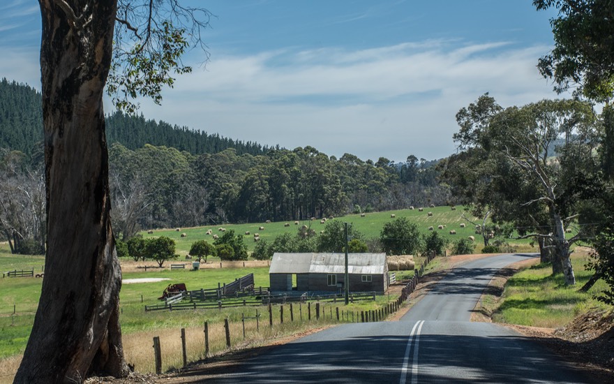
Heading there, we traveled through forests interspersed with open fields with horses and cattle, sheep, rolling hills, and plenty to enjoy. There were lots of train tracks; down here the trains are all about the on-going mining in the nearby hills, whereas north of Perth they are more about hauling grain. In the bigger town areas, there often were trotting clubs, harness racing tracks, and the like. This area is part of the greater Margaret River region, famed for its wineries.
We had an excellent couple of days with David and Amanda, who have become good friends. They showed us around Geographe Bay and Cape Naturaliste, the peninsula on the south end of the bay, which is an area filled with very pretty beaches. It being Rick’s birthday we made a stop at Simmo’s, the first (and quite possibly the best) of the local dairy outlets where we sampled their homemade ice cream. We may not do much in the way of wine tasting, but you can trust us to do our best on the ice cream front.
Finally parting company, after promises to hook up again later on, we went further south along the coast, following a series of lovely country lanes and passing many a winery offering ‘Cellar Door’ tasting opportunities.
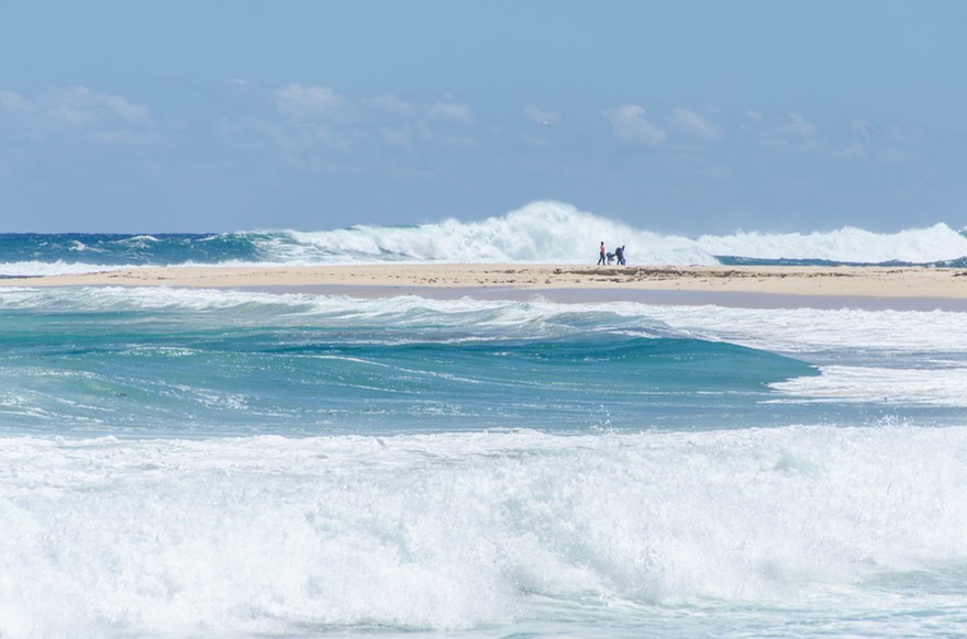
We enjoyed the really huge waves at Surfers Beach, where the Margaret River flows into the ocean. Our path eventually led us into Leeuwin-Naturaliste NP, a great park among the dunes and trees. It’s always swell to have the sand between our toes, and an extra pleasure was seeing our friend Mike Green again, this time in company with a friend who’d come out from England for a month’s visit. We had lots of fun and the next day they went north, while we went further south, along the lovely Boaranup Karri Forest Drive, complete with lovely foxglove in bloom, on our way down to Augusta.
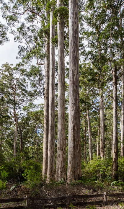
This was our first official drive through karri trees. We’d been seeing them for awhile, but this was a large, protected group of very nice specimens. The karri is a close relative of the kauri tree of New Zealand; equally huge and commanding, and just as interesting. We were intrigued to find out that the karri only grow in a small area of southwestern WA, nowhere else. It seems they thrive when they receive a minimum of 750 millimeters (30 inches) of rain annually; less than that and they don’t do well at all. We enjoyed the drive, along with the knowledge that more of these trees awaited us during the next couple of weeks.
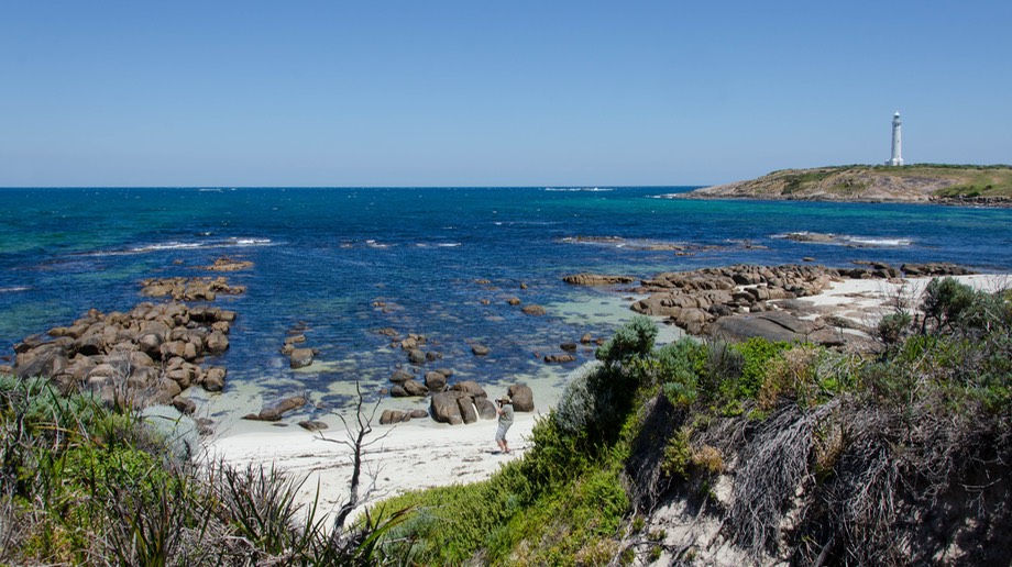
The town of Augusta’s claim to fame is that it is the southwestern-most point on the Australian mainland. It’s where the Indian and Southern Oceans meet and there’s a lighthouse. So we went, enjoyed the ocean views, stopped for lunch at a recommended fish and chip shop and then continued on. We meandered through the forests and along the rivers and, now that we had moved away from the coast, we thought it looked a bit like parts of Idaho, with fruit orchards as a lovely addition.
Having turned the corner so to speak, we angled southeast, heading towards the southern coast in order to spend more time along the water, but also to see more of the big timber trees that dominate that area. We wanted to see the coastal towns of Walpole and Denmark, and go east as far as Albany and the areas around there. This would take us about a week, and then we’d go back to Bunbury for the attack on the leaf springs. A good plan we thought, and a trip we enjoyed a lot. Tiger was sounding a bit like someone’s idea of a mechanical fishwife, but was otherwise fine.
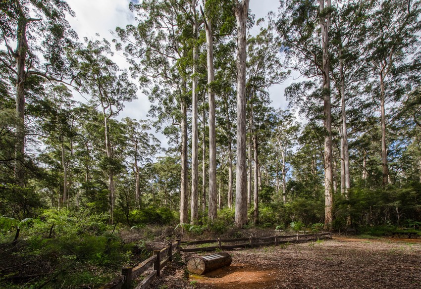
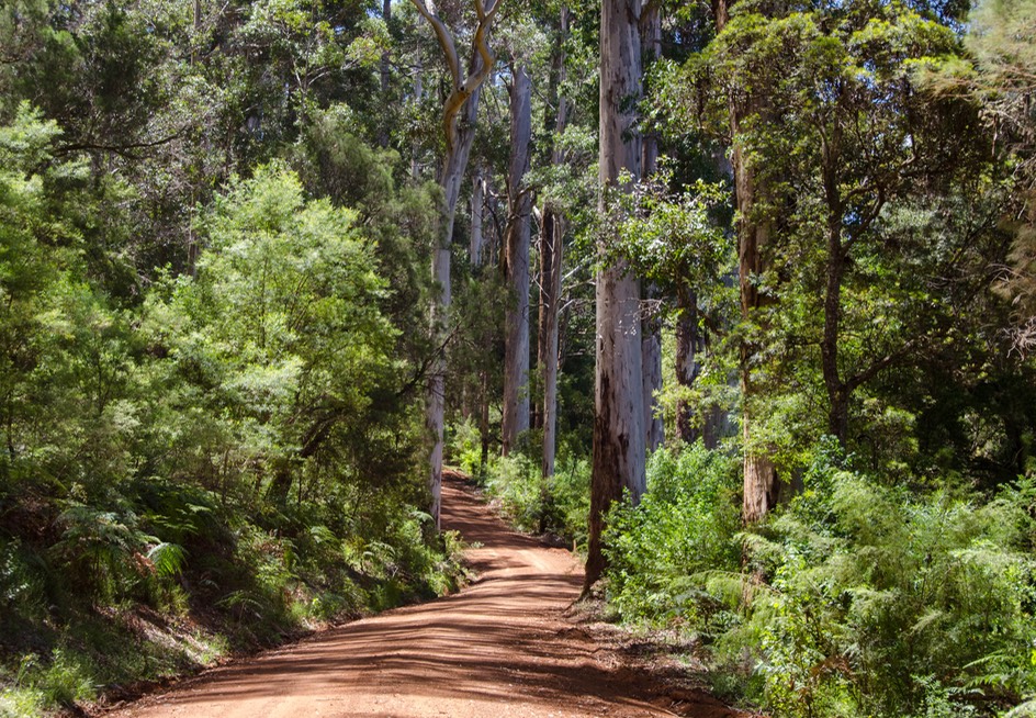
There is an area down here known as Tall Timber Country. We’ve been admiring Australia’s magnificent trees ever since we arrived, and the word was that some of the best were to be found where we were headed. We decided to prowl around and see what it was all about. No surprise, it was all quite magnificent. There are lovely drives and hikes through the forests of karri, jarrah, and marri trees, many in areas protected by national parks. The paved roads through the forests are wonderful, but as always, it’s when you get off on the unpaved sections that you can slow down, pull over anytime you like for pictures and views, and better enjoy the peacefulness of the forests.
We visited lumber towns like Bridgetown, Greenbushes, and Manjimup (home of the terrific Manjimup cherries; more on that later) and walked around the Giant Jarrah Tree and the nearby Gloucester Tree. This 60 meter tall tree was once used as a fire lookout point and it is really pretty amazing. They drove spikes into the tree in a spiral pattern to form a ladder for the intrepid lookouts to climb up to the top where there is a semi enclosed overlook. You can still climb it today if you are so inclined, but after some discussion — “Who, Me???” — we passed on this once in a lifetime opportunity. Later we found the One Tree Bridge, built from a single specimen; and the nearby 4 Aces trees, so named because these four tall trees all in a row grew up out of the trunk of a downed tree. The rather old-fashioned plaque nearby proclaims
“Long ago, thousands of karri seeds sprouted in the ash of a burnt-out log; They struggled fiercely for sunlight, water, and food from the soil; Four of those seedlings are living today; They are the four aces.”
These trees are highly revered.
We followed the route of the Karri Forest Explorer, which took us through many places we’d never have seen otherwise, up and down tiny unpaved roads, past pretty Beedelup Falls and through seemingly endless forests. It is centered around the town of Pemberton, and runs through three different national parks, all thru lovely pristine forest. This whole area must be especially amazing to those Aussies who live where there are no forests. And it was all just great. These trees are old, huge, and stately. You can just imagine what the area looked like a couple hundred years back, before most of it was logged — and before these last bits were preserved in parks.
In addition to tree walks, there are many little camping areas along the streams in the area. We were intrigued by one camp site called Snotty Gobble, and the hiking loop that you could access there. It was a pretty little spot and we might have stayed the night, but it was only mid-day and we had other things to see nearby. Great name, though. We stopped for the night further on, where we had a nice chat with yet another Aussie couple out seeing their country.
Wandering through the small towns, we had great opportunities to buy avocados and cherries and strawberries. Where the trees have been cleared, it’s a very productive area. We loved camping in the forests, listening to the birds and enjoying the quiet. With lots to see however, we kept on, heading south to Northcliffe, then out to D’Entrecasteaux NP which is a real treat; we spent a great day there enjoying the viewpoints, taking walks, and enjoying the tons of coastal flowers in bloom. A really beautiful spot.
We did have one disappointment. We were eager to see Shannon NP, which has its own forest trail, but it is a ways inland and as we got closer it was very smoky, and we could see that the smoke had spread throughout the area. We later learned it was a controlled burn that had smoldered but not actually gone out, and had now flared up again. We reluctantly moved along and continued on down to Walpole.
Along the way we also traveled through the town of Gnowangerup; unmemorable, except for the great name.
We drove up into the tingle trees and thought they were some of the best yet — Tingle Trees Rule!! By the way, everyone knows that Australia is famous for its eucalypts (eucalyptus in the US), and this is absolutely true. But what the non-botanists among us may not realize is that eucalypt is a broad term. We’ve been seeing marvelous examples all over Australia for the past six months but they represent an enormous variety of different trees; all related. Don’t hold us to the technical aspects please, but just some of the names include (we think) blue, red and silver gums, ghost gums, and down in this area the huge karri, marri, jarrah and tingle trees; all eucalypts. Quite amazing. And… we even found that they are all members of the myrtle family. Who knew!
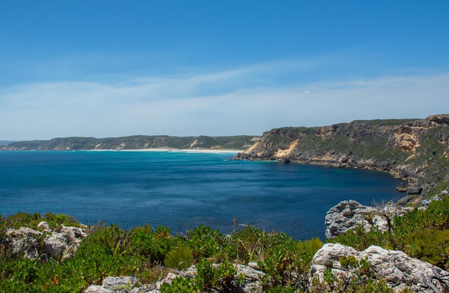
West of Denmark, the next “major” town on the coast, we’d been told we must stop to see the Elephant Rocks and Greens Pool. They were right, of course. Greens Pool is a major swimming hole, a sheltered area where swimming and snorkeling are safe from the undertow — just perfect for the quite warm afternoon we were experiencing. Conveniently, the rocks are right around the corner. Elephant Rocks are like Hippo’s Yawn, and the Devil’s Marbles; dome shaped outcroppings. You can guess the rest. They were fun, and in a nice spot right on the shore.
On to West Cape Howe (had to!), west of Albany, where we drove up to an overlook that had great views — no surprise — but also some ramps leading off the edge of the hill. These stumped us a for bit, until we saw a sign about paragliding… Ah. Nice area. Coastal sections along here look a lot like northern coastal Oregon, around Tillamook; same sleek cows, same low dunes, same misty weather. We spent a day puttering in Albany, but we could have stayed longer; we would have liked to have taken a closer look at some interesting things. Rather English says the guidebook; yup. Several lovely old buildings, all looking very nice, but quality, not just flash. We skipped the ANZAC museum, which we’d been looking forward to; we thought it was very expensive.
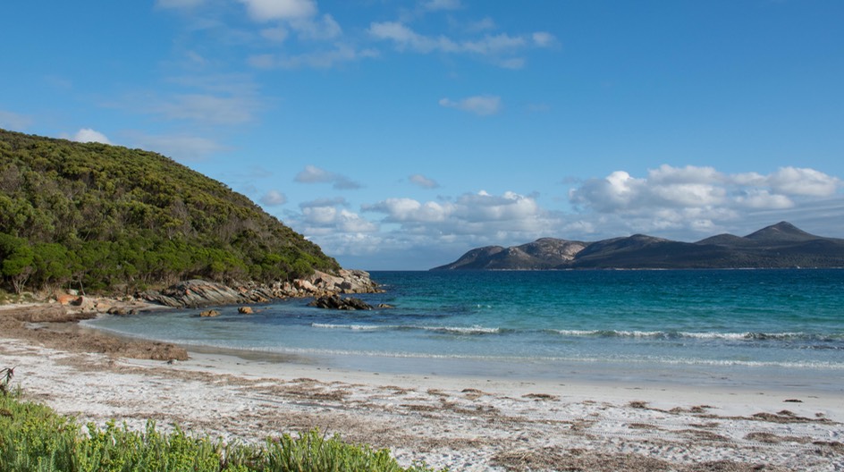
Everybody, but everybody, had told us not to miss Two Peoples Bay Nature Reserve, east of Albany. Once again we got good info. We found ourselves at a small, delightful little beach camp on a lovely turquoise bay, with squeaky, white sand. We happily spent two days sitting beside the water and walking along the beach. We shared the spot with fishermen and other travelers, as well as some who looked like they had settled in for the season. We aren’t the only ones who like to squirrel ourselves away in a small corner far from the madding crowd.
By now we needed to start back toward Bunbury, but we chose a route that detoured a little north through Porongorup NP, a small but interesting drive-through spot, and then on further north to Stirling Range NP, where we spent the night.
The Stirling Range is quite dramatic; these are “actual” mountains and our campground was at 263 meters (about 850 feet) — high for this neck of the woods. There are wonderful hikes here; getting up to the top of the major peak, Bluff Knoll, is apparently quite a feat. You have to be careful about the heat, the lack of water, staying on the trail, being sure to finish before dark; lots of things to think about. We have a good friend who had climbed it in his twenties and still considers it a major event in his life. Needless to say we passed on the hike but enjoyed the views and some terrific information panels at the trail head.
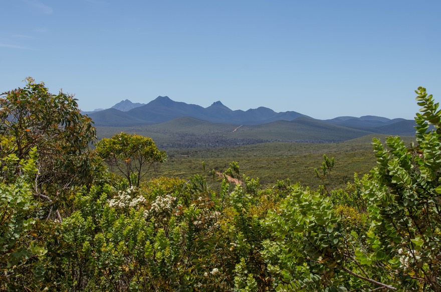
Driving westward out of Stirling, we stopped to enjoy many tiny, tiny flowers we’d not seen before, and some new seed pods (eucalypts); it was a nice visit. Stirling Range is an area of great biodiversity, as is, actually, all of Australia. It was here that we learned that Australia is one of the listed Mega-Diverse countries in the world, and SW Australia is the most diverse region here. Even we non-scientific, average-Joe types could see it. We can’t identify or name the species, but we can sure notice the changes in plants as we drive along and say, hey, we haven’t seen that one before!
Oz is really a pretty special place in this regard; we stopped to think for a bit about the extra time we’d rather serendipitously been allowed in this area. If we’d not had problems with the truck, we would not have been able to visit nearly so much of this section, and wouldn’t have appreciated all that it had to offer. We knew we were lucky to be able to see first-hand the “significance of protecting the diversity”, a phrase often used in talking about the biodiversity of this area.
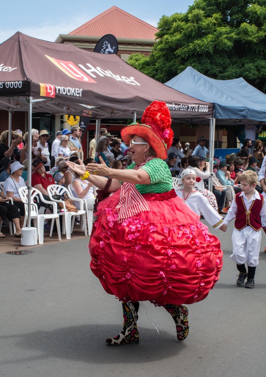
Once out of the park, we were back onto the edges of the grain fields. We drove through Mt Barker and on back to Manjimup for the Cherry Festival, meeting up with David and Amanda once again. There was no cherry pie eating (or making) contest — much to Rick’s dismay — but they did have cherry pip spitting and log splitting contests. A funky parade started things off, with the police piper band leading the way, locals dressed up in costume, and an Aborigine performing on the didgeridoo (fantastic) was a highlight later on. We bought cherries, spit at will, and then headed further west.
The next day we had a great afternoon visit with more new friends. Mazz and Syd Reilly, whom we’d met previously in Boddington, have been traveling full time in Australia for twelve years. We did our best to absorb some of their advice on places we should go while here. Next we drove into Bunbury and the leaf spring shop. Tiger got his springs cleaned, lubed and reset back to where the two spring packs matched each other and then we were back on the road and heading east for good: honest-to-goodness, no more little loops and returns; just set the hood toward the rising sun and keep on truckin’. We went back through Collie, past a huge coal mine, and ended the day parked up for the night along the Collie River (at least we think that’s what it was — and it sure was pretty!). Along the way we were watching, watching… and just before our turn off we hit a milestone by ringing up 200,000 miles on the Tiger. To save some of you from reaching for calculators, that’s 321,869 kilometers.
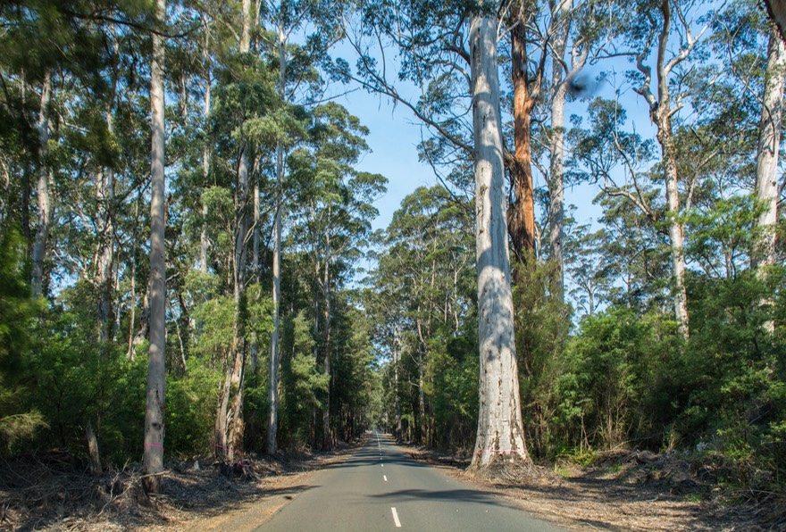
In looking at our route, we remembered reading somewhere that the roads in this area are long and boring, with “nothing but trees.” We’ve driven some roads where we might say that sort of thing, because some tree-lined roads can be boring. But not these. These trees are far from boring; they are elegant, shapely, colorful, lovely and ever-changing; and the roads winding gently amongst them are just as nice.
In this part of Western Australia, many of the town names end with “up.” “Up” is an Aborigine name for a place of water (at least that’s one meaning). Southwestern WA has been blessed with lots of water, and also had lots of Aborigines. Not so many any longer, it would seem, but they’ve left their stamp on the land.
As always in Australia, it is not difficult to see the mixing of cultures and origins in the variety of town names. Donnybrook is just down the road from Mumballup, with Bridgetown and then Manjimup next. To take it just a bit further, along the coast you will also see the mark left by ocean-going explorers. Dunsborough is the town nearest to Cape Naturaliste and further along Cape D’entrecastaux National Park lies between Augusta and Walpole. It all makes for interesting map reading.
Along with the towns, the highways are often named after important people from the development of an area: Stuart and Sturt are two of the best known, but we kind of like the Muir Highway, which runs through the southern forests. The Muir brothers, John and Thomas, were the first European settlers in the area; in 1856 they built a rush hut near the present-day town of Deeside. We think that’s neat. We don’t think there’s any connection with the John Muir famed for his extensive conservation work in the High Sierra of California, but who knows.
It’s mid-December now, and as we drive further east through the countryside, we’re seeing “Christmas scenes” in the grain fields: decorated hay bales, stacks of tires painted white and dressed as snowmen (or green and decorated with ornaments), etc. Just as you would anticipate seeing in the American midwest. The landscape is becoming more open and less filled with trees. Vast fields of grain and hay, much of it already harvested, muddy river beds with no running water, few bridges — mostly just “Subject to Flooding” signs and low flat areas with a bit of water around. We have been seeing the occasional lizard or emu along the highway; otherwise the land is increasingly barren.
We were heading east toward Esperance. We had hoped to spend some time exploring this part of the coast, but all our repair adventures had kept us bogged down for longer than we had anticipated, and we had time-sensitive mail waiting for us in Port Augusta in South Australia — nearly 2,000 kms further east. The mail had all been arranged more than a month before, as it must be, so we had to skip some very highly recommended national parks and lovely beach camping areas and zip along.
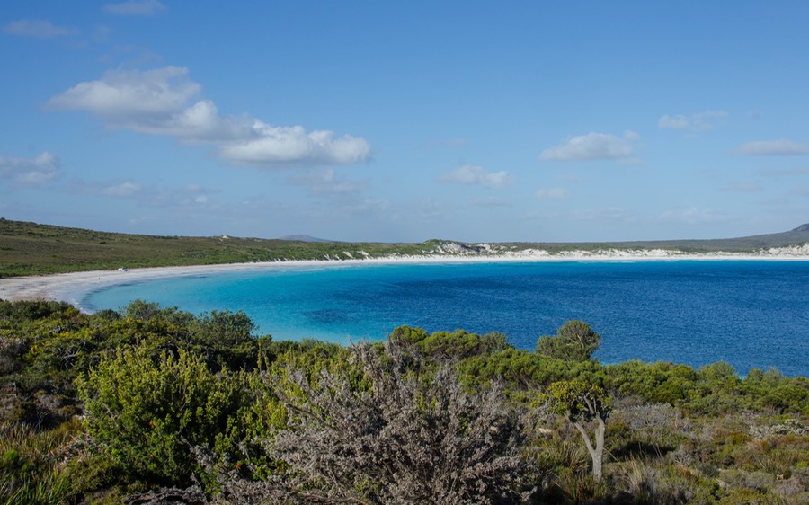
We moved quickly through Esperance for the moment, heading for Cape Le Grand NP and Lucky Bay where we were meeting up once more with David and Amanda. And what a place we came to!!! This turned out to be one of the loveliest spots we’ve ever seen — white sand, turquoise water, pretty hills — gorgeous, gorgeous, gorgeous. A shame we didn’t have an extra week available; we’d have spent it all right here. The National Park campground at Lucky Bay is very nice and has been newly renovated and enlarged. Not only is the bay on full display right in front of you, but kangaroos are common right in the campground. Great walks, beautiful views, and good friends to share it all with. Outstanding.
We made the most of the time we had, and then the next day we all waved good-by. We headed back through Esperance for fuel and groceries and then started heading north and then east, toward Port Augusta along the Eyre Highway. We went through Norseman (another town with camel train history) and turned east across the Nullarbor Plain. Took us 5 days. We spent a lovely but windy night along the Bunda Cliffs, and a less interesting one in the Woorlba Rest Area (132 kms west of Caiguna and 46 kms east of Balladonia if you want to look it up).
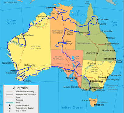
For all you non Aussies out there, here’s where you want to read closely. You may already know that Australia is almost as large as the Lower 48 States of the US. That’s pretty darn big. If you look at this map, you will see Adelaide near the bottom of South Australia and straight north from that is Darwin at the top of the Northern Territory. Those two cities are over 3,000 kms apart; almost 1,900 miles. That’s a little further than the distance from Brownsville, down at the southern tip of Texas, to International Falls up on the border between Minnesota and Canada. Hmmm! What you probably don’t know is that there are precisely, exactly, only… two paved east-west roads that criss-cross the area in between, connecting eastern and western Australia. Can you imagine the US with only Interstate 10 going along the southern border and then no paved through roads until you get to Interstate 90 up in Montana? I don’t think so, but that’s the way it is here. We’ve driven both of these routes in the past few months and you’ll see them marked on the map. We’d love to get back out into middle to see more of the outback while we’re here in Australia. Who knows?
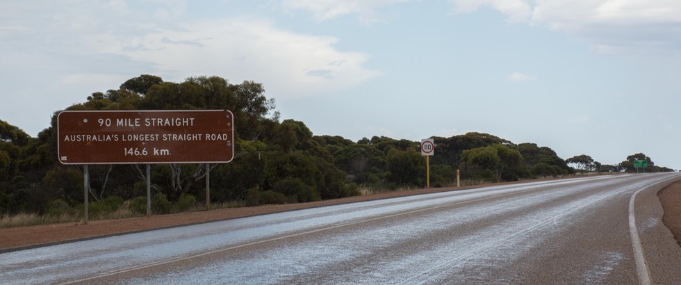
Sorry; we digress. The Eyre highway is the southern paved highway across Australia; there are no other options — especially in the hot-hot summertime. So how is this road, you ask? Happy to tell you all about it. In both WA and then SA the Eyre Highway crosses the Nullarbor Plain. There are Royal Flying Doctors landing strips marked out along this long, long, straight road. Nullarbor means “no trees” and yup, we pretty much agree. It did get a bit grim at times.
We stopped for fuel at the Mundrabilla Roadhouse out in the middle of absolutely nowhere. It was a pretty comfortable 80˚ F (26˚ C) with a strong wind coming from the south. Rick asked the cashier if the weather was normal for this time of year and she said yeah, pretty much. Is the wind usually from the south, he asked? And she said something we didn’t quite understand at the time: “You better hope so”, or words to that effect. We didn’t think a lot of it and we drove on. About half an hour later we started to feel the warmth inside the cab. A quick look at the instruments didn’t indicate any engine problems, but a glance outside told us the wind had shifted and was now coming from the north. We kid you not, within five minutes the outside thermometer had gone up to 112˚ F (44˚ C). Whoa! Suddenly we understood what the cashier meant about the wind.
Just about at that same moment we passed a cyclist out on this difficult road. Ouch!
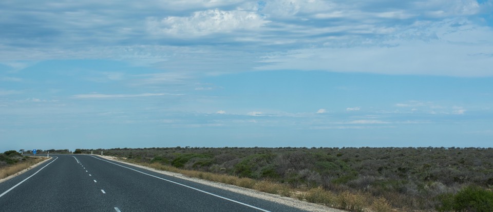
The Nullarbor is billed as something really different, but we found it pretty, well, boring is probably the best word, and not all that null arbor either in our minds. The only stretch you could actually say didn’t have any trees was only about 50 kms long and even then there were still plenty of shrubs and ground cover; hardly the barren wasteland we’d been anticipating. To us it seemed like a creation of some Tourist Bureau, “Come see the amazing Australian Nullarbor Plain!”, or some such. These guys should come to West Texas if they want to see some barren land. Ah well, this is said all in fun of course; we’d psyched ourselves up some for this trip, but in the end it was just a long drive, nothing special.
It gets a bit confusing here because the border between WA and SA happens sort of in the middle of this long road. There are time changes and quarantine stops in different places depending on whether you’re heading east or west, etc. So just bear with us a little in this area.
Leaving Western Australia (WA) was a bittersweet moment for us. We’d been here for three months and had stayed at or traveled through over 30 different national parks, enjoying each and every one and their excellent facilities. We had enjoyed the coastlines, the forests, the fields of grain, the trees and the rivers; and would have been happy to stay longer. We feel that it was the best possible place for us to get delayed with vehicle issues. WA gets left out of people’s itineraries, we think, because it’s so far away from the rest of the country. It’s sad, because we feel that, quietly, it’s the best of Australia. But then we haven’t been Over East yet so we’ll have to wait and see.
Crossing into SA, we moved our clocks ahead 2-1/2 hours; a big jump that would hold us only until we reached Victoria, when we’d have to change them an additional 1/2 hour. Rick said it was like jet lag, making such a big time change. We knew we’d have to go through a Quarantine station in entering SA, but the nice man there sent us on our way with no problems, as we’d already finished off everything of concern to him.
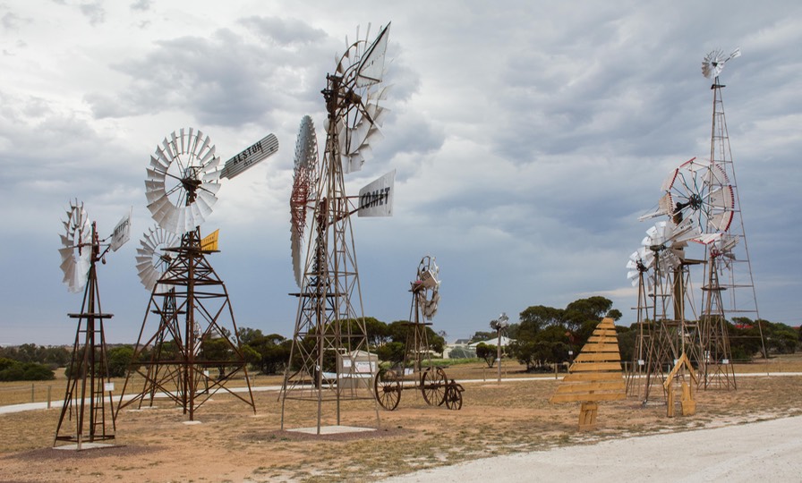
Things were still kind of bleak crossing this part of the plain, but we persevered and finally starting seeing signs of life ahead — trees and small towns. We stopped in Penong to see the windmill museum, which was simply charming. It was a large open dirt field, with maybe 12-15 old windmills that had been gathered together, all spinning in the constant wind. Each had been made by someone and had been used somewhere; there was a plaque giving each windmill’s history.
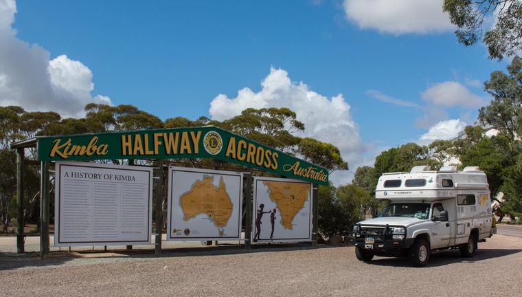
We made a small donation towards upkeep of the museum, read the information, smiled, and went on our way to Kimba, where we spent the night.
After a day of rest (and laundry) we set out for Port Augusta, a couple of hours away. We picked up our mail (yes!) spent a wad on groceries, rested a bit while we organized our thoughts as to what was next, and then began to explore some of South Australia as we worked our way east toward the Victorian Highlands.
We're heading to Adelaide first and that's where we’ll pick up next time.
Happy New Year from the gang: Rick, Kathy and the Tiger Who Squeaks No More
Click here to see more photos from this message