August 2022
The Long Way 'Round to Labrador
We drive all the way across Labrador after coming in through the back door
We’ve been waiting for you to ask… “What have you been doing the last few weeks, you two?” So, okay, here’s the story. We abandoned you along the St Lawrence Seaway, having driven across much of northern Québec during the month of July. We’d hit the banks of the Seaway near Tadoussac and followed the waterway, heading northeast, up to the town of Baie-Comeau. This is a well-traveled road, with lots of tourism, and it is a really, really pretty area.
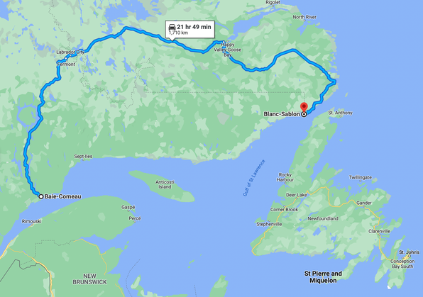
From Baie-Comeau you can continue further along the coast a full 600 kms to reach the end of the road and from there you can take a long ferry ride (32 hours) on out to Blanc-Sablon, located near the mouth of the St Lawrence. Then you can then enter Labrador from the east and see the southern coastal area, or skip Labrador and cross directly to Newfoundland. Maybe that would also be a good choice — more direct, you get a boat ride, and there probably aren’t as many bugs. But that wasn’t our plan. No, not us, your intrepid explorers (aka: These guys are nuts!). We were going to take the long way around, up and over, north from Baie-Comeau, and then east through inland Labrador via the Trans-Labrador Highway. We’d been wanting to do this drive for many years and finally here we are.
But first we needed to restock our supplies — like armies, we too travel on our stomachs — and who knew when we’d see a store again. So Baie-Comeau was our supply house. The town has grown over the years it seems, and the municipality sprawls along for quite a ways as you approach. The town took care of us well, and even had plenty of internet access, along with not one but two Tim Horton’s — we don’t care much for the coffee or the lunch menu, but the beignets are splendid.
There’s a pretty shoreline on the edge of town, with a small park, good for a nice walk, with plenty of gorgeous wildflowers and plaques talking about the history of the area. It’s nice up there, so we hung out for awhile. And we finally found out what a Hamster store is. We’d been seeing them around, as a chain with a lovely lavender storefront, but we were clueless. Now though, we were looking for a place to make some copies of a form that had been emailed to us; Google said they could do this, so we stuck our heads in the door and, Mais oui — but of course! It was a stationery store and craft shop. No Hamsters at all, but still full of goodies. Parfait!
The next day we completed our tasks early, topped up with (relatively cheap) fuel, grabbed some beignets for tomorrow’s breakfast, and started out, leaving town on Highway 389, the road going due north to the Québec/Labrador border.
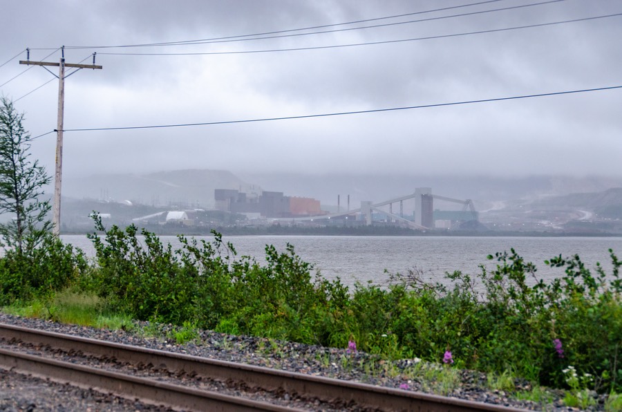
Before we get to the Traveling part of our story, let’s share some logistics about the drive between Baie-Comeau and the Labrador border. It’s about 600 kms long and has been there for a long time; most of it is paved now, with maybe 100 kms still dirt up near the north end. The highway connects to a huge dam, Manic-Five, which supplies electricity for that part of Québec. Then it goes on up towards the border, with the last section paralleling a rail line that runs from the St Lawrence Seaway to the Labrador border and then continues further north to a huge mine, in western Labrador. So, a shared passage, some of it paved but much of the shared part not paved; quite slippery/messy when it rains (duh); and you crisscross the railroad line nine times in the last 40 kms or so as you make your way to the border. We had the sense that this part of the road was carried over from when the rail line was being put in; really just a work road for the crews that is still in use. Kind of messy and certainly not attractive through here.
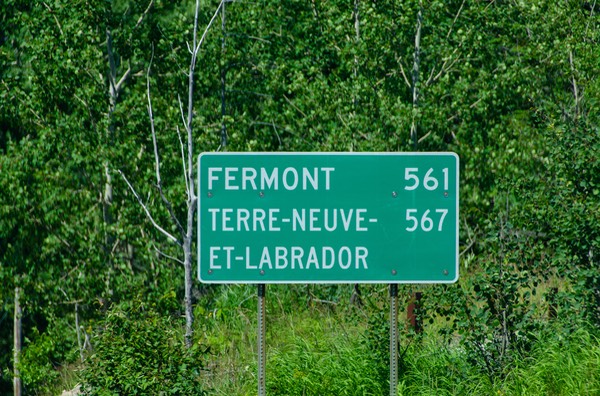
Fermont is the last town in Québec before you cross the border into Labrador, officially begin the Trans-Lab Hwy, and drive and drive and drive until you get to Happy Valley-Goose Bay (aka Happy Goose in this family) and thence drive more to the eastern coast of Labrador, where the lovely coastal area starts, and takes you down through Red Bay, St Denis, L’Anse-au-Loup, Forteau, and lots of lovely little towns and cozy tea houses.
This is the part of Labrador that we all love and enjoy visiting. Then when you’re ready, from the Red Bay area you head south down the coast until you reach Sablon-Blanc and take the ferry across the Strait of Belle Isle to Newfoundland and start wandering through that huge island, the other half of the province of Newfoundland and Labrador, or NFL&L, as this large bit of Canada is often called. Oh, and one more thing — Sablon-Blanc? Where the ferry from Labrador to NFL leaves from? That’s actually not in Labrador at all. The ferry is owned by, and run by, and sits in — guess where? You got it — Québec! Bewildered? Saying “what the….?” You aren’t alone. It’s all politics, naturally. But who wants to talk politics? We’ll just leave the discussion as it sits, at least for now.
By now you must be muttering, wondering when we’re going to get down to more interesting stuff, as in Tales From Labrador.
So, back to the beginning. Getting up to the border was mostly a very pleasant drive. Buggy, of course; we were in trees along the way, unless we were crossing bogs, which are grand to look at but that’s where most of the bugs live. We parked one night on a little road just next to a stream, with the ground cover to be enjoyed. Didn’t get out, because the little black ones are quite vicious, but it was lovely, the stream was quite photogenic, and there were wildflowers everywhere.
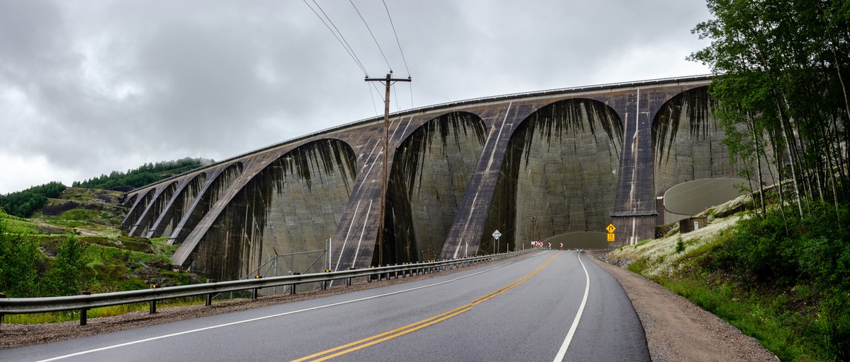
Fuel was amply available, and there were plenty of places to park for the night, in open pull-offs, next to water, stuff like that. Logging trucks were everywhere during the early part, but disappeared further up. We took a good look at the Manic-Five dam as we approached. We’d never been that close to such a huge monster before. Could have taken a tour — lots of people say they’re fascinating, and an old guy in Baie-Comeau was telling me I really ought to do it, but it’s not really our thing. So we wound our way up, crossed the top of the dam and shoved on.
The road from there to the border was intermittently unpaved. Not very attractive at some points, no problem otherwise. They are working very hard at getting this section completely paved and turned into a major highway. The newly finished sections are lovely, so the future looks bright.
We stayed our last night in Québec near Fermont, a bit west of the provincial border, and then plunged across the next morning. Soon we found ourselves in Labrador City, about 20 kms further along. In Labrador City there is a mall with Walmart, Canadian Tire, Tim Horton’s, and other odds and ends; it’s on the western edge of town. We were still pretty full up from what we’d bought beforehand, so didn’t do much; probably should have done more; saw nothing to compare with this opportunity all the way across Labrador and even into western Newfoundland a ways. Live and (sometimes) learn — as with many things in life, slow is best, no need to hurry.
We were getting a fair amount of rain at this point, and with the Labrador interior mostly being filled with trees and trees and more trees, interspersed with lakes and some open country, we just kept on moving. But after Labrador City it started getting sunnier. Joy!
We wanted to stop in Churchill Falls, roughly 100 kms east of Labrador City. For one thing, the town is supposed to have water for our tanks. Also, the falls are supposed to be enormous and splendid, so we wanted to see them. But we ran into a problem — no info center, no signage, no map that marked a road for us, and no one really to talk to. Churchill Falls is a very quiet little place. Later on, we found a different map, and it did have the road marked, but by then we were way down the road. Next time. One bit of loveliness as we left town, though — we saw a wolf, peeking out of the shrubbery. He was beautiful. And a black fox a few days later.
A digression on the subject of maps. This whole summer, in Canada, we’ve suffered from a lack of good maps covering the areas we were wandering in. Not Canada’s fault. It’s just that the provincial maps, of which we had a few, chop up these areas into bits that can be conveniently placed on a piece of paper in the odd corners where there’s a blank space; our destinations are off the beaten track. There are no real overview type maps to give you the wider view so useful in planning; makes it hard to connect the dots, if you will. Also, both this trip, and our earlier time up in the James Bay area, we weren’t entering from “the perfect starting place” where there would be a nice big visitor’s centre with tons of info and maps and the rest of that stuff. We seemed intent on coming in the back door.
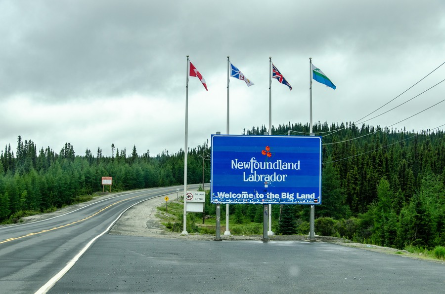
You see, most people go to Labrador by way of Newfoundland… either flying in to St John’s or perhaps taking a ferry up from Nova Scotia. Tourist offices galore. We barely even saw a “Welcome to….” sign at the border. So we were flying solo on these trips. There; done whining. But wait! There was a sign at Fermont telling us we were going on to Atlantic time starting at the border. Ahead one hour once again.
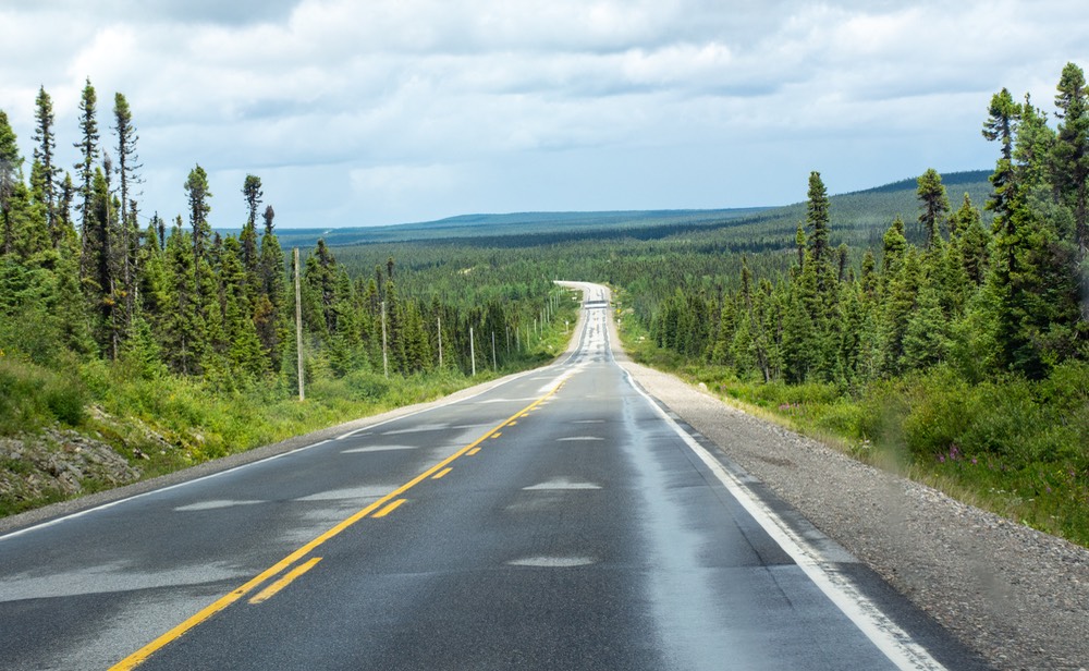
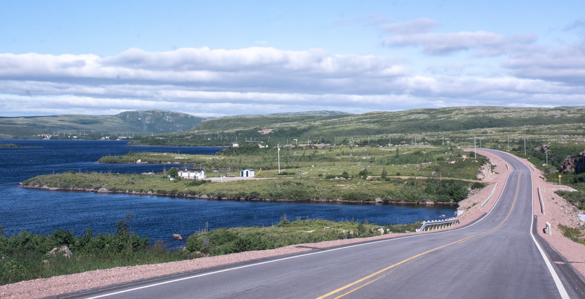
The driving across the interior was pleasant enough, the road was good, we were heading through and up and over nice hilly country, filled with taiga — small black firs, plenty of lichen, and caribou moss in the boggy areas. Plenty of spots for overnighting. Quite pleasant. We could have taken nice walks, but needed bug spray. And cream. And those funny screen room hats people have. So, we mostly stayed inside and enjoyed the view from there. Call us lazy, call us old, whatever; we don’t like fighting the bugs any more than we have to, and plenty of the little suckers get inside to torment us there. The newly paved sections had rest areas, information signs, and some had toilets, too.
A bit over half way to the east coast, we stopped in the town of Happy Valley-Goose Bay. This is very common in Canada — two towns will become combined, for various reasons. As we’ve mentioned, we immediately combined, and shrunk, the name to Happy Goose. Hope you don’t mind; I’m sure we’re not the first.
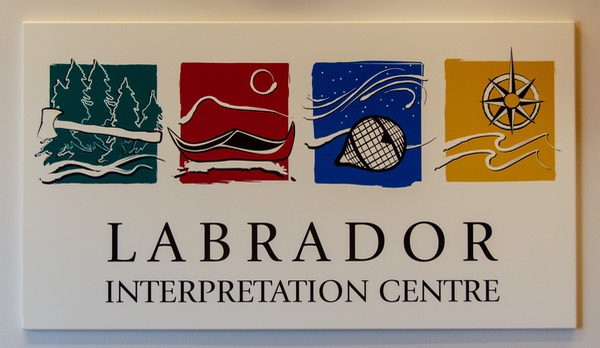
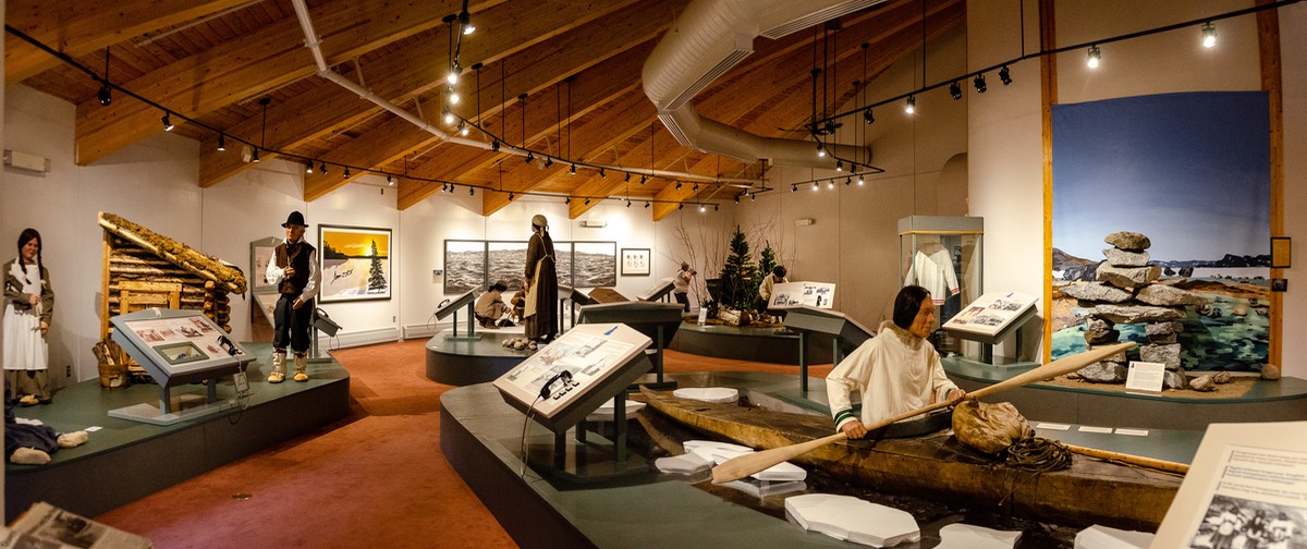
We enjoyed a couple of days here. Goose Bay was established in 1941 by NATO. There are military-type places to visit, a small visitor’s center, and in nearby North West River, about 40 kms north, there’s the Labrador Interpretation Centre. This is a small but nice indigenous interpretive center where we spent some rewarding time. There are remnants of several early tribes discussed, and plenty of artifacts. It’s pretty cool. We talked to someone there about the lack of caribou. They said the caribou population has been badly decimated through over-hunting, but with tighter controls in place they are now beginning to see some increase. We stayed the night not far away, up on a hill overlooking the water; it was really lovely. Could have stayed there for several days.
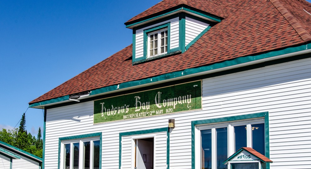
While in North West River, we stopped the next morning to see a small museum of local stuff; we were mostly interested in an old 1836 Hudson’s Bay Trading store, down close to the water. This little town was one of the oldest settlements in Labrador. Nice spot.
Going south from Happy-Goose, the road number changes from 500 to 510, and now the terrain was beginning to change a little bit as well. After several hundred kilometers of driving we have stopped climbing over this hump in the middle of the province, and have now dropped down from over 400 meters to about 80 meters in elevation. It’s warmer, and we’ve just passed through a grove of birch trees (we love birch trees). The soil is sandier, and we’re now seeing squirrels. Also, we’ve finally gotten into some lovely, gorgeous weather — about time!
The bugs are still awful, though. We might feel guilty about talking so much about the bugs, but in the grocery store at Happy-Goose a nice man came up to Rick for a chat. He’d seen us exiting the Tiger out in the parking lot and wanted to learn something about us. Anyway, after a bit of that he mentioned that he was actually the Mayor of Goose Bay; who knew. So about the third thing he said about this time was on the order of, “really sorry about all the bugs…”, so I guess if he can talk about them we can too. He got a good laugh when Rick told him that surely as Mayor he should do something about them. Hah!
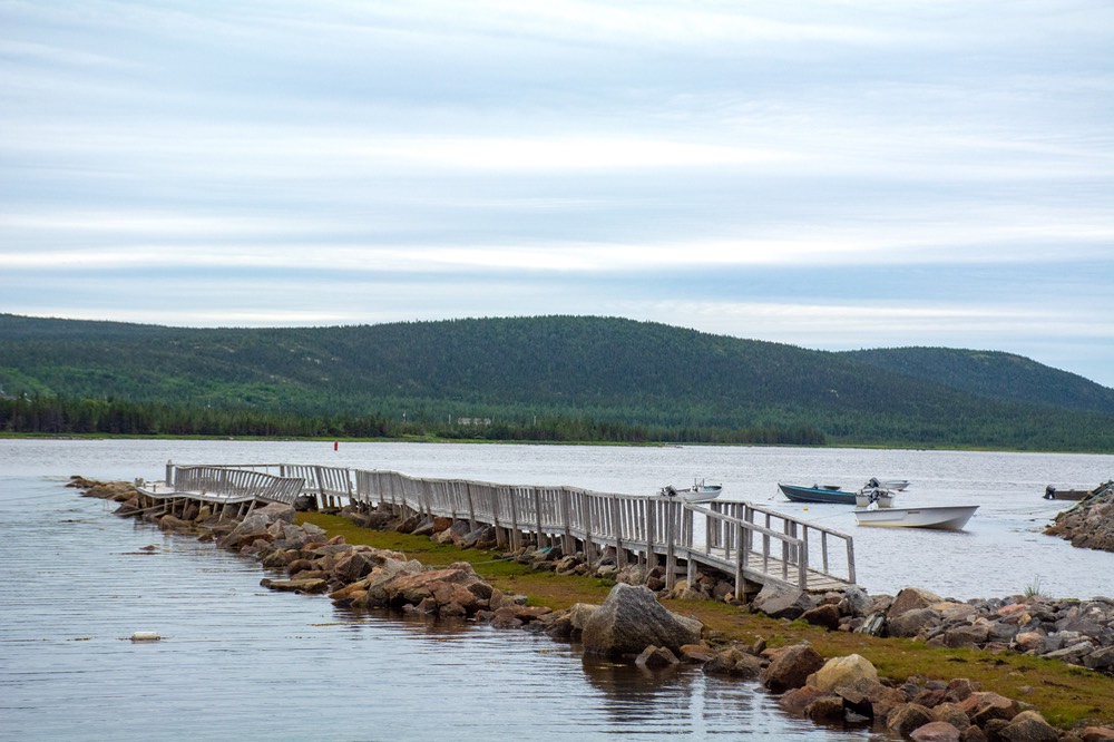
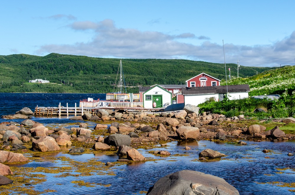
Soon we reached a turn off from rte 510, onto rte 516, heading for Cartwright. Not a large community, and not much going on; it didn’t seem to have recovered yet from the pandemic (many towns we traveled through were struggling mightily). Also, with the road in not having been paved, it was being by-passed by many. Why did we go? We have friends named Cartwright; they asked us to check it out. We drove in on a very good gravel road. It was quite nice, in part because the roadside brush had not been cut way back recently, and it was luxuriant and healthy and a lovely green. You drive along the edge of the Mealy Mountains and past a couple of lakes on your way into town. We enjoyed that drive a bunch. Cartwright used to be bustling. It’s right on the water, with a lovely beach nearby, and what was once an active fishery we understand. But the ferry doesn’t stop here any more, and the fishing has been curbed, etc. There are other towns in Labrador suffering the same way. But tourism is picking up this year; maybe it will hit them too.
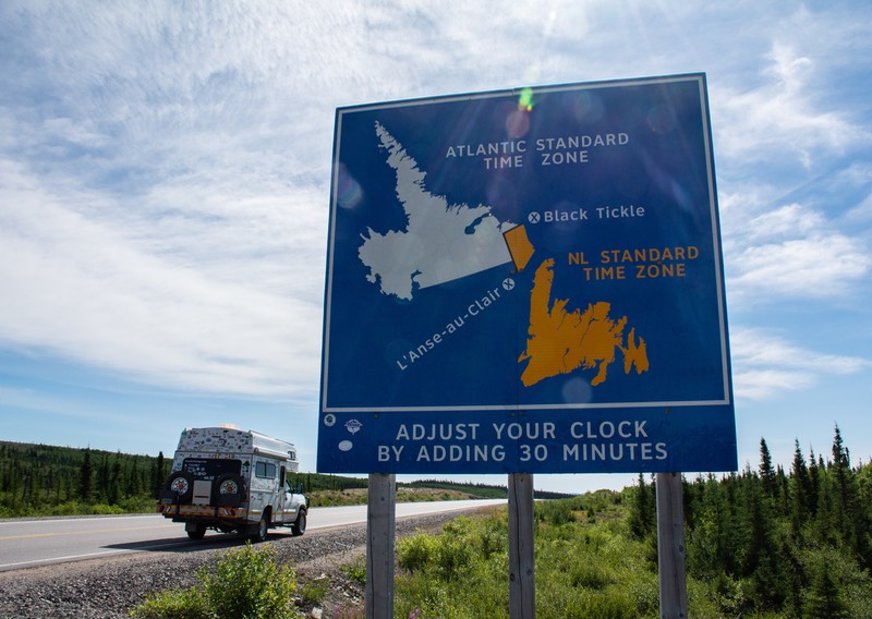
Back on the main highway soon we hit Km 280 and the time zone changed again and we had to move all the clocks ahead another 30 minutes. This put us on Newfoundland time — a bit early we thought, but okay by us. We were used to it and we knew it was coming. If you’re trying to keep track, we are now 1-1/2 hours ahead of Eastern time, so 4 1/2 hours ahead of Pacific time. About half of our clocks are in the electronic devices every modern family must have and they pretty much figure out where they are and make their own adjustments; for the others, Rick brings them all up to date to avoid confusion.
We made a quick run out from the highway to check out St Denis, supposed to be the best place on this coast to see icebergs. Well, maybe in May and June… but now? In August? Not a chance. Any bergs floating south had melted by now and given their all to the cause of rising sea levels — or something like that. But there is a very nice drive out to the town, and then you take this sort of steep road up to the top of a bluff and you can look out over the water, and try and spot them. With or without chunks of ice to look at, it’s still a really nice view. And, and, and… this is apparently the furthest east spot on the North American mainland that you can drive to!!! Totally cool, we think, and more easily enjoyed than icebergs anyway. In a month or so we’ll be out on Cape Spear in NFL, which is really the most eastern spot in North America.
It is now full summer here in Labrador and there are cars parked alongside the roads just about everywhere. They belong to the locals, out picking berries — cloudberries, aka bake apple berries. A few days later I had a piece of bakeapple berry crumble; quite yummy. It was enjoyed as dessert after a dinner of fish and chips in Red Bay, at the Whaler’s Restaurant, across the parking lot from the museum there.
Speaking of Red Bay, it’s a favorite of ours; we stayed for a couple of days near the very nice interpretive museum and restaurant. Splendid spot — views, photos, sea gulls, boats, museum, etc. We’d been here in 2004 and had been trying to get back ever since. For us, it’s perhaps our favorite spot on the eastern coast of Labrador — worth the entire trip. It is of course a World Heritage Site, but still, we’d been concerned that after 18 years it might have changed. I mean Cruise Ships in the harbor?? But no, much to our relief it looked and felt exactly the same; small, charming, natural looking and delightful. The museum complex in Red Bay is under more construction, with a new building being built, but what’s available right now is very interesting.
While in Red Bay, we had the good fortune to meet up with our friends Mary and Elaine. They were on a really fascinating cruise (which included Newfoundland, Iceland, Greenland, and started/ended in Nova Scotia) and stopped for a day here. Being casual travelers, and totally in charge of how quickly/slowly we move along, we had no trouble getting to Red Bay on the right date. We spent the morning giggling and sharing our mingled history as travelers. We had a splendid time and then waved them back onto their boat. A fog bank had started moving in, and they had begun hearing the fog horn from their ship out in the bay. It was kind of fun — the deep throat of the ship’s horn, responded to by the high-pitched response of the tenders running people back and forth — kind of like big daddy and the little squeakers. We enjoyed it.
Interestingly enough, this is the second time we’ve crossed paths with them in this manner. Back in January 2009 we were there to meet them and other friends as they came down the gangplank from another cruise, this time in Ushuaia, Argentina, aka Tierra del Fuego, the End of the Earth at the far southern tip of South America. We’ve also seen them from time to time in the US of course, but the cruise hook ups are the funnest ones.
We continued on and drove further south along the coast, stopping at a couple of grocery stores to get whatever was available. The Food Chopper in Forteau has wonderful baked goods that arrive fresh on Tuesdays. Don’t miss the homemade raisin bread. Found out we were going to miss the Forteau Bakeapple Festival, starting in about 2 days. Sad about that. But we’d already paid for our ferry out the next day. Another time. Oh, about that homemade Labrador raisin bread? It makes superb French toast. And it’s lovely with quince jelly from Templeton, CA and Tucson, AZ’s best homemade strawberry jam. (Thanks again, guys!)
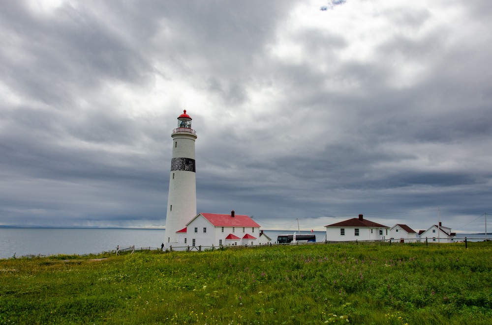
One last stop was in L’Anse Amour, at the lovely lighthouse there. Years back we had spent a lot of time there, so right now we simply wanted to enjoy its presence and the lovely views from the site. We spent our last night in Labrador close by. We were down the hill from the lighthouse, on a secondary road near the water, We had a great view of the entire area; it was quiet, there was a nice breeze (and no bugs, finally) and the water and clouds were beautiful. It was just the perfect place to end our time in Labrador.
The ferry ride from Blanc-Sablon, about a half hour further south, was quite painless. About 90 minutes of pleasant, smooth travel across the Strait, and then we found a lovely little spot on the other side where we could sit for a couple of days, catching our breath and watching the ferries coming and going over that beautiful blue water, under gorgeous skies and a light breeze. And welcomed ourselves to Newfoundland!
We had spent 10 days in Labrador. Was it worthwhile? Depends on how you look at it. We had always wanted to do this trip, coming in from the Québec side. When we first heard of the road many years ago, it was a big challenge, as almost the entire road from Baie-Comeau all the way to Red Bay was unpaved; something over 800 miles of wilderness together with the difficulties of the long, unpaved gravel road. That barrier and challenge has now been lessened since the road was finished. Now, aside from the 100 kms at the top of the Québec portion, it is all smooth pavement. So, in a way we’re sad to have missed the challenge, but then, it’s a lot easier now and that has its charms as well.
So, while Labrador is mostly just trees, and small ones at that, even so there were lovely bodies of water, literally thousands of lakes both large and small, and wildflowers forever, and enough sunshine to make things pretty, and nice people and some nice scenery. And then you get to the eastern shore and are in some of the loveliest area anywhere. So……?
We were happy to have made the journey.
We’ll close with a well placed borrowed thought from some other overlanders. To paraphrase: Is it worth doing this journey? Well sure, for those of us who want to see what’s around the next curve in the road and want to take as many less well known roads into as many less visited corners of the world as we can find the time to do — You Bet. But if you’re out traveling on your one month (or whatever) of vacation for the year… Nah, use your time in Nova Scotia and Newfoundland instead.
With high hopes for your continued health and happiness, we sign this missive off from La Tortuga and his traveling companions.
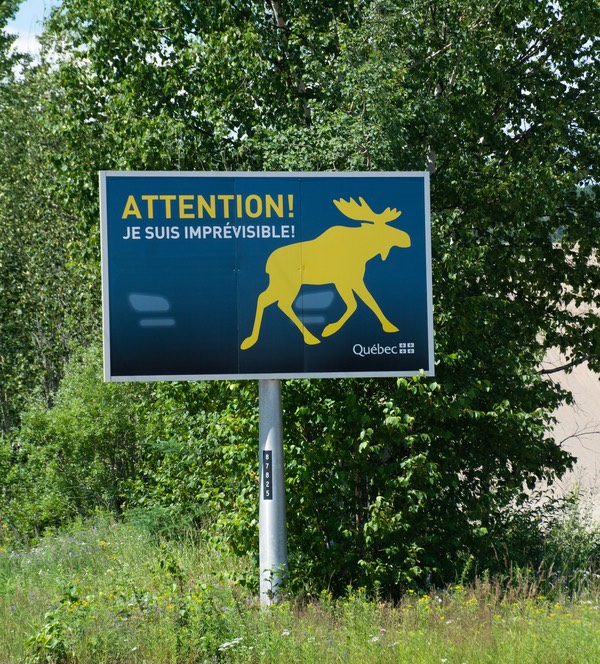
PS: It seems to us that perhaps the Labrador Moose have learned to read road signs and have been warned off. This is because while we saw numerous signs like this one warning us of the presence of the big critters we never saw a live one.
We’ve summarized our thoughts on this subject for you here. (Reader discretion is advised)
Chipmunks and robins, the occasional goose;
But hard as I look, nary a moose.
A fox, some squirrels, even a wolf;
But no icebergs, no whales, just empty gulf.
We’ve come so far,
But it’s never enough.
Many miles of road, sometimes smooth, sometimes rough;
But no sighting of moose, now that’s pretty tough.
Don’t forget to visit our Photo Page for Labrador