June/July 2017
Gone Walkabout
From Melbourne to Alice Springs, Roos, Emus & Uluru just for starters
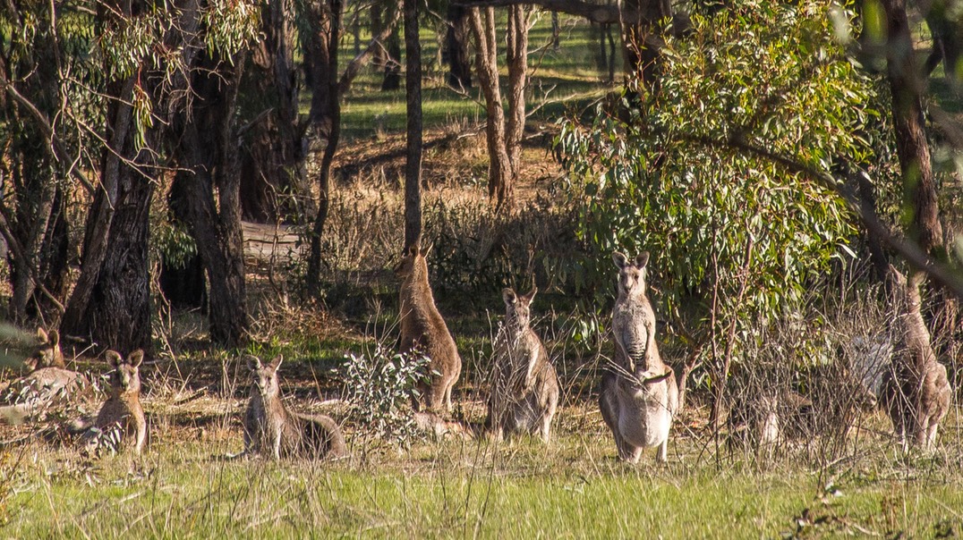
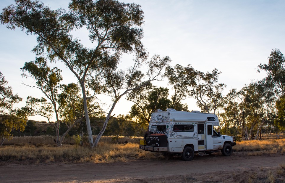
We’ve been back on the road in the Tiger over a month now, and we can tell you Australia is pretty near exactly as we’d been promised — a beautiful country with amazing natural sites to visit; a governmental bureaucracy that is the most confusing, convoluted and difficult to negotiate we’ve seen in a long while; people who are outgoing and friendly and happy to have you in their backyards; and a country that is so big we’ll never get to see it all, no matter how many times we are allowed to extend our visas! And what does all this mean? We’re having a great time, what else! By the way, this photo of Kangaroos would be great if it had been taken in a zoo, but Kathy snapped it out the side window of the Tiger as we drove past them along the road. Welcome to Oz.
We apologize for taking so long to get this message off to all of you. We arrived in Melbourne (Melbun in Aussie-speak) on June 9. The Tiger was scheduled to show up on the docks on June 14; we spent the time in-between dealing with red tape, seeing a bit of the city, and enjoying the company of Australian friends who lived a few hours to the east and had volunteered to take us under their wing as we learned the ropes. Gary and Liz were super; they not only picked us up at the airport, but they shepherded us around, gave us piles of maps to use while in-country, and organized places for us to stay while we waited for our ship to come in. Oh, yes, and allowed us to purchase a wifi device using their name and street address. Such wonderful friends!
We spent our last days in-waiting back in Melbourne at a hotel that was perfect for sight-seeing. If you’re looking for a spot, the Best Western Atlantis is rather bare bones, but it’s on Spencer Street close to the Southern Cross Train Station, a huge shopping center, and most perfect, it’s within the free tram area for visiting sights in downtown Melbourne. We were able to wander at will and get to it all for free. We spent a lot of time at the NGV (the National Gallery of Victoria), which was featuring a huge and excellent exhibit of modern Aboriginal art. The museum is located in Federation Square, a wild and woolly open space filled with fascinating architecture juxtaposed against traditional buildings, performance spaces, and the ever-present cafes and bars. There was a fellow dressed in his bathrobe and leading a goat. The police were giving him the evil eye, but seemed willing to let him alone. Wish I’d taken a picture.
Despite the short amount of time we had, we also poked around some of the small lanes and older buildings. Melbourne is famous for its Art Deco architecture, and we stuck our heads in a building that looked pretty inviting. The entry area was lovely, with lots of tile and murals. Should have stayed there, but we ended up taking the escalator to the second floor, where we suddenly found ourselves in the middle of a very busy dental office. They were cool about it and helped us find our way out as quickly as possible.
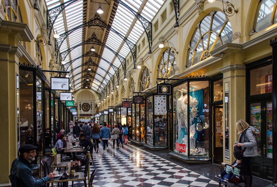
The same area had several other walk-through galleys and we managed to find the Block Arcade, constructed in the 1890s and one of the finest. Very fancy shops prevailed, the crowds were having a splendid time, and we enjoyed the scene. It was something else.
On the business end of things, we were able to track down Vic Roads; no, not a lounge singer. Victoria Road and Transport is the governmental entity in Victoria that is in charge of licensing drivers and vehicles for transport on the state’s roads. (Or something like that.) We were required to get CTP insurance for the Tiger. CTP is third-party liability insurance; in Europe they call it “green card coverage.” We’d spent many a day trying to work our way through the red tape involved in finding out if (1) we needed it, (2) how to get it, and (3) where to find a VicRoads office. Ultimately we worked our way through all that and even found the office, where, to our enormous surprise, the fellow knew what we wanted and could get it for us. Success!!! One more hurdle overcome. Guess we were lucky as he allowed that we might have found the only person in the office who knew what we needed - him.
Then, miracle of miracles, the Tiger actually arrived on schedule, and - even more miracles - two days later our shipping agent told us to get down here NOW before someone changes their minds. We took a taxi to the port, climbed in, and took off! In the end, getting our rig out of the port was the easiest part of the whole procedure. Yeah! This is definitely not aways the case and we’d heard some horror stories about difficulties encountered when bringing a vehicle into OZ. We followed the advice of our shipper in choosing Melbourne as our port of arrival and credit our success to their local agent. We’ll share more on this topic when we post our shipping page.
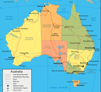
Before moving on, a tiny bit of geography may be helpful. Being as we are now traveling in the Southern Hemisphere, June is like December in terms of weather and heading north toward warmer temperatures replaces the heading south those of us who live in the Northern Hemisphere are all used to. So, having arrived in far southern Australia in Winter our basic plan had to be to move north directly and with this in mind our intent was to head toward Alice Springs in the center of the country and then further north from there.
Wanting to flee the big city as soon as possible, after the necessary stocking up we began by driving north towards the Murray River region, which had been highly recommended. We spent our first two nights in gold country. Now Rick and I, being from California, aren’t really Gold Rush enthusiasts. But this area of Victoria is quite charming, with many towns that retain some of their old buildings, Chinese camps, wells and mining machinery.
And we saw our first kangaroos - on our first night out of the city. Wow! Your first critters out in the wild are a pretty special sight. The roos were great; we saw bunches of them over the next couple of weeks, out in the fields and among the eucalyptus trees. Hard to photograph, but we worked at it. More recently, further north and out in the desert, the roos have been few and far between; mostly we see signs warning us to avoid them along the road. We expect more sightings as we go along.
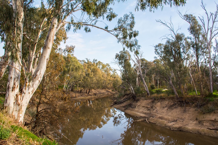
We slowly moved north until we got to Echuca, along the Murray. The Murray River mostly runs east-west across the border between Victoria and New South Wales, before turning south near the border with South Australia and running into the sea next to Adelaide (more OZ geography than you ever thought you wanted to know). Anyway, the Murray is a big, important river in a huge dry country. It’s lovely, too, and paddle boats can be a big part of the fun. We wandered in that area for a few days, mostly following the river as it drifted west of Echuca, being lovely and enchanting. We were able to bush camp along the river much of that time, which was particularly great. It’s very peaceful, there are few others around, and the whole experience is very nice.
The fields were very productive in the river plain; we saw cotton and pumpkins, along with other squashes at the roadside stands. Some fruit trees were in bloom, and there were happy vineyards just starting to leaf out.
In our wanderings, we followed a small road into a lonely area and abruptly ended up at a guard shack. Uniformed and very serious folks came to meet us, holding up hands and with guns in evidence. Hmm. We acted friendly and curious, they settled down and simply told us we had to turn around. Evidently we had encountered “the largest live firing range in the southern hemisphere” — e.g., army land and go away. Apparently 80 years ago it was built by (Lord) Kitchener; before then we could have driven through. Ah yes, a day late and a dollar short. So we reversed and found another road. No worries, mate.
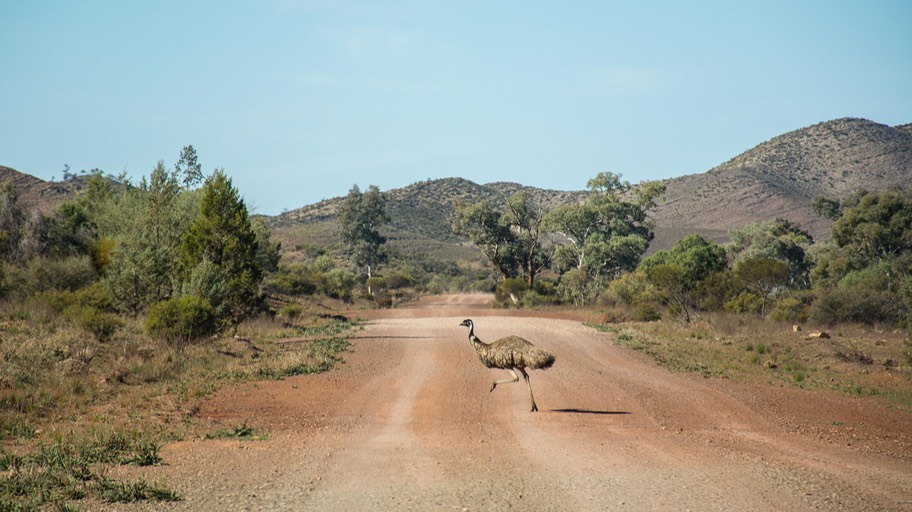
We've also started seeing emus, which are less skittish and easier to take pictures of. They were incredibly fun. They were very common out in the countryside, which was where we tried to be as often as possible. We saw them along the road, in the trees, alone and in groups. Standing, running, doing all kinds of things. They’re really big too.
We’ve known all along that Australia is huge. I think now they play a trick on you. The distances between places are so great that the maps are of a very large scale, thereby minimizing the apparent distances and making towns seem closer. That’s my story and I’ll stick to it.
Eventually we found our way to the border between Victoria and South Australia — and our first experience with the “fruit patrol.” (You can see I’ve grown up some — they are no longer “border bastards” like they were in South America.) Several of the states in Australia have controls at their borders, to keep the wrong bugs from finding their way into the crops on the other side of the line. Not to be sarcastic; this is a very important agricultural control, as long as you don’t lose a lot of your recently purchased food in the process. In any case, we’d been well warned and they got nothing from us. The only mini-disaster was that we’d been told they would take our honey (they didn’t) and we’d almost overdosed by trying to eat up some quite lovely stuff over the past few days. Sigh.
Incidentally, this was along about June 21, the shortest day of the year down here, and definitely the middle of winter; we were experiencing below freezing temps regularly. While shivering at night we entertained ourselves by wondering why they have Northern Territory, Western Australia, but just plain ol’ South Australia. Mutter, mutter.
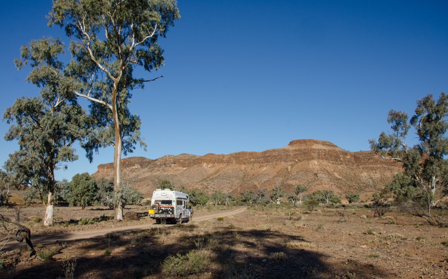
Having entered South Australia we started honing our off-road skills, knowing we were getting ever closer to our first “Track” time. Australia is famous for its gravel/dirt/sand tracks that criss-cross the interior of the country. These roads go long distances over rough ground, with few water reservoirs and even fewer restaurants and grocery stores. But they are great fun and a super way to get into beautiful and lonely areas. We were making sure we were ready for the challenge.
Rick had some off-road type things left to purchase (including the shovel I demanded we have on board), and we were still deciding which roads we thought the Tiger and its owners were up for. We stopped in Port Augusta, the last major town before Alice Springs, several hundred miles distant. After rotating the tires, filling the fridge/freezer with provisions, buying yet more of those treacherous maps, finding a suitable shovel and munching down the last hamburger for awhile, we moved on.
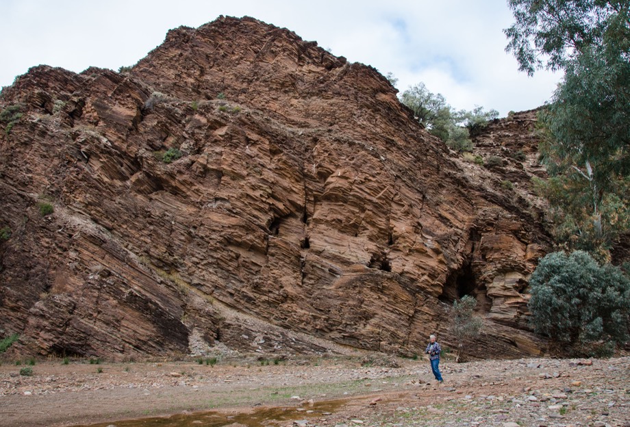
We headed first for the Flinders Ranges NP, along the way to Alice. This area had been recommended as both lovely and a good start on getting rugged. Both were true. We spent a few days wandering the gorges of the park, with the roads often being dry creek beds. There were rudimentary camping areas along the way, and lovely rocks to enjoy. Our very first night we’d gotten a late start, and ended up traveling well into the night darkness before giving up and finding a wide spot in the creek bed to park up for the night. Very nice. This is a great place to explore. The geology here goes back 580 million years.
Moving on after a couple of days, we stopped in the little village of Blinman, where we discovered fresh homemade bread; quite yummy. We kept moving a bit further east, still on gravel, and stopped in a bush camp at the foot of Mt Chambers, where we could walk up the gorge (again, a dry river bed) and take a good look at some interesting early indigenous rock engravings. Super. There were a few other folks in the camping spot, so we made some new friends. They all live in the Sydney area, and do a lot of traveling together. We were all headed in a similar direction, and we hope to see them somewhere further down the road, although we’ve not spotted them yet.
We made one further stop in the Flinders Ranges, at Vulkathunha/Gammon Ranges NP, with Italowie Gorge to enjoy, then made our way back west to Copley (Quandongberry pies) and then pavement at Leigh Creek — which had a grocery store and even some internet. Civilization as we know it!
After freshening the larder a bit and topping up our water tank we pressed on towards Marree, the beginning of the Oodnadatta Track, a well known official Australian adventure experience. The pavement ended just a bit above Leigh Creek and thereafter we were on gravel and sand. We made a short stop in a wide spot called Farina, where the locals are reconstructing the historic community and helping to pay for it with goodies baked in an underground oven; we helped out.
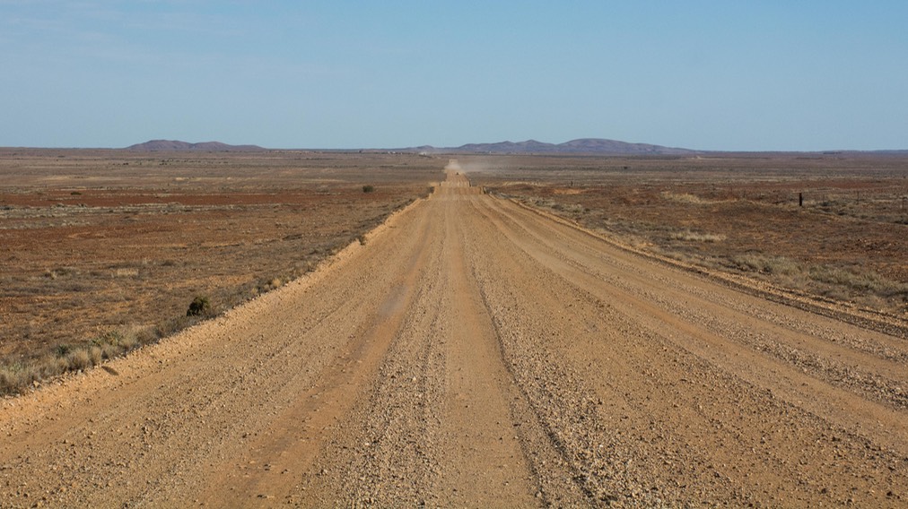
Why all this dirt road stuff you ask? Well, in the center of Australia there is only one paved road of any length, The Stuart Highway, which runs north-south from Darwin down to Adelaide, going through Alice Springs in the middle. There are short east-west paved roads, for example the main road out to Uluru (Ayers Rock). However, if you want to go across Australia you’ll be doing it on dirt and that is part of the reason why four wheel drive SUVs and trucks are the overwhelming vehicle of choice out here. The Oodnadatta Track is one of several roads that branch off the Stuart Hwy and connect The Alice to other regions. It’s one of the better known and easier tracks and so a good one for us to get our feet dry and dusty on.
You’re saying 618 kilometers (383 miles) of dirt road? For the fun of it? Well sure, why not. For those who come out into Australia’s enormous outback by choice, the attractions are many. There’s simply the challenge of it of course, to be able to do it is good. But it’s also the only way to leave the tour busses behind; to get to where you can be, if not completely alone, then at least in a place where you can feel that you are off by yourself; not a part of the crowd. Choosing to travel on dirt roads instead of paved has this same effect in most countries. The difference in Australia is that the distances are so great between pavement that it becomes a real adventure and not just a side trip. So, the Oodnadatta is only the first of what we hope will be a number of such experiences during our time here.
Traveling on an unpaved road in dry weather you learn to identify “incoming” vehicles by the dusty plume that precedes them. This is particularly helpful when you are moving back and forth across the road, side to side, looking for the smoothest areas and often ending up on the side of the road where that plume is going to arrive. Rick concentrates on the road just ahead, looking for those smoother places, while Kathy’s assignment is to keep an eye out for signs of oncoming traffic, knowing to shout out “incoming” at appropriate moments. Learning to drive the track.
One of our overnight bush camps included a charming unexpected event; we came upon Tomas (Tomi) Aperlo from Argentina. Tomi, in his early 30’s we guessed, is bicycling all over the world, in a general sense, and has been doing this for a long time already. We had a nice discussion about the pleasures of being on your own and talking about places we’d all visited; in the morning he came by for a hug, gave us some blog sites to check out (all in Spanish, of course) and went wheeling on down the gravel road. He was amazing and wonderful to meet.
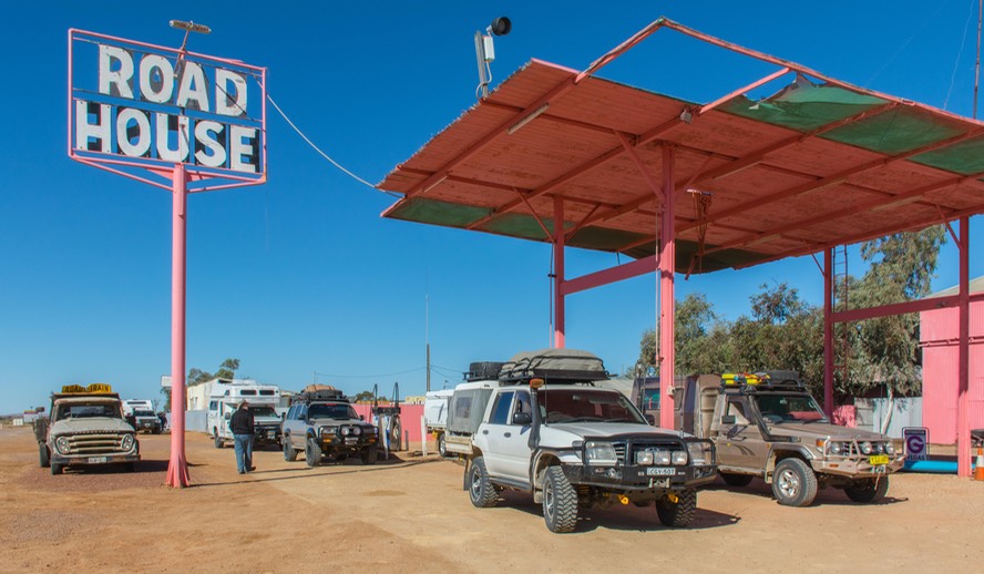
We pretty much stayed on the track, but did take a short road to the edge of Lake Eyre, 12 meters below sea level. This is mostly a dry lake bed, but occasionally after extensive rains turns from grey to blue. Not much to see at this time, but we were reminded of the salt pans of northern Argentina. We were traveling through the Kidman Cattle Station, and yes, Nicole is a descendent. This is the largest cattle station in Australia. In Oodnadatta we stopped at the famous Pink Roadhouse for fuel and a break. Yes, it is, indeed, totally pink. Got the pictures to prove it, and a new sticker on the back of the truck.
After reaching Oodnadatta, we decided to detour across the attractive-sounding Painted Desert instead of staying on the O track to Marla. It was about the same distance, but more interesting; we enjoyed the excursion and when we rejoined the pavement - bitumen as they say here - we turned north. We skipped Coober Pedy, for all of you waiting with bated breath to hear all about that; would’ve required too much back peddling and we aren’t really shoppers anyway.
Well naturally enough, it’s all a bit less interesting when the road is easy. The best thing was seeing large semis with three trailers. We knew they’d get longer than that soon enough, but these puppies were already up to over sixty (yes, 60) wheels. Our American 18- wheelers are just runabouts compared to these guys. Moving along the Stuart Highway we entered Northern Territory (no fruit patrol here, if you’re keeping track). Soon the roadside was presenting large rocks for our enjoyment. That was cool.
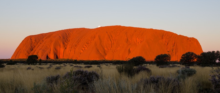
After a short run we turned west onto the Lasseter Highway toward Uluru/Kata Tjuta National Park. A significant moment in our lives. What do you say? Uluru, also known as Ayers Rock, is absolutely every single good thing anyone has ever said about it. A magical spot. We have great pictures to show you, but if you ever get the chance, come and see for yourself. Like the Grand Canyon in the US, photos can be beautiful, but they just can’t capture the experience completely. Everyone agrees that seeing Uluru in the light of a sunset is the best possible experience and we agree. We were lucky enough to be there on the night when the full moon came up right behind the rock at the perfect time; just before the shadows began climbing up the face.
We had a three-day pass for the park, which was great although we ended up being able to see everything we wanted to in just two days. There is no camping in the park, although there is a large resort right outside the gates; so each night we left the park and went to a bush camp a few miles away to the east, where we joined about 20 other rigs for overnight. The camp spot was huge, with plenty of room to get off to yourself, and the full moon was definitely a highlight of being there. It was here that we ran into another American couple who’d shipped their Sprinter van over from the US. We had known about them and they had been aware of us so it was great to cross paths and chat for awhile.
The Rock is only part of the story of this park. The Culture Center gives good info on the flora and fauna of the area. Even better, there is an excellent overview of the indigenous version of the creation of one of their most sacred sites, along with a lot of really good info on their lives and work today. You also got a chance to watch some of the artists at work. It was really neat and a great spot to spend a goodly amount of time.
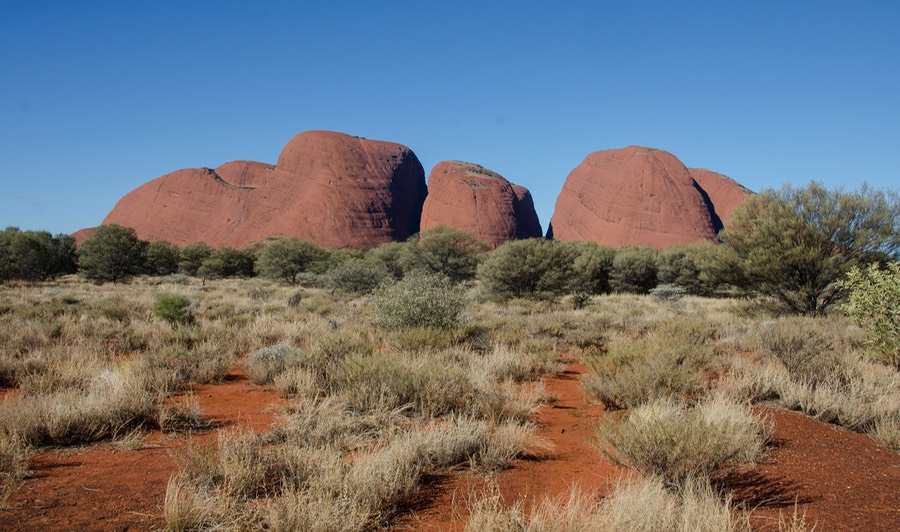
Some folks say they think that the other major site in the park, Kata Tjuta, is even more intriguing than Uluru. We think they are of equally impressive. Kata Tjuta is a collection of rock outcroppings and thus has a more varied shape, while Uluru is actually a monolith (one large rock), with two-thirds of it said to be underground. Each is captivating in its own way and together they make a great place to visit. We hiked into gorges, took pictures, stood and gazed, and had a great time. We were able to see the full moon rise over Uluru; that’s about as good as it gets. Oh; did we forget to mention the amazing red color these rocks are?
Near Uluru is Kings Canyon (Watarrka) NP, also a great spot. The canyon, not surprisingly, is your typical big ditch, this one carrying water through it enough of the time that there is a verdant glen one can walk through. There is also a steep hike to the rim of the canyon, then a nice walk around the entire rim before descending on the other side. For us, a saving grace was that sometime recently it was decided that it was okay to just climb the southern rim, which is close to the best views, walk as much as you wanted, and then return the same way if that was your pleasure. This is a bit shorter than the rim walk and we managed to do it. It was a real struggle for us; we aren’t in anything vaguely resembling “good shape.” Not at all surprising, it was quite warm for a change. We’ve been having very cool weather until now. Our good luck!
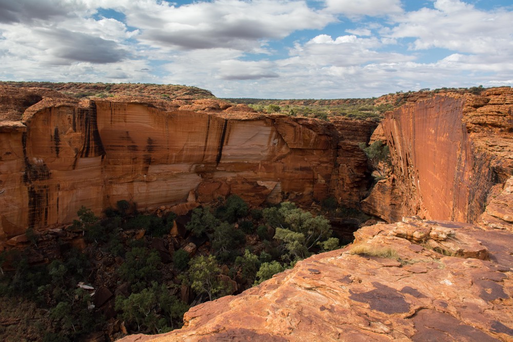
Beyond the difficulties, this is a beautiful place, with amazing geology. Red rock is everywhere; sections have tumbled off the cliff face, leaving huge slabs of vertical, shining surface. The views from the rim, out across the countryside, were great. Absolutely terrific and yes, worth the effort.
After we recovered from our “walk” (why can’t they say it was a strenuous hike?) we managed to get to an overlook a few miles away, where we settled in for the night. While there we met an Australian fellow and his Brazilian girlfriend, who were out for several months, seeing the country. This was an interesting encounter in part because the fellow stopped to talk to us because he saw our Latin America 2007-2009 sticker and wanted to tell us that he’d been there in that same time frame! Once again, our sticker collection led to us meeting people whom we otherwise might have missed. We seem to be seeing more folks in their 30s these days, taking time off between job commitments, or looking for new opportunities. Wish we’d done that in our early years, for sure. But there were adventures ahead so after a couple of hours visit we kept moving on.
On into the West MacDonnell Ranges and the unpaved, rough road that heads toward Alice Springs. This, the Red Centre Way (formerly known as the Mereenie Loop), goes partly through Aboriginal lands and requires a permit. We had stopped at the Kings Canyon Resort to get our permit before we began, but they were sold out and told us to get it at the other end of the section, at the Glen Helen Homestead Lodge, which we were able to do. We are beginning to learn the importance of these wayside lodges. You can usually get fuel and water, a place to stay the night, a decent meal, and a chance to catch your breath. To say nothing of fun stickers. Our collection is growing.
Onward, we were on a rough wide track with significant corrugations (washboard in the US). We were scooting all over the road like playing bumper cars. Each time we stopped for anything, Rick got out to check the tires. Then, at some point we heard a loud, somewhat familiar clunk and one side of the hood popped up. A hood hinge had broken. Rick got out to check on it. Ah yes, this was the same hinge that had broken in Argentina, in 2008. We’d gotten over 125,000 miles on that weld, not that bad. Duct tape would get us into Alice Springs for a proper repair.
We spent that night at a beautiful river bed bush camp, possibly the nicest we’ve seen yet. The late afternoon sunlight was lovely, the trees were in full bloom, and it was so very quiet. Refreshing after the chaos of the day.
The next day we started east to Alice.
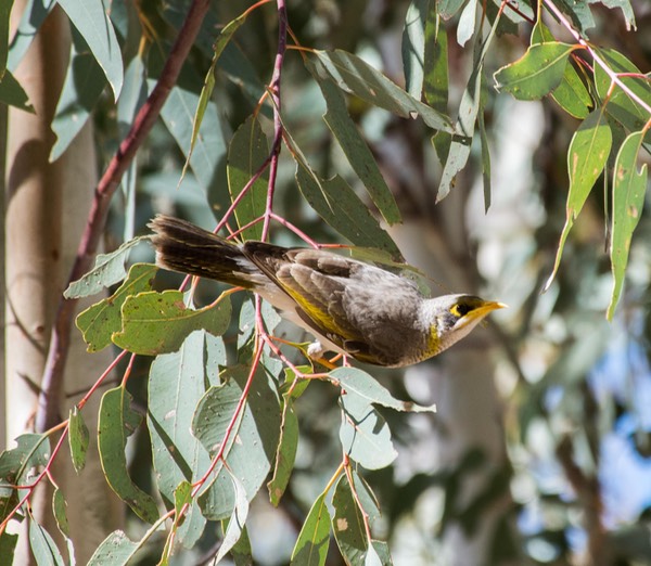
There are several places to head off the highway and explore the dramatic gorges, but we wanted to get to Alice by the end of the day. We did make a very nice stop at Ormiston Gorge however. You can climb to a great lookout with very nice views down into a river bed with ghost gum trees, and even water in a billabong. It was lovely, and the trees in the creek bed were filled with birds. Perhaps we’ll be able to come back into the West MacDonnells later, and do more exploring. Besides taking care of the truck, we have mail coming to Alice, and know it may take awhile.
And then we pulled into Alice Springs, which quickly became the new center of our world. We’ll be here for a week or so. More soon.
Rick and Kathy, and the tortoise currently known as Kurlibil (based on a Aboriginal word for a tortoise in a legend.
Click to see more photos from Gone Walkabout