July 2022
On the Road to Chisasibi
Wandering around in Quebéc’s far north
Oh, Canada. It is so good to be back after many years away. In our first six years on the road we spent the bulk of every summer up here, but the last time was 2007. After fifteen years of travel in other parts of the world we were delighted to be making a return.
Our last message ended with us in Michigan’s Upper Peninsula getting ready to cross into Canada at Sault Ste Marie. We’d crossed at this border a couple of times before, the first being in 2003. Everything looked much the same, but naturally some things had changed. We’d been following the ever changing border requirements of course, and thought we had things under control. As it turned out, we didn’t quite get it right. We knew we needed our passports of course, and also proof of having had our Covid vaccines. What we missed was that we had to enter our shot information into an app in advance of crossing the border. Big oops. If it didn’t show up on a computer screen it wasn’t real…? Oh well.
We started our attempt early in the morning (well, at least early for us), and it ended up taking us three trips across the border toll bridge before we got it right. After our first crossing we learned that the border folks absolutely would not even look at our paper vaccine cards. Instead it seems we absolutely HAD to have one of those square jobbies with all the squiggles they use now to identify you properly. And, no, we could not just park nearby and do that, we couldn’t be in Canada until we were fully documented. So we had to return back over that bridge and into the US. That was our first try. Charged $6.50 for the crossing.
So it was back to Michigan for us. Charged $6.50 again. Hmm. Sat in a parking lot on the Michigan side until we finally found the right website to get the right thingie. Multiple attempts were needed to properly upload a photo of our shot records into the correct app, but in the end all was accomplished and we were approved for entry. We could not get the photos to load on the official government site despite a pair of phone calls to friendly but ultimately unhelpful folks. Stopped for lunch and then tried again, this time on a different portal. Worked great but they charged a fee for the process. Grumble, grumble…
So back across we went heading into Canada — third time’s the charm — and this time a new person at the toll booth either took pity on us or just had a different opinion of what’s an RV and what’s just a truck. We get this a lot at toll booths so we’re used to it. Anyway, he just charged us the $4.00 toll for a two axle vehicle and we were thankful for small favors.
New thingie in hand (technically in phone) we approached the border point for the second time and this time all was well. We were in the computer so therefore we were legit and were eligible to come into the country. At last! Borders just aren’t as much fun as they used to be.
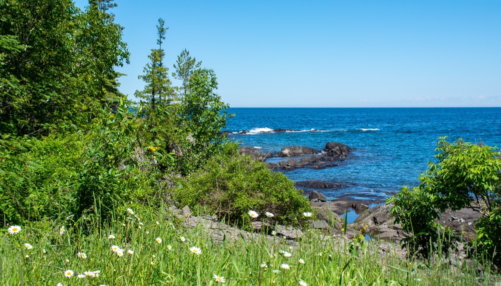
Our plan? We were heading for an out of the way road that would take us to James Bay, in the northernmost area of Quebéc Province. To get there, our route first took us north through some of Ontario, along the eastern portion of the road that circumnavigates the northern side of Lake Superior. It’s a really lovely road connecting Sault Ste Marie in the east to Duluth, MN on the west side. We’ve done the whole road twice before and happily say that if you’ve never done it you should begin making plans! On this year’s trip we would be heading east at the “top” of the lake, rather than west, so we only saw a small portion of the road before turning off.
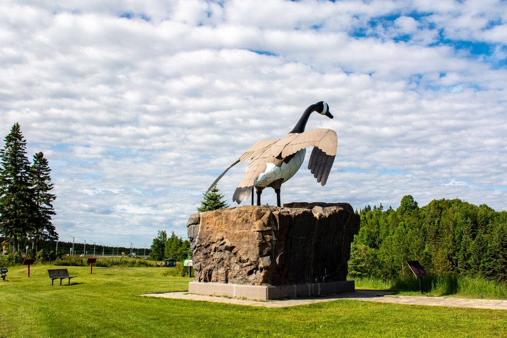
We stayed our first night along the waters of Pancake Bay, somewhere south of Lake Superior Provincial Park. The next day we found ourselves in a little town advertising fresh baked, hot apple fritters —WORLD FAMOUS — they were wonderful, just wonderful! Ate some at a picnic table overlooking the lake and bought some day old ones on sale for tomorrow’s breakfast. Burp. Forcing ourselves back on the road, we drove on through the park, heading up towards Wawa, the town with the funny name. Beautiful drive, and the occasional view of the lake was lovely. Along the way we stopped at some very nice waterfalls a bit off the highway, and then came into Wawa and the enormous goose statue that tells you you’ve arrived. Pretty cool statue, actually; and to be fair, Wawa is an indigenous term for wild goose.
From Wawa we went a bit east and traded one big lake (Superior) for what seemed to be thousands of smaller lakes. Lots of woods and lots of lakes up here, and green, green, green to boot. After Spring spent in the brown and dusty Southwestern US, we were ready for a change and really got it. We began to see sandhill cranes, and even spotted a fox. We spent nights at pretty little lakes; fisher persons were everywhere, and so were the mosquitoes. Our trip took us through the company town of Timmons (mining, mostly) where we learned that in the nearby town of Cochrane there is a polar bear habitat that we thought we might be interested in. However, in researching it, we found it apparently is a very commercial situation, even though its purpose is to take care of a small group of bears that had been rescued back a few years. Pay this much to see a bear; this much more to touch a bear… stuff like that. When we spotted on the map that there was a helicopter pad next to it, as well as an event arena for public programs, we bailed on the whole project. Not our style, so we kept moving. We had hoped for a more natural experience. I guess Churchill, in Manitoba, needs to go back on our list. Rick says we don’t have a list… hah, Kathy has a list for everything.
Well now, what province is just east of Ontario? Quebéc, of course. We crossed the provincial boundary, set the clocks an hour ahead, brushed up on our bits of French, and plunged onward. And smiled. We were driving through open forest and countryside. It began raining one morning, and looked like it might last the day. It was quiet, with little traffic. The mosquitoes had taken shelter for the moment, which suited us quite nicely; it was a bit chilly for them and probably they don’t do well dodging rain drops.
Drove through the town of Cadillac (French explorer of the 1600s) and beyond, and ended up in Amos, our target for the day. The area was looking a bit familiar (at least the names), but it was 2004 when we were last up in this neck of the woods and most places have changed a lot since we last came through. Our memory says that Amos used to be nowhere! Now it’s a charming summertime destination with lots of cafes and boutiques and loveliness. We enjoyed coming back to the area.
Some of the development around here is because it’s a good stop before driving further north, way north. And that’s where we were heading — to the James Bay area. James Bay is on the bottom of the huge Hudson Bay; you remember the Hudson Bay Company, maybe. That’s where the British started their massive fur trapping, logging, and general territorial settling.
Heading north from Amos you go up a ways to Matagami, the jumping off place for the James Bay Road; the town is your last real bit of “civilization” until you get up near the Bay, roughly 600 kms further on; a very long ways north. It’s also the last gas you’ll see for 381 kms and they make very sure to tell you that. We enjoyed Matagami, particularly a nice grassy area just outside town that had a path leading down to the waters of the Bell River. We managed to find the tourist office, and got some pretty good information on where we were planning to head. Good thing — we’d had almost nothing until then.
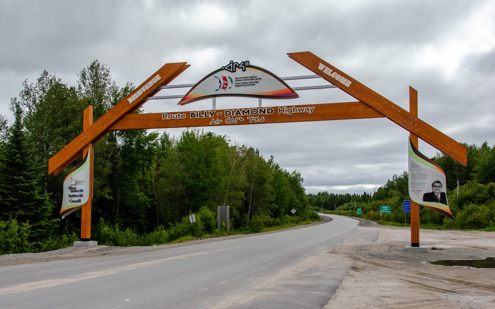
By the way, it was here that we also learned how to pronounce the town names in this area. Place the accent on the second syllable — ma-TA-ga-mi, and chi-SA-si-bi. Like that.
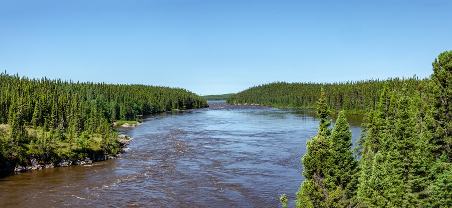
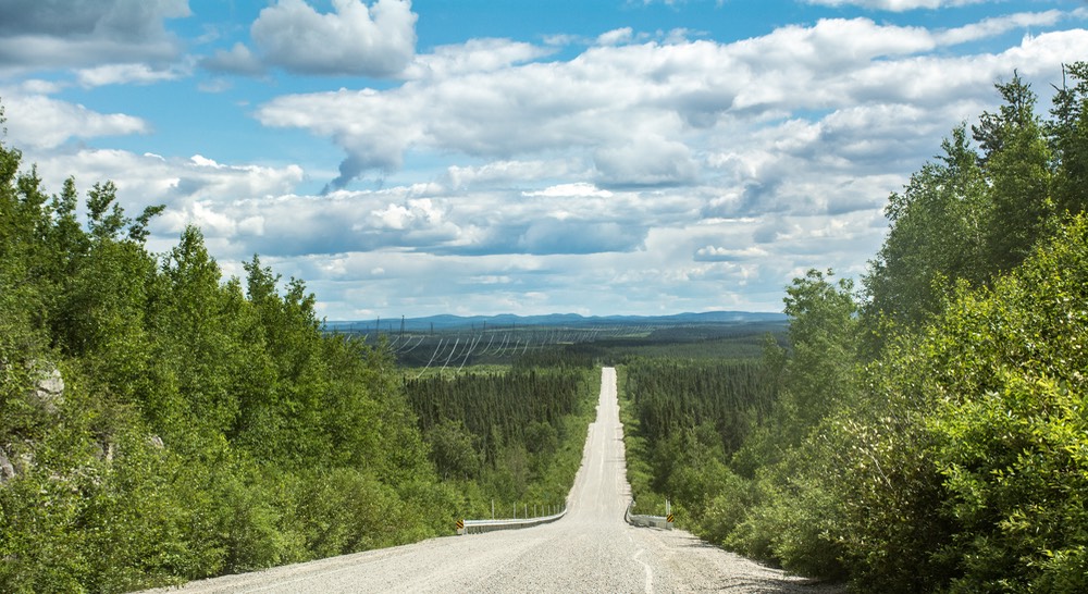
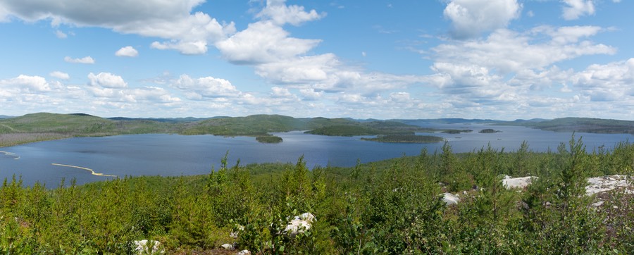
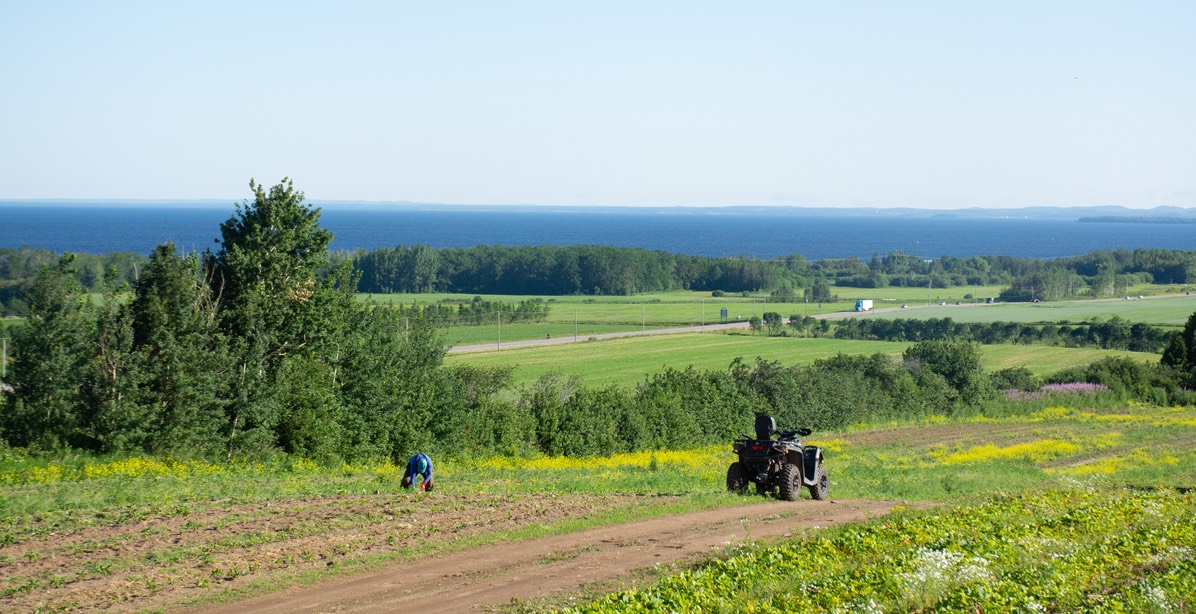
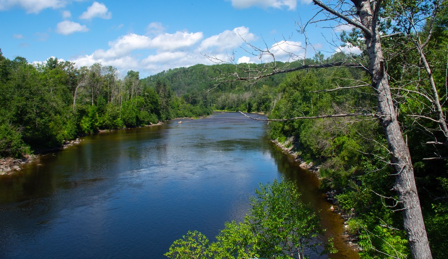
The James Bay Road (aka Rt 109, or the Billy-Diamond Road) has been kept in very good, paved condition part of the way north, as far as the fuel stop at km 381, and we found plenty of places to hole up for the night, along with lakes and rivers and even some waterfalls to see. We were reminded that northern Quebéc is water, water, and more water — everywhere you look — and plenty of bugs too. The scenery was lovely forever, but we weren’t delighted with the mosquitoes and, later on, large black flies. We have good screens on the Tiger, and lots of bug stuff; it helped a lot. But you sure weren’t too interested in long hikes back into the more remote areas to see what you couldn’t enjoy from the road! And sometimes you couldn’t even manage to hop out long enough to take that special picture you really wanted.
OK, that covers the bugs. We promise not to mention them again.
It was warmer than we’d expected and we found that overnighting in wide open spaces gave us a better chance to catch the fairly constant breeze to help us keep cool. The road sometimes kind of got boring, but the scenery was mostly quite nice. As we kept moving north the road wasn’t such good pavement and got quite bumpy at times. The change occurred just after the km 381 fuel stop, which is also a large maintenance and housing complex for the power company. We muttered but persevered and we’ve certainly been on much worse roads before.
The reason this road up to James Bay even exists is because of the huge hydroelectric plants that had been constructed up here. An enormous series of generating stations, including the world’s largest underground hydro facility, the entire scheme dominates all commercial activity in the region. All of this was quite disruptive to the indigenous groups that live up here when construction was begun back in the 70’s.
When you reach Radisson (no connection to the hotel folks), which is up at the top of the road and the headquarters of the “water project”, you can make arrangements for tours of some of the plants. It really is supposed to be quite amazing; the end result of it all is the provision of much of the electricity for Quebéc Province.
We had come up here to see the area and to hopefully stick a toe in James Bay. That’s what we do, go out of our way on sometimes very bad roads in buggy areas where there’s no decent wifi and too few ice cream stands — because it’s there. That’s the carrot at the end of the string, but we do reserve the right to whine just a bit as we go, despite it being all our choice to begin with.
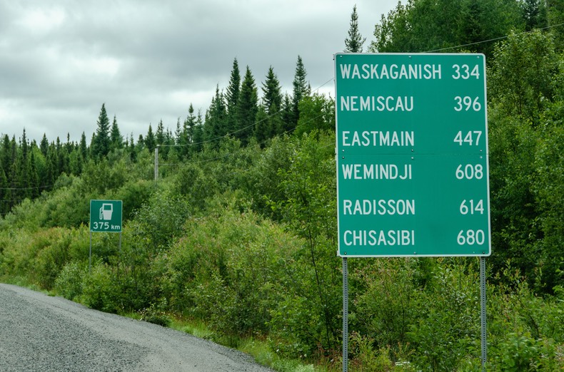
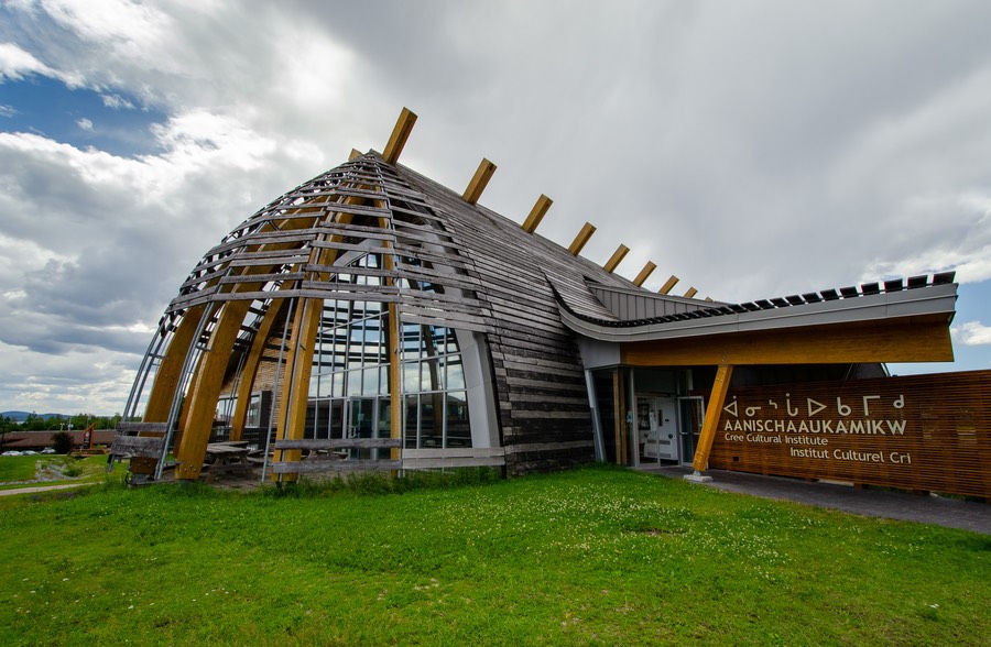
And this time there was a treat attached to the carrot. When we started reading the materials we had picked up at the tourist office, we realized that what would be special for us was to learn about the people who had been here first. There are many indigenous nations in Canada; the large one that inhabits the entire James Bay area and environs is part of the Cree Nation. It has its headquarters in the town of Oujé-Bougoumou, and its (presumably) largest congregation of inhabitants in the town of Chisasibi, on the edge of the Bay itself. Chisasibi is west of Radisson about 100 kms.
So now you can see our overriding plan. To visit Radisson and Chisasibi, at the end of the road. Then we would head back south and take a second road that would split off part-way back down the hill, called the Northern Road — Route du Nord — which would take us east and south to Oujé-Bougoumou. (oojay-BOO-ga-mo)
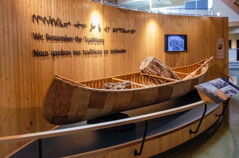
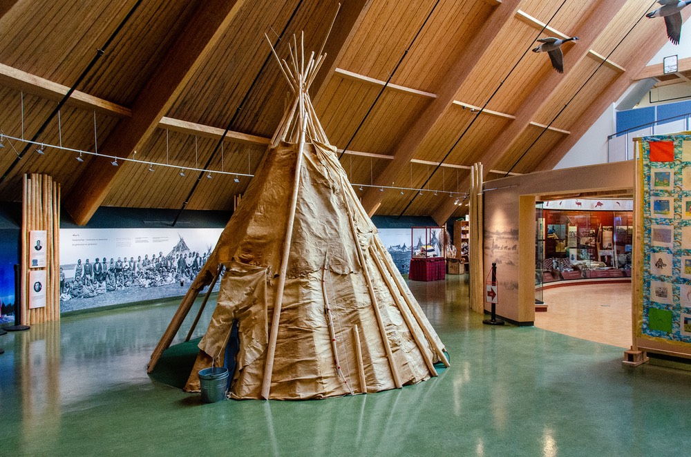
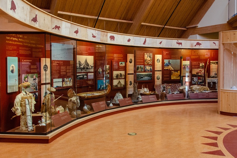
The highlights of the trip would prove to be the excellent cultural centers/museums we enjoyed at each end of the route, Chisasibi and Oujé-Bougoumou.
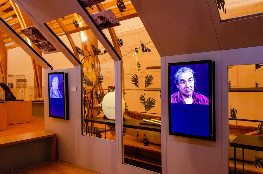
It all worked out pretty well. The two cultural centers were terrific. The Cree Nation (just our term, they have much more interesting words they use but they’re really hard for us to untangle) has been in this area for a very long time. They fish, they hunt, they are very artistic, have settled communities, long traditions and great respect for their elders. We were able to see some really nice artifacts and meet lovely people at both centers.
Not surprisingly, much of the 20th century was not good to them. A very familiar story of other peoples’ needs taking precedent, followed by being relocated, etc. It was not until the 1970s that they were able to negotiate with the Canadian government their status as free people here. In about 1975 a treaty was signed that gave them sovereignty, but it included the right of the government to start work on dams and hydro-electric facilities. And they were subject to relocation several times. During the period of late 1978 to 1980 the entire town of Chisasibi was relocated with its 2,000 people and about 200 houses, due to the changes in water flows caused by the massive hydro electric projects.

However, they have worked hard to maintain their traditions and their way of doing things, and the communities continue to work with the next generations to ensure they will carry on. We were able to watch films, see modern artistic work, and enjoyed all that a lot. In the Chisasibi area, the town had formerly lived on an island (Fort George) just off the coast in James Bay. The island had to be abandoned because it was going to be partly under water, so there are pictures of the relocation process, including moving a church off the island and resettling it in the town that was being created. It was all very interesting and enlightening. There seems to be a large element of forgiveness in all the themes and stories they tell, but there is some bitterness as well.
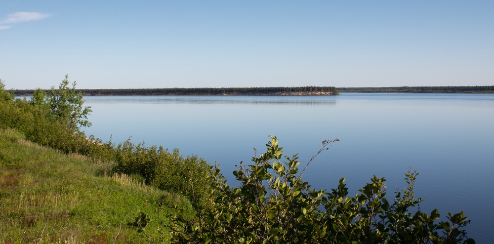
While in Chisasibi, we spent a night outside town parked beside La Grande Rivière, the broad river that leads out to the Bay. Our night was quiet and very nice, with a late evening sunset that was lovely if not dramatic; it was quiet and gentle, a continuation of our entire time in the area, just a slow darkening of the red and orange and blue that filled the sky and reflected off the water. Sadly, it wasn’t a good photograph due to the brush in the way and our inability to go outside long enough because of the b… oops can’t say that… to find a good composition. We only have the memories.
We had hoped to be able to drive from the town on out to the waters of the Bay itself, but this was not to be. Ultimately, we realized that it would be a symbolic completion for us, but the high cost of fuel and the time involved plus sandy roads just made us decide we didn’t care to go through the process. We are left with some regret, of course, but it wasn’t going to be an easy trip just to be able to say we’d gotten all the way out to the coast.
While we were up at the top end of the road, we drove into Radisson to have a look and maybe pick up some more information (very sketchy up this far). Not much there, mostly just a small company town, but clean and neat and a nice little visitor’s centre where we made friends with the young woman who ran the place, and her family. They live full-time in their hand-created motorhome — mom and dad and 4 boys Great folks, from Montreal.
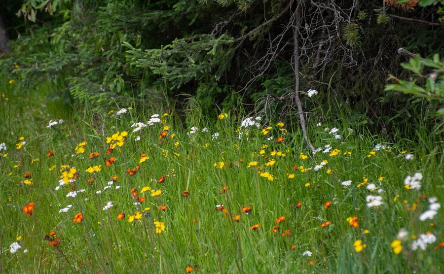
Some might question whether this entire trip was worth the bother and honestly, it’s sort of a tossup. It’s true that part of the time we were driving through stunted taiga, especially in an area still recovering from a long ago fire, and such terrain isn’t all that thrilling. But most of the trip was more scenic and was generally very green, with lots of lakes and rivers and wildflowers. Coming back down, after we got onto the Route du Nord, was the prettiest, with rolling hills and lots of grasses, and several different kinds of trees; all in the multicolored greens of the northern Spring.
The turnoff onto the Route du Nord is about half way between Metagami and Radisson, at km 274. This is a gravel road that would take us further east and then drop south back down out of the hills to rejoin “civilization” near the small city of Chibougamau. When we made this turn we wouldn’t see pavement again for more than 400 kms. But this was as good a gravel road as we’d ever seen in all our travels. Dusty? Yes, and at times it turned into a very white, very fine dust too. But maintained? You’ve never seen the like; smooth and calm at the 70 kph posted speed and with very little traffic.
The scenery in the area we were driving through became increasingly lovely and lush, with rolling hills, lots of birch trees, and rivers galore. While there weren’t any actual mountains, there was enough elevation change to provide a variety of views out over the greenery. Every 30 kms or so there would be a sign saying abat-poussiere debut, followed by a second sign several kms on saying abat-poussiere fin. Finally got a chance to look it up several days later — the signs were saying that they were applying dust-retardant in these areas. Pretty nifty, we thought.
About 100 kms east along the Rte du Nord is the town of Nemaska, where we got fuel, and then later along the road we took a bit of a detour to see a monument erected by the Cree to honor their ancestors, archaeological treasures, and traditions. It is situated on top of a knoll overlooking one of the huge dams, and speaks of reconciliation and forgiveness. It was very nice.
When we got down to Oujé-Bougamau, the second Cree cultural center, it was also quite nice; bigger, more upscale and perhaps less “personal” than the Chisasibi museum, but maybe that’s just our take on it. This community definitely appears to have more money and is perhaps better off. For one thing, the town had been honored by the UN on its fiftieth anniversary (1995) for its cultural programs so that recognition may have led to more in the way of grants or donations.
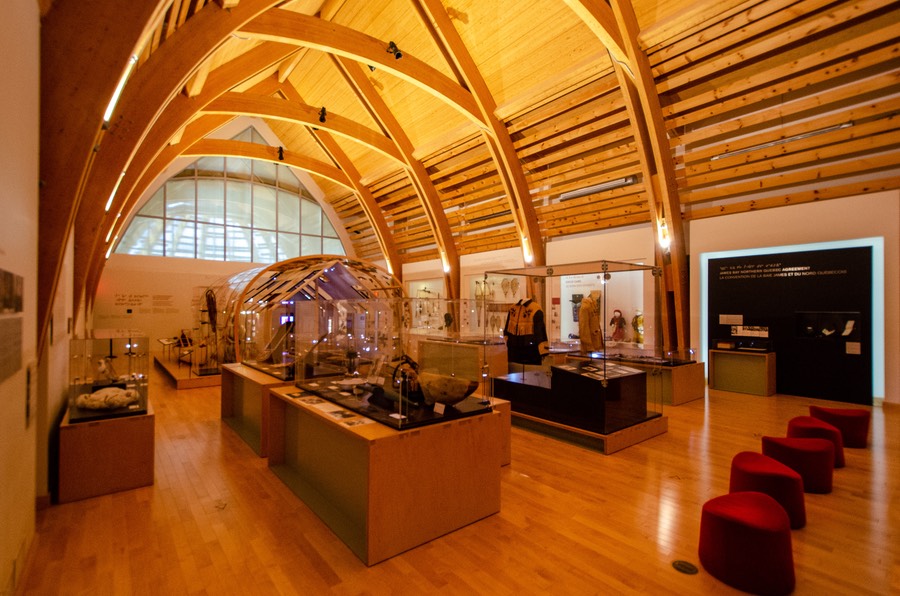
In any case, we had a lovely visit to the center, watched a film and toured the exhibits to our hearts content. The lady apologized for the fact there was very little in the gift shop as a result of Covid restrictions. Speaking of this, each of the communities we visited was continuing to take every possible precaution against Covid. They have some protections from the spread of the virus due to their remote location, but they are also always alert to changes in conditions and are ready to shut off the access roads if necessary. While we were in the area we spoke with another traveler who’d been told that case numbers were rising and there was a good chance Chisasibi would shut down by the weekend.
Joining the major road (167), which would take us back down into a more cosmopolitan area of Quebéc, we spent several days north of the town of Chibougamau, on a bluff overlooking Lake Gilman. We happened to be there during the weekend surrounding July 14, Bastille Day in France, which was celebrated here with fireworks. It was fun, and despite the holiday our space remained uncrowded, with some day visitors but no one else overnight.
This town was our first chance for shopping in quite some time, and we quickly restocked our shelves. Fuel was also cheaper!! One aspect of driving to remote locations is always that fuel becomes more expensive the further it has to go to be hauled in. For reference, with all prices converted into US dollars per gallon, we got diesel in Metagami for $6.71, then back in Chibougamau at $6.12 so these towns are the baseline. But at the depot at km 381 it was all the way up to an OUCH-producing $8.48, which was no fun. Our new friend at the visitor’s center in Radisson told us we could get fuel at the airport part way down and that would be less. Sure enough, following this local advice — it would not have occurred to us to stop for gas at an airport — we filled up for $7.29; then later on at Nemaska it was less again at $6.99. Yes, fuel costs are creating issues for travelers this summer and that’s a fact. But we press on regardless, knowing that we have paid even higher prices than this in years past. We loved — no adored — our five months in Turkey ten years ago, despite the fact that fuel was costing over $9.00 US per gallon. As with so many things in life, it is what it is.

With our trip to James Bay and the surrounding area concluded, it was time to move on. From Chibougamau we turned the Tiger in the direction of Lac Saint-Jean and the Saguenay River area, heading east towards the St Lawrence Seaway and continue on towards Labrador.
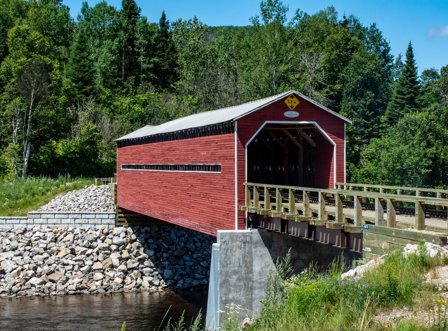
While James Bay was remote and isolated, we could immediately see that now we were moving into a more populated and popular part of Quebéc province. More people, more traffic, more other travelers, but a beautiful, beautiful area. In addition to the locals, this section of Quebéc seems to be a playground for all — adventurers, bicyclists, children at play, boats on all the waters, etc. There are several national parks, places to hike in the summer and ski in the winter, a wild animal zoo, a fjord to explore, blueberries and chocolate and honey and more. Even alpacas, and more ice cream stands serving excellent soft serve cones. All very lush and chock full of wildflowers, not to mention fresh strawberries (fraises) and legumes at roadside stands; and we are constantly looking to buy bluets and framboise — blueberries and raspberries for you non-French speaking folks.
We drove around much of Lac Saint-Jean. We got an oil change and service done at one of the local GM dealers; they were very nice and asked permission to attach one of their stick- on emblems to the back of the Tiger; request approved of course. We spent several days wandering and enjoying the Saguenay, slowly moving along; we spent our nights in city parks along the water or at lovely country overlooks on bluffs. Many towns in Quebéc (and other provinces as well) have made provision for people just passing through — spots with room and grass and nice views. They call them “overlooks” (viewpoints); you are welcome to stay the night. We would have been happy to carry on this way all summer long.
Slowly and gently we were approaching the St Lawrence River, and our turn north. We took a couple of side trips down to viewpoints, and wandered into one of the parks, as we had it listed as a great place and we wanted to attempt to get what they were calling a Parks Canada pass. But, for once, the American system of parks is easier to work your way through than its Canadian equal. All much too complicated to explain here between national and provincial designations, but we finally have decided that if we want to go into a park — of whatever category — it’s best to just pay the daily fee and enjoy. The system is too complicated for us foreigners. We’ll be fine.
We’ve reached the St Lawrence, and have started moving north. It continues to be beautiful. This is baleen whale country; we’ve been told you can see them in many places. The coastline is great, and we continue to spend our nights parked by the water, watching the birds and enjoying the quiet. You can drive out to various viewpoints, and they are always excellent fodder for our cameras.
And now we are in Baie-Comeau; it is from here that we will begin the next part of our summer. We’ll go inland on something labeled Rd 389, and then turn due north going up the sometimes-paved, sometimes-not-paved back road to the provincial border where we will cross into Labrador City. From there, it will be 1149 kms (712 miles) across to Happy Valley-Goose Bay, Red Bay and beyond. This road, the Trans Labrador Highway, is now officially completed and fully paved. We knew this was scheduled for this year, but saw the official announcement of completion online. This decades-old project, a dream really for the local population, was finished on July 8th. Just in time for our visit.
Now back up just a minute you say? Labrador?
Huh, who goes to Labrador?
Well, us, actually. We’ve been hoping to traverse remote Labrador this way for many years, and are glad to finally be starting this trip. When we first thought of doing this road it was all unpaved and quite an adventure, now it will be much easier.
The road will take us across the interior and along a bit of the eastern coast of this remote area. Then, from the town of Blanc-Sablon in Labrador we will take a little ferry across the Strait of Belle Isle to St Barbe and begin our adventures in Newfoundland. Together these two wonderful areas comprise the Province of Newfoundland and Labrador, or as they say here in Quebéc: Terre-Neuve-et-Labrador.
Waaaayyy back in 2004 we took the ferry from Nova Scotia to Newfoundland and then did a day trip on our motorcycle to Blanc-Sablon and on up the 30 miles of paved road — all there was at the time — as far as Red Bay. We loved it all and now we cannot wait to see even more of this wonderful and exotic region.
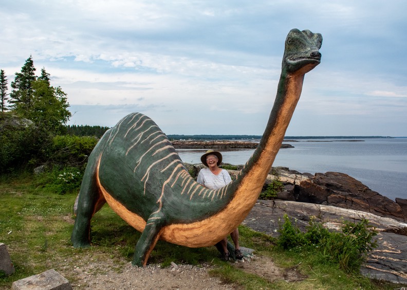
Sounds wonderful? We’ll tell you all about it. Themselves, Rick, Kathy, the always frisky Tortuga… and the dinosaurs who shared their park with us at Ragueneau.
Please be sure to go to the photo page for this story.
There are many more pictures we’d love to share with you, most especially from the two Cree cultural centers.