August 2017
The Dude Abides
"As you head further west the country flattens. But there are different styles of
termite mounds to break up the monotony”
This is quoted from Hema’s Great Desert Tracks road atlas, regarding the Plenty Highway. We feel that we should remind you once again… we are not making this stuff up!
Anyway, moving on, we’ve met Alice and she is ours. You might remember that we arrived in Alice Springs from the west, with a couple of repairs to get handled, along with lists of things to purchase, mail to pick up, sights to see, projects to complete… the list went on and on.
Two and a half weeks later, we’d done most of it, seen much of it, gathered in what was important to us, and were ready to take off again. It was a busy time, that’s for sure; but The Alice was up to the task.
We started by visiting the welder, he who would repair our broken hood hinge. Remember? The one that broke out there on a gravel road coming in on the Mareenie Loop? He was able to take us in the following morning after we arrived in town, and had us all complete before noon. He removed the hood, repaired the broken hinge and added a brace not only to the broken one but the other side as well. A great guy and a very professional shop; we would recommend him to anyone.
In tracking down a good mechanic, we quickly discovered that Alice Springs in the winter is a jumping place; the one we chose couldn’t take us in for a week. But he was well recommended, was familiar with the code problem we were experiencing, and we weren’t surprised we’d have to wait our turn. We spent that week in a small campground attached to a hotel at the south end of town, along with about 30 other rigs that were in town for one reason or another.
We don’t normally head for an official camping area, but we put our time there to good use — several loads of laundry, good internet connection for a lot of computer work, access to others going/coming in the same direction we were. We chatted with folks, shared laundry lines, and generally enjoyed the time. One nice surprise was a young Australian couple making their way in part by being buskers; they had a really interesting show they did, involving lots of fire. We got to watch them practice one evening after dark; rather cool, I must say!
Alice Springs is an oasis in the desert — literally. It’s in a pretty setting among the MacDonnell ranges of red rock mountains, has lots of trees and a river running through it (although usually dry it seems), and is filled with people having a good time. Well, at least the tourists are. This is the best time of the year to visit the area so there were bunches of us around. It was also a bit warmer than we’d been experiencing so far, and that was just great. We’d gone from hoarding every bit of warmth available and always parking in the sun, to opening windows and looking for shade and breeze.
Anyway, we kept nice and busy. A lot of projects got completed, and we also went to both the Desert Park and the Araleun Cultural Precinct, two very worthwhile experiences. They are great places to learn more about Australia’s desert region, called the Red Center.
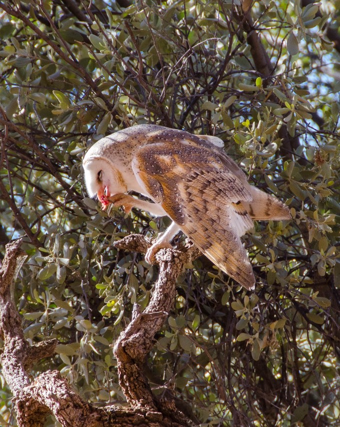
The Desert Park focuses on the plants and animals of this area, and does it very well. The best part was the Birds of Prey Show, with birds flying around, interacting with their trainers in amazing ways and showing themselves off to us. It was so good, we saw the show a second time later that afternoon. This, along with the terrific smaller birds being active in several aviaries, made up for most of the other animals dozing during the day.
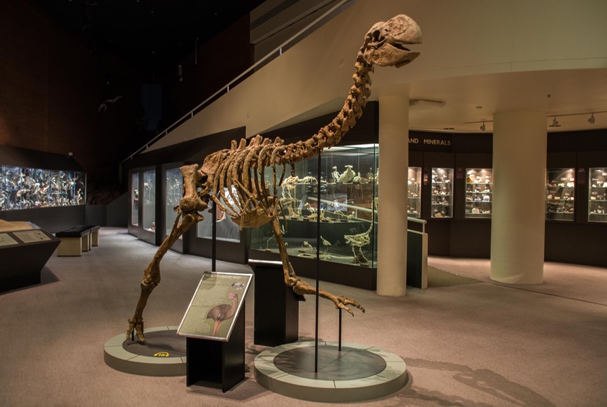
The Araleun center was a different kind of experience. There were galleries showing modern Aboriginal works (excellent!), a natural history museum (also very good), an area with early aeroplanes, and lots of special exhibits. What we’ve noticed about Aboriginal cultural centers in general is that they have a softer, gentler way of presenting information. Sometimes there’s no “hard” science at all, only the Aboriginal “dreamtime” approach; sometimes a bit of both. But always interesting and very informative. So far in Australia, we’ve been to several very good centers, but I’ve liked the presentations at Uluru the best of all.
Oops, forgot to tell you about the camel races. We’d missed out seeing the races when we were in Marree, a few weeks back, so we thought that we should at least check them out when they came to Alice Springs. Well, that didn’t take long. Visions of locals riding old Bessie Bactrian around in a casual country setting were quickly replaced by grandstands, carnival rides, vendors and exuberant announcers hyping all the activities available for the kiddies. Turns out this is a traveling show that was making the rounds of the Outback. That kind of stuff can be a real hoot, but it didn’t quite work for us. Rick took a picture of a camel for me, so I could have something to show for the effort, but we quickly moved on to other activities.
While we were at the mechanic’s shop, a couple of things got taken care of but a part had to be ordered from the States to deal with the code issue. Since we’d be around for another week, we decided to go off for a few days and see some of the area to the east of Alice.
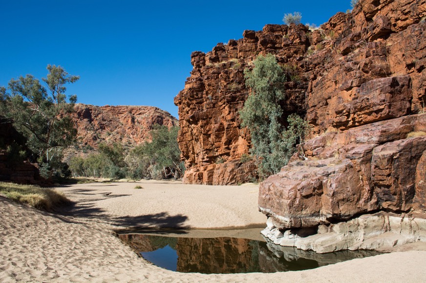
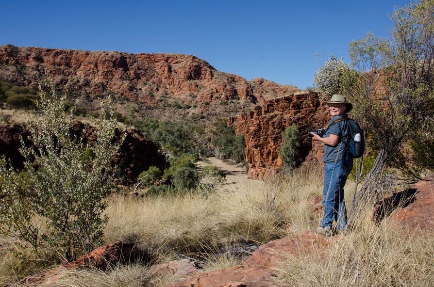
So, we trundled off to Trephina Gorge in the East McDonnell ranges, one of our best decisions in quite awhile. It’s a nature park down a long gravel road, with campgrounds to enjoy, beautiful hikes to take, gorgeous sunrises to get up for, and nice people to enjoy it all with. Oh, and some really interesting Aboriginal rock art representing caterpillars. We had a really good time. It’s a lovely spot and we could have stayed much longer. With the sun coming up almost an hour earlier than it had a month before, we had plenty of time to watch the play of the light on the nearby canyon walls. The weather was lovely, of course; it never rains around here (well, almost). The night skies in the desert are clear and there’s absolutely no pollution — it’s an incredible experience.
While camped there, we got to know the folks next door. From Perth, Glen & Yvonne are out wandering for about a year, exploring their country and deciding what’s next. We had a good time together, and parted hoping to run into each other down the road somewhere.
We’d only been been back in town a few days when, all on the same day, our mail showed up (YES!!! — after only 3 weeks in transit), and the part arrived from the States right on schedule. Awesome, dude! The next day, once the mechanic was finished, we were ready to hit the road. Did one last shopping, cleared our tanks and filled with water, and beat feet at last.
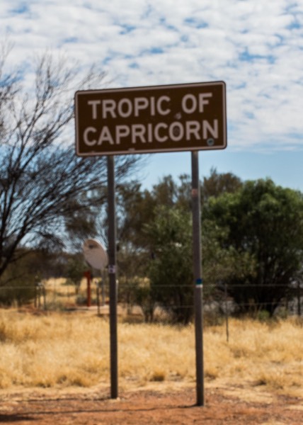
Leaving town and heading north on the Stuart Highway in order to get to our turnoff, the first order of business was to cross the Tropic of Capricorn at 23° 26′ 22″ degrees of south latitude. Over the years, we’ve crossed the Tropic of Cancer a few times in the Northern Hemisphere where it runs through Mexico, and the Tropic of Capricorn (Southern Hemisphere) when we were in South America. We saluted and went on, having officially entered the tropics.
In our last message, we mentioned that in planning our exploration of Australia, we were very interested in trying our hand at some of the desert tracks, the off-pavement roads that link much of the interior of the country. We’d gotten our first taste of these roads earlier along the Oodnadatta Track and later on the Mareenie Loop connecting King’s Canyon to Alice Springs. They had mostly been OK, but in places they really shook us up. Among the other repairs taken care of in Alice, we had the guys check all of the bolts and nuts on Tiger’s undersides… and yes, replace a couple that had loosened and gone missing.
So during the time we’d been in Alice, we’d been firming up plans for where to go over the next few months, what we wanted to see, and trying to decide what roads to take. We talked to folks in camp, re-read our off-road guide books, researched websites and talked to the guys in some of the four wheel drive shops in town; all trying to determine which roads we thought we could enjoy, not just survive. In our travels over the years, by the time we reached Alice Springs we had put 300,000 kms on the Tiger, quite a few of them on unpaved roads, particularly when we've traveled in North and South America, but also Morocco, Turkey, and Iceland. Oh yeah, and the roads in Armenia and Nicaragua might as well not have been paved either. As a result, we had a pretty good idea of what both the Tiger and its favorite occupants were able to handle, BUT, and this is a big BUT, we’d now had a taste of what the Australian version of “corrugations” means (washboarding in the US), and we had some concerns.
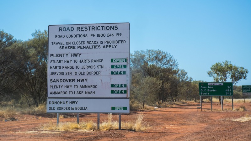
Our next major destination after leaving Alice Springs was to be Cape York in northern Queensland, Australia’s northeast corner. Naturally we had a choice of routes in tackling this 2,200-kilometer journey. The paved alternative takes you north on the Stuart Highway and then east on the Barkly highway and after awhile offers various options for connecting up toward Cape York. But there are also two main unpaved routes for covering sections of the distance and even shortening it up some: the Sandover and Plenty Highways. The hard thing about choosing any of the gravel roads is finding information on what their current condition is. It’s easy to find general descriptions in road atlases or online accounts, but none of these sources can tell you what the road is like right now. We’re still working on this general issue.
Eventually we chose to try the Plenty Highway for a variety of reasons, none of which made much difference in the end. We knew the road was paved for awhile and then became dirt/gravel for around 500 kms and we knew that at this time of year none of the river crossings would give us any trouble. What we could not find out was how recently the road had been graded and how bad the corrugations were. So we set off to see for ourselves.
It’s a pretty route, and we were enjoying ourselves just fine. Once the pavement ended we were alternating unpaved but well graded sections with sections of what is often called a “development road”, a kind of halfway house construction with a single paved lane down the middle and wide gravel verges. You drive down the middle until somebody comes along the other way and then both vehicles move to the left to let the other go by. If the vehicle coming toward you is a road train — up to 53 meters long (173’) with three or four trailers weaving along behind the cab — you make sure to get a long way off to the side.
After awhile we came to a sign saying “Grader Ahead” and thought, OK, good for these guys out here working on the road for us. Well… it turns out that we never saw the grader and all the sign really meant was that they hadn’t gotten to the next stretch yet at all. Our little world didn’t exactly come apart at the seams, but it got really, really shaky all of a sudden.
Anyone who has spent any time driving on corrugated roads knows the drill. If they aren’t too bad, the ride actually improves the faster you go because the tires just skip across the tops of the ridges. But there are lots of variables to this handy little equation and if any of them prevent you from going fast enough to reach that sweet spot then you are in trouble. If that happens, all the books say the same thing: if you can’t comfortably maintain a speed of 30-50 miles per hour then you’d better slow right down because there isn’t any middle ground.
So here we are, bouncing along at 10-12 miles per hour and wondering how long this would last when Kathy says, “Rick, I think the hood is shaking just like it did before”, and Rick says in his superior husband voice, “Oh no, dear, you’re just worried about it because it happened before. I saw the repair the welder did and trust me, that will never break again.” Not five minutes later the hood popped up exactly like before! Gesproing!! Rick was not pleased as he went looking for the duct tape and then re-taped the hood while watching the sun drop toward the western horizon.
It turned out the welding repair was indeed just fine.
Shame about the nut backing off and getting lost...
We’re fond of the expression “Well, that happened” — because out on the road things like this do indeed happen and we have to find ways to cope. Well, we soldiered on for a bit, heading for the rest area we knew was ahead and discussing what we should do, and actually had a couple of nice little side of the road moments with other travelers stopping to see if we needed assistance, and in one case asking if we could spare some water.
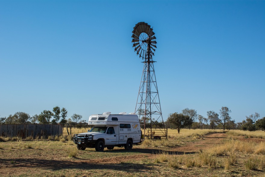
With evening upon us, we decided it was time to turn around and retreat to a spot not far back where we could stop for the night, and then return to Alice for more repairs. Despite the fact that it was only a missing nut on the hinge, both the bolt and the nut in this application are special parts and while a simple new nut and bolt out of the tool box made a good temporary fix to the problem after the last of the duct tape wasn’t strong enough to hold the hood in place, a proper repair was going to need more resources. Besides, we’d had enough of this road for the time being. After a quiet night beneath an old farm windmill, we returned to Alice and the welding shop.
In the long run this turned out to be the right decision. Lincoln (the welder) was chagrined that this had happened to us and took very good care to make things right, calling around until he found the necessary special nut that had been lost. We even noticed that the hood hadn’t been quite lining up correctly because of a spot weld that had come undone on the side opposite the original break, so he fixed that for us as well.
We’d learned a lesson through all of this, just like you’re always supposed to when things go wrong. Maybe… neither we nor our Chevy truck are quite up to some of these Aussie roads after all? Maybe… it isn’t just a question of grin and bare it and tough it out no matter what, but more a matter of deciding which roads are important for us to drive? Maybe… we can do a better job of putting our “off road” energies into roads that are the only way to get to somewhere we really want to go. Sounds good; we’ll let you know how it works out.
And that’s when the title for this message came to mind. Taken from what should be on everyone’s list of favorite movies, The Big Lebowski, we decided that despite a little frustration, a little disappointment, maybe some pulling in of horns (and remembering what The Man says in the saloon: “Sometimes you eat the b’ar and sometimes the b’ar eats you”), we are still the Dude — and The Dude Abides.
(ed. note: Since this incident leaving Alice Springs we’ve covered over 1,250kms on unpaved roads, some with difficulty but most with real pleasure.)
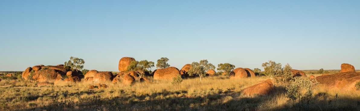
Leaving Alice once more, we headed north again, back up the Stuart Highway (past the Tropic of Capricorn and the Plenty Highway turnoff), on up to Devil’s Marbles Nature Park. And there we found an awesome spot to spend an afternoon and night. The “marbles” are very large roundish rocks all scattered hither and thither and stacked on top of each other. As the sun dropped in the sky, the rocks started to glow and then fade away with oncoming darkness. In the morning, before the sun rose, this incredible glow began again. It was quite something. We also met another friendly couple, this time from Melbourne. We had some great chats with Ken and Judy, and will hope to visit them at home.
We could have stayed for days, but finally moving on after a long morning’s chat we headed further north, on to Tennant Creek and a paved road eastward, the Barkly Highway. There were lots of bushes and plants in bloom along the way, with the flowers mostly shades of yellow. As promised, after a very wet winter, the desert was doing itself proud. Oh, and one more thing: we’d entered the Land of the Termite Mounds. They were absolutely everywhere, and we’d been promised they would stay with us throughout the Tropics. Wild!
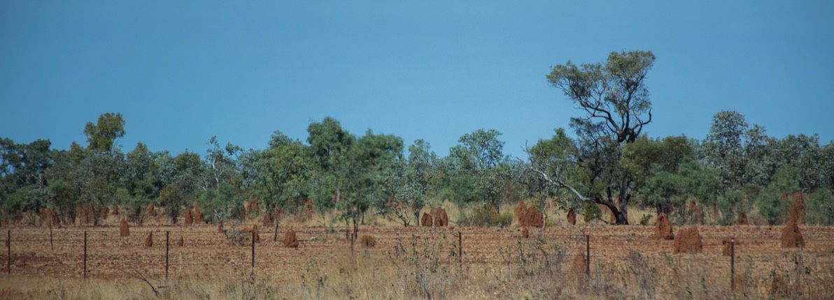
These mounds go from dinky to enormous; looking like crenellated castles to needles; from red to sandy to grey to green to black, depending on the color of the surrounding dirt. They can be quite intimidating, particularly when they are taller than you are, and you realize zillions of little bugs are crawling around inside hell bent on making a statement for the world to see. Gross but intriguing.
At Tennant Creek we stopped for a few hours, in part to get a good look at the Nyinkka Nyanyu Cultural Centre. This is a really good museum created and run by the local Aboriginal group; they are doing a fine job. Along with excellent information on the status of their treaty discussions ongoing with the government, there was much history to be shared about their early and current economic situation. One of the best things was an outdoor area with plants and displays; there was an audio explanation of the practical uses for each plant and its symbolism. It was a great place to visit.
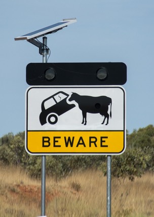
Cattle ranching prevails throughout much of northeastern Northern Territory, and on into Queensland. As we traveled east on the Barkly, we saw many herds, in various conditions depending on the environment. Much of what we saw were herds of Brahma; apparently they can survive better in the dry country. There were cows along the roads all the time, with warning signs telling you it would be the case. Far fewer fences than we’ve seen in other countries. There were rodeos being advertised in many of the towns, and it all seemed quite “western U.S.” to us.
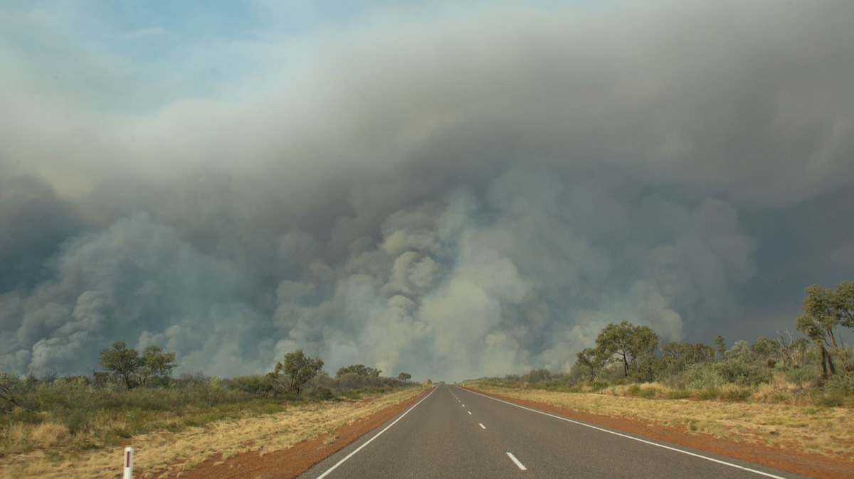
By mid-afternoon we could see smoke on the eastern horizon. Not quite knowing what was ahead, we kept on trucking. It got a lot worse, and ultimately we were driving through a controlled burn of the grassland. After a couple of hours we got through it and beyond most of the smoke, although we went through more fire the next day. It was pretty interesting. Being from the American West, we are quite used to fires, and since there were no large trees in the area we weren’t concerned about a “crown” fire, where the blaze jumps from tree to tree and spreads very quickly. Nevertheless, we were glad to get settled for the night, even though we could see a glow on the horizon, indicating live fire somewhere a ways away. A guess? The map showed we were crossing Aboriginal lands at the time, and it may have been part of their annual burning to rejuvenate certain areas. None of the other campers we ran into were concerned and we did get some fun photos out of it.
By now we were preparing to cross the border between Northern Territory and Queensland. At the same time, we were noticing a bit of a climate change. It was getting warmer, in part dependent on the direction of the wind. When it was out of the north, the temperature was 15-20 degrees warmer than when it came from the south. Well, it’s early August now; and we are definitely above the Tropic of Capricorn. We know more changes are coming as we continue moving northward and get closer to the east coast and a tropical climate.
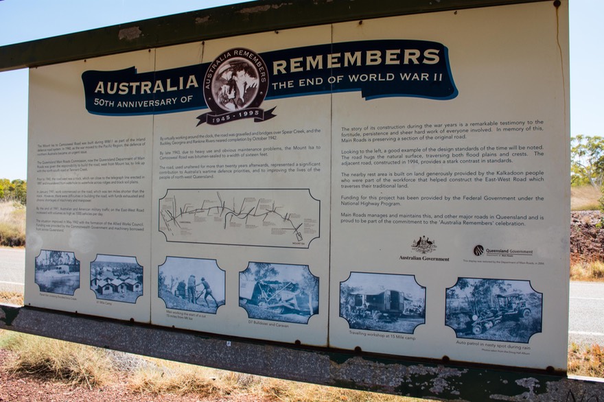
We crossed the border, heading for Camooweal. No big deal, but we’d seen that the road between there and the next town, Mount Isa, was built by American servicemen during World War II (there was a large American presence in Australia during the war). We stopped for a moment at a sign and monument to the American servicemen. The old road ran along side the newer highway and kept pace with us all the way into Mount Isa, and even further east than that.
Mount Isa is known to us only because some Aussie friends had met each other there — our buddies Kate and George, with whom we’ve had good times in several countries around Europe. They used to be involved in the mining industry — Mount Isa mining is one of the biggest operations in all of Australia. So we took a picture of the Welcome sign at the entrance to the town and sent it off to them. Factoid — according to our trusty guidebook, “Mount Isa is one of the largest cities in the world”, not because of its population but because the town boundaries cover zillions of hectares. So there!
Frankly, the town didn’t amount to much in our eyes, but we understand there was excellent food in the cafe at the visitor’s center. We did some shopping, and spent more time with the friends we’d made at Trephina Gorge. Oh, should have told you: the evening before, we’d made up our camp and were peacefully enjoying our evening at an overnight spot about halfway between the border and town, when rap-rap came on the screen door and this nice Aussie voice spoke up to say hello. It was Glen, of Glen-and-Yvonne-from-Perth. We had a great time catching up on each others’ activities, and the next day we met up with them again, in town. They’re good folks. After another evening of visits in yet a different rest area east of Mount Isa, including a lesson on where to find the Southern Cross in the nighttime sky (along with how to calculate true South), we finally parted. They were heading for Brisbane and we were off to Cape York. Perhaps we’ll see each other again.
We kept moving further eastward. An early indication we’d left Northern Territory? Increased road signage. Must have had a two-for-one sale on those road signs telling you about speed limits, how long the road trains could be on a certain stretch of road, approaching dips or crests, when you were going to cross a low spot that sometimes flooded — and how high the water got the worst it’s ever been — well, you get the idea. More money than sense, perhaps.
As we traveled along the Barkly, we started seeing trees again, and some hills; we were no longer moving through flat desert. And there began to be more birds. We would park for the night in a rest area near the highway, and if there were trees, the birds were there, too. We enjoyed them in the evening, and then again at sunrise. This has not only continued, but has increased. There are more and more birds wherever we stop. But, hmmm, something to ponder. We’ve not seen a single kangaroo since before we got to Alice Springs. Where have all the marsupials gone?
We reached Cloncurry, the next wide spot in the road, and saw the first river bed with water in it in over a month. Cloncurry is an important crossroads. If you keep going straight east from here, you’ll be on the Flinders Highway and will end up at the Pacific Ocean, at Townsville, somewhere south of Cairns (they say “Cans”). If you go southeast, on the Landsborough Highway you can make your way to Brisbane. But if you turn left, and go north onto the Burke Developmental Highway, and keep going for several hundred kms, you’ll end up in Normanton, near the Gulf of Carpentaria (they do pronounce the R in this one and the accent is on ‘tar’) on the edge of the Tropics and getting closer to Cape York — and adventures! So guess which way we went?
Due north to Normanton, naturally. We weren’t sure about which road to take from there, but knew it was the perfect jumping off place for our plans up in Cape York. And the visitor’s center would be able to help us with local info. One tip regarding finding out about road conditions we picked up from a nice lady in Mount Isa: talk to the people at the closest visitor center to either end of the road you’re interested in. We’ve learned that many of these unpaved roads are maintained at least in part by the local Shires, so the people who know the most are the folks who not only use the roads, but have a good idea of how current the maintenance is. Seemed like a good idea so we planned to check it out.
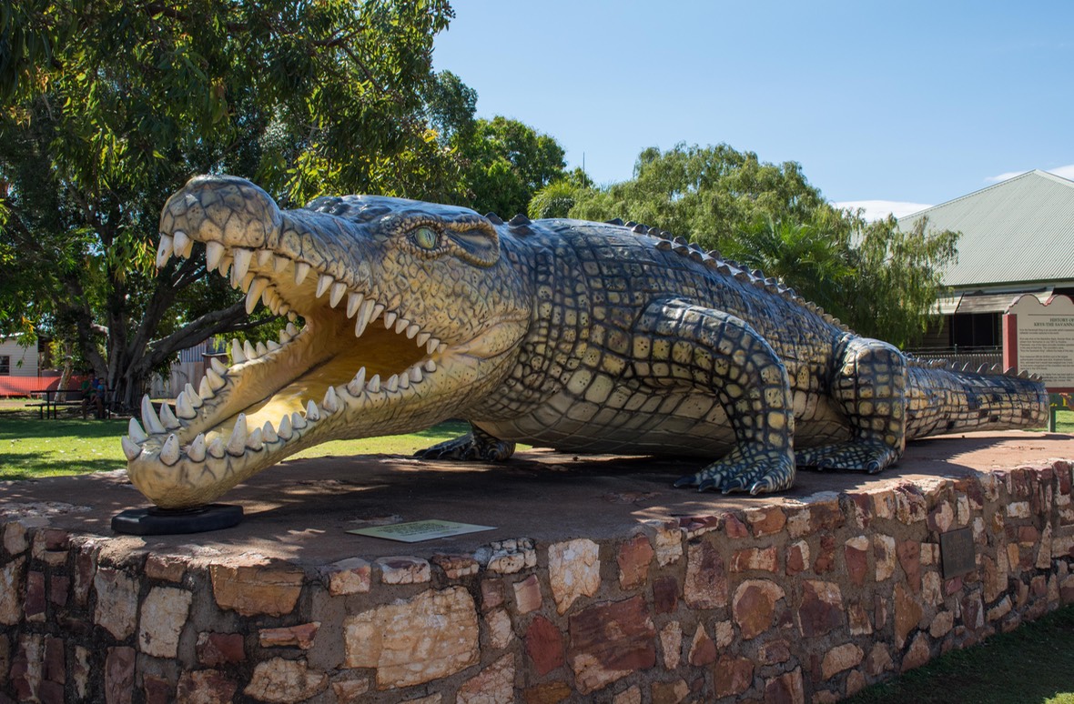
As we moved along, it continued to get hotter. We’d definitely entered the Tropics and in Normanton were only about 17˚ south of the equator. Arriving in town, we took in some of the local sites, including this model of what is said to be the largest estuarine (salt water) crocodile in the world, measuring 8.63 meters (over 28’) long. Quite a sight. The visitor’s center seemed to have taken the day off, but there was a sign directing us to a camping spot that was free, along the river (the Norman River, as it turns out). So we crossed the bridge, took note of the crocodile warning signs, and parked well away from the water. We had a quiet, if rather hot, night and weren’t disturbed. It seems the crocodiles had also taken the Sunday off.
The next day we went to the visitor’s center and talked to the ranger there; he was a fountain of information and filled in a lot of gaps in our knowledge about the various road options that lay ahead of us. We spent some time reviewing matters and making an overall plan for the Cape. We dug out the shorts and our lightest t-shirts, put away the sweats, made sure we had plenty of sunscreen and flipped our sleep sack over so the Summer side was on top.
And off we went. Crocodiles and strange birds and jungle stuff were waiting. Cairns and the Pacific Ocean (actually the Coral Sea, much more exotic to the ear) were only 625 kms towards the sunrise. We had decided to go east on a paved section of the Savannah Way, visit the Daintree National Park with its rainforests and waterfalls, then make for Cooktown, the beginning of the intriguing options for seeing Far Northern Queensland — the upper Cape York Peninsula. How far up we could go (some of these roads are seriously difficult, for real!) would depend on what we learned as we went along. The Top of the Cape — the northernmost point on the Australian mainland — was the jewel in the crown, so to speak, but we had doubts it was manageable for us. The talk is all about things not to be attempted alone; of deep rivers, slippery slopes, and “recovery gear” — perhaps a bit beyond our pay grade. But we would find out.
Life was good and Team Tiger was excited. Stay tuned for more Tales from the Tropics — from The Dude and friends.
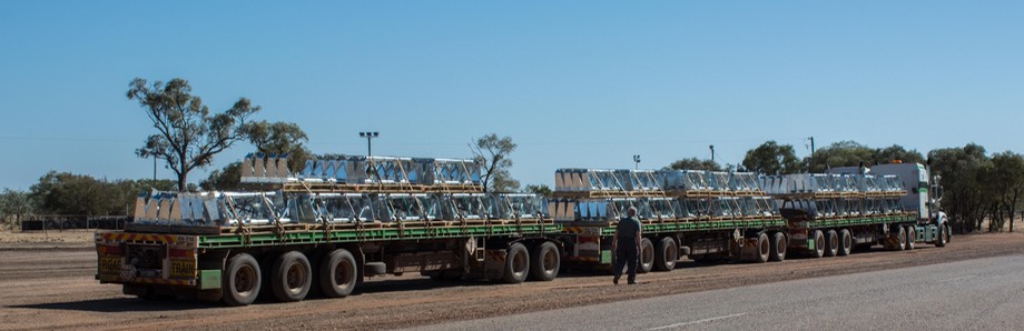
Rick pacing off the length of a road train.
Click to see more photos from The Dude Abides