August/September 2017
The Termite Report
We Cross northern Australia on the Savannah Way
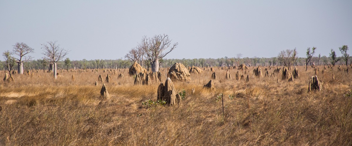
For the last few weeks, ever since we left Alice springs, Kathy’s been mesmerized by the multitudinous and often enormous termite mounds we’ve been seeing as we drive along. They are a major part of the scenery up here in the Tropics and we finally had the chance to learn a little bit about them when we visited Litchfield NP, south of Darwin. So stay with us here, while we travel past thousands of the suckers, from little bitty ones just getting a start, to huge monstrosities bigger than a parking lot, and everything in between. We’ll get to Litchfield after a bit.
When we arrived in Normanton (where we ended our last message), it was getting hotter, and humid for the first time. There were palm trees, and greenery all over the ground; there were crocodiles and we were not far from the Gulf of Carpentaria. We said hmmm, is this the way it’s going to be for the next couple of months, as we travel in the tropical far north?
Well, yes and no. Leaving Normanton we were headed east, traveling along a highway called the Savannah Way. It stayed hotter than before, but we quickly lost the foliage and the crocodiles for the time being (but not the termites). The Gulf waters curved further north, and our road was headed into the eastern part of the Outback, out in dusty cowboy country, heading toward Cairns and the Pacific Ocean (aka the Coral Sea).
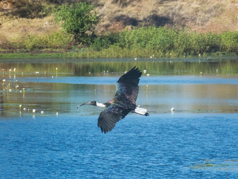
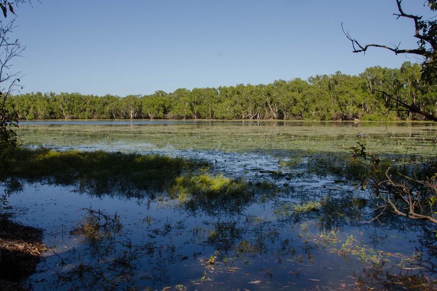
Soon the highway crossed a river bed — and there was even a decent amount of water flowing along. We had begun the exodus from the desert. It took a couple of days, but we began seeing more greenery, billabongs (waterholes), and more shorebirds; we were crossing a major flyway for migrating birds. We stopped for a night next to a pond, and the next morning were delighted to enjoy the variety of birds who had also stopped there.
It was still cowboy country, with the cattle looking like they could use a few days in lush grass; rockier now and with rolling hills beginning to be the norm. My apologies for not making a note of the town, but we did pass through the Stocklick Capital of Queensland.
Soon we were climbing for real, and ended our day in the town of Ravenshoe, which is, at 926 meters, the highest spot in Queensland. We know we shoulda asked, but couldn’t bring ourselves to do it: do you pronounce it Ravens Hoe, or Raven Shoe??? In any case it’s a charming and quiet old weekend getaway spot that hasn’t modernized much in the last 50 years; very nice. Terrific old photos of the logging that used to employ lots of locals and a discussion of the ecological policies that cost them those jobs. Chatted up the elderly, spry lady in the tourist office. “You going to Cairns? No? Good! Was there in ’69 and again in ’73; didn’t like it much then and haven’t been back.” We loved her.
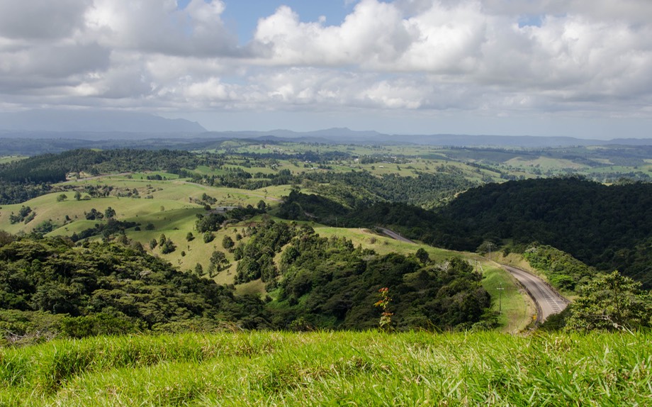
Ravenshoe is on the Atherton Tablelands, a large and lovely raised area of eastern Australia that’s up in the mountains just inland from the northern coast and a real treat to visit. The area has been a retreat for coastal folks for a very long time, and retains a lot of old charm. After we’d moved on, we realized there had been platypi around in the streams, and we’d missed our chance to see one. We may have to come back next spring. (Jennifer says that’s the plural for platypus; I thought it was platypuses; she has more internet connection than I do, so I guess she’s probably right. Humph.)
At some point, we came across a small national park called 40 Mile Scrub. I can hardly even find it on the map now. It wasn’t much (we’d stopped for lunch), but it was a section of preserved “scrub.” Scrub was what they had to cut through, cut down, and eliminate in order to tame the area enough to raise cattle/grow things/etc. I walked a trail cut through the scrub; it’s horrible. I cannot imagine chopping at it all day, every day, for years to try and create a home, much less farmland. Those early Aussies were some tough folk.
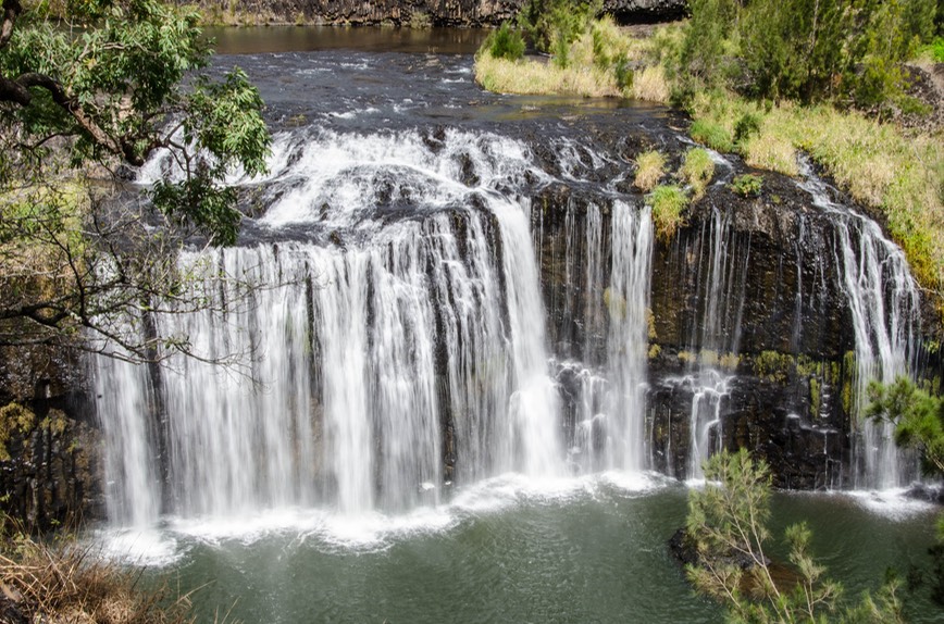
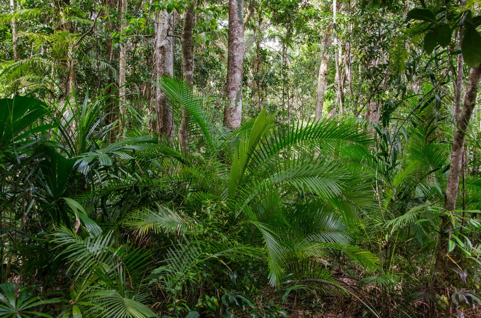
We wandered the Tablelands area, checking out several of the lovely local waterfalls. Some require a bit of work to get to, others are easy. It was fun, and we now know where all the water in Australia is, at least in August. The Tablelands are green and lush and lovely, and filled with variations on a theme of rainforest. There really are two Australias: the east coast, and all the rest.
We started gently moving further north and east, now through fruit orchards, banana trees bearing ripening fruit, local raspberries for sale beside the road, and gardens filled with hibiscus, lavender bushes, and nasturtiums. Lovely and green, and looking a little like rural northern Florida. Suddenly we heard a cuckoo bird — what a surprise — and it wasn’t the only time!
Even though we didn’t see a platypus, we did come across a huge yellow and black striped snake, which we gave a wide berth. It made quite an impression on these two city kids. We noticed the weather was getting a bit windier; it seemed we were beginning to pick up some of the southeast trades. This was a good sign, as it continued to stay warm; we enjoyed the evening breezes and the cool of the higher elevations. As it turns out, the wind has continued to be out of the southeast; it varies in strength, but has been consistent in direction all the way across the northern part of Australia.
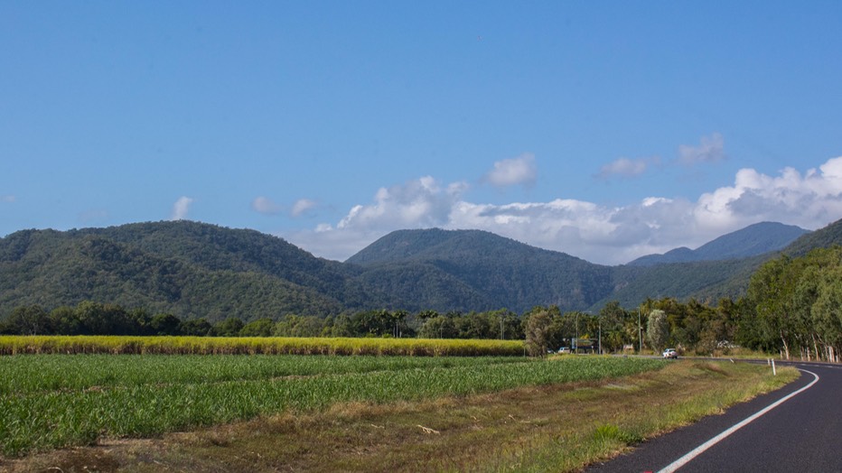
Getting further north, and closer to the coast, we went through cane fields. The sugar cane, in conjunction with forested hillsides, tropical plants, bougainvillea and lots of palm trees, all made us think of Guatemala. It was, of course, quite lovely. But along with the beauty came increasing numbers of people. The road we were driving, circling through the hills, was becoming crowded.
We were aiming for Daintree National Park, one of Australia’s best known. A World Heritage Site, it is the world’s largest continuous tropical rainforest, and quite a sight. A side comment: becoming a WHS is a mixed blessing, as we all know. The sheer number of people who visit, the increasing popularity of the area as a 4WD destination for folks who thrive on rough roads, along with development that can only partially be stopped, has led to The Daintree becoming something of a zoo. And that’s what we ran into, head on.
The park runs along a section of the coast north of Cairns. We entered it via the main road, which comes up from the south, and soon stopped at what was billed as a visitor’s center. Overrun with tour buses and folks lining up to pay for expensive souvenirs (including packets of English tea — ????), we couldn’t get anyone’s attention to explain to us what walks were available, the cost of the ferry that goes across the river that divides the park, etc. We’ve had this happen before sometimes — we assume that a visitor’s center has been provided in order to answer our questions, sell/give us maps, encourage us, and provide advice. We’ve finally figured out that this is the American model; other countries often have a different idea of the “plan.”
We had intended to take a hike into the rainforest to enjoy it for ourselves. But you can’t, not without taking a bus ($9 return each thank you) the four km in to a spot where you can start your walk. Well, hell. We were so put off by the approach and the number of people that we bailed. Such a disappointment; we’d been looking forward to this visit for quite awhile.
Our original plan for the Daintree had been to enter from the south and enjoy the sights going north to the park’s boundary at Cape Tribulation, then exit the park by continuing up the unpaved (and reputedly quite daunting) Bloomfield Track going north. The other way out of the park once you reach Cape Trib is to turn around and retrace your steps like most folks do. When we decided against seeing the southern part altogether, we pretty quickly figured out a new plan.
Our alternative, for those of you who know the area, was to take the inland road up to the Cooktown area, which is north of the top end of the Daintree, take a separate small road south to pick up the the Bloomfield, and then use it to maneuver over the cliffs and down to the coast, entering the park at its northern edge. Then we could visit a fair amount of the park, experience what it had to offer, and then climb back up the Bloomfield towards Cooktown in time for dinner. And this is what we did, after checking in with various locals to learn about the road and convince ourselves that the Tiger was up to the task.
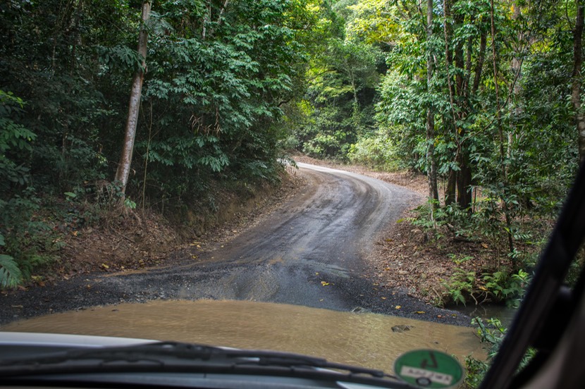
This is a great road and both we and Tiger loved it; we all had a swell time. The Bloomfield isn’t long, only around 30 kms each way, but it goes through some very nice country (rainforest), and its claims to fame are some thirty percent grades both up and down and several nice water crossings; nothing insurmountable at this time of year, but pretty and fun. We did it on a Sunday as it turned out, so we had lots of company, including a large motorcycle contingent riding adventure bikes. The track was just challenging enough to be both fun and good practice… (Rick is being modest here; the road was more difficult than that. And I must say that both he and the Tiger performed splendidly! Ed.) It was a truly great day. In the end we saw some of Cape Trib, did one of the rainforest walks nearby, got home in time for supper and felt pleased with our choices.
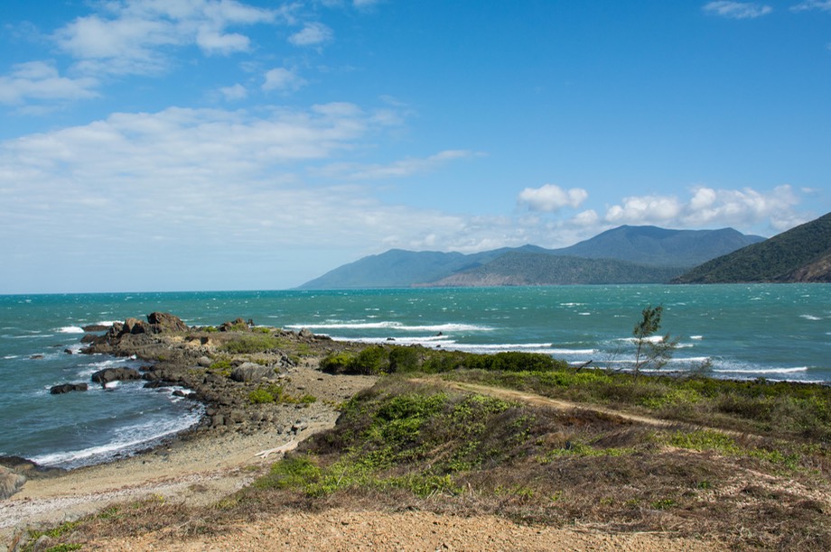
Along with being an approach to Daintree NP, Cooktown had been a goal on its own, and we were there for a few days. After visiting the botanical gardens and walking on the beach (where I waded in the Coral Sea), having local fish and chips and deciding not to take a picture of Himself (Captain Cook) — we had a better one we’d taken in New Zealand — we parked up on the bluff at Archers Point south of town and sat looking at the ocean for a couple of days. It was time for a rest, and definitely time to enjoy those southeast trade winds. This quickly was christened our favorite spot on the coast. We had a little patch all to ourselves, a pretty beach nearby, a lighthouse to be enjoyed, and para-sailers to watch further along the bay. Terrific spot.
Eventually we were ready to move on from Cooktown. We had spent time investigating how far up into the Cape York peninsula we wanted to go in the Tiger. Just what could it handle and how much bouncing round were we up for?
Rick talked to folks, read and reread our HEMA off-road atlas for Cape York, looked hard at the various tracks we could take, and planned our route. We’d known for some time that we were not going to try to go all the way to the tip, even though as the most northerly point in Australia it would have been great to get there. We could have gone a lot further than we did, but almost certainly not all the way. For one thing, the roads up there are famous for really bad corrugations this late in the dry season, but also for deep water crossings with steep and slippery banks. All of it might have been doable, but we didn’t like our chances. We were also aware that we had a whole lot of other places we wanted to see across the far northern part of the country, and the weather was going to get a lot hotter and stickier soon, and then the monsoons would arrive. We didn’t want to be anywhere up here when that happened.
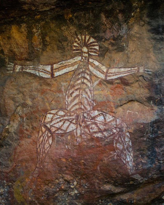
We wanted our route heading west across the Top to take us back through Normanton before going further west, and we hoped the roads we decided on would give us some good adventure along the way. From Cooktown we took the Battle Camp road across to Old Laura, through lovely, bushy countryside on a well maintained dirt road. Then dropped down to Split Rock so Kathy could pursue her interest in Aboriginal rock art. This was a very nice spot, almost totally deserted, and Kathy spent an hour or so climbing around among the rocks, following trails to new locations, enjoying the spots she visited and returning totally wiped out in the 95 degree heat. She recovered after a couple of hours and we went on, spending that night in a quiet spot off the road and next to a dry creek bed.
We awoke the following day with a wallaby near at hand, then later in the day saw another. We’d returned to the land of critters! Rinyurru NP was dead north of us, a very quiet park on dirt roads, with the biggest attractions being fishing and wetlands with billabongs, birds, and crocodiles. We drove on up and spent the night in an official one-vehicle camp site, parked beside water with croc warning signs; rather nervously checking where we put our feet as we wandered around, we had a nice late afternoon and evening, and then the next day moved on, unscathed.
By the way, there are two kinds of crocodiles in these here parts. Freshwater (“freshies”) and saltwater (“salties” — of course), and the salties include the estuarine crocs, so called because they don’t inhabit just the coastal seashores but range further and further up the rivers as the dry season removes much of their habitat. Freshies probably won’t bother you unless you get between them and something they care about. Salties are more dangerous, and the estuarine crocodiles you’d best stay well away from. The best explanation we heard was that an estuarine croc would consider humans to be legitimate prey! Welcome to the food chain! So now you know what we know; anything more you want, you’re on your own.
Anyhow, preparing to leave Rinyurru, we had hoped to take a track due north up to Bathurst Head, on the Gulf, but the ranger said that they were “mushing the cattle” so it wasn’t a good time. In any case, it was Aboriginal land and we’d need to get a permit. So we gave that a pass, and moved further west.
Emerging back onto a “real” road, we arrived at Musgrave Roadhouse. We’ve commented on these roadhouses before. They were (and still are) very important to rural travelers, providing services, a place to sleep and a meal, and maybe just a sense of still being part of the world again. It’s almost like civilization. The first thing we noticed was that, despite all the dry country around them, the roadhouse had plenty of water. Lush lawns, spring flowers in all the beds, a sprinkler keeping the dust down in the open areas — we hadn’t seen much of this in a while. We got fuel, then asked if we could get some water. “Take all you like” — so we filled everything we could find.
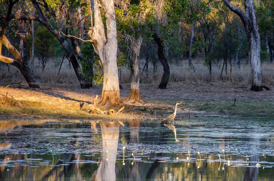
We spent our next night parked up next to a lagoon we spotted just off the road, and really hit the jackpot. We saw wallabies coming to the water to drink, and also several wading birds enjoying the pleasures of the bottom of the pond.
The next morning they all came back, the light was perfect, and it was great watching them. We have wonderful pictures to show how enchanting it was. As it turns out, the Tiger makes a perfect hide for watching critters. We stay inside, taking photos through the windows and the birds and beasts don’t take any notice of the truck — daily life proceeds.
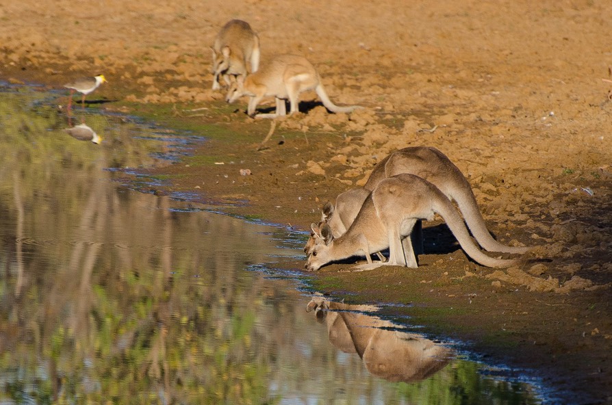
We proceeded to follow one rough dirt track after another most of the day, with some smooth sections mixed in; again that night we found a billabong and parked nearby. It was 95 degrees when we stopped, no breeze to be found, the evening was full of tiny bugs, and it was hard to enjoy anything about anything.
But we persevered, outlasting the night, and wallabies were busy enjoying the water when we awakened the next day. After the wallabies finally left, wouldn’t you know it — a group of cows showed up, spent awhile staring at us (a few scratching their backs on the edge of the storage box), and then finally wandered off to stare at something else a ways off. They were like workers waiting for the catering truck at break time. A great couple of mornings, and the perfect antidote to the rigors of the drive. We felt renewed; life was good.
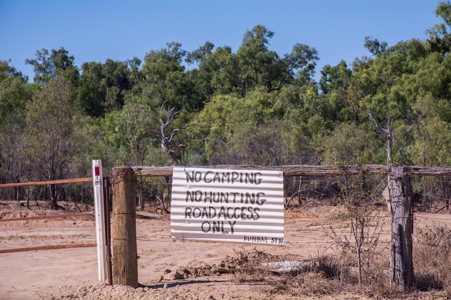
We crossed a major river, the Mitchell, a mere shadow now of its ferocious wet-season self. We were reminded of what some resources had said, that much of this whole area is flooded during the Wet, and towns/homesteads are isolated for weeks at a time. Shortly we passed by Dunbar Station, merely a cattle pen/ranch house/wide spot in the road, but one of the few bits of “civilization” around, and started on the Burke Developmental Road, which would make a wide arc and end us up back at Normanton. The kapok trees are in bloom now, sparse and spindly but with lovely yellow flowers; they add color to the grasses (along with those termite mounds, of course).
As the afternoon progressed, we both had headaches and were ready to be done, but stopping early to sit in the heat is not an attractive alternative to plugging ahead with the air conditioning running in the cab, so we pressed on. There were more rivers and fun ahead; we enjoyed the savannah grasses, wallabies sitting beside the road in the afternoon heat, and the trees — all breaking up the dry cattle-country landscape. The waterholes are shrinking in size and the air is drier. Some of our route took us along roads that had right-of-way across private land, and through several gates; we had to get out to open and close a couple of them. We’re going through areas where the road dirt is red; when the wind blows, the trees and grasses in the direction of the prevailing wind are all red colored for about six feet back from the road bed.
We arrived back in Normanton about two weeks after we’d left, and settled into our same area by the river (still didn’t see any crocodiles here). It had been a good run; in another world we would have stayed longer. We took a little time off to prepare for the next leg of our journey. Normanton has pretty good services — grocery, butchery, post office, tourist information center, etc. Even has a bakery, but it had closed suddenly, and we had to settle for the next-to-last loaf of Sliced Soft White Bread (trust us, not fit to eat), which we picked up at the fuel station just before it was snatched by someone else.
Starting further west, we weren’t expecting any dramatic scenery, although one resource said, “Beyond Woologorang Station are some sizable hills, a rarity in this area”, and we were looking forward to that. The road would pass through some Aboriginal lands, and although we didn’t need a pass at this point, we supposed it all would be rural, with few interruptions, all the way to Borroloola, still a pretty minor spot, but the largest on our short term horizon. So westward ho!
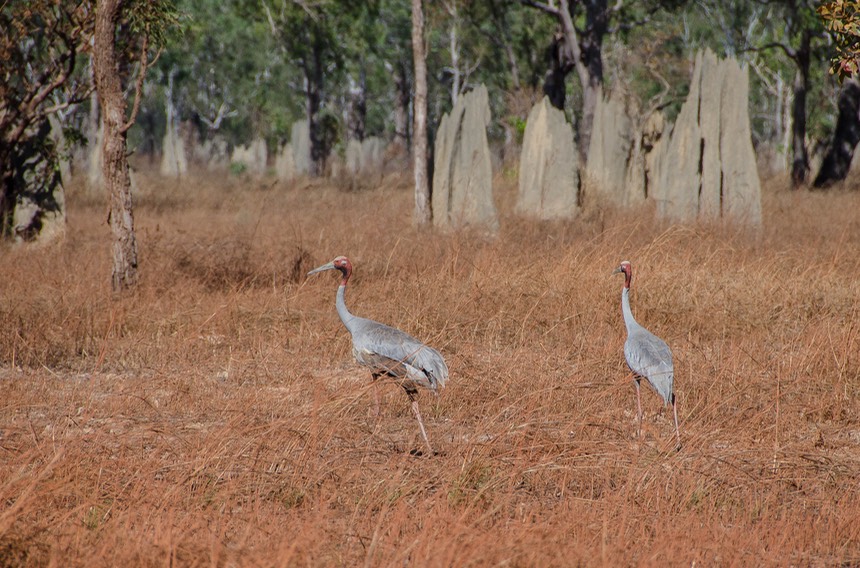
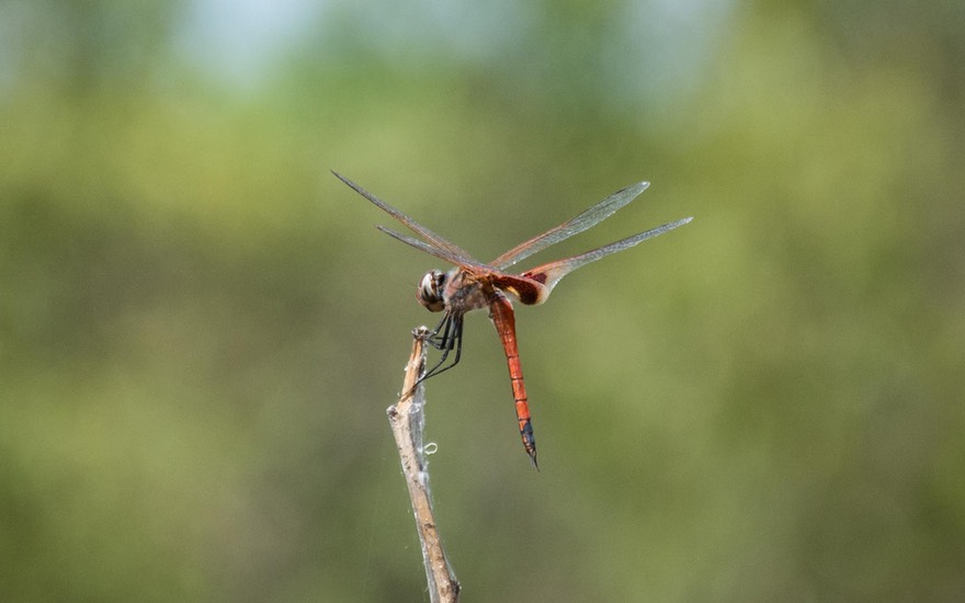
We began seeing brolgas out in the grasses. In the United States we call them cranes, and these were quite similar to the sandhill cranes we’d seen in Alaska. They were plentiful, always paired up, but sometimes in groups of pairs. Very interesting birds.
There are plenty of significant river crossings in this area, with the water heading north out to the nearby Gulf of Carpentaria. We were traveling along at about 28 meters above sea level and maybe 20 miles south of the Gulf. These “significant” crossings often involve a steep drop down to the water, a slow drive across through small boulders, and then a steep pull up out of the river bed and back to the level of the roadbed. Pretty interesting stuff; Rick’s a pro — he does them smoothly and calmly. No worries, mate, at least in the dry season.
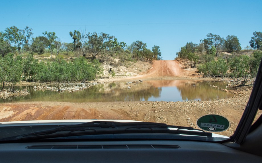
A couple of the river crossings were different. The rivers were very wide and shallow - maybe a couple of hundred meters across. These had concrete causeways built across them that would be underwater in the Wet, but would give a defined place for vehicles to drive through.
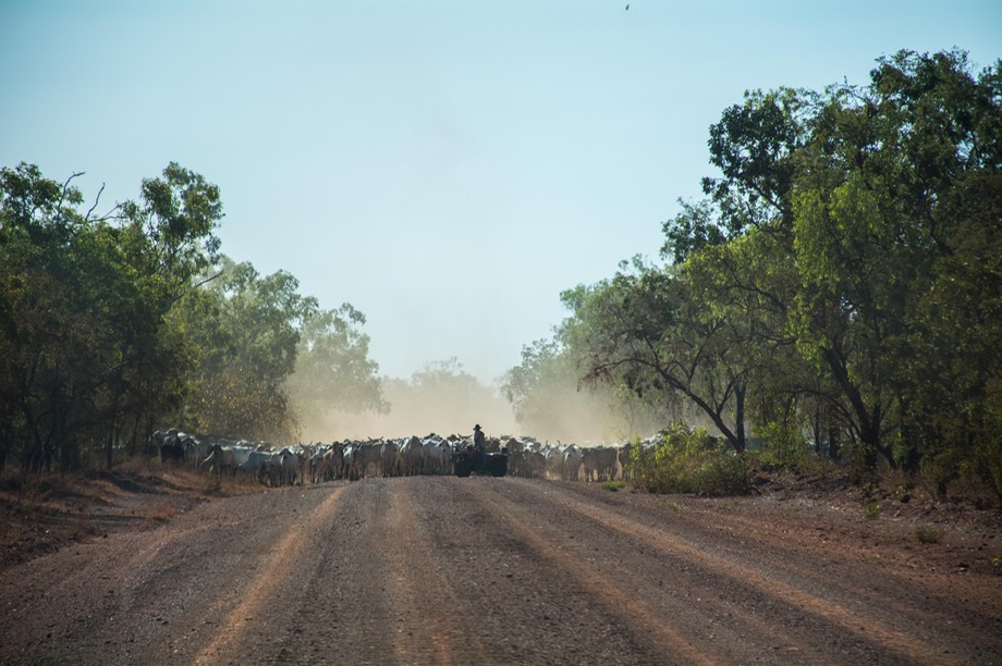
By now we had crossed back into Northern Territory. Soon the land became a bit more tropical, with palms, hanging vines, more foliage and greener grass. And cows! Suddenly we were surrounded by them, being moved from one pasture to another. In the local lingo, a “mob mush.” They had lots of supervision and we were guided right through the middle; one fellow told us there were a couple thousand of them being moved. Soon they’d all passed us by, the dust settled, and we resumed our journey. We’d done this before bunches of times in various places with sheep and goats; but cows are a helluva lot bigger.
We spent that night on a nice piece of open ground after crossing the Calvert River, described by the driver as “one deep ditch.” By the way, all these river crossings come with crocodile warnings, making you want to be extra careful not to turn over or get stuck…if we get into trouble, the first responder is likely to have very large jaws and lots of teeth — and no, not the Jaws of Life.
The next afternoon we arrived in Borroloola, where we rejoined pavement quite happily as the last section had been some of the worst yet — and had lasted the better part of 200 kilometers. Borroloola’s not so much, but it’s a real town, with schools, grocery stores (even a pizza place — closed this afternoon), and we enjoyed the change. We took care of business with fuel and a few groceries, aired up the tires and moved on a bit further west, where we found a pretty spot at a nearby rest area. We had a lovely, steady breeze all evening and night, and were so pleased we decided to stay an extra day. The humidity was down to 2%. I had put some water in a frying pan to soak overnight; the next morning it was dry as a bone — desiccated is the new word in our vocabulary.
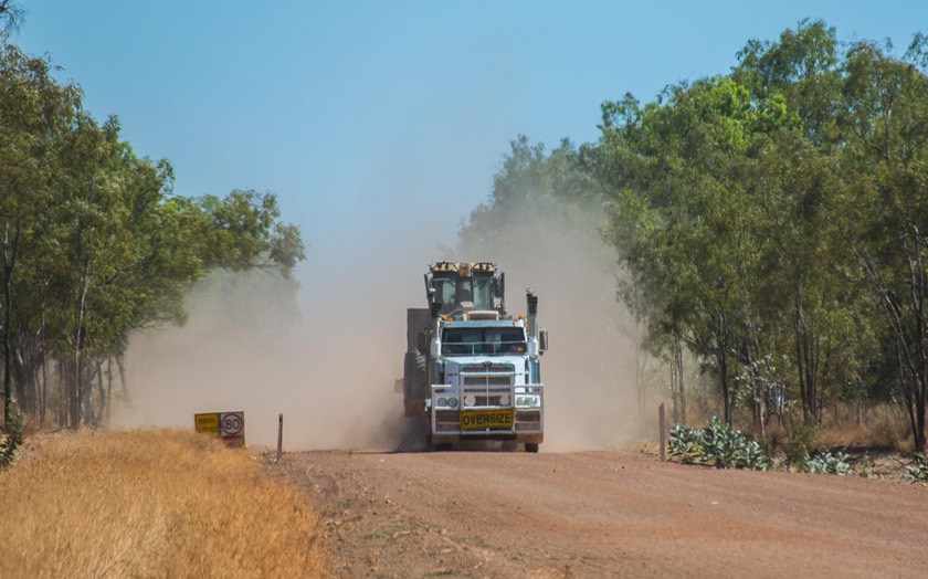
Having a bit of trouble sleeping at night, I entertained myself by watching the road trains passing along the highway. They’re really quite pretty, all decked out with red lights strung along the sides of their rig so they can be seen a long ways off. One of these nights I’m going to get my camera out and take a picture for you. Incidentally, we have a great deal of admiration for the drivers of these huge rigs. They’re doing a very difficult job, and doing it very professionally. They’ve been courteous, careful, and I always get a return wave. We passed one fellow beside the road, changing a flat… what might have been one of over 70 tires on one of these rigs. What a nightmare, but he seemed to be taking it in stride!
By now we were heading for Katherine, a large town about 300 kms south of Darwin and a jumping off place for further adventures. Arriving, we noticed that the humidity had gone up to 4%; Michelle (our combination clock and go-to source of weather info) thinks it’s going to rain. Such a ditz. We stayed here for a couple of days, catching up on laundry, internet, and visiting the tourist office to get some info on what was ahead. We even washed the Tiger! We wanted to visit Darwin, on the edge of the Beagle Gulf and the Timor Sea. And looming out there, at the top of the pile, right up against the Van Diemen Gulf, was Kakadu NP, a World Heritage Site and home to some of the most well known Aboriginal rock art in the country.
And right along the way, heading north, was Litchfield NP, home of those termite mounds I keep talking about.
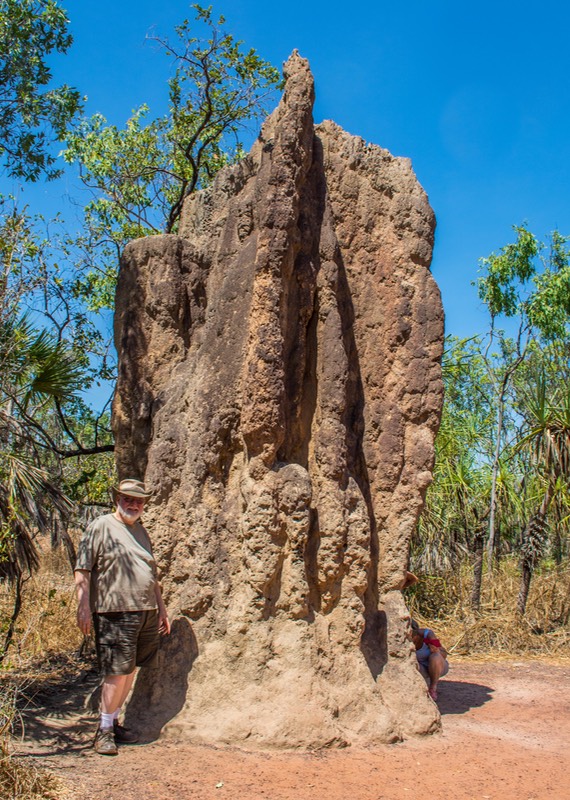
Stopping at Litchfield for a couple of days was a nice experience. We were far enough up towards the coast for it to be quite tropical. The park had waterfalls with swimming holes — called plunge pools in our guide book — nice campgrounds, interesting sandstone rock formations, and about a zillion termite mounds. They were cool, and there was information explaining about what they were, why their homes looked the way they did, and stuff like that.
So here’s the deal on termite mounds. To get only semi-technical, apparently there are two different kinds of termites up here: cathedral termites and magnetic termites. A “mature” cathedral termite mound can be very large, bigger than a person, and quite chubby — kind of like the Michelin Man. Some of them get very old; there is one at Litchfield dated back over 50 years. The magnetic termite mounds are shaped quite differently; they tend to be two-sided rather than round, sort of pointy looking, and are aligned on a north-south axis, like a compass. This alignment is supposedly to minimize the heat’s effect on the structure. Magnetic termites tend to live in flood plain areas, surviving the wet each season, while cathedral termites prefer somewhat higher ground. There — all you need to know, and more. I promise to leave you alone now, except to say that there are more pictures in the photo gallery, along with more info I know you’ll want to see...
Tearing ourselves away from the termites (finally, you say), we shot on up to Darwin. Heading in, we noticed the drivers had become more aggressive. We weren’t used to traffic any more, and almost never get even close to the speed limit, which, by the way, is 130 kph (80 mph) on the major highways. But the highway builders did a pretty good job of providing adequate passing lanes and we managed to avoid getting hit by those with more urgent matters ahead than what we had in mind.
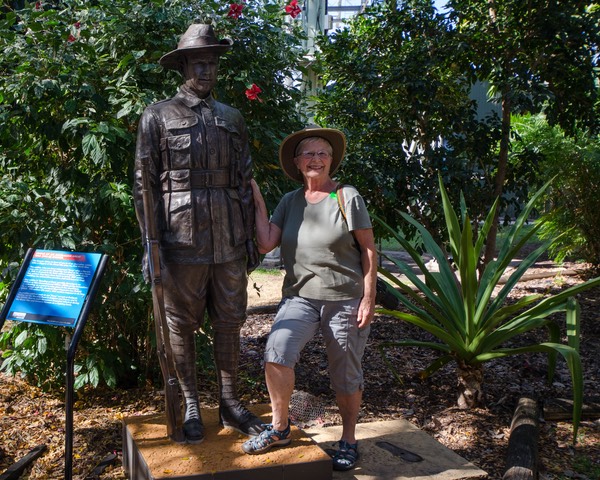
It was hot. It was humid. And we’d been told that this was still the “cool” season. But Darwin was rather nice — an interesting and attractive town. We visited East Point, which is a military enclave sticking out into the bay with a nice view of the city. It’s the home of a very nice military museum featuring a WWII display on the bombing and defense of Darwin during the war, and also a small section on Australian troops in Viet Nam. The whole place was excellently done and very thought-provoking. On our way up to Darwin we had passed through Adelaide River, a nice old railroad town that had also taken Japanese bombs during the war, and along the highway there were several airfields remaining from that era.
And on an un-military subject, we stuck our heads in the door at the Chinese temple. The original structure dated back to 1887 wth the arrival of the Chinese as part of the gold mining scene. It, along with the entire city of Darwin, was destroyed by Cyclone Tracy in 1974, and was rebuilt subsequently.
We even managed to get some business attended to in Darwin. The mail was waiting for us (hurray); we had the front tires flipped inside-to-outside to even the wear; and we had a routine service done on the Tiger. And then we beat feet out of town again. Not surprisingly, the best way for us to keep cool is to keep moving.
Still in the greater Darwin area, we visited Kakadu National Park. As we were driving into the park, coming up from the south, we saw an unusual group of critters, a clump that most people don’t get the chance at. Rick spotted a small herd of water buffalo, pulled over to the side of the road, and we were able to get a good look at them as they took exception to our presence and fled the scene in a semi-dignified fashion. It was a great start to a good visit.
Turns out Kakadu’s a pretty nice place. The Aboriginal Cultural Center was outstanding. The rock art was the best I’ve seen in Australia. We had hot sticky nights with lots of bugs and few breezes to compensate. We got a really early start one morning to go hike to a rock art site — 78 degrees and 89% humidity at about 7:30 am — that lasted about 15 minutes! Hard to keep moving; lethargy sets in as soon as you sit down. We saw crocodiles at a river crossing; they weren’t too active either.
At the park visitor’s center we learned a little more about how the presence of these beasts is an issue. Each year, as the wet season ends and the park is preparing for the tourists, the rangers have to patrol each known habitat that visitors want to get to, to make sure the swimming holes, the river areas, etc. are free of the estuarine crocodiles. The tour operators are anxious to take their clients out to these places, and so the pressure is on to clear the locales. We were able to see a film that showed them trapping and removing a crocodile from an area where hikers go. It was quite something.
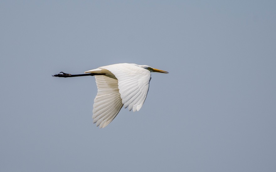
Our last morning we drove to a wetlands site at Mamukala, where there was a hide for watching the birds. It was really nifty and since the Magpie Geese had just arrived, there was tons of activity. Cool, and all very satisfying. Just cannot get enough of those birds.
By the way, we really encourage you to go to our Photo Page for this message as we’ve had some great opportunities to get pretty special pictures of critters, birds, scenery and of course termite mounds for you to enjoy.
We returned to Katherine once again to gather ourselves before starting the next phase of our visit to Aussieland. All roads heading out of the Darwin area go through Katherine, as it is the crossroads for the Savannah Way continuing west and the north-south Stuart highway. We were delighted to find that although it was still pretty hot during the day, we were now far enough south of the coast that it cooled right down at night, with a consistently strong breeze. The refrigerator has begun to regain its youth a little. It has struggled mightily over the last few weeks with the higher temps and humidity.
Back in increasingly dry air, sometimes filled with dust, I find myself thinking about the American pioneers, out on the prairie and trying to make a life there. The women, struggling so hard to make a family home, often living in sod houses. Or change the location; I’m sure the Australian pastoralists, settling these rural homesteads, experienced the same hardships.
We have dry throats, drink huge amounts of water every day, cough a lot and have our clothing in bags to keep the dust out. My eyes hurt; our hand lotion supply is running low. It’s a combination of high temp and low humidity. But forgive me, I’m just whinging.
While here in Katherine, we have fairly decent internet, and are doing research on the specifics of where we want to go next. Our plan is to head further west, to Kununurra in Western Australia. Kununurra (pronounced sort of like Kananarra) is the base camp for most travels into The Kimberley, the mighty Kimberley, the western section of the Top End — and the home of the Gibb River Road, one of the all-time legendary 4WD roads in this part of the world.
So as we head off into the western sunset, until next time from our gang,
Rick, Kathy and La Tortuga
Click to see many more photos from The Termite Report