May/June 2017
A Fond Farewell
We reluctantly say goodbye to New Zealand
We left you as we were getting close to Wellington. And we had a stroke of excellent fortune. We had decided to check out what we knew to be a free overnight parking area in Mana, a suburb not too far north of the city. Our plan was to check it out and then drive on in to spend the day; our end game would be to drive back here again that night (maybe 30 miles?). We thought this would work out okay.
But no need. We drove into one of the prettiest areas we’ve been to yet, a community park with free motorhome parking right on the water and near the local marina. But the real deal? It’s a stone’s throw from the metro line into the city, and at the other end the train station is an easy walk to the museum we wanted to visit. It was suggested we should simply leave the Scow right there, go spend our day in the city, and come back in the evening. All would be quite safe.
So we did. We spent a total of 3 nights by the water watching the tide come in and out, enjoying the quiet spot, the dog walkers and boats parading past, the kids playing soccer and rugby on Saturday, and a chance to catch our breath. And then, best of all, we made friends with some other campers, and they loaned us the equipment we needed in order to get EXCELLENT wifi. It was awesome, and we were so delighted to be back in touch with the world. We made arrangements to stop in and see our new friends at their home in Palmerston North a few days later, and to return their equipment then. Such nice people.
More awesome? The Te Papa Museum (officially The Museum of New Zealand) in Wellington. Wellington is a great city, and very cool, by the way. In fact it is number one on a 2017 list of cities with the best quality of life in the world compiled by Deutsche Bank (Ed. note: there are a number of such lists). We find that easy to believe as we visited on a beautiful sunny day and had a great time there, wandering the center area with lots of cool modern buildings, walking along the pedestrian-only waterfront and enjoying the people enjoying themselves as we made our way to and from the Te Papa. If this is a new museum for you, it’s an amalgam of various aspects of the social, natural and historical foundation for the country that is New Zealand today. It’s extremely well done, deserves at least a whole day to itself, and completely wore us out. We loved it.
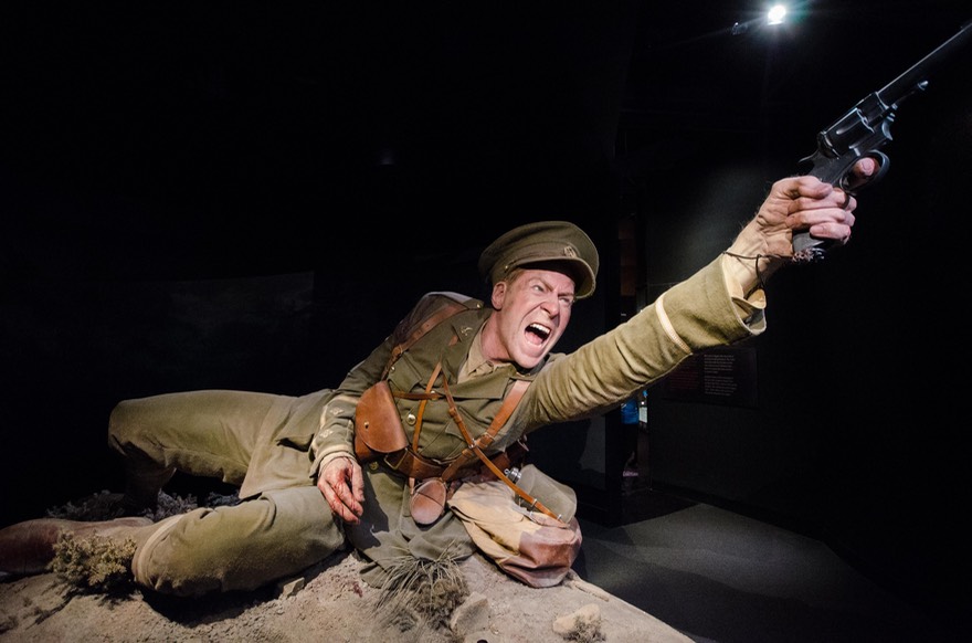
Along with the permanent galleries, they mount various special exhibits. Before we’d even gotten there, we’d been told we must see the temporary exhibit on New Zealand’s participation in World War I, variously called “The Gallipolli” room and “The ANZAC” room. Either way, it is really well done, and greatly admired. The displays are innovative and very detailed, with tons of information shared in many different ways. The most striking aspect of the exhibit is the use of extraordinarily lifelike larger than life sculptures of eight individuals whose stories are used to tell the tale of the battle experience. To learn more about the exhibit you might want to visit their outstanding website.
But I do have to say there were other exhibits that we enjoyed even more. One was a series of short documentaries called “My Place.” In it, locals talked about their favorite part of this country and showed the viewer why it was so special to them. There were sheep ranchers, and a woman who had spent her entire adult life at a certain location on the coast southwest of Auckland, and a Chinese gentleman who was a citizen of New Zealand who had adopted the customs and life style of the Maori; people like that. It was an amazing film, and we sat through much of it twice, totally entranced. It truly captured the spirit of the people here, and why they love their country so much.
Another was a special presentation on immigration. It was very timely, given this ongoing issue throughout the world, and had an international approach. New Zealand was originally inhabited by pacific islanders around 1350, and then by Europeans in the 1800-1900s, with the attendant problems, some of which continue today in conflicts between the Maori and the “white population.” More recently, there have been waves of people migrating to New Zealand from many other areas, particularly from Asia; and now refugees from troubled areas in the Middle East. They seem to be ending up on North Island for the most part, and in some cases not fitting in well.
So there are issues. The approach of the exhibit was that we are all one people, and it was presented in such an interesting way. Hard to explain, but in addition to pictures and stories round the room, there was an ongoing changing screen. It would start out with a face, and as you watched it the camera would move closer and closer to the head of the person. As it did so you eventually realized that it wasn’t a picture of a person, it was a person’s face made up of hundreds of tiny pictures of other people’s faces. Closer and closer it got, and ultimately zoomed in on one specific face, which then became the entire screen. Then the camera would get close in to that person, and you’d see that again it was composed of tiny pictures of other people’s faces. We are all one people. It was mesmerizing.
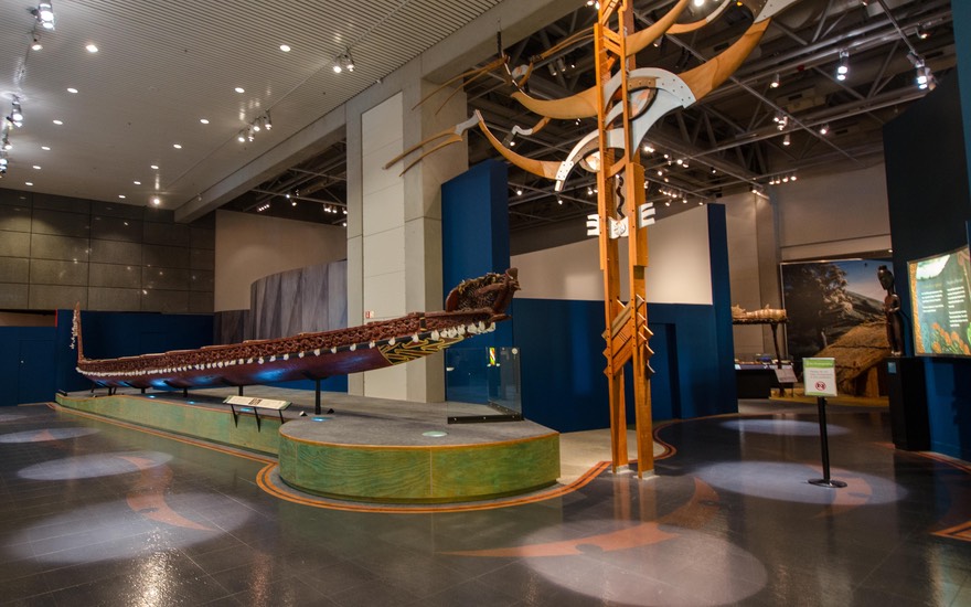
Perhaps the most important permanent exhibition in the museum was the large section on the history and artifacts of the Maori. There were extensive displays and illustrations and explanations. And it was so well done. The Maori request that no photos be taken in this area, as the items are sacred, so we have nothing to show you. You simply must come and see for yourself.
The Te Papa is a very large museum and we spent several hours wandering and enjoying. We had walked there from the train station when we first arrived, along the waterfront; but were so whupped by the time we finished we grabbed a bus with all the other commuters and made our way back to the station through the downtown. People on the bus would ask if we needed help with directions and was everything good; wonderful, friendly folks. In both directions we really enjoyed the sights and sounds of a nifty city.
When we finally left the area, we didn’t actually go all that far, just through the mountains and over to Cape Pelliser, the southernmost point on North Island (we have a thing about these places, don’t we!). We were able to get almost out to the point, although we stopped when we reached a water hazard we thought might be too much for Scow Baby (borrowing from Ciao Baby, Tessa!). One flat tire had been enough for us. The cape lighthouse wasn’t the only reason we were there, of course; fur seals were reputed to be in evidence (but not now, of course) and we’d been told that some of the best fish and chips anywhere was sold right at the spot where we were going to spend the night.
We spent that night down by the water, at the edge of the little village of Ngawi, listening to the waves and enjoying the starry night after a terrific sunset. The F&C folks had taken the day off, but we loved it there anyway. The next day we turned our noses north and began the journey back up toward Auckland… looking for F&C along the way. We were owed!
Soon we found ourselves up to our ears in wineries. New Zealand has several very well respected wine-producing areas, and this was one. We drove through Martinborough, one of the main towns, enjoying all the cafes and wine tasting rooms — just like home in California. It was yet another pretty day and the vineyards were ablaze in fall color.
We ended up the night (and stayed on for a second one as well) in Masterton, alongside Lake Henley on the edge of town. It was a very nice area, and well used by dog walkers, joggers, and a huge assortment of swans, ducks, and geese. They put on quite a show, and we loved it. We found our fish and chips within walking distance, got to watch the local primary school putting on a field day the next morning, and were delighted with ourselves. The waterfowl were splendid, showing off to each other and preening at the edge of the water. Cool. The days were beautiful, and the nights frigid. It was the first of June.
We stopped in Palmerston North to drop off the gizmo and spend an evening with Caroline and Richard, our new friends from down near Wellington. Ultimately they said to keep the device until we were ready to leave the country; just stick it in the mail before getting on the plane. How nice of them!
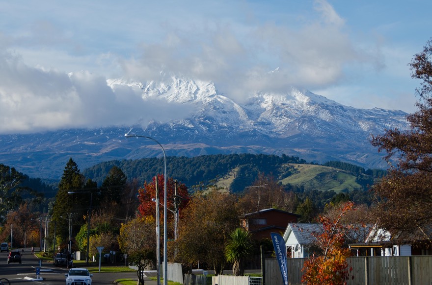
We took a great road heading north the next day, a small country lane heading through the rural farmland between Amhurst and Manawatu, filled with trees losing their leaves, grassy hillsides, and critters. The mountains to the west were peeking through the clouds. There were lovely valleys between the hills, deer in the fields (first we’d seen up here), and pheasants to flush out from beside the road. It was very pleasant. At Manawatu we rejoined the highway and kept moving north-ish. I say “ish” because we made one detour, to the small town of Ohakune, to take pictures of a big carrot (don’t ask, says Rick). We spent that night back at the pretty little park in Turangi where we’d spent our first night on North Island three weeks before. A river runs nearby, and it was filled with trout fishermen; apparently this particular river is a good’un.
At this point we had decisions to make. With a bit more than a week to go, we were faced with choosing between the Rotorua area, and heading out to the East Cape region. It was tough. Rotorua is well known for its volcanic activity and ongoing chances to see “the earth in action.” Great, but we’d recently spent a lot of time in Iceland seeing just such activity; also, we’re both from the western US and have been to Yellowstone a number of times over the years.
The second great opportunity in the Rotorua area is to learn about the Maori and experience some of their culture. This was appealing; however, we’d been having so much great exposure to the Maori people in their home areas, and seeing their artifacts in their museums, that we felt we were already fairly knowledgeable. Also, the Cape Peninsula is definitely Maori country and had a lot to offer as well.
Ultimately, we decided that heading out to the remote East Cape would be our choice. We knew it would be worth it — very rural, and the lighthouse there was the easternmost point in the country, and as such deserved a visit. By the way, this easternmost point in NZ also happens to be the easternmost point in the World… come again, you say??? You got it, remember the International Date Line thingie? Well east cape in NZ is at nearly 179˚ East latitude. About 75 miles offshore it gets to 180˚ East, which also happens to be 180˚ West; where the countdown down to 0˚ at Greenwich begins. Huh, who knew?
So off we went. To get over the mountains in order to start this jaunt, we took the road from (very lovely) Lake Taupo to Napier — a winding mountain trek through the rain over to the east side of the North Island.
Napier is well known for its Art Deco architecture. Unfortunately, we found it touristy and full of chain stores selling boring stuff; also the admittedly interesting buildings were covered with modern signage that pretty much destroyed the effect. We were unimpressed. The next day we drove south a little ways to check out Hastings, also known for its Art Deco buildings. It was better, not as touristy, but still not worth the bother. We did find, though, that if we’d wanted we could have spent some time at the local showgrounds visiting the Pigeon and Poultry Show… Pigeons and Poultry we said… hmmmm? Sorry to disappoint, but we decided to take a pass.
But onward. Increasingly rural, increasingly Maori. We took the winding road out onto the Cape peninsula, through the rugged countryside up towards Gisborne, further north along the coast. We went past very pretty Lake Tutira, enjoyed the continuing fall color display, and started enjoying ourselves again. This road is called the Pacific Coast Highway; how about that! It’s called that all the way around the Cape.
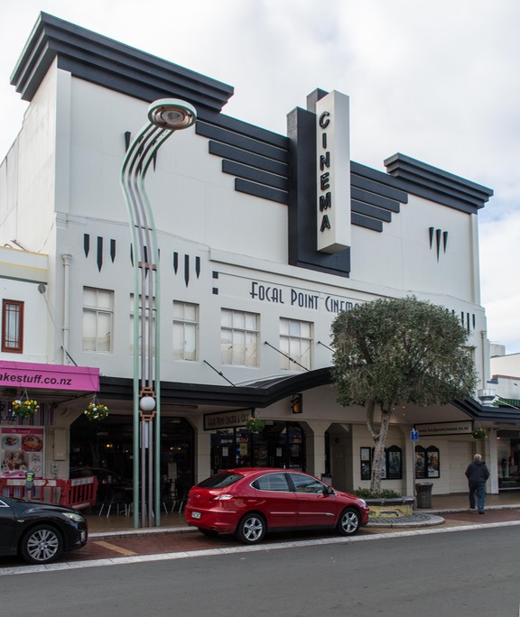
We spent that night in Gisborne, and loved it. What a great town! We were parked along the edge of the pretty river that runs through town, a super spot with lots of lawn and birds and interesting statues, and then — had a super time at the movies! Gisborne is a very nice, out of the way, smallish town with much more interesting architecture and public sculpture than the more famous towns we’d visited earlier, and it really suited us.
There is a nifty old 1930’s movie house, the Odeon Theater, and it was showing a new documentary that had just been released, titled McLaren. We had seen the movie poster earlier in the day at the theater in Hastings, but they didn’t have the movie yet. Here in Gisborne it was playing. Now Bruce McLaren was New Zealand’s best racing driver in the sixties and early seventies and went on to build his own racing cars, which enjoyed tremendous success in Grand Prix, Indy, and especially in the Can-Am series in North America. The McLaren company still exists today and produces some of the world’s best hyper fast, and hyper expensive, sports cars. The movie is the work of New Zealand film maker Roger Donaldson, who also did The World’s Fastest Indian film we’ve already mentioned. All you motor heads out there — do not miss seeing McLaren.
So we had a good time, and were reluctant to move on the next day. But our days in New Zealand were counting down and we needed to keep making forward progress. We followed the coastline, seeing surfing beaches alternating with inland pastures as we went over hills. We now were seeing lots of loose goats along the roads and up into the wooded areas. We say “loose” because you simply cannot make a goat stay where you want it to, except to tie it to something; but these critters didn’t seem to have a pasture at all, they were just wandering at will. We enjoyed seeing them them hither and yon.
We went through lots of forested areas, some being heavily logged; at one point we went past a sign saying “We are moving trees to make room for more” — an interesting way to put it, and we did indeed see many signs of reforestation efforts.
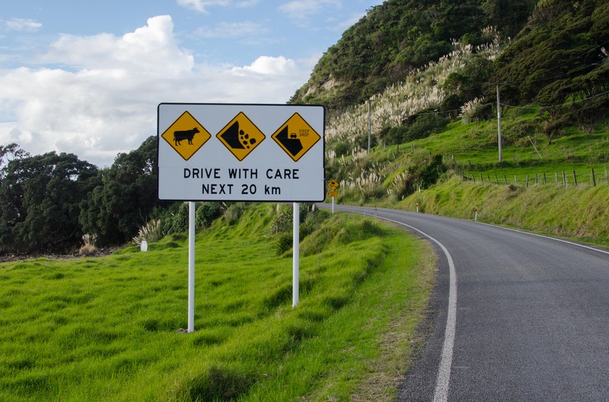
At Te Araroa we turned off on a small track to make the drive out to the Cape lighthouse. Well, at least that was our intention. It’s about 21 km of (mostly) gravel; we made it about 4 of those kms, reaching 178.4˚ E. We ran into a water hazard that was negotiable, but not for us. The road was quite badly deteriorated and the outer third or more had fallen into the sea. Hummph. Some traffic was going and coming, but not rental vans. We’d given it the ol’ college try, but had to turn back. Where’s that Tiger when you really want it? (Singapore? Hong Kong? Who can say?).
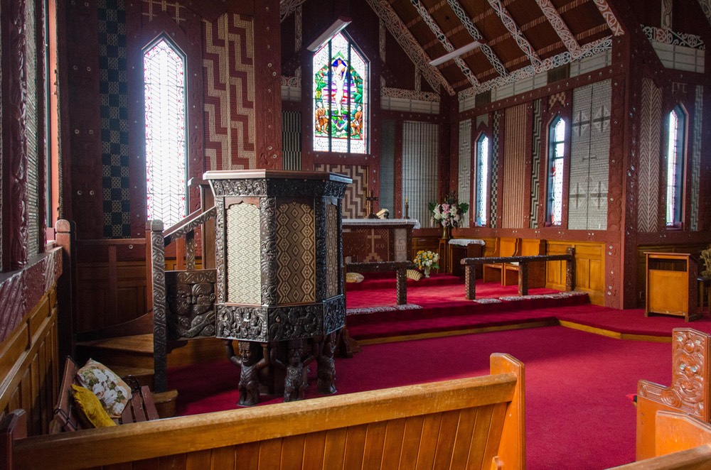
We really did enjoy the rest of the trip around the peninsula and were quite glad we’d made the effort. It’s very rural, with small towns and lots of open space, beautiful scenery, and forests of ferns midst huge trees. We stopped in Tikitiki to see a really pretty small Anglican Church whose interior is fully decorated with Maori art; it was beautiful. We spent our last night in the area at a small community park on a bay at the north end of the slightly larger town of Te Kaha; it’s worth the trip just for the names of the towns, don’t you think? We had heavy storms during the night, but woke to a mostly sunny day, and finished the loop of East Cape in Otapi.
From there we stayed on the coast for the rest of our time in New Zealand, enjoying the bays, the small towns and the lovely places to park at night right on the edge of the water. We stopped in Whakatane to visit the museum (rats — closed for renovation) and wander the interesting town. Whakatane is very important to the Maori and figures in their legends. Learning more about all this was really meaningful, and to stop at these places to enjoy locations that had been sacred for centuries was about as good as it gets.
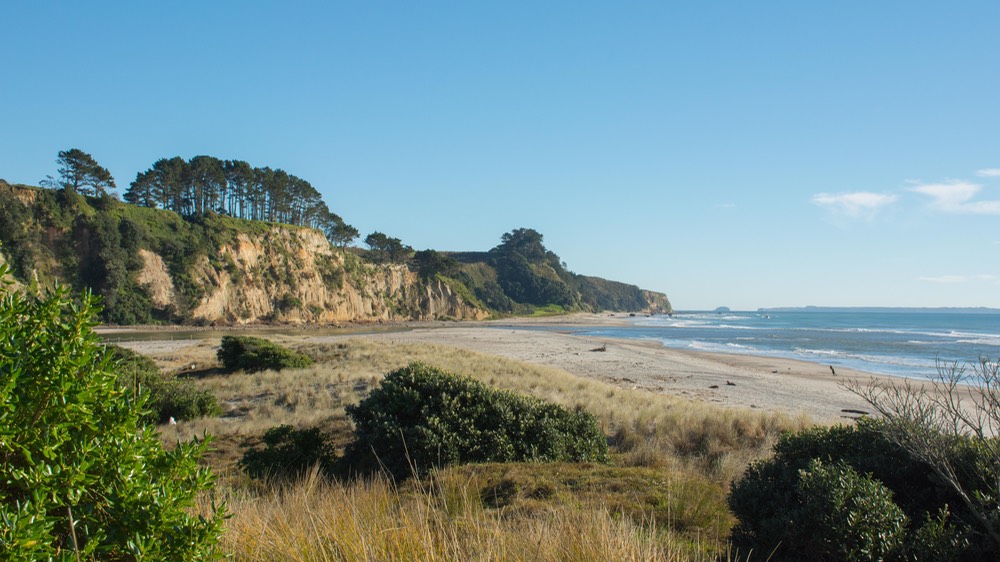
We spent our last camping nights at a charming spot, Dotterel Point at the end of Pukehina Beach. We took a nice walk on the beach and I made a mess of my tennis shoes walking through wet grass and sand; Rick was smarter than I and took a different route. It took two days to get them dry enough to wear on the airplane — I did get a great photo though. Our camping spot had us sitting looking east into a perfect sunrise, gazing out at the Pacific Ocean from the “far side” of the water — for those of us who grew up in California anyway! And from here, today, the water certainly looks “pacific.” A lovely spot in the continuing beautiful fall weather.
It was a great finish to a super trip. The next day we trotted on up to Auckland, took care of some chores, spent our last night in-country at some friends-of-friends there (had a super evening with Jocelyn and Ken) and headed for the rental drop off point and the airport the next day.
While we were on our way to Australia we chatted a bit about our time here in En Zed (as some like to call it). We hadn’t expected to enjoy ourselves as much as we did. When we found we would have 10 weeks here instead of 5, we were quite frustrated. What to do with all that time? We’d been advised to plan to “spend 2/3 of your time on South Island and 1/3 further north.” But given our rental issues we would need to split our time evenly between the two islands. This bothered us at the time but ended up being just fine.
While we found each of the two islands to be equally beautiful, they have real differences. The south is more purely agricultural while the north looks to have more industry. We’d say there is more truck traffic on North Island, actually more people and traffic in general, though we can easily imagine that in peak travel times tourist traffic in South Island becomes a real issue for locals; several of them told us about it. For the record, we enjoyed our time in North Island just as much as we had further south.
In many ways, it seemed to us that South Island gives you a sense of what New Zealand used to be like. There are fewer large regional cities, and they are quite a distance from each other. It’s not just a hop-skip-and jump between Nelson or Christchurch, and Dunedin or Invercargill (a real favorite of ours, by the way). And rugged Fiordland is like nothing you’ll see in North Island. Many of the Southerners still reflect their immigrant attitudes of inventiveness, stubborn individuality, and the whole idea of wanting to be left alone. Maybe a bit more conservative in their thinking?
On the other hand, the filming of the Lord of the Rings movies happened in South Island. And that island will never be the same again. The level of touristic activity is astounding, even in the off-season. The sheer number of people who fly in, rent a vehicle, and whip around seeing every LOTH thing South Island has to offer (mostly in a two or three week time frame) is overwhelming. The popular spots are jammed, regardless of the season. And to us, what they have come for has nothing to do with New Zealand. It’s an experience created out of whole cloth. We have nothing else to add on that subject.
North Island seems more closely tied to the “outside” world. Auckland (hugest city by far) and Wellington (the capital) act as bookends to what North Island largely stands for — sophistication, shopping, tall buildings, faster drivers — the modern world. The great museums and cultural activities seem to be better represented here.
And it’s warmer. What’s climate got to do with it, you wonder. Well, it has led to an influx of immigrants from the warmer parts of the world (a big generalization, we realize, but it does seem to be part of the picture). Many of the newcomers nowadays have arrived from Asia, which is a real change from traditional patterns of New Zealand immigration. This results in all the things you might expect in terms of a certain level of change, perhaps some racial tension — and a larger variety of takeaway shops.
Also at least in part because of the warmer climate, there has always been more of a Maori presence in the north. Remember that the Maori are descended from pacific islanders who quite naturally chose to locate in a place that was more like the homes they had left behind. Many towns have Maori names. Their artifacts are well represented in museums; and local communities have meeting places and churches and schools with an indigenous feel. Historically, the smaller number of Maori tribes who arrived on South Island were less successful in maintaining their individuality and strength (again, our generalization). Maoris on North Island were better able to defend themselves and establish/maintain their rights to their land. Entire parts of the island are owned by the Maori; they look, feel and operate differently. And good for them.
Our sense is that the residents of both islands are happy to have some distance between them. Having to take a ferry or plane to get back and forth is a huge barrier, but they seem to prefer it that way. The idea of a bridge between the islands is simply a non-starter. Can you imagine what would be required in order to make it withstand the earthquakes that are such a part of their lives in New Zealand, not to mention the infamous weather in the Cook Strait?
Both islands have many beautiful places to see and enjoy. When we realized our time was running out and we would have to leave, we wished things were different. We could have stayed several weeks longer. Rick has begun muttering that maybe we should bring the Tiger over and do more exploring. Hmmmm.
So we’ll leave you with this — “real” Kiwi men wear shorts regardless of the weather; and one final question: Can there really be 65 different varieties of flax in New Zealand?
Rick and Kathy, running off to Melbourne to wave at the Tiger as he pulls into port
Click to see more photos from A Fond Farewell