May-July 2025
The Vermillion Crush
We begin our summer travels
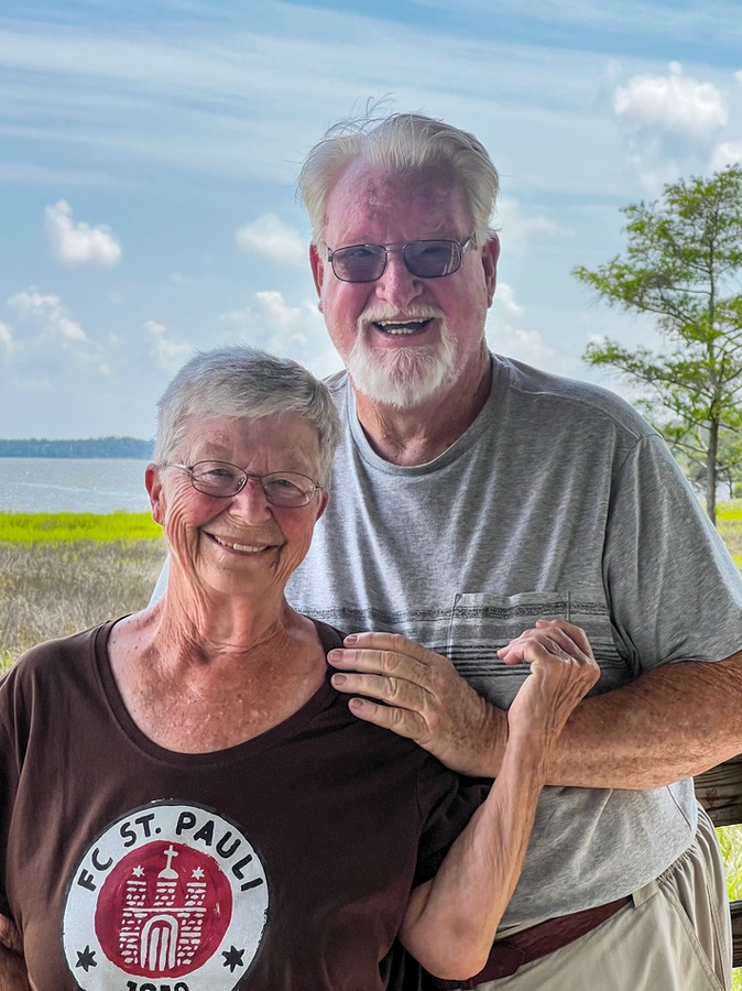
Hello from the two of us, happy be on the road and wandering from hither to yon. If you want to follow our route, you might want to keep a map handy.
This spring, we stayed in lower Alabama later in the year than usual. We always want to leave the area before it gets too hot, with the plan of keeping ourselves in cooler places by moving north and finding higher elevations. This year we had friends from California coming through for a visit as well, so we didn’t hit the road ’til after our delightful time together in mid-May.
When we left home, our first stop was in Red Bay, AL for an afternoon visit with some traveling friends. Red Bay is where Allegro motorhomes are made and our friends had stopped there for some work on their coach; a pause while crossing the country in order to get to a wedding on the east coast. We had a great visit, and are hoping to be able to spend more time with them later in the summer.
Moving on, we spent the night near Tupelo, Mississippi, a real favorite of ours. This is where Elvis Presley grew up, and it’s fun to touch base there. It’s a very basic southern town, quite nice, small, unassuming, and very pleasant. The next day we drifted west thru the countryside to Oxford. Another favorite lovely spot, we really like Oxford, with its charming central square and amazing bookstore on one corner. Being on a schedule, we didn’t stop this time, but will return soon we hope. Oxford is the home of William Faulkner, whose house makes a terrific visit, and also the University of Mississippi. And Shiloh Civil War Military Cemetery is not far north of Tupelo, across the state line into Tennessee. Beautiful area — with plenty to visit again in the future.
Still in Mississippi, somewhere north of Tupelo, we picked up the Natchez Trace out of Tishomingo (have you seen the Cohen brothers film, “Brother Where Art Thou?). Stayed on the Trace for a bit; lovely and pretty and quiet. So many of the little towns in the area have very nice parks, with lots of playing fields and ponds and walking paths. Charming, really charming. Mississippi was looking its finest on a lovely day in late May.
It’s absolutely grand to be driving In the South in May. One thing we did notice though: we are seeing far more corn than cotton in the fields these days. We wondered if this was a permanent change in what is being grown down here.
We crossed the Mississippi River as we entered Arkansas, at Helena. It was Sunday, the first of June. We’ve driven through this way several times before. A real center for the Delta Blues, with a great little museum, good music, and a quiet little town. But we needed to move on through this time because we were on our way to Searcy, where we spent a week getting some work done on the coach. This is the home of a place called RV Fog Dr. where very nice people repair dual pane windows that have fogged up. They also do paint work and in addition to taking care of three windows we had them do a really nice repainting of the lower front of the coach. A nice place to hang out; we could walk to a close-by town park, with great walking paths to enjoy…and there was a donut shop around the corner, too!
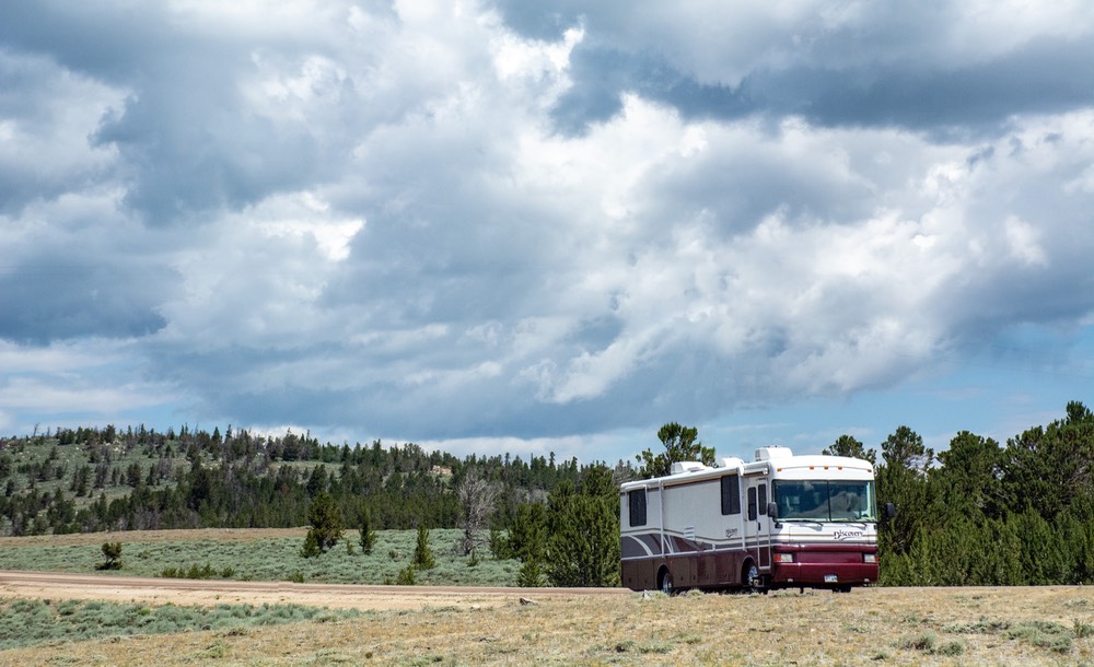
After nearly a week’s stay over Memorial Day weekend, the work was finished, and we left Searcy, driving north and crossing the state line into Missouri. We were heading for the Rippee Conservation Area, a lovely area along a river, where we had camped before and had really enjoyed it. But! The area had taken a real beating in the most recent set of storms, a few days earlier, and the whole area was shut down to campers (we learned later). No one stopped us from driving into the area, but it was hard to find the roads we needed (this is a rough-ish part of the Ozarks, and when we did find the road we wanted, it was pretty well destroyed). We ended up having to back the rig about a half mile on a pretty difficult little road before Rick could find a place to turn around. This is one reason why we don’t tow a car; we still like to explore small roads and occasionally we need to work our way out of a tight spot.
Spent that night in nearby Ava, Missouri. This is a charming small town; we need to come back to explore it. We really like the Ozarks, and it would be great to spend more time here. But not right now. We wanted to keep moving further north. So on to the Jefferson City area.
In “Jeff City” we crossed the Missouri River while we were in the city taking care of a couple of errands. The capital of Missouri, it’s a really old city, and needs lots of maintenance in the older areas, but it’s still quite pleasant and has a nice city center.
(By the way, we think it’s time for us to start work on The Definitive Roadkill Catalogue. We are seeing lots of dead armadillos along the roadsides, as well as deer and raccoons.)
You must be wondering where in heaven’s name we are headed. Actually, we’ve been moving generally north towards South Dakota, and hoping to stop and see the Loess Hills area near St Joseph, Iowa, and Council Bluffs along the way. We need to get Rick a new driver’s license. (Every few years someone needs something in South Dakota — the state to which we belong.)
We also wanted to explore some more of northern Missouri, and had read about a really nice conservation area with lots of places to camp for several days and enjoy “the real Missouri” — open land with lots of trees, deer, the occasional turkey and other critter, and lots of solitude. We drove around the little roads until we found the perfect place, and then settled. The Atlanta Conservation Area! Go look for it just north of Macon, Missouri. We really enjoyed ourselves. Trails to walk, lakes to wander towards, etc. A great spot, although we knew it would get very busy and noisy during hunting season. It was perfect in early June but somehow we didn’t take any pictures. Just not yet into the swing of being on the road; we’ll definitely have to come back another time.
After resting for a couple of days, and enjoying the area, we headed further west, into Council Bluffs. Shortly after hitting the main road though, we had to stop — it seems we’d picked up some water in the fuel and we had a warning light on. Well, fortunately we are still able to say that it’s never too late to learn, and Rick picked up some new tips in working through this problem. He knows where the water separator is so he went out to see about draining whatever water had collected there. Unfortunately, what he learned was that if you attempt to drain the water while the engine is running you end up losing the priming of the fuel pump and the engine dies and won’t restart. So he found a local diesel shop online and they sent someone out to get us going again. Not the first time and not the last we’re sure.
A couple of hours later, all better, we were back on the road again. And then monumental rains visited us. It was not our best day! But we plunged ahead, stopping for the night in Council Bluffs.
The town of Vermillion, South Dakota, was our next destination. We stayed on the Iowa side of the river as we drove north on I-29. The Missouri River forms the border between Iowa and Nebraska through here and we kept expecting to be tossed up onto a bridge over the river at any moment, but it didn’t happen — not there.
Would we ever get to cross over to the west side of the Mighty Mo?? No, although we got close in Sioux City. But our path to Vermillion stayed on the Iowa side all the way; and then the river takes a turn west just as you enter South Dakota and approach Vermillion, which is south of Sioux Falls. (You got all that? No, there won’t be a test…)
Vermillion is one of our favorite stopover towns anywhere. It’s a relatively small town, although a university town, with all that offers, and only has one small city park to enjoy. But there’s just something about that place — we really like to stop there and do so whenever we have the chance. The Lions Club park in Vermillion has just five RV sites with hookups but it is lovingly maintained and in a very pleasant location. In the past it has even been free, but now carries a $10 per night fee that the city has reluctantly imposed in order to limit its use by folks who just wanted to move in and live there.
The “Vermillion Crush” title for this message comes from Rick having to make a very tight maneuver to move from one park site to another, right next door. Two of the five sites had concrete pads, while the others were gravel. We’d moved into one of the unpaved sites, out of the way of workers who were cleaning up fallen tree limbs and branches after a recent strong storm. It turned out that the next morning they were going to begin the work of preparing to pave the 3 remaining sites, so they asked us to move onto a paved site.
It was going to be a fairly straightforward back up maneuver that Rick judged he could do in one turn, just backing around from one site to the next one over, while reversing the placement of the coach. We’d initially parked in the first site facing south but decided we’d rather be facing north. So back and around we went without any pause or correction; couldn’t have been smoother. Rick was pleased and while backing into the new site all properly lined up, one of the workers standing and watching Rick do his thing put two thumbs up and said how he had “crushed” the maneuver. He’d been quite impressed, and we figured we had a good title for this message.
Rick had hoped he could get his license renewed here in Vermillion. If so, we could bid the entire area adios, and start moving west across the prairie areas, heading straight to Wyoming, our next goal.
But ‘twas not to be. Vermillion was remodeling their offices and they were closed down for several weeks. So what to do? Well, turning due west, and staying just north of the border with Nebraska, the town of Yankton was not all that far away and was in the proper direction. And yes, they were open and issuing driver’s licenses. Not too long after hearing the good news, Rick had a new license in hand, and we were ready to leave the Missouri River. Goodby to the Lewis and Clark Trail, fond memories of getting glimpses of the river, and we were ready to get a start toward the rest of the summer. Enough of this chasing around.
After leaving Yankton, we had most of South Dakota to cross but wanted to delay heading up to pick up I-90 as long as possible. The back roads ahead were quite pleasant for the most part, going through nice countryside. But we wish the roadbed had been better. Many of the roads throughout the country are being repaired these days; boy do the repair folks love to dig huge ditches!
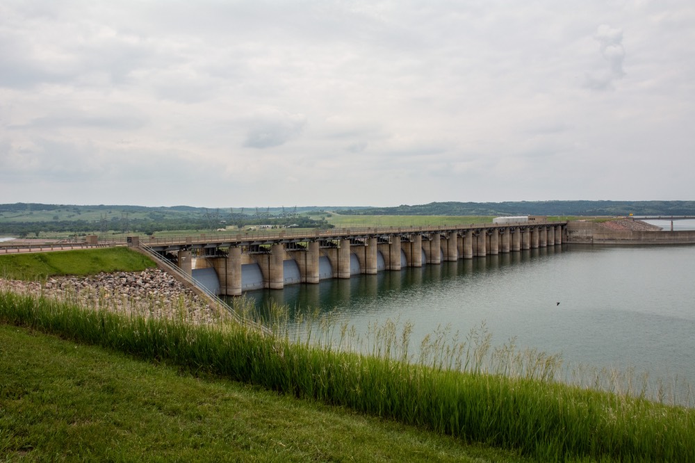
After awhile we came around a corner and found ourselves approaching Randall Dam, a quiet spot with a rest area, plaques talking about the dam’s construction, etc. And a very pleasant crossing spot. So we finally crossed over the Mighty Mo in Picktown, and continued on. Next time we come through here I want to visit old Fort Randall.
We straddled the Nebraska/SD border for a ways, then, after passing through a tiny spot in the road called Bonesteel (where do they get these names!), we decided it was time to swing north towards I-90, unfortunately over the worst section of road yet, and finally hit the highway. Gasp. Slim Charles has many fine features, but driving over rough roads is not one of them.
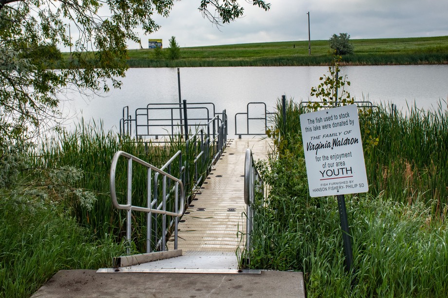
We spent a night in the small town of Murdo, SD in a small city park right off the road. It hadn’t looked like much from the highway, but Kathy went for a nice walk, and it really was a charmer. It was all so green. There was a big fishing pond in the center of the park, and a fishing bridge, and a really pretty walking trail around the edges; even a nice sign saying No Horses in Park (which I thought was kind of fun). Plenty of flowers in bloom, pretty darn nice. Despite the fact that we were traveling along I-90, it was very quiet at night. Terrific!
Oh, and by the way, if you can’t find Murdo on the map, it’s just about an inch to the east of the changing of the clock sign from Central into Mountain Time. You see it now?
The next day we started across the Dakota Badlands. They were also very green in early June, and a real pleasure. However, as we started into the Rapid City-Sturgis-Spearfish corridor, we stopped enjoying ourselves. The countryside was very nice, but the mood was destroyed by a continuous parade of huge billboards proclaiming all of the wonderful things to be visited and explored in each of these towns (and oh, don’t forget Wall Drug, of course!) It was pretty bad, miles and miles of “very ugly” actually. A real drag, and seemingly endless.
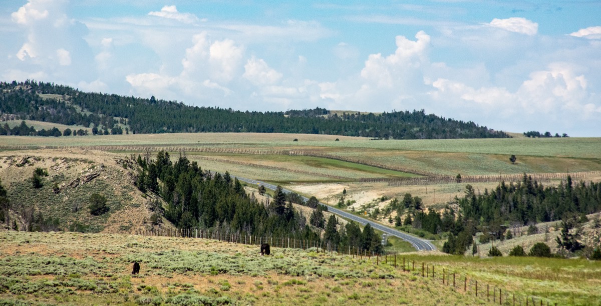
But we carried on, continuing straight through the area and soon we crossed into Wyoming. We spent the night next to an even lovelier city park, in Gillette. We’ve spent a fair number of nights in Gillette over the years because we have had a fair amount of work done on vehicles there. When getting work done we’ve always stayed on the grounds of the repair place and there are pronghorn that hang out nearby so we get to enjoy them. No pronghorn this time; we suspect city parks don’t fall into their comfort zone, but now we’ve discovered a lovely, quiet, green park with several baseball fields and other activity areas to be enjoyed, and a soccer field with a walking path nearby — and it was perfect for us. Just great.
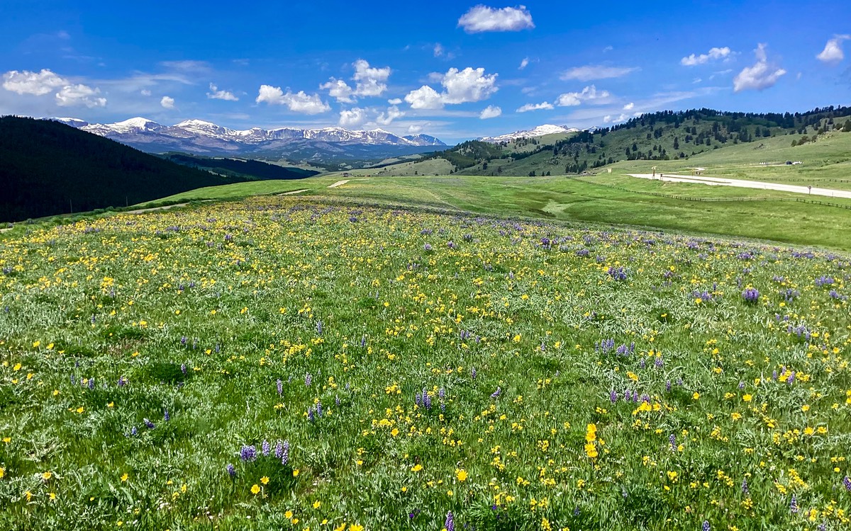
The next day we continued west to Sheridan. There were heavy winds at times, otherwise very pleasant. We stopped in Sheridan for a couple of days to take care of some business, then traveled south a ways into Buffalo, and up into the Big Horn mountains; our plan was to stay up there for several weeks. There is still plenty of snow to be seen …. and we were surrounded by an amazing show of wildflowers in the meadows. Wow! Visiting our “Summer House” in the Big Horns is a primary focus for our summer travels each year and it was particularly lovely this time.
As we drove into Buffalo for the first time this year, we found a major construction project going on at the intersection of the two main roads through town and up into the mountains. It was awkward to negotiate, but we found a way to avoid the worst of the mess. But this meant we didn’t get to enjoy much of the downtown area, a very nice place to be. Sigh — next year — they should be done by then!
In addition to the beauty of the Big Horns and the wonderful moderate temperatures we enjoy here, our secondary reason for being in this area was to be able to see a very good chiropractor whose office is in Sheridan. Unfortunately it is about an hour’s drive each way, but we went back and forth regularly, and really appreciated what he was able to do for us. Another aspect of Sheridan that we really enjoy is the local YMCA and its huge swimming pool — it was totally super and we visited several times while in town.
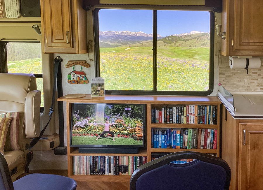
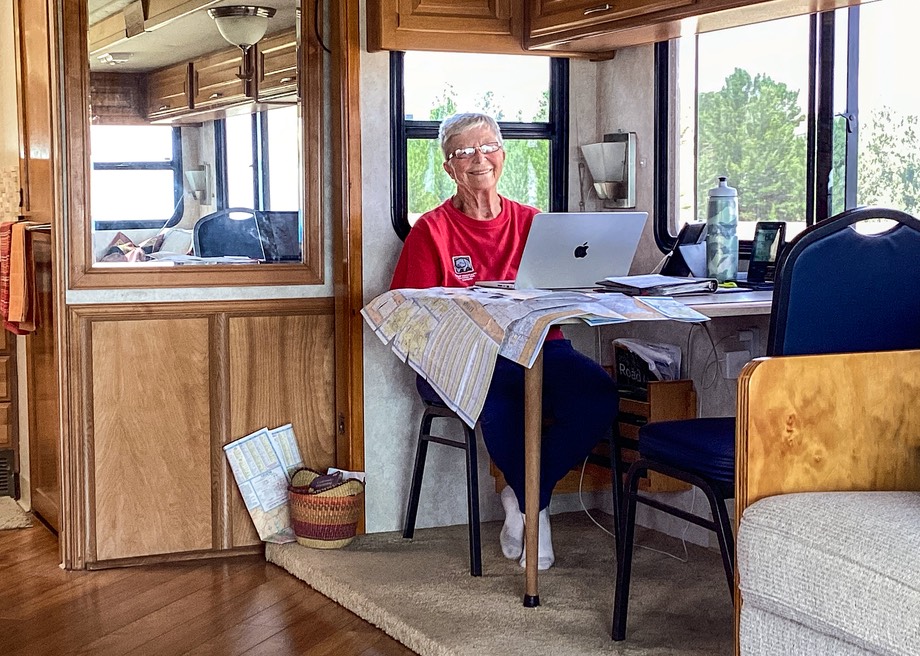
Another thing we’ve been doing in our effort to not squander the progress we had both made over the past winter in getting in better shape and losing some weight is to continue with our yoga practice by working with a Yoga For Seniors DVD. So far in our five weeks on the road we’ve been able to hold our weight steady so our efforts seem to be paying off. We sent this picture off to the lady who did the DVD and also to our instructor back home in Alabama.
Even though our ‘commute’ from our Buffalo hilltop to Sheridan took about an hour each way, it was not an unpleasant drive. This particular stretch of I-90 is one of the nicer sections of highway we know. The road winds through rolling hills that are still green in June and there is very little traffic, including the big trucks. And, the pavement is excellent through here. Pretty great.
But enough was enough. After about 3 weeks, it was time to move on. Our plan had been to move up higher into the mountains from Buffalo, and enjoy some different spots in the area. But, in chatting with friends who had stopped by while coming through, they’d commented about the pleasures of driving through Yellowstone NP on a day pass as they headed towards us. We had mistakenly thought that you had to make advance reservations for that, but they said that wasn’t necessary. So why not, we thought? We shifted gears, changed our route, and started across the middle of Wyoming, heading towards Cody and Yellowstone’s eastern entrance.
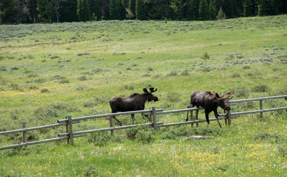
We decided to take Route 14 and then 14A west across the Big Horns. This is an incredibly lovely road that goes through nice mountain passes, across open fields (with a few moose to enjoy on this trip) and great views. Closed during the winter (snow), we were delighted it was open for us now. Although we prefer Hwy 16 through the mountains we had certainly done Hwy 14A as well, and always enjoyed the drive.
The other factor raising its head as we were busy changing plans was the fact that for the past couple of weeks Rick had been noticing an intermittent loss of power from the engine. Hwy 14A features steep climb and descent grades on both the eastern and western ends and climbing the grade after leaving Sheridan this problem became very evident — and now qualified as a significant concern. The coach would make it up any sort of hill we might encounter, but the going was slow. It was also clear that the problem was occurring more and more frequently.
After completing Hwy 14A, and coming down the long 10% grade down the western side of the Big Horns, we spent the night in the small town of Powell, most of the way to Cody, at their lovely city park. The next morning we drove on into Cody, and Rick decided to stop to consider our options at a point where we could make some phone calls. We were sitting at the intersection of several major roads. Yellowstone was straight ahead over more mountains and with anticipated heavy traffic. Or we could go south and stay at low elevations. Or… or… what? What was the best plan?
Rick talked to our favorite mechanic (in Oregon sadly), and also called the nearest Cummins dealer, in Billings, Montana…roughly 100 miles away in the wrong direction. After reviewing possible likely causes of the problem and with the agreement that whatever it was, in the absence of warning lights it was unlikely to do any further damage if we continued to drive, we made the decision to drive to Billings.
The trip was quite pleasant, actually. Billings is roughly due north of Cody along the Clarks Fork of the Yellowstone River (Clark of the Lewis & Clark explorations) for much of the way, and then along the Yellowstone River itself. The only sadness was that we had to drop the “Yellowstone Plan”, at least for now. Rick was not comfortable with the vision of leading a long train of impatient drivers over the mountains with limited chances to pull off to let them pass.
Also, by going up to Billings — the Cummins folks said they could look at us that afternoon — we’d have an answer to our problem in the shortest amount of time. Maybe we could go on to Yellowstone after we were all fixed up?
The folks at Billings could not have been nicer. They got us diagnosed, but not fixed due to not having the needed part (which turned out to be an intermittent fuel injector). They said it was OK for us to continue driving and, after asking where we might be in a couple of weeks, that they would order the parts for shipment to that location. And now, one week later, we’ve confirmed the parts have now arrived in Salt Lake City and we will get the work done next week. Thank you Cummins.
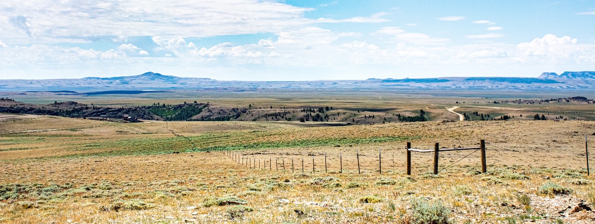
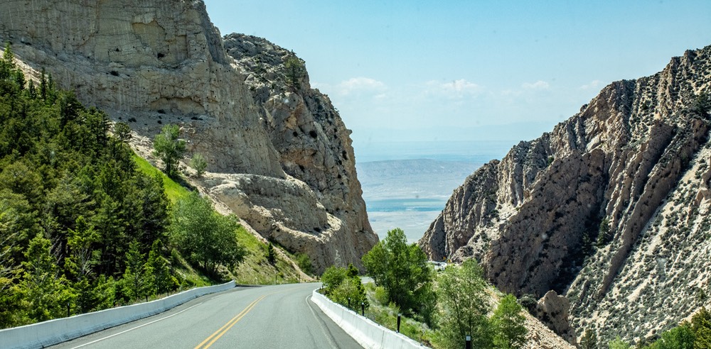
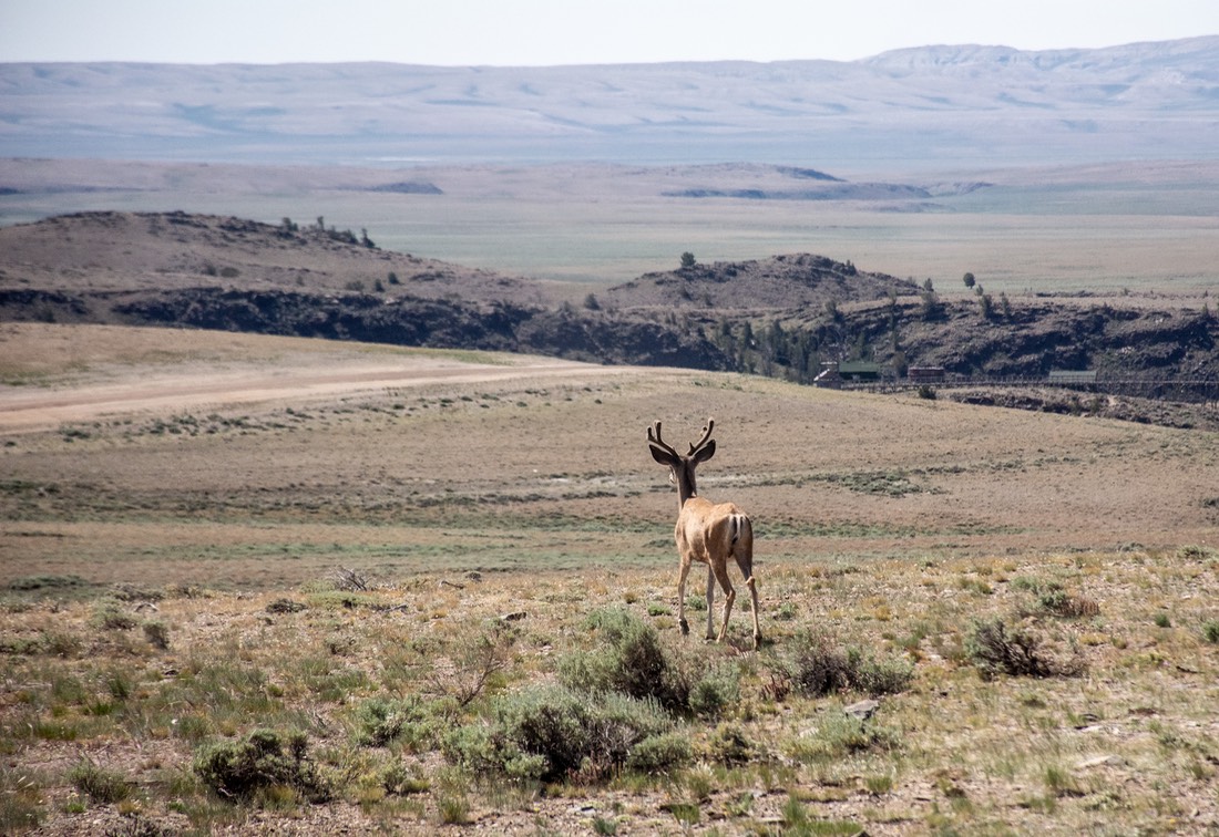
So. What’s the deal with us now? We left Billings, dropped back down into Wyoming, came south through Thermopolis (and its gorgeous canyons), Riverton and Lander, and are now sitting atop a different lovely knoll — just below the Continental Divide, in the South Pass area, with an old mining ghost town nearby. Aka, a nice quiet knoll (we like knolls, ya know) a bit off the main road (Highway 28), with a view forever, a small clump of cows, a few pronghorn, a lovely young buck deer, lots of wind, sunshine, and an elevation of 8280 feet. We’ve stayed here a couple of times before. It’s not nearly as pretty as the ‘Summer House’ out of Buffalo, but it shares some of the same features; cool, quiet, relative solitude, expansive views and occasional critters. We really don’t need much more than that.
It took us a while to get up to the top of the pass; Rick is a fine and patient driver, everyone had assured him he should be able to get here easily enough… although slowly, and 28 is a great highway with plenty of passing lanes and pull outs. Along the way we turned up the volume on some Billy Joel and just enjoyed life as we live it. The refrigerator is VERY full in preparation for a week or more of staying still, and Kathy’s going to make lasagna tomorrow night. All in all, we are set.
We’re here until after the weekend of the 4th, then we’ll start moseying along, heading into Utah for repairs and a nice visit with our friends Gary & Carol. The only thing that’s been missing all summer is Kathy’s bike — no room to bring it along. Just wait until we get back in October!
Rick, Kathy and Slim; all movin' a little slower, but still happy
P.S. This morning, here’s the scene: dead asleep at 6:00 — suddenly we started feeling heavy thumping on the edges/sides of the coach. What the hell??? Are we being robbed, or maybe someone is trying to climb inside to get nice and warm? Sudden high winds and blowing debris? Sitting up to look around, suddenly a loud moooo(!) answered the question. We were surrounded by a bunch of cattle, mooing and rubbing their backs on the corners of Slim Charles. Gee, it was soooo nice to be able to provide a scratching post at the right height!!! Rick opened the window and after various shooing words and waving of arms finally got them to move off.
We’d had this happen before, once in the Pyrenees when we were joined by a bunch of cows in the field. The other time in Africa, when an elephant started poking at the Tiger one evening out in the bush. I guess we must look pretty attractive to the critters.
You’ll want to visit the Photo Page for this story to enjoy more pictures.